Premium Only Content
This video is only available to Rumble Premium subscribers. Subscribe to
enjoy exclusive content and ad-free viewing.
Lets hit the road!
RyansRocks
- 18 / 41
1
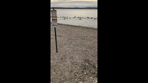
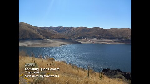
A Cold Lake Lowell Rockhunt!
RyanzRocks
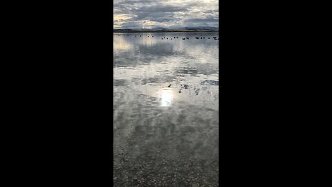
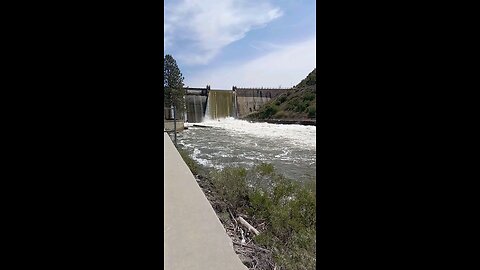
Lake Lowell, located in Nampa, Idaho, is a significant recreational and wildlife area. Here are some key points about Lake Lowell:
Historical Background: Lake Lowell was originally called Deer Flat Reservoir and was the first storage reservoir completed for the Boise Project, one of the earliest Reclamation projects. It opened in 1909 and has since played a crucial role in irrigating over 200,000 acres of land in Canyon County.
Recreational Activities: The lake offers a variety of activities including boating, swimming, fishing, birdwatching, hiking, and hunting. It is known for its steady breeze, making it a favored spot for sailing among Boise sailors. Motorized and non-motorized boating are allowed from April 15 to September 30, with human-powered boats permitted 200 yards in front of the Upper and Lower Dams between October 1 and April 14.
Wildlife and Conservation: Part of the Deer Flat National Wildlife Refuge, Lake Lowell is home to over 200 recorded avian species, making it a great birding spot. The refuge provides habitats for a wide range of wildlife, including spectacular concentrations of mallards and Canada geese.
Fishing: The lake is popular for fishing, with largemouth bass being the most sought-after species. Other fish include channel catfish, black and white crappie, rainbow trout, bluegill, pumpkinseed sunfish, and yellow perch. The Idaho Fish and Game regularly stocks catfish to enhance fishing opportunities.
Health Advisories: There have been instances where health advisories were issued due to high levels of toxin-producing cyanobacteria in the water, which can be harmful to people, pets, and livestock. Precautions include avoiding swimming, ensuring pets do not enter the water, and not using the lake water for cooking or drinking.
Park and Facilities: Lake Lowell Park, managed by Canyon County, offers amenities like picnic tables, BBQ grills, restrooms, water fountains, a disc golf course, and a story trail. However, certain activities like using bounce houses or inflatables are prohibited.
Access and Directions: Lake Lowell is accessible from various points, with one of the main routes being taking Exit 35 off Interstate 84, heading north and then west on Karcher Road to Lake Avenue, and south to the Upper Dam.
2
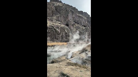
Cold Rockhunt in a Hot Springs!
RyanzRocks
Snively Hot Springs is a primitive, undeveloped hot spring located on the banks of the Lower Owyhee River in eastern Oregon. Here's a description:
* Natural Beauty: Situated in a scenic desert landscape, the springs offer a stark contrast between the hot water and the surrounding arid environment.
* Soaking Pools: The hot springs consist of natural rock-lined pools created by visitors over time. These pools mix the extremely hot spring water (over 190 degrees Fahrenheit) with the cooler Owyhee River water to create a range of temperatures.
* Primitive Experience: There are no developed facilities at Snively Hot Springs. It's a truly "back-to-nature" experience with minimal amenities.
* Day Use Only: Camping is not permitted at the site.
Important Notes:
* Road Conditions: The road leading to Snively Hot Springs can be rough in places, so a high-clearance vehicle is recommended.
* Safety: Be cautious when entering the hot springs, as the water temperatures can vary significantly.
* Respect the Environment: Please pack out all trash and minimize your impact on this natural area.
3
Snively Gulch!
RyanzRocks
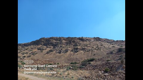
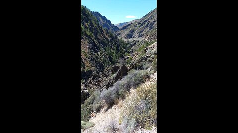
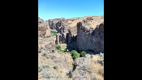
Snively Gulch is a remote area located in the Owyhee Mountains of eastern Oregon. It is known for its stunning scenery, including towering canyon walls, rugged terrain, and crystal-clear rivers.
The area is also home to a variety of wildlife, such as deer, elk, and bighorn sheep. Visitors to Snively Gulch can enjoy hiking, camping, fishing, and swimming.
One of the most popular attractions in Snively Gulch is the Snively Hot Springs, a series of natural springs that flow into the Owyhee River. The springs are said to have healing properties and are a popular destination for relaxation and soaking.
Snively Gulch is a great place to experience the beauty and solitude of the Owyhee Mountains. It is a popular destination for outdoor enthusiasts and nature lovers.
4
Roadcut Snively Gulch!
RyanzRocks
Snively Gulch is a remote area located in the Owyhee Mountains of eastern Oregon. It is known for its stunning scenery, including towering canyon walls, rugged terrain, and crystal-clear rivers.
The area is also home to a variety of wildlife, such as deer, elk, and bighorn sheep. Visitors to Snively Gulch can enjoy hiking, camping, fishing, and swimming.
One of the most popular attractions in Snively Gulch is the Snively Hot Springs, a series of natural springs that flow into the Owyhee River. The springs are said to have healing properties and are a popular destination for relaxation and soaking.
Snively Gulch is a great place to experience the beauty and solitude of the Owyhee Mountains. It is a popular destination for outdoor enthusiasts and nature lovers.
1
comment
5
Walkin' a wash!
RyanzRocks
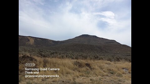
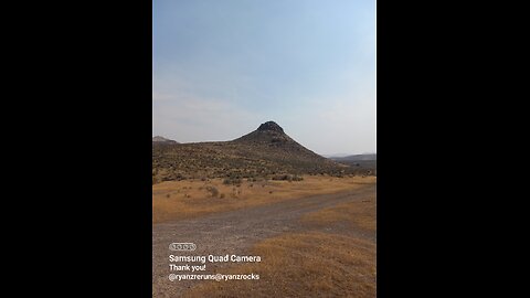
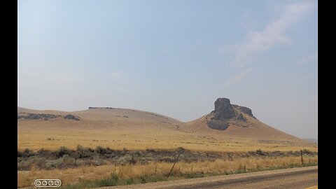
Hatstack Butte, Oregon:
Hatstack Butte is a geological feature located in Oregon, noted for its distinctive shape and elevation. Here are some key points about Hatstack Butte:
Elevation: Hatstack Butte stands at approximately 4,015 feet in elevation.
Location: It is situated in central Oregon, part of the High Desert landscape where buttes are common features.
Access and Recreation: While there's no specific mention of trails directly to Hatstack Butte, the surrounding area is known for hiking and recreational opportunities. Nearby, Juniper Butte and other buttes offer hiking paths within the Crooked River National Grassland.
Land Use: Some parts of Hatstack Butte and its surroundings are managed by the Bureau of Land Management (BLM), while other sections could be privately owned. This affects access for recreational purposes.
6
Out rockhoundin' the other daaaayie...
RyanzRocks
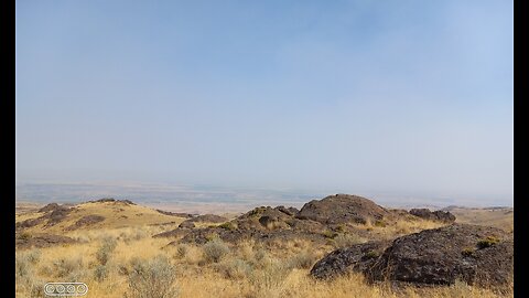
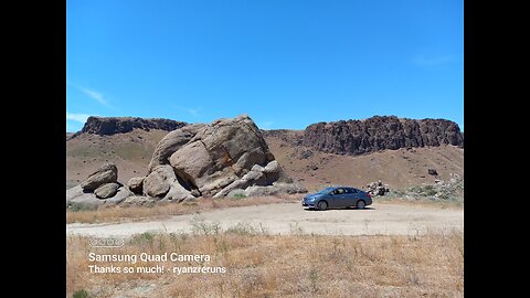
Near the Haystack Butte in the Owyhee area: notable for rockhounding enthusiasts. It's known for Jellybean Jasper, among other types of rocks and minerals.
7
Lake Lowell Rockhunt?
RyanzRocks
Lake Lowell, located in Idaho, is a significant man-made reservoir within the Deer Flat National Wildlife Refuge. Here are some key points about Lake Lowell:
Location: Lake Lowell is situated approximately 5 miles southwest of Nampa, Idaho, in Canyon County.
History and Purpose: Originally called Deer Flat Reservoir, it was the first storage reservoir completed for the Boise Project, one of the earliest projects by the U.S. Bureau of Reclamation, aimed at providing irrigation water for agriculture in the region. It opened in 1909.
Size and Capacity: The lake covers an area of about 9,800 acres (14.5 square miles) with 28 miles of shoreline and has a maximum capacity of 169,000 acre-feet of water.
Wildlife and Recreation: It's a part of one of the oldest wildlife refuges in the U.S., hosting over 200 recorded avian species, making it a great spot for birdwatching. Recreational activities include boating, fishing, swimming, disc golf, and more. The lake is open for boating from April 15 to September 30 each year, with human-powered boats allowed year-round near the Upper and Lower Dams.
Fishing: Lake Lowell is popular for fishing, with species like largemouth bass, channel catfish, rainbow trout, bluegill, crappie, and yellow perch available. Idaho Fish & Game regularly stocks catfish to enhance fishing opportunities.
Health Advisories: There have been instances where health advisories were issued due to high levels of toxin-producing cyanobacteria in the water, which can be harmful to people, pets, and livestock. Precautions include avoiding swimming, wading, or other water contact during advisory periods.
Amenities: Lake Lowell Park, managed by Canyon County, offers amenities like picnic tables, BBQ grills, restrooms, a water fountain, a disc golf course, and a Story Trail. No reservations are required; amenities are available on a first-come, first-served basis.
Access: The lake can be accessed via various points, including Lake Lowell Park on the Upper Dam's east side. Directions usually involve exiting Interstate 84 at exit 35 and heading towards Karcher Road, then Lake Avenue.
Lake Lowell serves both as an essential irrigation source and a recreational hub in southwestern Idaho, providing a blend of natural beauty, wildlife observation opportunities, and various outdoor activities.
8
Salmon Falls Creek Reservoir!
RyanzRocks
Salmon Falls Creek Reservoir has a multifaceted history intertwined with the region's agricultural development, engineering achievements, and recreational evolution:
Construction and Purpose: The Salmon Falls Dam, which created the Salmon Falls Creek Reservoir, was constructed between 1908 and 1910 by the Salmon River Canal Company. Originally, the dam was built to provide irrigation water for farms in the region, addressing the need for a reliable water source for agriculture in the arid climate of southern Idaho. The dam was one of the largest in the world at the time of its construction and was listed on the National Register of Historic Places in 2009 due to its historical significance.
Challenges: The dam faced initial challenges due to the porous, lava-rich terrain which allowed water to leak through rather than accumulate in the reservoir as planned. It took 74 years for the reservoir to reach full capacity in 1984, significantly longer than anticipated.
Recreational Development: Over time, the reservoir transformed from a primarily irrigation-focused water body to a significant recreational area. Lud Drexler, a pioneer sportsman, played a crucial role in its development for public use, leading to the establishment of Lud Drexler Park in 1981. This park now offers facilities for boating, fishing, camping, and other outdoor activities, making the reservoir a popular spot for recreation in south-central Idaho and Northern Nevada.
Fishing and Wildlife: The reservoir is renowned for its fishing, particularly for walleye, making it one of the premier walleye fisheries in Idaho. Various species of fish like brown trout, Chinook and kokanee salmon, yellow perch, among others, are stocked or naturally present, contributing to its status as one of the most plentiful fisheries in southern Idaho. However, there have been concerns about the health of the walleye population due to issues like forage availability and stunted growth from over-abundant predators.
Environmental Impact: Efforts have been made to manage the environmental impact, particularly concerning water quality and the ecological balance of species within the reservoir. Actions like adjusting water releases for flood control and managing fish populations have been part of this ongoing effort.
Community and Cultural Significance: The area around Salmon Falls Creek Reservoir has historical significance beyond just its physical structures. It served as a trade route for Native American groups between the Snake River Plain and the Great Basin, highlighting its cultural importance before modern development.
This history reflects a story of engineering ambition, environmental adaptation, and the transformation of a landscape into a community resource for both agriculture and leisure.
9
Rabbit Springs Lava Flow!
RyanzRocks
Thundereggs can indeed be found near Jackpot, Nevada, particularly in an area known as Rabbit Springs, which is located just off Highway 93 about three miles north of Jackpot. Here's what you need to know based on the available information:
Location and Accessibility: The Rabbit Springs site between Twin Falls and Jackpot is noted for containing clusters of fluorescent thundereggs. These are accessible from Highway 93, making them relatively easy to find for rockhounding enthusiasts. The area is on Bureau of Land Management (BLM) land, which generally allows for rock collecting under certain conditions.
Nature of Thundereggs: Thundereggs found here are described as being made up of a combination of volcanic and agate materials. Their true beauty is fully realized when they are viewed under a fluorescent light source, which makes them glow. This property makes them particularly interesting to collectors.
Historical Context: While the specific site in Jackpot isn't detailed in historical context, the broader area of Nevada has a rich history of thunderegg mining, with notable sites like the Black Rock Desert being closed off, highlighting the rarity and value of these geological formations.
For anyone interested in rockhounding near Jackpot, Nevada:
Preparation: Bring tools like a rake, shovel, and perhaps a GPS unit as suggested for other rockhounding trips in the region. Be prepared for potentially digging into the soil to find these gems.
Legal Considerations: Always verify the current regulations for rock collecting on BLM land, as rules can change. Respect the environment by not over-digging or leaving the area in disarray.
Experience: Rockhounding here can be a fun family activity or a serious pursuit for collectors, given the unique properties of these thundereggs.
Remember, while the information provided here is based on the search results, conditions like access, rules, or even the availability of thundereggs can change. It's always good to check with local resources or BLM offices for the latest information before heading out.
10
Broken Geodes & Thundereggs!
RyanzRocks
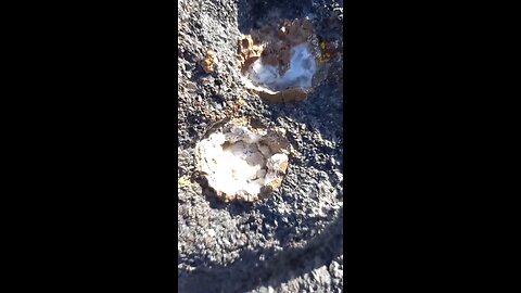
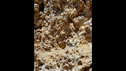
These rocks appears to be a type of **thunder eggs** and **geodes**. Here's why:
1. **Coloration and Banding**: The rock shows a combination of colors, including brown, white, green, and possibly some hints of other colors, which is typical for agates and thunder eggs. The banding pattern is also characteristic of agates, which form in cavities of volcanic rocks.
2. **Translucency**: Some parts of the rock are translucent, which is common in agates due to their chalcedony composition.
3. **Texture**: The rock's texture looks somewhat waxy or glassy, which is typical for agates that have been polished or naturally worn smooth.
4. **Inclusions**: The yellowish or brownish areas could be due to iron oxide or other mineral inclusions, which are often found in agates. Thunder eggs are nodules of agate found in volcanic rocks, and they often have a hollow or partially hollow interior filled with crystals or banded agate.
11
Whole Thundereggs from Rabbit Springs Lava Flow!
RyanzRocks
Rabbit Springs, which is located just off Highway 93 about three miles north of Jackpot, Nevada. Here's a little bit on the lava field based on the available information:
Location and Accessibility: The Rabbit Springs site between Twin Falls and Jackpot is noted for containing clusters of fluorescent thundereggs. These are accessible from Highway 93, making them relatively easy to find for rockhounding enthusiasts. The area is on Bureau of Land Management (BLM) land, which generally allows for rock collecting under certain conditions.
Nature of Thundereggs: Thundereggs found here are described as being made up of a combination of volcanic and agate materials. Their true beauty is fully realized when they are viewed under a fluorescent light source, which makes them glow. This property makes them particularly interesting to collectors.
Historical Context: While the specific site in Jackpot isn't detailed in historical context, the broader area of Nevada has a rich history of thunderegg mining, with notable sites like the Black Rock Desert being closed off, highlighting the rarity and value of these geological formations.
For anyone interested in rockhounding near Jackpot, Nevada:
Preparation: Bring tools like a rake, shovel, and perhaps a GPS unit as suggested for other rockhounding trips in the region. Be prepared for potentially digging into the soil to find these gems.
Legal Considerations: Always verify the current regulations for rock collecting on BLM land, as rules can change. Respect the environment by not over-digging or leaving the area in disarray.
Experience: Rockhounding here can be a fun family activity or a serious pursuit for collectors, given the unique properties of these thundereggs.
Remember, while the information provided here is based on the search results, conditions like access, rules, or even the availability of thundereggs can change. It's always good to check with local resources or BLM offices for the latest information before heading out.
12
Thunderegg Nest!
RyanzRocks
Rabbit Springs, which is located just off Highway 93 about three miles north of Jackpot, Nevada. Here's a little bit on the lava field based on the available information:
Location and Accessibility: The Rabbit Springs site between Twin Falls and Jackpot is noted for containing clusters of fluorescent thundereggs. These are accessible from Highway 93, making them relatively easy to find for rockhounding enthusiasts. The area is on Bureau of Land Management (BLM) land, which generally allows for rock collecting under certain conditions.
Nature of Thundereggs: Thundereggs found here are described as being made up of a combination of volcanic and agate materials. Their true beauty is fully realized when they are viewed under a fluorescent light source, which makes them glow. This property makes them particularly interesting to collectors.
Historical Context: While the specific site in Jackpot isn't detailed in historical context, the broader area of Nevada has a rich history of thunderegg mining, with notable sites like the Black Rock Desert being closed off, highlighting the rarity and value of these geological formations.
For anyone interested in rockhounding near Jackpot, Nevada:
Preparation: Bring tools like a rake, shovel, and perhaps a GPS unit as suggested for other rockhounding trips in the region. Be prepared for potentially digging into the soil to find these gems.
Legal Considerations: Always verify the current regulations for rock collecting on BLM land, as rules can change. Respect the environment by not over-digging or leaving the area in disarray.
Experience: Rockhounding here can be a fun family activity or a serious pursuit for collectors, given the unique properties of these thundereggs.
Remember, while the information provided here is based on the search results, conditions like access, rules, or even the availability of thundereggs can change. It's always good to check with local resources or BLM offices for the latest information before heading out.
13
Snake River Canyon! (near the Evel Knieval jump)
RyanzRocks
The geology of the Snake River Canyon near Twin Falls, Idaho, is both fascinating and complex, shaped by millions of years of geological processes. Here's an overview:
Formation
Volcanic Activity: The canyon's history is closely tied to the volcanic activity of the Yellowstone hotspot. Around 17 million years ago, the hotspot began to influence the region, leading to extensive volcanic activity. The Columbia River Basalt Group, massive lava flows, covered much of the area, including where the Snake River now flows.
Erosion: The Snake River Canyon itself was primarily carved out by the erosive power of the Snake River. However, the initial shaping was also influenced by the uplift of the region, which began around 10 million years ago due to the tectonic forces associated with the Basin and Range Province.
Geological Features
Basalt Cliffs: The canyon walls are composed largely of basalt from the Columbia River Basalt Group eruptions. These layers of basalt, which can be seen in the various cliffs and outcrops, were formed by multiple volcanic events, each layer representing a different flow.
Perrine Bridge:
A significant geological feature near Twin Falls is the natural bridge known as the Perrine Bridge, which spans the canyon. While the bridge itself is man-made, it's built where the natural geology of the canyon narrows, showcasing the canyon's depth and the rugged basalt formations.
Craters of the Moon:
Although not directly part of the canyon's geology, the nearby Craters of the Moon National Monument provides a glimpse into the volcanic past that shaped the region, with its lava fields and cinder cones.
Erosion and Modern Geology
River Erosion: The Snake River continues to erode its path through the canyon, carrying sediment downstream. This ongoing process has resulted in the canyon's deep, V-shaped profile, especially notable around Shoshone Falls, sometimes called the "Niagara of the West."
Sedimentation: The river also deposits sediments, influencing the canyon's floor. Over geological time, these deposits have contributed to changes in the river's course and the canyon's shape.
Tectonic Uplift: Part of the Snake River Plain is still rising due to tectonic movements, which affects the river's gradient and, consequently, the erosion patterns in the canyon.
Recent Geological Events
Earthquakes: The region experiences seismic activity due to its location near the edge of the Basin and Range Province, which can influence the canyon's geology through minor shifts or larger earthquakes.
Human Impact: Human activities, including dam construction (like the Shoshone Falls Dam), have altered the natural flow and erosional patterns of the river, affecting the canyon's geological evolution.
The Snake River Canyon is a dynamic geological feature where volcanic, tectonic, and fluvial processes continue to shape the landscape, offering a rich field for geological study and appreciation.
3
comments
14
Rockhunting at Graveyard Point!
RyanzRocks
The Graveyard Point area is seven miles from Homedale, Idaho, just two miles across the Idaho-Oregon border. There have been numerous different claims and mining operations in this area, including the Linda Marie and Beverly Marie claims. Graveyard Point Plume Agate is a well-known seam agate found in far eastern Oregon.
- https://www.google.com/search
2
comments
15
Boise River Rockhunting!
RyanzRocks
Just down from Lucky Peak State Park. The Boise River is a 102-mile-long tributary of the Snake River in the Northwestern United States. It drains a rugged portion of the Sawtooth Range in southwestern Idaho northeast of Boise, as well as part of the western Snake River Plain.
- Wikipedia
16
Wash walkin'
RyanzRocks
@RyanzRocks #noob #rockhound #rockformation #tumbling #agates #rocks #rockhounders #rockstructure #metamorphicrocks #metamorphic #igneousrocks #igneous #quartz #quartzite #geology #nodules #minerals #crystals #glowrocks #idahorockhunting #idahogems #rockcutting #thundereggs #chalcedony #opal #lavarock #rigidtools #ryobitools #riverrocks #translucentrocks #translucent #rockgarden #flow #vevortools #jasper #granite #caves #marble #carnelian #gneiss #limestone #calcite #gold #silver #botryoidal
Indian Creek, ID
RyanzRocks
Indian Creek is a 66-mile (106 km) long tributary of the Boise River in Canyon, Elmore, and Ada counties in Idaho, United States.
River course
Beginning at an elevation of 5,047 feet (1,538 m) south of Arrowrock Reservoir in western Elmore County]], it flows west into Ada County and through the town of Kuna. It then flows northwest into Canyon County, through Nampa, and finally to its mouth in Caldwell, at an elevation of 2,349 feet (716.0 m). Indian Creek has a 295-square-mile (764 km2) watershed.
1
comment
19
Huge Sheared Off Boulder! @ryanzrocks
RyanzRocks
@RyanzRocks #noob #rockhound #rockformation #sandstone #tumbling #agates #rocks #rockhounders #rockstructure #metamorphicrocks #metamorphic #igneousrocks #igneous #quartz #quartzite #geology #nodules #minerals #crystals #glowrocks #idahorockhunting #idahogems #rockcutting #thundereggs #chalcedony #opal #lavarock #rigidtools #ryobitools #riverrocks #translucentrocks #translucent #rockgarden #flow #vevortools #jasper #granite #caves #marble #carnelian #gneiss #limestone #calcite #gold #silver #botryoidal #geodes
20
Succor Creek Canyon, OR.
RyanzRocks
@RyanzRocks #noob #rockhound #rockformation #sandstone #tumbling #agates #rocks #rockhounders #rockstructure #metamorphicrocks #metamorphic #igneousrocks #igneous #quartz #quartzite #geology #nodules #minerals #crystals #glowrocks #idahorockhunting #idahogems #rockcutting #thundereggs #chalcedony #opal #lavarock #rigidtools #ryobitools #riverrocks #translucentrocks #translucent #rockgarden #flow #vevortools #jasper #granite #caves #marble #carnelian #gneiss #limestone #calcite #gold #silver #botryoidal #geodes
21
Watch for Rocks!
RyanzRocks
@RyanzRocks #noob #rockhound #rockformation #sandstone #tumbling #agates #rocks #rockhounders #rockstructure #metamorphicrocks #metamorphic #igneousrocks #igneous #quartz #quartzite #geology #nodules #minerals #crystals #glowrocks #idahorockhunting #idahogems #rockcutting #thundereggs #chalcedony #opal #lavarock #rigidtools #ryobitools #riverrocks #translucentrocks #translucent #rockgarden #flow #vevortools #jasper #granite #caves #marble #carnelian #gneiss #limestone #calcite #gold #silver #botryoidal #geodes
22
Rockhounding at Lucky Peak Reservoir!
RyanzRocks
@RyanzRocks #noob #rockhound #rockformation #tumbling #agates #rocks #rockhounders #rockstructure #metamorphicrocks #metamorphic #igneousrocks #igneous #quartz #quartzite #geology #nodules #minerals #crystals #glowrocks #idahorockhunting #idahogems #rockcutting #thundereggs #chalcedony #opal #lavarock #rigidtools #ryobitools #riverrocks #translucentrocks #translucent #rockgarden #flow #vevortools #jasper #granite #caves #marble #carnelian #gneiss #limestone #calcite #gold #silver #botryoidal
23
Kuna Cave Lavatube!
RyanzRocks
Kuna Caves are lava tubes found south of Kuna, Idaho. There is currently one publicly known entrance to the cave, an opening in the ground with a caged ladder leading down into the cave.
Background
The caves are about 50 feet (15 m) deep and run about a quarter mile north and around 1,000 feet (300 m) south from the entrance. The southern portion of the cave requires you to crawl through a trench dug out of the clay floor of the cave leading to a small space approximately 4 feet (1.2 m) long by 3 feet (0.91 m) wide by 3 feet (0.91 m) high in which you can turn around to return to the main cavern.[1]
Though according to locals, at one time the system had been much larger and was composed of multiple caves, even stretching to the Snake River, before the United States Army Corps of Engineers blocked it off by detonating dynamite collapsing a portion of the cave.[2] A logbook was placed deep in the North end of the cave for people to sign in 2018. Although the entrance has a ladder to get down into the cavern, it is not maintained. The short road leading to the cave is unmaintained, often very muddy, and the cave itself is littered with trash and graffiti. The interior temperature of the cave hovers around 56 °F (13 °C) year round.[3]
The official Bureau of Land Management stance on the cave is that it should not be visited by the general public.
24
Rockhounding near Mitchell Butte, OR
RyanzRocks
@RyanzRocks #noob #rockhound #rockformation #tumbling #agates #rocks #rockhounders #rockstructure #metamorphicrocks #metamorphic #igneousrocks #igneous #quartz #quartzite #geology #nodules #minerals #crystals #glowrocks #idahorockhunting #idahogems #rockcutting #thundereggs #chalcedony #opal #lavarock #rigidtools #ryobitools #riverrocks #translucentrocks #translucent #rockgarden #flow #vevortools #jasper #granite #caves #marble #carnelian #gneiss #limestone #calcite #gold #silver #botryoidal
25
Up Rats Nest Road!
RyanzRocks
@RyanzRocks #noob #rockhound #rockformation #tumbling #agates #rocks #rockhounders #rockstructure #metamorphicrocks #metamorphic #igneousrocks #igneous #quartz #quartzite #geology #nodules #minerals #crystals #glowrocks #idahorockhunting #idahogems #rockcutting #thundereggs #chalcedony #opal #lavarock #rigidtools #ryobitools #riverrocks #translucentrocks #translucent #rockgarden #flow #vevortools #jasper #granite #caves #marble #carnelian #gneiss #limestone #calcite #gold #silver #botryoidal
26
27
28
29
30
31
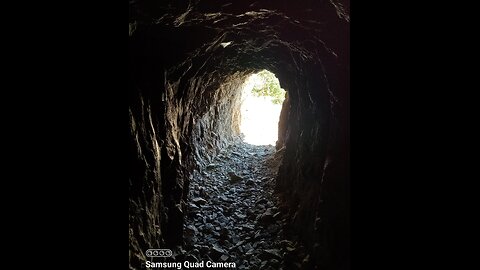
Another cave!!!
RyanzRocks
A cave or cavern is a natural void under the Earth's surface. Caves often form by the weathering of rock and often extend deep underground. Exogene caves are smaller openings that extend a relatively short distance underground (such as rock shelters). Caves which extend further underground than the opening is wide are called endogene caves.
Speleology is the science of exploration and study of all aspects of caves and the cave environment. Visiting or exploring caves for recreation may be called caving, potholing, or spelunking.
Formation types
The formation and development of caves is known as speleogenesis; it can occur over the course of millions of years. Caves can range widely in size, and are formed by various geological processes. These may involve a combination of chemical processes, erosion by water, tectonic forces, microorganisms, pressure, and atmospheric influences. Isotopic dating techniques can be applied to cave sediments, to determine the timescale of the geological events which formed and shaped present-day caves.
It is estimated that a cave cannot be more than 3,000 metres (9,800 ft) vertically beneath the surface due to the pressure of overlying rocks. This does not, however, impose a maximum depth for a cave which is measured from its highest entrance to its lowest point, as the amount of rock above the lowest point is dependent on the topography of the landscape above it. For karst caves the maximum depth is determined on the basis of the lower limit of karst forming processes, coinciding with the base of the soluble carbonaterocks. Most caves are formed in limestone by dissolution.
Caves can be classified in various other ways as well, including a contrast between active and relict: active caves have water flowing through them; relict caves do not, though water may be retained in them. Types of active caves include inflow caves ("into which a stream sinks"), outflow caves ("from which a stream emerges"), and through caves ("traversed by a stream").
Speleothems in Hall of the Mountain King of Ogof Craig a Ffynnon, a solutional cave in South Wales.
Solutional cave
Solutional caves or karst caves are the most frequently occurring caves. Such caves form in rock that is soluble; most occur in limestone, but they can also form in other rocks including chalk, dolomite, marble, salt, and gypsum. Except for salt caves, solutional caves result when rock is dissolved by natural acid in groundwater that seeps through bedding planes, faults, joints, and comparable features. Over time cracks enlarge to become caves and cave systems.
The largest and most abundant solutional caves are located in limestone. Limestone dissolves under the action of rainwater and groundwater charged with H2CO3 (carbonic acid) and naturally occurring organic acids. The dissolution process produces a distinctive landform known as karst, characterized by sinkholes and underground drainage. Limestone caves are often adorned with calcium carbonate formations produced through slow precipitation. These include flowstones, stalactites, stalagmites, helictites, soda straws and columns. These secondary mineral deposits in caves are called speleothems.
The portions of a solutional cave that are below the water table or the local level of the groundwater will be flooded.
32
Creepy cave!!!
RyanzRocks
A cave or cavern is a natural void under the Earth's surface. Caves often form by the weathering of rock and often extend deep underground. Exogene caves are smaller openings that extend a relatively short distance underground (such as rock shelters). Caves which extend further underground than the opening is wide are called endogene caves.
Speleology is the science of exploration and study of all aspects of caves and the cave environment. Visiting or exploring caves for recreation may be called caving, potholing, or spelunking.
Formation types
The formation and development of caves is known as speleogenesis; it can occur over the course of millions of years. Caves can range widely in size, and are formed by various geological processes. These may involve a combination of chemical processes, erosion by water, tectonic forces, microorganisms, pressure, and atmospheric influences. Isotopic dating techniques can be applied to cave sediments, to determine the timescale of the geological events which formed and shaped present-day caves.[4]
It is estimated that a cave cannot be more than 3,000 metres (9,800 ft) vertically beneath the surface due to the pressure of overlying rocks. This does not, however, impose a maximum depth for a cave which is measured from its highest entrance to its lowest point, as the amount of rock above the lowest point is dependent on the topography of the landscape above it. For karst caves the maximum depth is determined on the basis of the lower limit of karst forming processes, coinciding with the base of the soluble carbonate rocks. Most caves are formed in limestone by dissolution.
Caves can be classified in various other ways as well, including a contrast between active and relict: active caves have water flowing through them; relict caves do not, though water may be retained in them. Types of active caves include inflow caves ("into which a stream sinks"), outflow caves ("from which a stream emerges"), and through caves ("traversed by a stream").[7]
Speleothems in Hall of the Mountain King of Ogof Craig a Ffynnon, a solutional cave in South Wales.
Solutional cave
Solutional caves or karst caves are the most frequently occurring caves. Such caves form in rock that is soluble; most occur in limestone, but they can also form in other rocks including chalk, dolomite, marble, salt, and gypsum. Except for salt caves, solutional caves result when rock is dissolved by natural acid in groundwater that seeps through bedding planes, faults, joints, and comparable features. Over time cracks enlarge to become caves and cave systems.
The largest and most abundant solutional caves are located in limestone. Limestone dissolves under the action of rainwater and groundwater charged with H2CO3 (carbonic acid) and naturally occurring organic acids. The dissolution process produces a distinctive landform known as karst, characterized by sinkholes and underground drainage. Limestone caves are often adorned with calcium carbonate formations produced through slow precipitation. These include flowstones, stalactites, stalagmites, helictites, soda straws and columns. These secondary mineral deposits in caves are called speleothems.
The portions of a solutional cave that are below the water table or the local level of the groundwater will be flooded.
33
34
Long way down!
RyanzRocks
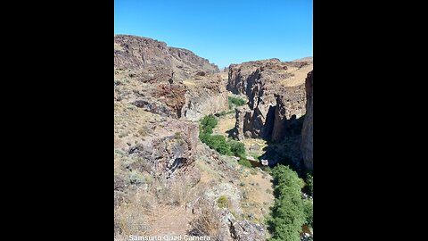
Succor Creek State Natural Area lies in a deep, rocky canyon and is a remote haven for rock hounds and wildlife watchers. Limited souvenir collecting by rock hounds is permitted in the park. A rough 15 mile dirt road leads from Oregon 201 to the park, which has primitive camping and day-use areas along both side of the creek. No water is available.
The Succor Creek Bridge is open to vehicles for access to the campsites on the east side of the creek (right/south of the bridge). The road to the left/north of the bridge is not safe for vehicular travel.
There are no pay phones or cell phone services at the Park. Staff and Staff Volunteers are not stationed at this site. This is a remote recreational experience, please prepare accordingly.
Year-round camping (first-come, first-served)
Four primitive sites on the west side of the creek
14 primitive campsites on the east side of the creek
Vault toilet
No water available
35
Succor Creek Canyon!
RyanzRocks
Succor Creek State Natural Area lies in a deep, rocky canyon and is a remote haven for rock hounds and wildlife watchers. Limited souvenir collecting by rock hounds is permitted in the park. A rough 15 mile dirt road leads from Oregon 201 to the park, which has primitive camping and day-use areas along both side of the creek. No water is available.
The Succor Creek Bridge is open to vehicles for access to the campsites on the east side of the creek (right/south of the bridge). The road to the left/north of the bridge is not safe for vehicular travel.
There are no pay phones or cell phone services at the Park. Staff and Staff Volunteers are not stationed at this site. This is a remote recreational experience, please prepare accordingly.
Year-round camping (first-come, first-served)
Four primitive sites on the west side of the creek
14 primitive campsites on the east side of the creek
Vault toilet
No water available
36
Graveyard Point
RyanzRocks
The Graveyard Point area is seven miles from Homedale, Idaho, just two miles across the Idaho-Oregon border. There have been numerous different claims and mining operations in this area, including the Linda Marie and Beverly Marie claims. Graveyard Point Plume Agate is a well-known seam agate found in far eastern Oregon.
- https://www.google.com/search
37
38
40
41
Indian Creek, ID
3 months ago
9
Indian Creek is a 66-mile (106 km) long tributary of the Boise River in Canyon, Elmore, and Ada counties in Idaho, United States.
River course
Beginning at an elevation of 5,047 feet (1,538 m) south of Arrowrock Reservoir in western Elmore County]], it flows west into Ada County and through the town of Kuna. It then flows northwest into Canyon County, through Nampa, and finally to its mouth in Caldwell, at an elevation of 2,349 feet (716.0 m). Indian Creek has a 295-square-mile (764 km2) watershed.
Loading 1 comment...
-
 1:01:08
SNEAKO
3 hours agoFRIDAY NIGHT VIBES
18.2K -
 1:16:47
Talk Nerdy 2 Us
9 hours agoTrump’s Biggest Sign, Sticker Mule’s Secrets & The Cybersecurity Threats They Don’t Want You to Know
6.84K5 -
 4:57:20
Robert Gouveia
6 hours agoHegseth Final Vote; Trump SLAPS Biased D.C. Judge; Rebuilding North Carolina
26K43 -
 47:40
47:40
Man in America
7 hours agoCan Trump Avert Economic Disaster Amid a $35T Debt Crisis? w/ Collin Plume
33.6K2 -
 LIVE
LIVE
I_Came_With_Fire_Podcast
10 hours ago🔥🔥Trump’s FIRST WEEK, FTOs, Deportations, & JFK FILES🔥🔥
215 watching -
 5:26:14
Barry Cunningham
7 hours agoTRUMP DAILY BRIEFING: PETE HEGSETH & KRISTI NOEM CONFIRMATIONS - TRUMP IN CALIFORNIA!
19.4K26 -
 2:06:17
Joker Effect
2 hours agoWhy So Serious Gameplay: Making scrubs in Brawlhalla cry baby tears.
10.9K3 -
 1:24:02
Roseanne Barr
6 hours ago $14.74 earnedDaddy's Home | The Roseanne Barr Podcast #84
39.8K55 -
 1:31:05
Glenn Greenwald
5 hours agoProf. John Mearsheimer on Israel/Gaza Ceasefire, Trump's Foreign Policy, Ukraine, Free Speech Crackdowns & More | SYSTEM UPDATE #396
71K55 -
 4:33:48
Nerdrotic
8 hours ago $27.48 earnedHollywood LOST the Culture War! Star Trek Section 31, Disney Lies! | Friday Night Tights #338 w RMB
115K17
