-
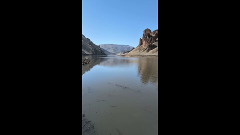
Room with a view!
RyanzRocksNear Leslie Gulch. Leslie Gulch is a stunning canyon located in Malheur County, Oregon, though it’s very close to the Oregon-Idaho border. It’s part of the Owyhee Canyonlands, a remote and rugged region known for its dramatic landscapes. The gulch is famous for its towering rock formations made of volcanic tuff, which create a surreal, almost otherworldly scenery with honeycombed cliffs and vibrant colors ranging from reds to yellows. It’s situated on the east side of Owyhee Lake (also called Owyhee Reservoir), formed by the Owyhee River, and is managed by the Bureau of Land Management (BLM) as an Area of Critical Environmental Concern. The area is named after Hiram E. Leslie, a rancher who tragically died there in 1882 after being struck by lightning. Before that, it was known as Dugout Gulch. It’s a haven for outdoor enthusiasts, offering hiking, camping, wildlife viewing, and even boating near the reservoir. The Slocum Creek Campground, with 10 sites, is a popular spot for visitors, though it’s primitive—no water or electricity, just pit toilets and basic amenities. The gulch is home to over 200 California bighorn sheep, along with mule deer, elk, coyotes, and a variety of birds like quail and raptors. It also hosts rare plants, some found nowhere else, like Packard’s blazing star and Etter’s groundsel. Getting there involves a bit of a trek—usually about a 15-mile drive down a gravel road from either Succor Creek Road or McBride Creek Road, accessible from Highway 95 in Idaho or Highway 201 in Oregon. It’s roughly two hours from Boise, Idaho, making it a feasible day trip from there, though the remoteness means no cell service and a need for preparation, especially since the road can get tricky after rain.46 views -
Lake Owyhee!
RyanzRocksLake Owyhee State Park is a remote gem in eastern Oregon, perched on the northeastern edge of the Owyhee Reservoir, about 40 miles southwest of Ontario. It’s a stark contrast to Leslie Gulch, which sits on the reservoir’s eastern shore, but they’re part of the same wild, volcanic landscape. The park spans the shores of the 53-mile-long Owyhee Reservoir, formed by the Owyhee Dam in 1932, and it’s a hotspot for camping, boating, and fishing amid a deep, colorful canyon that’s a testament to the area’s volcanic past.48 views -
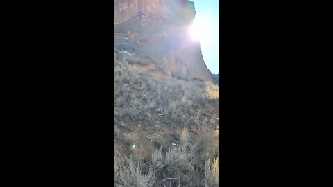
Entering the Gulch!
RyanzRocksLeslie Gulch is a stunning canyon located in Malheur County, Oregon, though it’s very close to the Oregon-Idaho border. It’s part of the Owyhee Canyonlands, a remote and rugged region known for its dramatic landscapes. The gulch is famous for its towering rock formations made of volcanic tuff, which create a surreal, almost otherworldly scenery with honeycombed cliffs and vibrant colors ranging from reds to yellows. It’s situated on the east side of Owyhee Lake (also called Owyhee Reservoir), formed by the Owyhee River, and is managed by the Bureau of Land Management (BLM) as an Area of Critical Environmental Concern. The area is named after Hiram E. Leslie, a rancher who tragically died there in 1882 after being struck by lightning. Before that, it was known as Dugout Gulch. It’s a haven for outdoor enthusiasts, offering hiking, camping, wildlife viewing, and even boating near the reservoir. The Slocum Creek Campground, with 10 sites, is a popular spot for visitors, though it’s primitive—no water or electricity, just pit toilets and basic amenities. The gulch is home to over 200 California bighorn sheep, along with mule deer, elk, coyotes, and a variety of birds like quail and raptors. It also hosts rare plants, some found nowhere else, like Packard’s blazing star and Etter’s groundsel. Getting there involves a bit of a trek—usually about a 15-mile drive down a gravel road from either Succor Creek Road or McBride Creek Road, accessible from Highway 95 in Idaho or Highway 201 in Oregon. It’s roughly two hours from Boise, Idaho, making it a feasible day trip from there, though the remoteness means no cell service and a need for preparation, especially since the road can get tricky after rain.54 views -
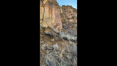
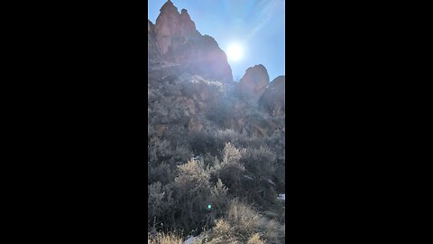
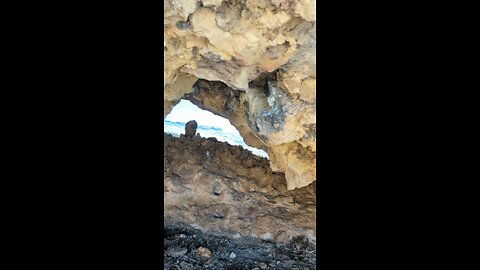
What planet am I on?!?!
RyanzRocksLeslie Gulch is a stunning canyon located in Malheur County, Oregon, though it’s very close to the Oregon-Idaho border. It’s part of the Owyhee Canyonlands, a remote and rugged region known for its dramatic landscapes. The gulch is famous for its towering rock formations made of volcanic tuff, which create a surreal, almost otherworldly scenery with honeycombed cliffs and vibrant colors ranging from reds to yellows. It’s situated on the east side of Owyhee Lake (also called Owyhee Reservoir), formed by the Owyhee River, and is managed by the Bureau of Land Management (BLM) as an Area of Critical Environmental Concern. The area is named after Hiram E. Leslie, a rancher who tragically died there in 1882 after being struck by lightning. Before that, it was known as Dugout Gulch. It’s a haven for outdoor enthusiasts, offering hiking, camping, wildlife viewing, and even boating near the reservoir. The Slocum Creek Campground, with 10 sites, is a popular spot for visitors, though it’s primitive—no water or electricity, just pit toilets and basic amenities. The gulch is home to over 200 California bighorn sheep, along with mule deer, elk, coyotes, and a variety of birds like quail and raptors. It also hosts rare plants, some found nowhere else, like Packard’s blazing star and Etter’s groundsel. Getting there involves a bit of a trek—usually about a 15-mile drive down a gravel road from either Succor Creek Road or McBride Creek Road, accessible from Highway 95 in Idaho or Highway 201 in Oregon. It’s roughly two hours from Boise, Idaho, making it a feasible day trip from there, though the remoteness means no cell service and a need for preparation, especially since the road can get tricky after rain.58 views -
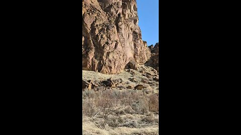
Beautiful day at the Gulch!
RyanzRocksLeslie Gulch is a stunning canyon located in Malheur County, Oregon, though it’s very close to the Oregon-Idaho border. It’s part of the Owyhee Canyonlands, a remote and rugged region known for its dramatic landscapes. The gulch is famous for its towering rock formations made of volcanic tuff, which create a surreal, almost otherworldly scenery with honeycombed cliffs and vibrant colors ranging from reds to yellows. It’s situated on the east side of Owyhee Lake (also called Owyhee Reservoir), formed by the Owyhee River, and is managed by the Bureau of Land Management (BLM) as an Area of Critical Environmental Concern. The area is named after Hiram E. Leslie, a rancher who tragically died there in 1882 after being struck by lightning. Before that, it was known as Dugout Gulch. It’s a haven for outdoor enthusiasts, offering hiking, camping, wildlife viewing, and even boating near the reservoir. The Slocum Creek Campground, with 10 sites, is a popular spot for visitors, though it’s primitive—no water or electricity, just pit toilets and basic amenities. The gulch is home to over 200 California bighorn sheep, along with mule deer, elk, coyotes, and a variety of birds like quail and raptors. It also hosts rare plants, some found nowhere else, like Packard’s blazing star and Etter’s groundsel. Getting there involves a bit of a trek—usually about a 15-mile drive down a gravel road from either Succor Creek Road or McBride Creek Road, accessible from Highway 95 in Idaho or Highway 201 in Oregon. It’s roughly two hours from Boise, Idaho, making it a feasible day trip from there, though the remoteness means no cell service and a need for preparation, especially since the road can get tricky after rain.67 views -
Cliffs at Leslie Gulch!
RyanzRocksLeslie Gulch is a stunning canyon located in Malheur County, Oregon, though it’s very close to the Oregon-Idaho border. It’s part of the Owyhee Canyonlands, a remote and rugged region known for its dramatic landscapes. The gulch is famous for its towering rock formations made of volcanic tuff, which create a surreal, almost otherworldly scenery with honeycombed cliffs and vibrant colors ranging from reds to yellows. It’s situated on the east side of Owyhee Lake (also called Owyhee Reservoir), formed by the Owyhee River, and is managed by the Bureau of Land Management (BLM) as an Area of Critical Environmental Concern. The area is named after Hiram E. Leslie, a rancher who tragically died there in 1882 after being struck by lightning. Before that, it was known as Dugout Gulch. It’s a haven for outdoor enthusiasts, offering hiking, camping, wildlife viewing, and even boating near the reservoir. The Slocum Creek Campground, with 10 sites, is a popular spot for visitors, though it’s primitive—no water or electricity, just pit toilets and basic amenities. The gulch is home to over 200 California bighorn sheep, along with mule deer, elk, coyotes, and a variety of birds like quail and raptors. It also hosts rare plants, some found nowhere else, like Packard’s blazing star and Etter’s groundsel. Getting there involves a bit of a trek—usually about a 15-mile drive down a gravel road from either Succor Creek Road or McBride Creek Road, accessible from Highway 95 in Idaho or Highway 201 in Oregon. It’s roughly two hours from Boise, Idaho, making it a feasible day trip from there, though the remoteness means no cell service and a need for preparation, especially since the road can get tricky after rain.40 views -
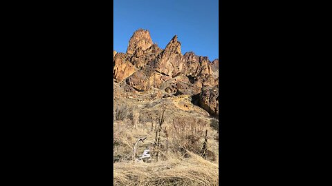
PEOPLE CLIMB THESE!
RyanzRocksLeslie Gulch is a stunning canyon located in Malheur County, Oregon, though it’s very close to the Oregon-Idaho border. It’s part of the Owyhee Canyonlands, a remote and rugged region known for its dramatic landscapes. The gulch is famous for its towering rock formations made of volcanic tuff, which create a surreal, almost otherworldly scenery with honeycombed cliffs and vibrant colors ranging from reds to yellows. It’s situated on the east side of Owyhee Lake (also called Owyhee Reservoir), formed by the Owyhee River, and is managed by the Bureau of Land Management (BLM) as an Area of Critical Environmental Concern. The area is named after Hiram E. Leslie, a rancher who tragically died there in 1882 after being struck by lightning. Before that, it was known as Dugout Gulch. It’s a haven for outdoor enthusiasts, offering hiking, camping, wildlife viewing, and even boating near the reservoir. The Slocum Creek Campground, with 10 sites, is a popular spot for visitors, though it’s primitive—no water or electricity, just pit toilets and basic amenities. The gulch is home to over 200 California bighorn sheep, along with mule deer, elk, coyotes, and a variety of birds like quail and raptors. It also hosts rare plants, some found nowhere else, like Packard’s blazing star and Etter’s groundsel. Getting there involves a bit of a trek—usually about a 15-mile drive down a gravel road from either Succor Creek Road or McBride Creek Road, accessible from Highway 95 in Idaho or Highway 201 in Oregon. It’s roughly two hours from Boise, Idaho, making it a feasible day trip from there, though the remoteness means no cell service and a need for preparation, especially since the road can get tricky after rain.43 views -
Jagged!
RyanzRocksLeslie Gulch is a stunning canyon located in Malheur County, Oregon, though it’s very close to the Oregon-Idaho border. It’s part of the Owyhee Canyonlands, a remote and rugged region known for its dramatic landscapes. The gulch is famous for its towering rock formations made of volcanic tuff, which create a surreal, almost otherworldly scenery with honeycombed cliffs and vibrant colors ranging from reds to yellows. It’s situated on the east side of Owyhee Lake (also called Owyhee Reservoir), formed by the Owyhee River, and is managed by the Bureau of Land Management (BLM) as an Area of Critical Environmental Concern. The area is named after Hiram E. Leslie, a rancher who tragically died there in 1882 after being struck by lightning. Before that, it was known as Dugout Gulch. It’s a haven for outdoor enthusiasts, offering hiking, camping, wildlife viewing, and even boating near the reservoir. The Slocum Creek Campground, with 10 sites, is a popular spot for visitors, though it’s primitive—no water or electricity, just pit toilets and basic amenities. The gulch is home to over 200 California bighorn sheep, along with mule deer, elk, coyotes, and a variety of birds like quail and raptors. It also hosts rare plants, some found nowhere else, like Packard’s blazing star and Etter’s groundsel. Getting there involves a bit of a trek—usually about a 15-mile drive down a gravel road from either Succor Creek Road or McBride Creek Road, accessible from Highway 95 in Idaho or Highway 201 in Oregon. It’s roughly two hours from Boise, Idaho, making it a feasible day trip from there, though the remoteness means no cell service and a need for preparation, especially since the road can get tricky after rain.46 views 1 comment -
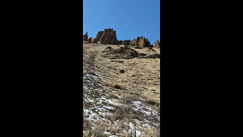
Blue Skies at the Gulch!
RyanzRocksLeslie Gulch is a stunning canyon located in Malheur County, Oregon, though it’s very close to the Oregon-Idaho border. It’s part of the Owyhee Canyonlands, a remote and rugged region known for its dramatic landscapes. The gulch is famous for its towering rock formations made of volcanic tuff, which create a surreal, almost otherworldly scenery with honeycombed cliffs and vibrant colors ranging from reds to yellows. It’s situated on the east side of Owyhee Lake (also called Owyhee Reservoir), formed by the Owyhee River, and is managed by the Bureau of Land Management (BLM) as an Area of Critical Environmental Concern. The area is named after Hiram E. Leslie, a rancher who tragically died there in 1882 after being struck by lightning. Before that, it was known as Dugout Gulch. It’s a haven for outdoor enthusiasts, offering hiking, camping, wildlife viewing, and even boating near the reservoir. The Slocum Creek Campground, with 10 sites, is a popular spot for visitors, though it’s primitive—no water or electricity, just pit toilets and basic amenities. The gulch is home to over 200 California bighorn sheep, along with mule deer, elk, coyotes, and a variety of birds like quail and raptors. It also hosts rare plants, some found nowhere else, like Packard’s blazing star and Etter’s groundsel. Getting there involves a bit of a trek—usually about a 15-mile drive down a gravel road from either Succor Creek Road or McBride Creek Road, accessible from Highway 95 in Idaho or Highway 201 in Oregon. It’s roughly two hours from Boise, Idaho, making it a feasible day trip from there, though the remoteness means no cell service and a need for preparation, especially since the road can get tricky after rain.45 views -
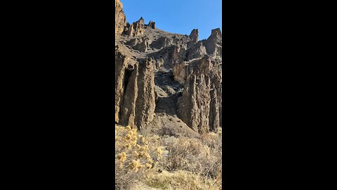
Cool formations!
RyanzRocksLeslie Gulch is a stunning canyon located in Malheur County, Oregon, though it’s very close to the Oregon-Idaho border. It’s part of the Owyhee Canyonlands, a remote and rugged region known for its dramatic landscapes. The gulch is famous for its towering rock formations made of volcanic tuff, which create a surreal, almost otherworldly scenery with honeycombed cliffs and vibrant colors ranging from reds to yellows. It’s situated on the east side of Owyhee Lake (also called Owyhee Reservoir), formed by the Owyhee River, and is managed by the Bureau of Land Management (BLM) as an Area of Critical Environmental Concern. The area is named after Hiram E. Leslie, a rancher who tragically died there in 1882 after being struck by lightning. Before that, it was known as Dugout Gulch. It’s a haven for outdoor enthusiasts, offering hiking, camping, wildlife viewing, and even boating near the reservoir. The Slocum Creek Campground, with 10 sites, is a popular spot for visitors, though it’s primitive—no water or electricity, just pit toilets and basic amenities. The gulch is home to over 200 California bighorn sheep, along with mule deer, elk, coyotes, and a variety of birds like quail and raptors. It also hosts rare plants, some found nowhere else, like Packard’s blazing star and Etter’s groundsel. Getting there involves a bit of a trek—usually about a 15-mile drive down a gravel road from either Succor Creek Road or McBride Creek Road, accessible from Highway 95 in Idaho or Highway 201 in Oregon. It’s roughly two hours from Boise, Idaho, making it a feasible day trip from there, though the remoteness means no cell service and a need for preparation, especially since the road can get tricky after rain.45 views