Premium Only Content
This video is only available to Rumble Premium subscribers. Subscribe to
enjoy exclusive content and ad-free viewing.
Lets hit the road!
HumbleConservative
- 82 / 82
1
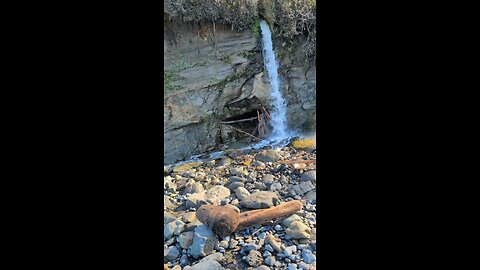
Beautiful Blues at Beverly Beach!
HumbleConservative
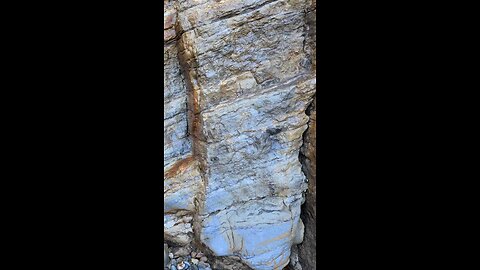
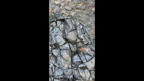
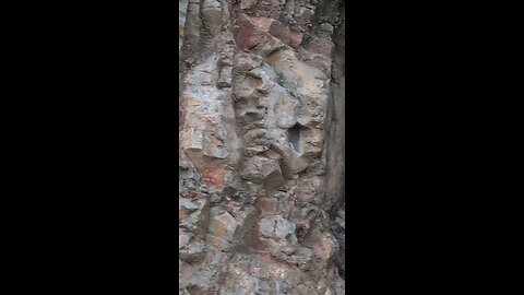
These rocks appear to be a type of sedimentary rock, likely a sandstone or shale, with some interesting features. The blue-gray coloration and the layered, striated texture suggest it could be a mudstone or siltstone that has undergone some degree of alteration, possibly due to mineral content or weathering processes. The presence of yellowish-brown veins or streaks might indicate iron oxide or other mineral deposits, which are common in coastal sedimentary rocks exposed to the elements.
Given the context of Beverly Beach, Oregon, this rock could be part of the geological formations found along the Oregon Coast, where sedimentary layers from ancient marine environments are often exposed. These layers can contain fossils or impressions, as the area is known for fossil hunting. The blue hue might also hint at the presence of reduced iron or other minerals, which can give rocks unusual colors when exposed to air and water over time.
Without a closer analysis (like a sample test or expert fieldwork), it’s hard to be definitive, but this looks like a weathered sedimentary rock, possibly a siltstone or mudstone with mineral staining.
2
Big Blue Pacific!
HumbleConservative
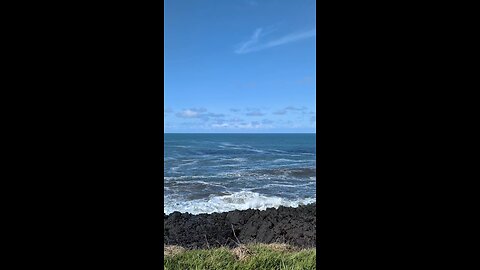
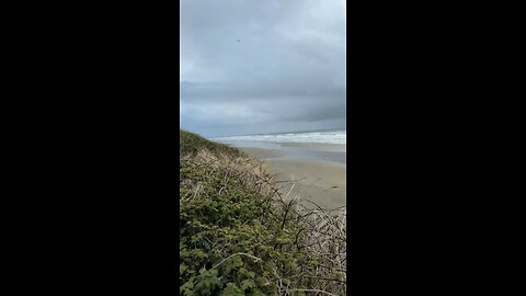
Moolack Beach is a rugged, beautiful stretch of the central Oregon Coast, just south of Wade Creek Beach and about 4 miles north of Newport in Lincoln County. It’s part of the same continuous sandy shoreline as Beverly Beach to the north, but Moolack stands out with its mix of soft sand, rocky outcrops, and dramatic cliffs. It’s less touristy than spots like Cannon Beach, offering a wilder, more laid-back vibe perfect for beachcombers, rockhounds, and anyone who loves untamed coastal scenery.
You can access Moolack Beach from a few points off Highway 101. The main one is a gravel pull-out near milepost 135, marked by a small “Moolack Beach” sign—room for about 10-15 cars. From there, a short, easy trail (about 0.1 miles) winds through a grassy dune area down to the sand. Another access is via Beverly Beach State Park to the north, where you can walk south along the shore for roughly a mile to reach Moolack. At low tide, the beach stretches wide, revealing tide pools and rocky patches; at high tide, it narrows, so timing matters.
What sets Moolack apart is its geology. The cliffs—up to 100 feet high—are layered sandstone and siltstone, packed with fossils from millions of years ago (think clams and snails). Erosion exposes these, and winter storms often wash agates, jasper, and petrified wood onto the shore—prime hunting grounds for rock enthusiasts. The beach also has scattered sea stacks and boulders, remnants of ancient coastal erosion. To the south, you’ll spot Yaquina Head Lighthouse, a scenic backdrop about 2 miles away.
It’s a great place to explore. Tide pools near the rocks host sea stars, anemones, and crabs, though they’re not as dense as at Devils Punchbowl. The sand is soft and walkable, stretching over 2 miles, with Wade Creek to the north as a loose boundary. Surfers occasionally hit the waves, and kite flyers take advantage of the steady breeze. Whales pass by during migration (December-January and March-April), visible from the cliffs or beach if you’re lucky. There’s no real infrastructure—no restrooms or picnic tables—so it’s raw and natural, with Highway 101’s hum in the background.
The name “Moolack” might come from a Native term, possibly meaning “elk” or “place of elk,” though exact origins are murky. It’s close enough to your earlier spots—5 minutes from Wade Creek, 10 from Devils Punchbowl—for a multi-beach day.
3
Near the Punchbowl!
HumbleConservative
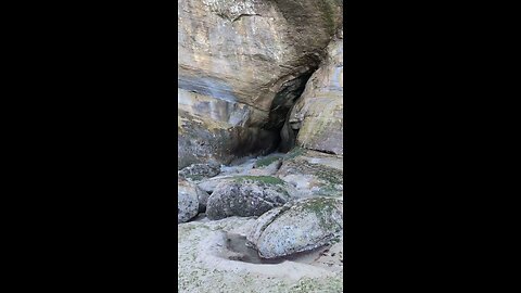
Devil's Punchbowl State Natural Area is a stunning spot on the central Oregon Coast, located in Otter Rock, about 5 miles south of Depoe Bay and 8 miles north of Newport. It’s a day-use state park centered around a massive, bowl-shaped rock formation carved into a headland, partially open to the Pacific Ocean. This "punchbowl" was likely formed when the roofs of two sea caves collapsed, and over time, relentless waves sculpted it into the dramatic feature you see today. During high tide, especially in stormy weather, waves crash in with a thundering roar, churning and foaming inside the bowl—pretty wild to watch from above. At low tide, you can actually hike down to explore the interior, though you’ve got to time it right and stay cautious, as the ocean can be unpredictable.
The park itself offers more than just the punchbowl. There’s a scenic overlook right near the parking lot where you can take in the view, plus picnic tables with ocean vistas—perfect for a coastal lunch. Trails lead down to the beach, where you can check out tidepools teeming with starfish, anemones, and crabs, especially on the north side. Surfers love the waves near Gull Rock, a big offshore pinnacle about half a mile out, and the area’s part of the Oregon Islands National Wildlife Refuge, so you might spot seabirds, seals, or even whales if you’re there during migration season (spring or late winter).
Heads up, though: the stairs to the beach are set to be closed for repairs from April 15th to May 15th, 2025—so right now, on April 4th, 2025, they’re still open, but plan accordingly if you’re visiting later this month. If the stairs are out, the next beach access is south at Beverly Beach State Park. Parking can get tight, especially in summer, but it’s free, and the vibe’s laid-back with a coffee shop and small shops nearby in Otter Rock. It’s a classic Oregon Coast stop—raw, rugged, and worth the detour off Highway 101.
4
Beverly Beach!
HumbleConservative
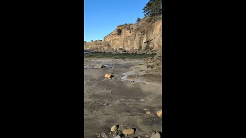
Beverly Beach, Oregon, is a beautiful spot along the Oregon Coast, known for its stunning sandy beaches and natural charm. It’s an unincorporated community in Lincoln County, located on U.S. Route 101, just north of Yaquina Head and south of Beverly Beach State Park.
5
Beverly Beach Oregon!
HumbleConservative
Beverly Beach, Oregon, is a beautiful spot along the Oregon Coast, known for its stunning sandy beaches and natural charm. It’s an unincorporated community in Lincoln County, located on U.S. Route 101, just north of Yaquina Head and south of Beverly Beach State Park.
6
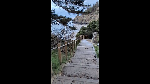
Path to the Punchbowl!
HumbleConservative
Devil's Punchbowl State Natural Area is a stunning spot on the central Oregon Coast, located in Otter Rock, about 5 miles south of Depoe Bay and 8 miles north of Newport. It’s a day-use state park centered around a massive, bowl-shaped rock formation carved into a headland, partially open to the Pacific Ocean. This "punchbowl" was likely formed when the roofs of two sea caves collapsed, and over time, relentless waves sculpted it into the dramatic feature you see today. During high tide, especially in stormy weather, waves crash in with a thundering roar, churning and foaming inside the bowl—pretty wild to watch from above. At low tide, you can actually hike down to explore the interior, though you’ve got to time it right and stay cautious, as the ocean can be unpredictable.
The park itself offers more than just the punchbowl. There’s a scenic overlook right near the parking lot where you can take in the view, plus picnic tables with ocean vistas—perfect for a coastal lunch. Trails lead down to the beach, where you can check out tidepools teeming with starfish, anemones, and crabs, especially on the north side. Surfers love the waves near Gull Rock, a big offshore pinnacle about half a mile out, and the area’s part of the Oregon Islands National Wildlife Refuge, so you might spot seabirds, seals, or even whales if you’re there during migration season (spring or late winter).
Heads up, though: the stairs to the beach are set to be closed for repairs from April 15th to May 15th, 2025—so right now, on April 4th, 2025, they’re still open, but plan accordingly if you’re visiting later this month. If the stairs are out, the next beach access is south at Beverly Beach State Park. Parking can get tight, especially in summer, but it’s free, and the vibe’s laid-back with a coffee shop and small shops nearby in Otter Rock. It’s a classic Oregon Coast stop—raw, rugged, and worth the detour off Highway 101.
7
Beautiful Beverly Beach Sand Art!
HumbleConservative
Beverly Beach, Oregon, is a beautiful spot along the Oregon Coast, known for its stunning sandy beaches and natural charm. It’s an unincorporated community in Lincoln County, located on U.S. Route 101, just north of Yaquina Head and south of Beverly Beach State Park.
8
Heading home along the Columbia River!
HumbleConservative
The Columbia River Gorge is a stunning canyon of the Columbia River in the Pacific Northwest of the United States. It stretches over 80 miles (130 kilometers) where the river cuts through the Cascade Range, forming part of the border between Washington and Oregon.
9
John Day Dam!
HumbleConservative
The John Day Dam is a major structure on the Columbia River, located at river mile 215.6, about 28 miles (45 km) east of The Dalles, Oregon, and just below the mouth of the John Day River. It spans the river between Sherman County, Oregon, and Klickitat County, Washington. Operated by the U.S. Army Corps of Engineers, this concrete gravity run-of-the-river dam was completed in 1971 after construction began in 1958, at a cost of $511 million. It’s part of the Columbia River Basin dam system, designed primarily for hydroelectric power and navigation.
Here’s what stands out about it:
Power Generation: It has 16 turbine units with a nameplate capacity of 2,160 megawatts and an overload capacity of 2,485 megawatts—enough to power roughly two cities the size of Seattle. Skeleton units for four more generators were built in, hinting at potential expansion.
Navigation Lock: The John Day Lock boasts the highest lift of any U.S. lock at 110 feet (34 meters), allowing barges and ships to navigate the river’s elevation changes.
Reservoir: The dam forms Lake Umatilla, stretching 76.4 miles (123 km) upstream to the McNary Dam. The reservoir’s full pool elevation is 268 feet (82 meters), with a usable storage capacity of 534,000 acre-feet between 257 and 268 feet.
Fish Passage: It includes fish ladders on both sides to aid salmon and steelhead migration, though the 76-mile reservoir has been noted as a tough stretch for young salmon, with high mortality rates reported in studies from the mid-2000s.
The dam’s not open to the public for tours, but you can get a good view from Giles French Park downstream. It’s a powerhouse—literally and figuratively—but its impact on the river’s ecology, especially salmon runs, has long been debated.
2
comments
10
Beautiful Beverly Beach Sand Art!
HumbleConservative
Beverly Beach, Oregon, is a beautiful spot along the Oregon Coast, known for its stunning sandy beaches and natural charm. It’s an unincorporated community in Lincoln County, located on U.S. Route 101, just north of Yaquina Head and south of Beverly Beach State Park. The area got its name in the early 1930s from Curtis and Florence May Christy, who owned the land and asked their young daughter, Florence Daneene Christy, to name it. She chose "Beverly" after her favorite doll, and the name stuck.
The main draw here is Beverly Beach State Park, a popular destination for visitors. It features a large, forest-sheltered campground along Spencer Creek, with giant, wind-sculpted trees and easy access to miles of beach stretching from Yaquina Head (where you can spot the lighthouse) to Otter Rock. The park offers something for everyone: 53 full-hookup RV sites, 76 electrical sites with water, 128 tent sites, and 21 yurts (some pet-friendly), plus group camping areas and a hiker/biker camp. A short walkway under Highway 101 takes you straight to the beach, perfect for kite flying, sandcastle building, surfing, fossil hunting, or just relaxing. The park also has amenities like hot showers, flush toilets, a playground, and a visitor center.
The beach itself is wide and flat, great for long walks, and on clear days, you can see from Cape Foulweather down to Yaquina Head. It’s a hotspot for surfers (especially in winter) and fossil enthusiasts, with ancient shells and marine life impressions visible in the cliffs. Nearby attractions like the Oregon Coast Aquarium, Yaquina Head Lighthouse, and Newport’s shops and restaurants are just a short drive away, making it a convenient base for exploring the central coast.
It’s a busy place, especially in summer, with the campground being one of Oregon’s largest and most popular, hosting nearly 170,000 campers a year. If you’re after peace and quiet, head north or south along the beach to escape the crowds. Whether you’re camping or just stopping by for the day, Beverly Beach offers a classic Oregon Coast experience—raw, rugged, and unforgettable.
11
Beverly Beach Cliff Side!
HumbleConservative
Beverly Beach, Oregon, is a beautiful spot along the Oregon Coast, known for its stunning sandy beaches and natural charm. It’s an unincorporated community in Lincoln County, located on U.S. Route 101, just north of Yaquina Head and south of Beverly Beach State Park. The area got its name in the early 1930s from Curtis and Florence May Christy, who owned the land and asked their young daughter, Florence Daneene Christy, to name it. She chose "Beverly" after her favorite doll, and the name stuck.
The main draw here is Beverly Beach State Park, a popular destination for visitors. It features a large, forest-sheltered campground along Spencer Creek, with giant, wind-sculpted trees and easy access to miles of beach stretching from Yaquina Head (where you can spot the lighthouse) to Otter Rock. The park offers something for everyone: 53 full-hookup RV sites, 76 electrical sites with water, 128 tent sites, and 21 yurts (some pet-friendly), plus group camping areas and a hiker/biker camp. A short walkway under Highway 101 takes you straight to the beach, perfect for kite flying, sandcastle building, surfing, fossil hunting, or just relaxing. The park also has amenities like hot showers, flush toilets, a playground, and a visitor center.
The beach itself is wide and flat, great for long walks, and on clear days, you can see from Cape Foulweather down to Yaquina Head. It’s a hotspot for surfers (especially in winter) and fossil enthusiasts, with ancient shells and marine life impressions visible in the cliffs. Nearby attractions like the Oregon Coast Aquarium, Yaquina Head Lighthouse, and Newport’s shops and restaurants are just a short drive away, making it a convenient base for exploring the central coast.
It’s a busy place, especially in summer, with the campground being one of Oregon’s largest and most popular, hosting nearly 170,000 campers a year. If you’re after peace and quiet, head north or south along the beach to escape the crowds. Whether you’re camping or just stopping by for the day, Beverly Beach offers a classic Oregon Coast experience—raw, rugged, and unforgettable.
12
Beverly Beach!
HumbleConservative
Beverly Beach, Oregon, is a beautiful spot along the Oregon Coast, located in Lincoln County. It’s an unincorporated community situated on U.S. Route 101, just north of Yaquina Head and south of Beverly Beach State Park. The area got its name in the early 1930s from Curtis and Florence May Christy, who owned the property and wanted to create a seaside community. They asked their young daughter, Florence Daneene Christy (Pearson), for a name, and she chose "Beverly" after her favorite doll.
The main attraction here is Beverly Beach State Park, a popular destination known for its large, forest-sheltered campground and easy access to a long stretch of sandy beach. The beach runs from Yaquina Head (where you can spot the lighthouse) to the headlands of Otter Rock, offering plenty of space for activities like kite flying, sandcastle building, surfing, or fossil hunting. The campground itself is nestled along Spencer Creek, surrounded by giant, wind-sculpted trees, and features a mix of tent sites, RV hookups, and yurts—perfect for a coastal getaway. It’s a busy spot, especially in summer, but the beach is expansive enough that you can still find a quiet corner to enjoy.
The park is just 5 miles north of Newport, making
it a convenient base for exploring nearby attractions like the Oregon Coast Aquarium, Yaquina Head Lighthouse, or the shops and restaurants in Newport and Depoe Bay. Whether you’re camping or just stopping by for the day, it’s a classic Oregon Coast experience with a mix of natural beauty and laid-back vibes.
13
Angry Seas and a Lighthouse!
HumbleConservative
Yaquina Head Lighthouse is a striking piece of Oregon Coast history, perched on Yaquina Head, a basalt promontory extending nearly a mile into the Pacific Ocean, just north of Newport and near Agate Beach. At 93 feet, it’s the tallest lighthouse in Oregon, built in 1873 to replace the less effective Yaquina Bay Lighthouse, which struggled with visibility issues. Its first-order Fresnel lens, crafted in Paris in 1868, still operates today, powered by a 1,000-watt bulb (a far cry from the lard oil it once burned). The light’s signature pattern—two seconds on, two off, two on, 14 off—cuts through the night up to 19 miles out, a beacon for mariners navigating these rocky shores.
The lighthouse sits within the Yaquina Head Outstanding Natural Area, managed by the BLM, and it’s a hotspot for more than just history buffs. The surrounding 100-acre site is alive with natural spectacle: tide pools brimming with sea stars and anemones, a noisy seabird colony on Colony Rock (think murres, cormorants, and gulls), and marine life like harbor seals and gray whales, especially visible during their migrations (late December to January and March to April). The headland itself is a geological relic, formed by lava flows 14 million years ago, and its cobble beaches below are a treasure trove for agate hunters, especially after storms.
Building it was no picnic—construction dragged on for two years thanks to relentless storms and supply woes, finally lighting up on August 20, 1873. Today, it’s a visitor favorite, pulling in about 400,000 people yearly. You can explore the interpretive center (open 10 a.m. to 4 p.m.) and, with a reservation, climb the lighthouse tower itself, though hours are tighter (check ahead). Entry’s $7 per vehicle, or free with an America the Beautiful pass. The site’s got parking, restrooms, and trails, but watch for sneaker waves if you’re down by the water.
It’s a perfect pairing with Agate Beach—just a few miles south—offering a mix of coastal beauty, wildlife, and a glimpse into maritime past.
14
Morning tide!
HumbleConservative
Nye Beach is a charming, historic neighborhood and beach area in Newport, Oregon, just a few miles south of Yaquina Head Lighthouse and Agate Beach. It’s nestled along the Pacific Coast, where the sandy shores meet a vibrant, artsy community that’s been a draw since the late 19th century. The beach itself stretches about a mile, framed by cliffs to the north and the Yaquina Bay jetty to the south, making it a scenic spot for strolling, kite flying, or just soaking in the ocean vibes. It’s less about agate hunting here and more about the laid-back coastal experience—think waves crashing, gulls overhead, and the occasional sandcastle.
Historically, Nye Beach was Newport’s first tourist hub. It kicked off in the 1860s when a settler named Sam Dunderfelder (great name, right?) stumbled on an agate, sparking interest. But it was John Nye, who claimed the land in 1866, that gave it its name. By the 1890s, it was a full-on summer retreat—tents, bathhouses, and a rickety boardwalk over the dunes. The arrival of the “Honeymoon Special” train from the Willamette Valley in the early 1900s turned it into a proper getaway, with dance halls and hot seawater baths. A fire in 1940 wiped out much of the old commercial strip, but it bounced back, evolving into today’s mix of quaint cottages, boutique shops, and eateries.
Now, it’s Newport’s cultural heart. The Nye Beach Turnaround, marked by a stone pillar, is the main access point, with parking and restrooms nearby. You’ll find the Newport Visual Arts Center and Performing Arts Center right up the hill, hosting galleries, workshops, and shows. The neighborhood’s got a funky, eclectic feel—think bookstores, cafes like Café Stephanie, and spots like Nana’s Irish Pub, all within a few blocks. It’s walkable, with historic homes and oceanfront rentals adding to the charm.
The beach itself is public and free, perfect for a sunset walk or a chilly dip (it’s the Oregon Coast, so bring a sweater). It ties into Newport’s broader scene—close to the bayfront’s seafood joints and the Oregon Coast Aquarium—but keeps its own distinct, artsy soul. If you’re hitting Agate Beach or Yaquina Head, Nye’s an easy add-on for a taste of local flavor.
15
Natural Sand Art at the Beach!
HumbleConservative
Agate Beach is a beautiful coastal area located in Lincoln County, Oregon, just north of Newport along the Pacific Ocean. It’s part of the Agate Beach State Recreation Site, a state park known for its wide, sandy shores stretching nearly 4 miles between Newport and Yaquina Head. The beach is a popular spot for a variety of activities like surfing, razor clamming, kite flying, birdwatching, and, of course, hunting for agates—those colorful, translucent gemstones formed in volcanic rock millions of years ago. Despite its name, agates aren’t as abundant here as they once were due to changes in the local landscape, like the elongation of Yaquina Bay jetties and sand buildup since the 1960s, but you can still find them, especially after winter storms when gravel beds are exposed.
The park itself sits between the new and old U.S. Highway 101, with easy access via a tunnel under the old highway from a large parking lot. It’s got amenities like restrooms, picnic tables, and plenty of space for parking, even for trailers. Historically, Agate Beach was its own unincorporated community with a post office from 1912 to 1971, and it’s tied to the legacy of composer Ernest Bloch, who lived there in his later years—his 1914 house is on the National Register of Historic Places. The beach also made headlines in 2012 when a 165-ton dock from the 2011 Japanese tsunami washed ashore, bringing with it a mix of marine life that had to be cleared to prevent invasive species.
It’s a great spot to visit year-round, drawing around 190,000 people annually. If you’re looking for agates, your best bet is during low tide after a storm, when the ocean churns up fresh gravel. Just keep an eye on the waves—sneaker waves can catch you off guard—and enjoy the vast, open beauty of this Oregon Coast gem.
16
Angry Seas this morning!
HumbleConservative
Nye Beach is a charming, historic neighborhood and beach area in Newport, Oregon, just a few miles south of Yaquina Head Lighthouse and Agate Beach. It’s nestled along the Pacific Coast, where the sandy shores meet a vibrant, artsy community that’s been a draw since the late 19th century. The beach itself stretches about a mile, framed by cliffs to the north and the Yaquina Bay jetty to the south, making it a scenic spot for strolling, kite flying, or just soaking in the ocean vibes. It’s less about agate hunting here and more about the laid-back coastal experience—think waves crashing, gulls overhead, and the occasional sandcastle.
Historically, Nye Beach was Newport’s first tourist hub. It kicked off in the 1860s when a settler named Sam Dunderfelder (great name, right?) stumbled on an agate, sparking interest. But it was John Nye, who claimed the land in 1866, that gave it its name. By the 1890s, it was a full-on summer retreat—tents, bathhouses, and a rickety boardwalk over the dunes. The arrival of the “Honeymoon Special” train from the Willamette Valley in the early 1900s turned it into a proper getaway, with dance halls and hot seawater baths. A fire in 1940 wiped out much of the old commercial strip, but it bounced back, evolving into today’s mix of quaint cottages, boutique shops, and eateries.
Now, it’s Newport’s cultural heart. The Nye Beach Turnaround, marked by a stone pillar, is the main access point, with parking and restrooms nearby. You’ll find the Newport Visual Arts Center and Performing Arts Center right up the hill, hosting galleries, workshops, and shows. The neighborhood’s got a funky, eclectic feel—think bookstores, cafes like Café Stephanie, and spots like Nana’s Irish Pub, all within a few blocks. It’s walkable, with historic homes and oceanfront rentals adding to the charm.
The beach itself is public and free, perfect for a sunset walk or a chilly dip (it’s the Oregon Coast, so bring a sweater). It ties into Newport’s broader scene—close to the bayfront’s seafood joints and the Oregon Coast Aquarium—but keeps its own distinct, artsy soul. If you’re hitting Agate Beach or Yaquina Head, Nye’s an easy add-on for a taste of local flavor.
17
Agate Beach!
HumbleConservative
Agate Beach is a beautiful coastal area located in Lincoln County, Oregon, just north of Newport along the Pacific Ocean. It’s part of the Agate Beach State Recreation Site, a state park known for its wide, sandy shores stretching nearly 4 miles between Newport and Yaquina Head. The beach is a popular spot for a variety of activities like surfing, razor clamming, kite flying, birdwatching, and, of course, hunting for agates—those colorful, translucent gemstones formed in volcanic rock millions of years ago. Despite its name, agates aren’t as abundant here as they once were due to changes in the local landscape, like the elongation of Yaquina Bay jetties and sand buildup since the 1960s, but you can still find them, especially after winter storms when gravel beds are exposed.
The park itself sits between the new and old U.S. Highway 101, with easy access via a tunnel under the old highway from a large parking lot. It’s got amenities like restrooms, picnic tables, and plenty of space for parking, even for trailers. Historically, Agate Beach was its own unincorporated community with a post office from 1912 to 1971, and it’s tied to the legacy of composer Ernest Bloch, who lived there in his later years—his 1914 house is on the National Register of Historic Places. The beach also made headlines in 2012 when a 165-ton dock from the 2011 Japanese tsunami washed ashore, bringing with it a mix of marine life that had to be cleared to prevent invasive species.
It’s a great spot to visit year-round, drawing around 190,000 people annually. If you’re looking for agates, your best bet is during low tide after a storm, when the ocean churns up fresh gravel. Just keep an eye on the waves—sneaker waves can catch you off guard—and enjoy the vast, open beauty of this Oregon Coast gem.
18
Nye Beach Cliff side!
HumbleConservative
Nye Beach is a charming historic district in Newport, Oregon, nestled along the Central Oregon Coast. Perched on a sea cliff overlooking the Pacific Ocean, it’s been a beloved vacation spot since the late 19th century. The area blends natural beauty with a vibrant cultural scene, featuring sandy beaches, easy access via the Nye Beach Turnaround, and a quaint neighborhood vibe.
You’ll find a mix of local shops, art galleries, and eateries—think cozy cafes, bakeries like Blue Pig, and spots like the Chowder Bowl serving up award-winning clam chowder. The district’s historic overlay runs from Northwest Twelfth Street to Southwest Second Street, bounded by Hurbert Street and the ocean, offering a compact yet rich area to explore. It’s home to cultural hubs like the Newport Visual Arts Center and Performing Arts Center, reflecting its artistic soul.
The beach itself draws tide-poolers, surfers, and beachcombers, with stunning sunset views and activities like kite flying or crabbing. It’s just steps from oceanfront lodging options like the Inn at Nye Beach, known for its luxury amenities and infinity spa. Nearby, Newport’s Bayfront and the Oregon Coast Aquarium are a short drive away, adding to the coastal allure.
19
Nye Beach Newport Oregon!
HumbleConservative
Nye Beach is a charming historic district in Newport, Oregon, nestled along the Central Oregon Coast. Perched on a sea cliff overlooking the Pacific Ocean, it’s been a beloved vacation spot since the late 19th century. The area blends natural beauty with a vibrant cultural scene, featuring sandy beaches, easy access via the Nye Beach Turnaround, and a quaint neighborhood vibe.
You’ll find a mix of local shops, art galleries, and eateries—think cozy cafes, bakeries like Blue Pig, and spots like the Chowder Bowl serving up award-winning clam chowder. The district’s historic overlay runs from Northwest Twelfth Street to Southwest Second Street, bounded by Hurbert Street and the ocean, offering a compact yet rich area to explore. It’s home to cultural hubs like the Newport Visual Arts Center and Performing Arts Center, reflecting its artistic soul.
The beach itself draws tide-poolers, surfers, and beachcombers, with stunning sunset views and activities like kite flying or crabbing. It’s just steps from oceanfront lodging options like the Inn at Nye Beach, known for its luxury amenities and infinity spa. Nearby, Newport’s Bayfront and the Oregon Coast Aquarium are a short drive away, adding to the coastal allure.
20
Willamette National Forest!
HumbleConservative
Willamette National Forest is a stunning expanse of natural beauty in western Oregon, USA, covering over 1.6 million acres. Established in 1933, it stretches along the western slopes of the Cascade Range, offering a diverse landscape of rugged mountains, deep valleys, and dense forests. The forest is home to iconic peaks like Mount Jefferson and the Three Sisters, as well as numerous rivers, waterfalls (like the famous Sahalie and Koosah Falls), and hot springs.
It’s a haven for outdoor enthusiasts, with over 1,700 miles of trails for hiking, biking, and horseback riding, plus opportunities for camping, fishing, and skiing in the winter. The forest is rich in biodiversity, hosting Douglas-fir, western hemlock, and cedar trees, alongside wildlife like black bears, elk, and spotted owls. Volcanic features, such as lava fields and cinder cones, add a unique geological flair.
1
comment
21
Dam Drivin'!
HumbleConservative
Lucky Peak State Park is located in Idaho, just a short distance from Boise. It’s a popular spot for outdoor activities like swimming, picnicking, fishing, boating, and biking. The park consists of three main areas: Discovery Park, Sandy Point, and Spring Shores, each offering its own unique features.
Discovery Park is great for picnicking and fishing along the Boise River, with shaded areas and a calm, flat water section perfect for kayaking or canoeing. It’s about 8 miles southeast of Boise and easily accessible by car or a 30-minute bike ride via the Boise River Greenbelt.
Sandy Point, located at the base of Lucky Peak Dam, has a sandy beach for swimming and sunbathing, though pets aren’t allowed here. It’s open from 8 AM to 4 PM daily.
Spring Shores features a marina with boat ramps and rentals, ideal for boating enthusiasts, and is a 40-minute drive from Boise. Both Discovery Park and Spring Shores are open from sunrise to sunset.
The park surrounds part of Lucky Peak Reservoir, created in 1955 by the Lucky Peak Dam, managed by the U.S. Army Corps of Engineers. Entry fees range from $7 to $14 per vehicle, depending on the day. It’s a fantastic place to enjoy nature close to the city, drawing over half a million visitors annually.
22
Lucky Peak Dam!
HumbleConservative
Lucky Peak State Park is located in Idaho, just a short distance from Boise. It’s a popular spot for outdoor activities like swimming, picnicking, fishing, boating, and biking. The park consists of three main areas: Discovery Park, Sandy Point, and Spring Shores, each offering its own unique features.
Discovery Park is great for picnicking and fishing along the Boise River, with shaded areas and a calm, flat water section perfect for kayaking or canoeing. It’s about 8 miles southeast of Boise and easily accessible by car or a 30-minute bike ride via the Boise River Greenbelt.
Sandy Point, located at the base of Lucky Peak Dam, has a sandy beach for swimming and sunbathing, though pets aren’t allowed here. It’s open from 8 AM to 4 PM daily.
Spring Shores features a marina with boat ramps and rentals, ideal for boating enthusiasts, and is a 40-minute drive from Boise. Both Discovery Park and Spring Shores are open from sunrise to sunset.
The park surrounds part of Lucky Peak Reservoir, created in 1955 by the Lucky Peak Dam, managed by the U.S. Army Corps of Engineers. Entry fees range from $7 to $14 per vehicle, depending on the day. It’s a fantastic place to enjoy nature close to the city, drawing over half a million visitors annually.
23
Rockhounding at The Graveyard!
HumbleConservative
Graveyard Point in Idaho is a fascinating spot, especially if you’re into rockhounding or curious about unique natural and historical sites. It’s located in Owyhee County, near the Oregon-Idaho border, just a few miles west of Homedale, Idaho. The area is renowned for its rich deposits of plume agate, a type of chalcedony with feathery, plume-like inclusions, often found in seams within the local basalt rock. This makes it a popular destination for rock collectors looking to dig up or pick through surface “float” material for treasures like agates, jasper, or even petrified wood.
The name "Graveyard Point" comes from a small pioneer cemetery perched on a hill, marked by a stone monument built in the early 1950s by rockhounds from the Northwest and California mineral societies. The monument lists five names—McConnell (1896), Thomas infant (1901), Mussell infant (1901), Jack Sparks (1914), and Old Uncle Billy Stull (no date)—though historical records suggest some graves might be missing or misnamed. It’s a bit of a haunting footnote to an otherwise rugged, desert landscape.
Getting there can be tricky due to private property and “No Trespassing” signs, but there’s public land managed by the Bureau of Land Management (BLM) where collecting is allowed. A common route starts in Homedale: head west on Highway 19, turn onto Graveyard Point Road, and follow it about 4 miles to where it connects to public access points near Nielsen Lane (also called Sage Road). From there, a high-clearance 4WD vehicle is recommended as the dirt roads get rough, winding through sagebrush desert toward the collecting sites southwest of the cemetery. Coordinates like N 43°33.554' W 117°02.066' can guide you to the heart of the agate area.
The terrain’s a mix of high desert and hills, with agate veins popping up every 10 yards or so across hundreds of acres. Some veins are a foot thick and stretch 30 feet long, filled with clear or colorful chalcedony—think blues, ambers, or grays—sometimes with black dendrites or angel wing formations. It’s been a rockhounding hotspot since the 1950s, and while there are active mining claims (like the Beverly Marie claim), plenty of free collecting spots remain if you steer clear of private land.
If you’re planning a trip, bring tools like a shovel, geology pick, or chisel, and expect a remote vibe—camping’s an option, but there’s no fancy lodging nearby. Closest towns for a bed are Homedale or farther out, Nampa or Caldwell. Just respect the land, watch for private boundaries, and you’ll likely leave with some stunning finds and a story to tell.
24
Graveyard Point Rockhunt!
HumbleConservative
Graveyard Point in Idaho is a fascinating spot, especially if you’re into rockhounding or curious about unique natural and historical sites. It’s located in Owyhee County, near the Oregon-Idaho border, just a few miles west of Homedale, Idaho. The area is renowned for its rich deposits of plume agate, a type of chalcedony with feathery, plume-like inclusions, often found in seams within the local basalt rock. This makes it a popular destination for rock collectors looking to dig up or pick through surface “float” material for treasures like agates, jasper, or even petrified wood.
The name "Graveyard Point" comes from a small pioneer cemetery perched on a hill, marked by a stone monument built in the early 1950s by rockhounds from the Northwest and California mineral societies. The monument lists five names—McConnell (1896), Thomas infant (1901), Mussell infant (1901), Jack Sparks (1914), and Old Uncle Billy Stull (no date)—though historical records suggest some graves might be missing or misnamed. It’s a bit of a haunting footnote to an otherwise rugged, desert landscape.
Getting there can be tricky due to private property and “No Trespassing” signs, but there’s public land managed by the Bureau of Land Management (BLM) where collecting is allowed. A common route starts in Homedale: head west on Highway 19, turn onto Graveyard Point Road, and follow it about 4 miles to where it connects to public access points near Nielsen Lane (also called Sage Road). From there, a high-clearance 4WD vehicle is recommended as the dirt roads get rough, winding through sagebrush desert toward the collecting sites southwest of the cemetery. Coordinates like N 43°33.554' W 117°02.066' can guide you to the heart of the agate area.
The terrain’s a mix of high desert and hills, with agate veins popping up every 10 yards or so across hundreds of acres. Some veins are a foot thick and stretch 30 feet long, filled with clear or colorful chalcedony—think blues, ambers, or grays—sometimes with black dendrites or angel wing formations. It’s been a rockhounding hotspot since the 1950s, and while there are active mining claims (like the Beverly Marie claim), plenty of free collecting spots remain if you steer clear of private land.
If you’re planning a trip, bring tools like a shovel, geology pick, or chisel, and expect a remote vibe—camping’s an option, but there’s no fancy lodging nearby. Closest towns for a bed are Homedale or farther out, Nampa or Caldwell. Just respect the land, watch for private boundaries, and you’ll likely leave with some stunning finds and a story to tell.
25
Beautiful day at The Graveyard!
HumbleConservative
Graveyard Point in Idaho is a fascinating spot, especially if you’re into rockhounding or curious about unique natural and historical sites. It’s located in Owyhee County, near the Oregon-Idaho border, just a few miles west of Homedale, Idaho. The area is renowned for its rich deposits of plume agate, a type of chalcedony with feathery, plume-like inclusions, often found in seams within the local basalt rock. This makes it a popular destination for rock collectors looking to dig up or pick through surface “float” material for treasures like agates, jasper, or even petrified wood.
The name "Graveyard Point" comes from a small pioneer cemetery perched on a hill, marked by a stone monument built in the early 1950s by rockhounds from the Northwest and California mineral societies. The monument lists five names—McConnell (1896), Thomas infant (1901), Mussell infant (1901), Jack Sparks (1914), and Old Uncle Billy Stull (no date)—though historical records suggest some graves might be missing or misnamed. It’s a bit of a haunting footnote to an otherwise rugged, desert landscape.
Getting there can be tricky due to private property and “No Trespassing” signs, but there’s public land managed by the Bureau of Land Management (BLM) where collecting is allowed. A common route starts in Homedale: head west on Highway 19, turn onto Graveyard Point Road, and follow it about 4 miles to where it connects to public access points near Nielsen Lane (also called Sage Road). From there, a high-clearance 4WD vehicle is recommended as the dirt roads get rough, winding through sagebrush desert toward the collecting sites southwest of the cemetery. Coordinates like N 43°33.554' W 117°02.066' can guide you to the heart of the agate area.
The terrain’s a mix of high desert and hills, with agate veins popping up every 10 yards or so across hundreds of acres. Some veins are a foot thick and stretch 30 feet long, filled with clear or colorful chalcedony—think blues, ambers, or grays—sometimes with black dendrites or angel wing formations. It’s been a rockhounding hotspot since the 1950s, and while there are active mining claims (like the Beverly Marie claim), plenty of free collecting spots remain if you steer clear of private land.
If you’re planning a trip, bring tools like a shovel, geology pick, or chisel, and expect a remote vibe—camping’s an option, but there’s no fancy lodging nearby. Closest towns for a bed are Homedale or farther out, Nampa or Caldwell. Just respect the land, watch for private boundaries, and you’ll likely leave with some stunning finds and a story to tell.
26
Room with a view!
HumbleConservative
Near Leslie Gulch. Leslie Gulch is a stunning canyon located in Malheur County, Oregon, though it’s very close to the Oregon-Idaho border. It’s part of the Owyhee Canyonlands, a remote and rugged region known for its dramatic landscapes. The gulch is famous for its towering rock formations made of volcanic tuff, which create a surreal, almost otherworldly scenery with honeycombed cliffs and vibrant colors ranging from reds to yellows. It’s situated on the east side of Owyhee Lake (also called Owyhee Reservoir), formed by the Owyhee River, and is managed by the Bureau of Land Management (BLM) as an Area of Critical Environmental Concern.
The area is named after Hiram E. Leslie, a rancher who tragically died there in 1882 after being struck by lightning. Before that, it was known as Dugout Gulch. It’s a haven for outdoor enthusiasts, offering hiking, camping, wildlife viewing, and even boating near the reservoir. The Slocum Creek Campground, with 10 sites, is a popular spot for visitors, though it’s primitive—no water or electricity, just pit toilets and basic amenities. The gulch is home to over 200 California bighorn sheep, along with mule deer, elk, coyotes, and a variety of birds like quail and raptors. It also hosts rare plants, some found nowhere else, like Packard’s blazing star and Etter’s groundsel.
Getting there involves a bit of a trek—usually about a 15-mile drive down a gravel road from either Succor Creek Road or McBride Creek Road, accessible from Highway 95 in Idaho or Highway 201 in Oregon. It’s roughly two hours from Boise, Idaho, making it a feasible day trip from there, though the remoteness means no cell service and a need for preparation, especially since the road can get tricky after rain.
27
Lake Owyhee!
HumbleConservative
Lake Owyhee State Park is a remote gem in eastern Oregon, perched on the northeastern edge of the Owyhee Reservoir, about 40 miles southwest of Ontario. It’s a stark contrast to Leslie Gulch, which sits on the reservoir’s eastern shore, but they’re part of the same wild, volcanic landscape. The park spans the shores of the 53-mile-long Owyhee Reservoir, formed by the Owyhee Dam in 1932, and it’s a hotspot for camping, boating, and fishing amid a deep, colorful canyon that’s a testament to the area’s volcanic past.
28
Entering the Gulch!
HumbleConservative
Leslie Gulch is a stunning canyon located in Malheur County, Oregon, though it’s very close to the Oregon-Idaho border. It’s part of the Owyhee Canyonlands, a remote and rugged region known for its dramatic landscapes. The gulch is famous for its towering rock formations made of volcanic tuff, which create a surreal, almost otherworldly scenery with honeycombed cliffs and vibrant colors ranging from reds to yellows. It’s situated on the east side of Owyhee Lake (also called Owyhee Reservoir), formed by the Owyhee River, and is managed by the Bureau of Land Management (BLM) as an Area of Critical Environmental Concern.
The area is named after Hiram E. Leslie, a rancher who tragically died there in 1882 after being struck by lightning. Before that, it was known as Dugout Gulch. It’s a haven for outdoor enthusiasts, offering hiking, camping, wildlife viewing, and even boating near the reservoir. The Slocum Creek Campground, with 10 sites, is a popular spot for visitors, though it’s primitive—no water or electricity, just pit toilets and basic amenities. The gulch is home to over 200 California bighorn sheep, along with mule deer, elk, coyotes, and a variety of birds like quail and raptors. It also hosts rare plants, some found nowhere else, like Packard’s blazing star and Etter’s groundsel.
Getting there involves a bit of a trek—usually about a 15-mile drive down a gravel road from either Succor Creek Road or McBride Creek Road, accessible from Highway 95 in Idaho or Highway 201 in Oregon. It’s roughly two hours from Boise, Idaho, making it a feasible day trip from there, though the remoteness means no cell service and a need for preparation, especially since the road can get tricky after rain.
29
What planet am I on?!?!
HumbleConservative
Leslie Gulch is a stunning canyon located in Malheur County, Oregon, though it’s very close to the Oregon-Idaho border. It’s part of the Owyhee Canyonlands, a remote and rugged region known for its dramatic landscapes. The gulch is famous for its towering rock formations made of volcanic tuff, which create a surreal, almost otherworldly scenery with honeycombed cliffs and vibrant colors ranging from reds to yellows. It’s situated on the east side of Owyhee Lake (also called Owyhee Reservoir), formed by the Owyhee River, and is managed by the Bureau of Land Management (BLM) as an Area of Critical Environmental Concern.
The area is named after Hiram E. Leslie, a rancher who tragically died there in 1882 after being struck by lightning. Before that, it was known as Dugout Gulch. It’s a haven for outdoor enthusiasts, offering hiking, camping, wildlife viewing, and even boating near the reservoir. The Slocum Creek Campground, with 10 sites, is a popular spot for visitors, though it’s primitive—no water or electricity, just pit toilets and basic amenities. The gulch is home to over 200 California bighorn sheep, along with mule deer, elk, coyotes, and a variety of birds like quail and raptors. It also hosts rare plants, some found nowhere else, like Packard’s blazing star and Etter’s groundsel.
Getting there involves a bit of a trek—usually about a 15-mile drive down a gravel road from either Succor Creek Road or McBride Creek Road, accessible from Highway 95 in Idaho or Highway 201 in Oregon. It’s roughly two hours from Boise, Idaho, making it a feasible day trip from there, though the remoteness means no cell service and a need for preparation, especially since the road can get tricky after rain.
30
Beautiful day at the Gulch!
HumbleConservative
Leslie Gulch is a stunning canyon located in Malheur County, Oregon, though it’s very close to the Oregon-Idaho border. It’s part of the Owyhee Canyonlands, a remote and rugged region known for its dramatic landscapes. The gulch is famous for its towering rock formations made of volcanic tuff, which create a surreal, almost otherworldly scenery with honeycombed cliffs and vibrant colors ranging from reds to yellows. It’s situated on the east side of Owyhee Lake (also called Owyhee Reservoir), formed by the Owyhee River, and is managed by the Bureau of Land Management (BLM) as an Area of Critical Environmental Concern.
The area is named after Hiram E. Leslie, a rancher who tragically died there in 1882 after being struck by lightning. Before that, it was known as Dugout Gulch. It’s a haven for outdoor enthusiasts, offering hiking, camping, wildlife viewing, and even boating near the reservoir. The Slocum Creek Campground, with 10 sites, is a popular spot for visitors, though it’s primitive—no water or electricity, just pit toilets and basic amenities. The gulch is home to over 200 California bighorn sheep, along with mule deer, elk, coyotes, and a variety of birds like quail and raptors. It also hosts rare plants, some found nowhere else, like Packard’s blazing star and Etter’s groundsel.
Getting there involves a bit of a trek—usually about a 15-mile drive down a gravel road from either Succor Creek Road or McBride Creek Road, accessible from Highway 95 in Idaho or Highway 201 in Oregon. It’s roughly two hours from Boise, Idaho, making it a feasible day trip from there, though the remoteness means no cell service and a need for preparation, especially since the road can get tricky after rain.
31
Cliffs at Leslie Gulch!
HumbleConservative
Leslie Gulch is a stunning canyon located in Malheur County, Oregon, though it’s very close to the Oregon-Idaho border. It’s part of the Owyhee Canyonlands, a remote and rugged region known for its dramatic landscapes. The gulch is famous for its towering rock formations made of volcanic tuff, which create a surreal, almost otherworldly scenery with honeycombed cliffs and vibrant colors ranging from reds to yellows. It’s situated on the east side of Owyhee Lake (also called Owyhee Reservoir), formed by the Owyhee River, and is managed by the Bureau of Land Management (BLM) as an Area of Critical Environmental Concern.
The area is named after Hiram E. Leslie, a rancher who tragically died there in 1882 after being struck by lightning. Before that, it was known as Dugout Gulch. It’s a haven for outdoor enthusiasts, offering hiking, camping, wildlife viewing, and even boating near the reservoir. The Slocum Creek Campground, with 10 sites, is a popular spot for visitors, though it’s primitive—no water or electricity, just pit toilets and basic amenities. The gulch is home to over 200 California bighorn sheep, along with mule deer, elk, coyotes, and a variety of birds like quail and raptors. It also hosts rare plants, some found nowhere else, like Packard’s blazing star and Etter’s groundsel.
Getting there involves a bit of a trek—usually about a 15-mile drive down a gravel road from either Succor Creek Road or McBride Creek Road, accessible from Highway 95 in Idaho or Highway 201 in Oregon. It’s roughly two hours from Boise, Idaho, making it a feasible day trip from there, though the remoteness means no cell service and a need for preparation, especially since the road can get tricky after rain.
32
PEOPLE CLIMB THESE!
HumbleConservative
Leslie Gulch is a stunning canyon located in Malheur County, Oregon, though it’s very close to the Oregon-Idaho border. It’s part of the Owyhee Canyonlands, a remote and rugged region known for its dramatic landscapes. The gulch is famous for its towering rock formations made of volcanic tuff, which create a surreal, almost otherworldly scenery with honeycombed cliffs and vibrant colors ranging from reds to yellows. It’s situated on the east side of Owyhee Lake (also called Owyhee Reservoir), formed by the Owyhee River, and is managed by the Bureau of Land Management (BLM) as an Area of Critical Environmental Concern.
The area is named after Hiram E. Leslie, a rancher who tragically died there in 1882 after being struck by lightning. Before that, it was known as Dugout Gulch. It’s a haven for outdoor enthusiasts, offering hiking, camping, wildlife viewing, and even boating near the reservoir. The Slocum Creek Campground, with 10 sites, is a popular spot for visitors, though it’s primitive—no water or electricity, just pit toilets and basic amenities. The gulch is home to over 200 California bighorn sheep, along with mule deer, elk, coyotes, and a variety of birds like quail and raptors. It also hosts rare plants, some found nowhere else, like Packard’s blazing star and Etter’s groundsel.
Getting there involves a bit of a trek—usually about a 15-mile drive down a gravel road from either Succor Creek Road or McBride Creek Road, accessible from Highway 95 in Idaho or Highway 201 in Oregon. It’s roughly two hours from Boise, Idaho, making it a feasible day trip from there, though the remoteness means no cell service and a need for preparation, especially since the road can get tricky after rain.
33
Jagged!
HumbleConservative
Leslie Gulch is a stunning canyon located in Malheur County, Oregon, though it’s very close to the Oregon-Idaho border. It’s part of the Owyhee Canyonlands, a remote and rugged region known for its dramatic landscapes. The gulch is famous for its towering rock formations made of volcanic tuff, which create a surreal, almost otherworldly scenery with honeycombed cliffs and vibrant colors ranging from reds to yellows. It’s situated on the east side of Owyhee Lake (also called Owyhee Reservoir), formed by the Owyhee River, and is managed by the Bureau of Land Management (BLM) as an Area of Critical Environmental Concern.
The area is named after Hiram E. Leslie, a rancher who tragically died there in 1882 after being struck by lightning. Before that, it was known as Dugout Gulch. It’s a haven for outdoor enthusiasts, offering hiking, camping, wildlife viewing, and even boating near the reservoir. The Slocum Creek Campground, with 10 sites, is a popular spot for visitors, though it’s primitive—no water or electricity, just pit toilets and basic amenities. The gulch is home to over 200 California bighorn sheep, along with mule deer, elk, coyotes, and a variety of birds like quail and raptors. It also hosts rare plants, some found nowhere else, like Packard’s blazing star and Etter’s groundsel.
Getting there involves a bit of a trek—usually about a 15-mile drive down a gravel road from either Succor Creek Road or McBride Creek Road, accessible from Highway 95 in Idaho or Highway 201 in Oregon. It’s roughly two hours from Boise, Idaho, making it a feasible day trip from there, though the remoteness means no cell service and a need for preparation, especially since the road can get tricky after rain.
1
comment
34
Blue Skies at the Gulch!
HumbleConservative
Leslie Gulch is a stunning canyon located in Malheur County, Oregon, though it’s very close to the Oregon-Idaho border. It’s part of the Owyhee Canyonlands, a remote and rugged region known for its dramatic landscapes. The gulch is famous for its towering rock formations made of volcanic tuff, which create a surreal, almost otherworldly scenery with honeycombed cliffs and vibrant colors ranging from reds to yellows. It’s situated on the east side of Owyhee Lake (also called Owyhee Reservoir), formed by the Owyhee River, and is managed by the Bureau of Land Management (BLM) as an Area of Critical Environmental Concern.
The area is named after Hiram E. Leslie, a rancher who tragically died there in 1882 after being struck by lightning. Before that, it was known as Dugout Gulch. It’s a haven for outdoor enthusiasts, offering hiking, camping, wildlife viewing, and even boating near the reservoir. The Slocum Creek Campground, with 10 sites, is a popular spot for visitors, though it’s primitive—no water or electricity, just pit toilets and basic amenities. The gulch is home to over 200 California bighorn sheep, along with mule deer, elk, coyotes, and a variety of birds like quail and raptors. It also hosts rare plants, some found nowhere else, like Packard’s blazing star and Etter’s groundsel.
Getting there involves a bit of a trek—usually about a 15-mile drive down a gravel road from either Succor Creek Road or McBride Creek Road, accessible from Highway 95 in Idaho or Highway 201 in Oregon. It’s roughly two hours from Boise, Idaho, making it a feasible day trip from there, though the remoteness means no cell service and a need for preparation, especially since the road can get tricky after rain.
35
Cool formations!
HumbleConservative
Leslie Gulch is a stunning canyon located in Malheur County, Oregon, though it’s very close to the Oregon-Idaho border. It’s part of the Owyhee Canyonlands, a remote and rugged region known for its dramatic landscapes. The gulch is famous for its towering rock formations made of volcanic tuff, which create a surreal, almost otherworldly scenery with honeycombed cliffs and vibrant colors ranging from reds to yellows. It’s situated on the east side of Owyhee Lake (also called Owyhee Reservoir), formed by the Owyhee River, and is managed by the Bureau of Land Management (BLM) as an Area of Critical Environmental Concern.
The area is named after Hiram E. Leslie, a rancher who tragically died there in 1882 after being struck by lightning. Before that, it was known as Dugout Gulch. It’s a haven for outdoor enthusiasts, offering hiking, camping, wildlife viewing, and even boating near the reservoir. The Slocum Creek Campground, with 10 sites, is a popular spot for visitors, though it’s primitive—no water or electricity, just pit toilets and basic amenities. The gulch is home to over 200 California bighorn sheep, along with mule deer, elk, coyotes, and a variety of birds like quail and raptors. It also hosts rare plants, some found nowhere else, like Packard’s blazing star and Etter’s groundsel.
Getting there involves a bit of a trek—usually about a 15-mile drive down a gravel road from either Succor Creek Road or McBride Creek Road, accessible from Highway 95 in Idaho or Highway 201 in Oregon. It’s roughly two hours from Boise, Idaho, making it a feasible day trip from there, though the remoteness means no cell service and a need for preparation, especially since the road can get tricky after rain.
36
Sommer Camp Rd area!
HumbleConservative
Sommer Camp Road in Idaho, particularly around the Owyhee County area, is known for its rockhounding potential due to the region's rich geological history. Here's what you might find or need to know if you're interested in rockhounding there:
Rockhounding Potential:
Minerals and Gems: The area around Sommer Camp Road could potentially yield various minerals and gems, including agates, jaspers, and possibly fossils. Idaho is renowned for its variety of rockhounding opportunities, with places like the Owyhee Mountains being known for agates and jasper.
Regulations:
Public Land: Much of the land in Idaho where rockhounding is popular, including areas near Sommer Camp Rd, is managed by the Bureau of Land Management (BLM) or the U.S. Forest Service. Casual collecting is generally permitted, but collecting on state endowment trust land requires that the land isn't under a valid exploration location or mineral lease.
Private Property: It's crucial to respect private property rights. Always seek permission before entering or collecting on private land.
Local Tips:
Sinker Creek: Near Marsing, which is relatively close to Sommer Camp Rd, is known for fossilized wood, petrified palm root, and agate. This could be a nearby spot to explore if rockhounding on Sommer Camp Rd itself isn't fruitful.
Tools and Preparation: Equip yourself with the right gear like rock hammers, chisels, safety goggles, gloves, and containers for your finds. Always be prepared for the terrain, which can be rugged.
Best Practices:
Always verify land status before you start collecting. Information about land use can be obtained from local BLM or Idaho Department of Lands (IDL) offices.
Practice responsible collecting by not disturbing the environment more than necessary, and only take what you can use for your collection.
Additional Considerations:
Safety and Environment: Be aware of the natural environment, including potential wildlife like snakes, as mentioned in local guides. Also, be mindful of weather conditions, especially in remote areas where rescue might be delayed.
Community Engagement: Joining a local rockhounding club can provide you with more specific insights, group trips, and collective knowledge which can enhance your rockhounding experience.
While Sommer Camp Rd itself might not be explicitly listed as a prime rockhounding location in the immediate resources, the surrounding area in Owyhee County certainly holds promise for those interested in geology. Always ensure you have the latest information on collecting regulations and land status from official sources or local rockhounding communities before you set out.
37
Do you see the Cross?
HumbleConservative
Sommer Camp Road in Idaho, particularly around the Owyhee County area, is known for its rockhounding potential due to the region's rich geological history. Here's what you might find or need to know if you're interested in rockhounding there:
Rockhounding Potential:
Minerals and Gems: The area around Sommer Camp Road could potentially yield various minerals and gems, including agates, jaspers, and possibly fossils. Idaho is renowned for its variety of rockhounding opportunities, with places like the Owyhee Mountains being known for agates and jasper.
Regulations:
Public Land: Much of the land in Idaho where rockhounding is popular, including areas near Sommer Camp Rd, is managed by the Bureau of Land Management (BLM) or the U.S. Forest Service. Casual collecting is generally permitted, but collecting on state endowment trust land requires that the land isn't under a valid exploration location or mineral lease.
Private Property: It's crucial to respect private property rights. Always seek permission before entering or collecting on private land.
Local Tips:
Sinker Creek: Near Marsing, which is relatively close to Sommer Camp Rd, is known for fossilized wood, petrified palm root, and agate. This could be a nearby spot to explore if rockhounding on Sommer Camp Rd itself isn't fruitful.
Tools and Preparation: Equip yourself with the right gear like rock hammers, chisels, safety goggles, gloves, and containers for your finds. Always be prepared for the terrain, which can be rugged.
Best Practices:
Always verify land status before you start collecting. Information about land use can be obtained from local BLM or Idaho Department of Lands (IDL) offices.
Practice responsible collecting by not disturbing the environment more than necessary, and only take what you can use for your collection.
Additional Considerations:
Safety and Environment: Be aware of the natural environment, including potential wildlife like snakes, as mentioned in local guides. Also, be mindful of weather conditions, especially in remote areas where rescue might be delayed.
Community Engagement: Joining a local rockhounding club can provide you with more specific insights, group trips, and collective knowledge which can enhance your rockhounding experience.
While Sommer Camp Rd itself might not be explicitly listed as a prime rockhounding location in the immediate resources, the surrounding area in Owyhee County certainly holds promise for those interested in geology. Always ensure you have the latest information on collecting regulations and land status from official sources or local rockhounding communities before you set out.
38
Huntin' near the Gulch!
HumbleConservative
Opalene Gulch is located in Owyhee County, Idaho. Here are some details about Opalene Gulch:
Location: It is situated near the town of Marsing, Idaho. The gulch itself is a physical feature classified as a valley with coordinates around Latitude 43.41804 and Longitude -116.7755202.
Length: Opalene Gulch stretches approximately 4.6 miles in length.
Elevation: It has an elevation of about 2,569 feet above sea level.
Geological Interest: The area around Opalene Gulch is known for its opal deposits. There are mentions of opal mining activities near Opalene Gulch, Hardtrigger Creek, and Squaw Creek. These areas have been of interest to rockhounds and gem collectors.
Fishing and Recreation: For those interested in fishing, Opalene Gulch does not have specific special rules applied, but general fishing regulations in Idaho would apply. However, no stocking records for fish have been found specifically for Opalene Gulch.
Weather: For today's weather, Opalene Gulch, like much of Owyhee County, might experience overcast conditions with temperatures around the mid-70s and cooling down to the 60s by night. However, exact conditions can vary, so checking a local weather forecast would be advisable before planning a visit.
Maps and Topography: There's a USGS topographic map named after Opalene Gulch, which provides detailed geographical and topographical information about the area. Maps from various years, including 1992, are available for those interested in historical or detailed land features.
This information should provide a good overview if you're planning to visit or are researching Opalene Gulch, Idaho. Remember, for activities like rockhounding, always ensure you have the proper permissions, especially since some areas might be on private or claimed land.
39
Opalene Gulch Area!
HumbleConservative
Opalene Gulch is located in Owyhee County, Idaho. Here are some details about Opalene Gulch:
Location: It is situated near the town of Marsing, Idaho. The gulch itself is a physical feature classified as a valley with coordinates around Latitude 43.41804 and Longitude -116.7755202.
Length: Opalene Gulch stretches approximately 4.6 miles in length.
Elevation: It has an elevation of about 2,569 feet above sea level.
Geological Interest: The area around Opalene Gulch is known for its opal deposits. There are mentions of opal mining activities near Opalene Gulch, Hardtrigger Creek, and Squaw Creek. These areas have been of interest to rockhounds and gem collectors.
Fishing and Recreation: For those interested in fishing, Opalene Gulch does not have specific special rules applied, but general fishing regulations in Idaho would apply. However, no stocking records for fish have been found specifically for Opalene Gulch.
Weather: For today's weather, Opalene Gulch, like much of Owyhee County, might experience overcast conditions with temperatures around the mid-70s and cooling down to the 60s by night. However, exact conditions can vary, so checking a local weather forecast would be advisable before planning a visit.
Maps and Topography: There's a USGS topographic map named after Opalene Gulch, which provides detailed geographical and topographical information about the area. Maps from various years, including 1992, are available for those interested in historical or detailed land features.
This information should provide a good overview if you're planning to visit or are researching Opalene Gulch, Idaho. Remember, for activities like rockhounding, always ensure you have the proper permissions, especially since some areas might be on private or claimed land.
40
Huntin' the Gulch!
HumbleConservative
Opalene Gulch is located in Owyhee County, Idaho. Here are some details about Opalene Gulch:
Location: It is situated near the town of Marsing, Idaho. The gulch itself is a physical feature classified as a valley with coordinates around Latitude 43.41804 and Longitude -116.7755202.
Length: Opalene Gulch stretches approximately 4.6 miles in length.
Elevation: It has an elevation of about 2,569 feet above sea level.
Geological Interest: The area around Opalene Gulch is known for its opal deposits. There are mentions of opal mining activities near Opalene Gulch, Hardtrigger Creek, and Squaw Creek. These areas have been of interest to rockhounds and gem collectors.
Fishing and Recreation: For those interested in fishing, Opalene Gulch does not have specific special rules applied, but general fishing regulations in Idaho would apply. However, no stocking records for fish have been found specifically for Opalene Gulch.
Weather: For today's weather, Opalene Gulch, like much of Owyhee County, might experience overcast conditions with temperatures around the mid-70s and cooling down to the 60s by night. However, exact conditions can vary, so checking a local weather forecast would be advisable before planning a visit.
Maps and Topography: There's a USGS topographic map named after Opalene Gulch, which provides detailed geographical and topographical information about the area. Maps from various years, including 1992, are available for those interested in historical or detailed land features.
This information should provide a good overview if you're planning to visit or are researching Opalene Gulch, Idaho. Remember, for activities like rockhounding, always ensure you have the proper permissions, especially since some areas might be on private or claimed land.
41
Beautiful day coming back from the Gulch!
HumbleConservative
Opalene Gulch is located in Owyhee County, Idaho. Here are some details about Opalene Gulch:
Location: It is situated near the town of Marsing, Idaho. The gulch itself is a physical feature classified as a valley with coordinates around Latitude 43.41804 and Longitude -116.7755202.
Length: Opalene Gulch stretches approximately 4.6 miles in length.
Elevation: It has an elevation of about 2,569 feet above sea level.
Geological Interest: The area around Opalene Gulch is known for its opal deposits. There are mentions of opal mining activities near Opalene Gulch, Hardtrigger Creek, and Squaw Creek. These areas have been of interest to rockhounds and gem collectors.
Fishing and Recreation: For those interested in fishing, Opalene Gulch does not have specific special rules applied, but general fishing regulations in Idaho would apply. However, no stocking records for fish have been found specifically for Opalene Gulch.
Weather: For today's weather, Opalene Gulch, like much of Owyhee County, might experience overcast conditions with temperatures around the mid-70s and cooling down to the 60s by night. However, exact conditions can vary, so checking a local weather forecast would be advisable before planning a visit.
Maps and Topography: There's a USGS topographic map named after Opalene Gulch, which provides detailed geographical and topographical information about the area. Maps from various years, including 1992, are available for those interested in historical or detailed land features.
This information should provide a good overview if you're planning to visit or are researching Opalene Gulch, Idaho. Remember, for activities like rockhounding, always ensure you have the proper permissions, especially since some areas might be on private or claimed land.
42
A Cold Lake Lowell Rockhunt!
HumbleConservative
Lake Lowell, located in Nampa, Idaho, is a significant recreational and wildlife area. Here are some key points about Lake Lowell:
Historical Background: Lake Lowell was originally called Deer Flat Reservoir and was the first storage reservoir completed for the Boise Project, one of the earliest Reclamation projects. It opened in 1909 and has since played a crucial role in irrigating over 200,000 acres of land in Canyon County.
Recreational Activities: The lake offers a variety of activities including boating, swimming, fishing, birdwatching, hiking, and hunting. It is known for its steady breeze, making it a favored spot for sailing among Boise sailors. Motorized and non-motorized boating are allowed from April 15 to September 30, with human-powered boats permitted 200 yards in front of the Upper and Lower Dams between October 1 and April 14.
Wildlife and Conservation: Part of the Deer Flat National Wildlife Refuge, Lake Lowell is home to over 200 recorded avian species, making it a great birding spot. The refuge provides habitats for a wide range of wildlife, including spectacular concentrations of mallards and Canada geese.
Fishing: The lake is popular for fishing, with largemouth bass being the most sought-after species. Other fish include channel catfish, black and white crappie, rainbow trout, bluegill, pumpkinseed sunfish, and yellow perch. The Idaho Fish and Game regularly stocks catfish to enhance fishing opportunities.
Health Advisories: There have been instances where health advisories were issued due to high levels of toxin-producing cyanobacteria in the water, which can be harmful to people, pets, and livestock. Precautions include avoiding swimming, ensuring pets do not enter the water, and not using the lake water for cooking or drinking.
Park and Facilities: Lake Lowell Park, managed by Canyon County, offers amenities like picnic tables, BBQ grills, restrooms, water fountains, a disc golf course, and a story trail. However, certain activities like using bounce houses or inflatables are prohibited.
Access and Directions: Lake Lowell is accessible from various points, with one of the main routes being taking Exit 35 off Interstate 84, heading north and then west on Karcher Road to Lake Avenue, and south to the Upper Dam.
43
Cold Rockhunt in a Hot Springs!
HumbleConservative
Snively Hot Springs is a primitive, undeveloped hot spring located on the banks of the Lower Owyhee River in eastern Oregon. Here's a description:
* Natural Beauty: Situated in a scenic desert landscape, the springs offer a stark contrast between the hot water and the surrounding arid environment.
* Soaking Pools: The hot springs consist of natural rock-lined pools created by visitors over time. These pools mix the extremely hot spring water (over 190 degrees Fahrenheit) with the cooler Owyhee River water to create a range of temperatures.
* Primitive Experience: There are no developed facilities at Snively Hot Springs. It's a truly "back-to-nature" experience with minimal amenities.
* Day Use Only: Camping is not permitted at the site.
Important Notes:
* Road Conditions: The road leading to Snively Hot Springs can be rough in places, so a high-clearance vehicle is recommended.
* Safety: Be cautious when entering the hot springs, as the water temperatures can vary significantly.
* Respect the Environment: Please pack out all trash and minimize your impact on this natural area.
44
Snively Gulch!
HumbleConservative
Snively Gulch is a remote area located in the Owyhee Mountains of eastern Oregon. It is known for its stunning scenery, including towering canyon walls, rugged terrain, and crystal-clear rivers.
The area is also home to a variety of wildlife, such as deer, elk, and bighorn sheep. Visitors to Snively Gulch can enjoy hiking, camping, fishing, and swimming.
One of the most popular attractions in Snively Gulch is the Snively Hot Springs, a series of natural springs that flow into the Owyhee River. The springs are said to have healing properties and are a popular destination for relaxation and soaking.
Snively Gulch is a great place to experience the beauty and solitude of the Owyhee Mountains. It is a popular destination for outdoor enthusiasts and nature lovers.
45
Roadcut Snively Gulch!
HumbleConservative
Snively Gulch is a remote area located in the Owyhee Mountains of eastern Oregon. It is known for its stunning scenery, including towering canyon walls, rugged terrain, and crystal-clear rivers.
The area is also home to a variety of wildlife, such as deer, elk, and bighorn sheep. Visitors to Snively Gulch can enjoy hiking, camping, fishing, and swimming.
One of the most popular attractions in Snively Gulch is the Snively Hot Springs, a series of natural springs that flow into the Owyhee River. The springs are said to have healing properties and are a popular destination for relaxation and soaking.
Snively Gulch is a great place to experience the beauty and solitude of the Owyhee Mountains. It is a popular destination for outdoor enthusiasts and nature lovers.
1
comment
46
Walkin' a wash!
HumbleConservative
Hatstack Butte, Oregon:
Hatstack Butte is a geological feature located in Oregon, noted for its distinctive shape and elevation. Here are some key points about Hatstack Butte:
Elevation: Hatstack Butte stands at approximately 4,015 feet in elevation.
Location: It is situated in central Oregon, part of the High Desert landscape where buttes are common features.
Access and Recreation: While there's no specific mention of trails directly to Hatstack Butte, the surrounding area is known for hiking and recreational opportunities. Nearby, Juniper Butte and other buttes offer hiking paths within the Crooked River National Grassland.
Land Use: Some parts of Hatstack Butte and its surroundings are managed by the Bureau of Land Management (BLM), while other sections could be privately owned. This affects access for recreational purposes.
47
Out rockhoundin' the other daaaayie...
HumbleConservative
Near the Haystack Butte in the Owyhee area: notable for rockhounding enthusiasts. It's known for Jellybean Jasper, among other types of rocks and minerals.
48
Lake Lowell Rockhunt?
HumbleConservative
Lake Lowell, located in Idaho, is a significant man-made reservoir within the Deer Flat National Wildlife Refuge. Here are some key points about Lake Lowell:
Location: Lake Lowell is situated approximately 5 miles southwest of Nampa, Idaho, in Canyon County.
History and Purpose: Originally called Deer Flat Reservoir, it was the first storage reservoir completed for the Boise Project, one of the earliest projects by the U.S. Bureau of Reclamation, aimed at providing irrigation water for agriculture in the region. It opened in 1909.
Size and Capacity: The lake covers an area of about 9,800 acres (14.5 square miles) with 28 miles of shoreline and has a maximum capacity of 169,000 acre-feet of water.
Wildlife and Recreation: It's a part of one of the oldest wildlife refuges in the U.S., hosting over 200 recorded avian species, making it a great spot for birdwatching. Recreational activities include boating, fishing, swimming, disc golf, and more. The lake is open for boating from April 15 to September 30 each year, with human-powered boats allowed year-round near the Upper and Lower Dams.
Fishing: Lake Lowell is popular for fishing, with species like largemouth bass, channel catfish, rainbow trout, bluegill, crappie, and yellow perch available. Idaho Fish & Game regularly stocks catfish to enhance fishing opportunities.
Health Advisories: There have been instances where health advisories were issued due to high levels of toxin-producing cyanobacteria in the water, which can be harmful to people, pets, and livestock. Precautions include avoiding swimming, wading, or other water contact during advisory periods.
Amenities: Lake Lowell Park, managed by Canyon County, offers amenities like picnic tables, BBQ grills, restrooms, a water fountain, a disc golf course, and a Story Trail. No reservations are required; amenities are available on a first-come, first-served basis.
Access: The lake can be accessed via various points, including Lake Lowell Park on the Upper Dam's east side. Directions usually involve exiting Interstate 84 at exit 35 and heading towards Karcher Road, then Lake Avenue.
Lake Lowell serves both as an essential irrigation source and a recreational hub in southwestern Idaho, providing a blend of natural beauty, wildlife observation opportunities, and various outdoor activities.
49
Salmon Falls Creek Reservoir!
HumbleConservative
Salmon Falls Creek Reservoir has a multifaceted history intertwined with the region's agricultural development, engineering achievements, and recreational evolution:
Construction and Purpose: The Salmon Falls Dam, which created the Salmon Falls Creek Reservoir, was constructed between 1908 and 1910 by the Salmon River Canal Company. Originally, the dam was built to provide irrigation water for farms in the region, addressing the need for a reliable water source for agriculture in the arid climate of southern Idaho. The dam was one of the largest in the world at the time of its construction and was listed on the National Register of Historic Places in 2009 due to its historical significance.
Challenges: The dam faced initial challenges due to the porous, lava-rich terrain which allowed water to leak through rather than accumulate in the reservoir as planned. It took 74 years for the reservoir to reach full capacity in 1984, significantly longer than anticipated.
Recreational Development: Over time, the reservoir transformed from a primarily irrigation-focused water body to a significant recreational area. Lud Drexler, a pioneer sportsman, played a crucial role in its development for public use, leading to the establishment of Lud Drexler Park in 1981. This park now offers facilities for boating, fishing, camping, and other outdoor activities, making the reservoir a popular spot for recreation in south-central Idaho and Northern Nevada.
Fishing and Wildlife: The reservoir is renowned for its fishing, particularly for walleye, making it one of the premier walleye fisheries in Idaho. Various species of fish like brown trout, Chinook and kokanee salmon, yellow perch, among others, are stocked or naturally present, contributing to its status as one of the most plentiful fisheries in southern Idaho. However, there have been concerns about the health of the walleye population due to issues like forage availability and stunted growth from over-abundant predators.
Environmental Impact: Efforts have been made to manage the environmental impact, particularly concerning water quality and the ecological balance of species within the reservoir. Actions like adjusting water releases for flood control and managing fish populations have been part of this ongoing effort.
Community and Cultural Significance: The area around Salmon Falls Creek Reservoir has historical significance beyond just its physical structures. It served as a trade route for Native American groups between the Snake River Plain and the Great Basin, highlighting its cultural importance before modern development.
This history reflects a story of engineering ambition, environmental adaptation, and the transformation of a landscape into a community resource for both agriculture and leisure.
50
Rabbit Springs Lava Flow!
HumbleConservative
Thundereggs can indeed be found near Jackpot, Nevada, particularly in an area known as Rabbit Springs, which is located just off Highway 93 about three miles north of Jackpot. Here's what you need to know based on the available information:
Location and Accessibility: The Rabbit Springs site between Twin Falls and Jackpot is noted for containing clusters of fluorescent thundereggs. These are accessible from Highway 93, making them relatively easy to find for rockhounding enthusiasts. The area is on Bureau of Land Management (BLM) land, which generally allows for rock collecting under certain conditions.
Nature of Thundereggs: Thundereggs found here are described as being made up of a combination of volcanic and agate materials. Their true beauty is fully realized when they are viewed under a fluorescent light source, which makes them glow. This property makes them particularly interesting to collectors.
Historical Context: While the specific site in Jackpot isn't detailed in historical context, the broader area of Nevada has a rich history of thunderegg mining, with notable sites like the Black Rock Desert being closed off, highlighting the rarity and value of these geological formations.
For anyone interested in rockhounding near Jackpot, Nevada:
Preparation: Bring tools like a rake, shovel, and perhaps a GPS unit as suggested for other rockhounding trips in the region. Be prepared for potentially digging into the soil to find these gems.
Legal Considerations: Always verify the current regulations for rock collecting on BLM land, as rules can change. Respect the environment by not over-digging or leaving the area in disarray.
Experience: Rockhounding here can be a fun family activity or a serious pursuit for collectors, given the unique properties of these thundereggs.
Remember, while the information provided here is based on the search results, conditions like access, rules, or even the availability of thundereggs can change. It's always good to check with local resources or BLM offices for the latest information before heading out.
51
Broken Geodes & Thundereggs!
HumbleConservative
These rocks appears to be a type of **thunder eggs** and **geodes**. Here's why:
1. **Coloration and Banding**: The rock shows a combination of colors, including brown, white, green, and possibly some hints of other colors, which is typical for agates and thunder eggs. The banding pattern is also characteristic of agates, which form in cavities of volcanic rocks.
2. **Translucency**: Some parts of the rock are translucent, which is common in agates due to their chalcedony composition.
3. **Texture**: The rock's texture looks somewhat waxy or glassy, which is typical for agates that have been polished or naturally worn smooth.
4. **Inclusions**: The yellowish or brownish areas could be due to iron oxide or other mineral inclusions, which are often found in agates. Thunder eggs are nodules of agate found in volcanic rocks, and they often have a hollow or partially hollow interior filled with crystals or banded agate.
52
Whole Thundereggs from Rabbit Springs Lava Flow!
HumbleConservative
Rabbit Springs, which is located just off Highway 93 about three miles north of Jackpot, Nevada. Here's a little bit on the lava field based on the available information:
Location and Accessibility: The Rabbit Springs site between Twin Falls and Jackpot is noted for containing clusters of fluorescent thundereggs. These are accessible from Highway 93, making them relatively easy to find for rockhounding enthusiasts. The area is on Bureau of Land Management (BLM) land, which generally allows for rock collecting under certain conditions.
Nature of Thundereggs: Thundereggs found here are described as being made up of a combination of volcanic and agate materials. Their true beauty is fully realized when they are viewed under a fluorescent light source, which makes them glow. This property makes them particularly interesting to collectors.
Historical Context: While the specific site in Jackpot isn't detailed in historical context, the broader area of Nevada has a rich history of thunderegg mining, with notable sites like the Black Rock Desert being closed off, highlighting the rarity and value of these geological formations.
For anyone interested in rockhounding near Jackpot, Nevada:
Preparation: Bring tools like a rake, shovel, and perhaps a GPS unit as suggested for other rockhounding trips in the region. Be prepared for potentially digging into the soil to find these gems.
Legal Considerations: Always verify the current regulations for rock collecting on BLM land, as rules can change. Respect the environment by not over-digging or leaving the area in disarray.
Experience: Rockhounding here can be a fun family activity or a serious pursuit for collectors, given the unique properties of these thundereggs.
Remember, while the information provided here is based on the search results, conditions like access, rules, or even the availability of thundereggs can change. It's always good to check with local resources or BLM offices for the latest information before heading out.
53
Thunderegg Nest!
HumbleConservative
Rabbit Springs, which is located just off Highway 93 about three miles north of Jackpot, Nevada. Here's a little bit on the lava field based on the available information:
Location and Accessibility: The Rabbit Springs site between Twin Falls and Jackpot is noted for containing clusters of fluorescent thundereggs. These are accessible from Highway 93, making them relatively easy to find for rockhounding enthusiasts. The area is on Bureau of Land Management (BLM) land, which generally allows for rock collecting under certain conditions.
Nature of Thundereggs: Thundereggs found here are described as being made up of a combination of volcanic and agate materials. Their true beauty is fully realized when they are viewed under a fluorescent light source, which makes them glow. This property makes them particularly interesting to collectors.
Historical Context: While the specific site in Jackpot isn't detailed in historical context, the broader area of Nevada has a rich history of thunderegg mining, with notable sites like the Black Rock Desert being closed off, highlighting the rarity and value of these geological formations.
For anyone interested in rockhounding near Jackpot, Nevada:
Preparation: Bring tools like a rake, shovel, and perhaps a GPS unit as suggested for other rockhounding trips in the region. Be prepared for potentially digging into the soil to find these gems.
Legal Considerations: Always verify the current regulations for rock collecting on BLM land, as rules can change. Respect the environment by not over-digging or leaving the area in disarray.
Experience: Rockhounding here can be a fun family activity or a serious pursuit for collectors, given the unique properties of these thundereggs.
Remember, while the information provided here is based on the search results, conditions like access, rules, or even the availability of thundereggs can change. It's always good to check with local resources or BLM offices for the latest information before heading out.
54
Snake River Canyon! (near the Evel Knieval jump)
HumbleConservative
The geology of the Snake River Canyon near Twin Falls, Idaho, is both fascinating and complex, shaped by millions of years of geological processes. Here's an overview:
Formation
Volcanic Activity: The canyon's history is closely tied to the volcanic activity of the Yellowstone hotspot. Around 17 million years ago, the hotspot began to influence the region, leading to extensive volcanic activity. The Columbia River Basalt Group, massive lava flows, covered much of the area, including where the Snake River now flows.
Erosion: The Snake River Canyon itself was primarily carved out by the erosive power of the Snake River. However, the initial shaping was also influenced by the uplift of the region, which began around 10 million years ago due to the tectonic forces associated with the Basin and Range Province.
Geological Features
Basalt Cliffs: The canyon walls are composed largely of basalt from the Columbia River Basalt Group eruptions. These layers of basalt, which can be seen in the various cliffs and outcrops, were formed by multiple volcanic events, each layer representing a different flow.
Perrine Bridge:
A significant geological feature near Twin Falls is the natural bridge known as the Perrine Bridge, which spans the canyon. While the bridge itself is man-made, it's built where the natural geology of the canyon narrows, showcasing the canyon's depth and the rugged basalt formations.
Craters of the Moon:
Although not directly part of the canyon's geology, the nearby Craters of the Moon National Monument provides a glimpse into the volcanic past that shaped the region, with its lava fields and cinder cones.
Erosion and Modern Geology
River Erosion: The Snake River continues to erode its path through the canyon, carrying sediment downstream. This ongoing process has resulted in the canyon's deep, V-shaped profile, especially notable around Shoshone Falls, sometimes called the "Niagara of the West."
Sedimentation: The river also deposits sediments, influencing the canyon's floor. Over geological time, these deposits have contributed to changes in the river's course and the canyon's shape.
Tectonic Uplift: Part of the Snake River Plain is still rising due to tectonic movements, which affects the river's gradient and, consequently, the erosion patterns in the canyon.
Recent Geological Events
Earthquakes: The region experiences seismic activity due to its location near the edge of the Basin and Range Province, which can influence the canyon's geology through minor shifts or larger earthquakes.
Human Impact: Human activities, including dam construction (like the Shoshone Falls Dam), have altered the natural flow and erosional patterns of the river, affecting the canyon's geological evolution.
The Snake River Canyon is a dynamic geological feature where volcanic, tectonic, and fluvial processes continue to shape the landscape, offering a rich field for geological study and appreciation.
3
comments
55
Rockhunting at Graveyard Point!
HumbleConservative
The Graveyard Point area is seven miles from Homedale, Idaho, just two miles across the Idaho-Oregon border. There have been numerous different claims and mining operations in this area, including the Linda Marie and Beverly Marie claims. Graveyard Point Plume Agate is a well-known seam agate found in far eastern Oregon.
- https://www.google.com/search
2
comments
56
Boise River Rockhunting!
HumbleConservative
Just down from Lucky Peak State Park. The Boise River is a 102-mile-long tributary of the Snake River in the Northwestern United States. It drains a rugged portion of the Sawtooth Range in southwestern Idaho northeast of Boise, as well as part of the western Snake River Plain.
- Wikipedia
57
Wash walkin'
HumbleConservative
@RyanzRocks #noob #rockhound #rockformation #tumbling #agates #rocks #rockhounders #rockstructure #metamorphicrocks #metamorphic #igneousrocks #igneous #quartz #quartzite #geology #nodules #minerals #crystals #glowrocks #idahorockhunting #idahogems #rockcutting #thundereggs #chalcedony #opal #lavarock #rigidtools #ryobitools #riverrocks #translucentrocks #translucent #rockgarden #flow #vevortools #jasper #granite #caves #marble #carnelian #gneiss #limestone #calcite #gold #silver #botryoidal
59
Indian Creek, ID
HumbleConservative
Indian Creek is a 66-mile (106 km) long tributary of the Boise River in Canyon, Elmore, and Ada counties in Idaho, United States.
River course
Beginning at an elevation of 5,047 feet (1,538 m) south of Arrowrock Reservoir in western Elmore County]], it flows west into Ada County and through the town of Kuna. It then flows northwest into Canyon County, through Nampa, and finally to its mouth in Caldwell, at an elevation of 2,349 feet (716.0 m). Indian Creek has a 295-square-mile (764 km2) watershed.
1
comment
60
Huge Sheared Off Boulder! @ryanzrocks
HumbleConservative
@RyanzRocks #noob #rockhound #rockformation #sandstone #tumbling #agates #rocks #rockhounders #rockstructure #metamorphicrocks #metamorphic #igneousrocks #igneous #quartz #quartzite #geology #nodules #minerals #crystals #glowrocks #idahorockhunting #idahogems #rockcutting #thundereggs #chalcedony #opal #lavarock #rigidtools #ryobitools #riverrocks #translucentrocks #translucent #rockgarden #flow #vevortools #jasper #granite #caves #marble #carnelian #gneiss #limestone #calcite #gold #silver #botryoidal #geodes
61
Succor Creek Canyon, OR.
HumbleConservative
@RyanzRocks #noob #rockhound #rockformation #sandstone #tumbling #agates #rocks #rockhounders #rockstructure #metamorphicrocks #metamorphic #igneousrocks #igneous #quartz #quartzite #geology #nodules #minerals #crystals #glowrocks #idahorockhunting #idahogems #rockcutting #thundereggs #chalcedony #opal #lavarock #rigidtools #ryobitools #riverrocks #translucentrocks #translucent #rockgarden #flow #vevortools #jasper #granite #caves #marble #carnelian #gneiss #limestone #calcite #gold #silver #botryoidal #geodes
62
Watch for Rocks!
HumbleConservative
@RyanzRocks #noob #rockhound #rockformation #sandstone #tumbling #agates #rocks #rockhounders #rockstructure #metamorphicrocks #metamorphic #igneousrocks #igneous #quartz #quartzite #geology #nodules #minerals #crystals #glowrocks #idahorockhunting #idahogems #rockcutting #thundereggs #chalcedony #opal #lavarock #rigidtools #ryobitools #riverrocks #translucentrocks #translucent #rockgarden #flow #vevortools #jasper #granite #caves #marble #carnelian #gneiss #limestone #calcite #gold #silver #botryoidal #geodes
63
Rockhounding at Lucky Peak Reservoir!
HumbleConservative
@RyanzRocks #noob #rockhound #rockformation #tumbling #agates #rocks #rockhounders #rockstructure #metamorphicrocks #metamorphic #igneousrocks #igneous #quartz #quartzite #geology #nodules #minerals #crystals #glowrocks #idahorockhunting #idahogems #rockcutting #thundereggs #chalcedony #opal #lavarock #rigidtools #ryobitools #riverrocks #translucentrocks #translucent #rockgarden #flow #vevortools #jasper #granite #caves #marble #carnelian #gneiss #limestone #calcite #gold #silver #botryoidal
64
Kuna Cave Lavatube!
HumbleConservative
Kuna Caves are lava tubes found south of Kuna, Idaho. There is currently one publicly known entrance to the cave, an opening in the ground with a caged ladder leading down into the cave.
Background
The caves are about 50 feet (15 m) deep and run about a quarter mile north and around 1,000 feet (300 m) south from the entrance. The southern portion of the cave requires you to crawl through a trench dug out of the clay floor of the cave leading to a small space approximately 4 feet (1.2 m) long by 3 feet (0.91 m) wide by 3 feet (0.91 m) high in which you can turn around to return to the main cavern.[1]
Though according to locals, at one time the system had been much larger and was composed of multiple caves, even stretching to the Snake River, before the United States Army Corps of Engineers blocked it off by detonating dynamite collapsing a portion of the cave.[2] A logbook was placed deep in the North end of the cave for people to sign in 2018. Although the entrance has a ladder to get down into the cavern, it is not maintained. The short road leading to the cave is unmaintained, often very muddy, and the cave itself is littered with trash and graffiti. The interior temperature of the cave hovers around 56 °F (13 °C) year round.[3]
The official Bureau of Land Management stance on the cave is that it should not be visited by the general public.
65
Rockhounding near Mitchell Butte, OR
HumbleConservative
@RyanzRocks #noob #rockhound #rockformation #tumbling #agates #rocks #rockhounders #rockstructure #metamorphicrocks #metamorphic #igneousrocks #igneous #quartz #quartzite #geology #nodules #minerals #crystals #glowrocks #idahorockhunting #idahogems #rockcutting #thundereggs #chalcedony #opal #lavarock #rigidtools #ryobitools #riverrocks #translucentrocks #translucent #rockgarden #flow #vevortools #jasper #granite #caves #marble #carnelian #gneiss #limestone #calcite #gold #silver #botryoidal
66
Up Rats Nest Road!
HumbleConservative
@RyanzRocks #noob #rockhound #rockformation #tumbling #agates #rocks #rockhounders #rockstructure #metamorphicrocks #metamorphic #igneousrocks #igneous #quartz #quartzite #geology #nodules #minerals #crystals #glowrocks #idahorockhunting #idahogems #rockcutting #thundereggs #chalcedony #opal #lavarock #rigidtools #ryobitools #riverrocks #translucentrocks #translucent #rockgarden #flow #vevortools #jasper #granite #caves #marble #carnelian #gneiss #limestone #calcite #gold #silver #botryoidal
68
69
70
71
72
Another cave!!!
HumbleConservative
A cave or cavern is a natural void under the Earth's surface. Caves often form by the weathering of rock and often extend deep underground. Exogene caves are smaller openings that extend a relatively short distance underground (such as rock shelters). Caves which extend further underground than the opening is wide are called endogene caves.
Speleology is the science of exploration and study of all aspects of caves and the cave environment. Visiting or exploring caves for recreation may be called caving, potholing, or spelunking.
Formation types
The formation and development of caves is known as speleogenesis; it can occur over the course of millions of years. Caves can range widely in size, and are formed by various geological processes. These may involve a combination of chemical processes, erosion by water, tectonic forces, microorganisms, pressure, and atmospheric influences. Isotopic dating techniques can be applied to cave sediments, to determine the timescale of the geological events which formed and shaped present-day caves.
It is estimated that a cave cannot be more than 3,000 metres (9,800 ft) vertically beneath the surface due to the pressure of overlying rocks. This does not, however, impose a maximum depth for a cave which is measured from its highest entrance to its lowest point, as the amount of rock above the lowest point is dependent on the topography of the landscape above it. For karst caves the maximum depth is determined on the basis of the lower limit of karst forming processes, coinciding with the base of the soluble carbonaterocks. Most caves are formed in limestone by dissolution.
Caves can be classified in various other ways as well, including a contrast between active and relict: active caves have water flowing through them; relict caves do not, though water may be retained in them. Types of active caves include inflow caves ("into which a stream sinks"), outflow caves ("from which a stream emerges"), and through caves ("traversed by a stream").
Speleothems in Hall of the Mountain King of Ogof Craig a Ffynnon, a solutional cave in South Wales.
Solutional cave
Solutional caves or karst caves are the most frequently occurring caves. Such caves form in rock that is soluble; most occur in limestone, but they can also form in other rocks including chalk, dolomite, marble, salt, and gypsum. Except for salt caves, solutional caves result when rock is dissolved by natural acid in groundwater that seeps through bedding planes, faults, joints, and comparable features. Over time cracks enlarge to become caves and cave systems.
The largest and most abundant solutional caves are located in limestone. Limestone dissolves under the action of rainwater and groundwater charged with H2CO3 (carbonic acid) and naturally occurring organic acids. The dissolution process produces a distinctive landform known as karst, characterized by sinkholes and underground drainage. Limestone caves are often adorned with calcium carbonate formations produced through slow precipitation. These include flowstones, stalactites, stalagmites, helictites, soda straws and columns. These secondary mineral deposits in caves are called speleothems.
The portions of a solutional cave that are below the water table or the local level of the groundwater will be flooded.
73
Creepy cave!!!
HumbleConservative
A cave or cavern is a natural void under the Earth's surface. Caves often form by the weathering of rock and often extend deep underground. Exogene caves are smaller openings that extend a relatively short distance underground (such as rock shelters). Caves which extend further underground than the opening is wide are called endogene caves.
Speleology is the science of exploration and study of all aspects of caves and the cave environment. Visiting or exploring caves for recreation may be called caving, potholing, or spelunking.
Formation types
The formation and development of caves is known as speleogenesis; it can occur over the course of millions of years. Caves can range widely in size, and are formed by various geological processes. These may involve a combination of chemical processes, erosion by water, tectonic forces, microorganisms, pressure, and atmospheric influences. Isotopic dating techniques can be applied to cave sediments, to determine the timescale of the geological events which formed and shaped present-day caves.[4]
It is estimated that a cave cannot be more than 3,000 metres (9,800 ft) vertically beneath the surface due to the pressure of overlying rocks. This does not, however, impose a maximum depth for a cave which is measured from its highest entrance to its lowest point, as the amount of rock above the lowest point is dependent on the topography of the landscape above it. For karst caves the maximum depth is determined on the basis of the lower limit of karst forming processes, coinciding with the base of the soluble carbonate rocks. Most caves are formed in limestone by dissolution.
Caves can be classified in various other ways as well, including a contrast between active and relict: active caves have water flowing through them; relict caves do not, though water may be retained in them. Types of active caves include inflow caves ("into which a stream sinks"), outflow caves ("from which a stream emerges"), and through caves ("traversed by a stream").[7]
Speleothems in Hall of the Mountain King of Ogof Craig a Ffynnon, a solutional cave in South Wales.
Solutional cave
Solutional caves or karst caves are the most frequently occurring caves. Such caves form in rock that is soluble; most occur in limestone, but they can also form in other rocks including chalk, dolomite, marble, salt, and gypsum. Except for salt caves, solutional caves result when rock is dissolved by natural acid in groundwater that seeps through bedding planes, faults, joints, and comparable features. Over time cracks enlarge to become caves and cave systems.
The largest and most abundant solutional caves are located in limestone. Limestone dissolves under the action of rainwater and groundwater charged with H2CO3 (carbonic acid) and naturally occurring organic acids. The dissolution process produces a distinctive landform known as karst, characterized by sinkholes and underground drainage. Limestone caves are often adorned with calcium carbonate formations produced through slow precipitation. These include flowstones, stalactites, stalagmites, helictites, soda straws and columns. These secondary mineral deposits in caves are called speleothems.
The portions of a solutional cave that are below the water table or the local level of the groundwater will be flooded.
74
Cave full of thundereggs!
HumbleConservative
#cave #thundereggs #hiking #succorcreek #geology #ryanzrocks
75
Long way down!
HumbleConservative
Succor Creek State Natural Area lies in a deep, rocky canyon and is a remote haven for rock hounds and wildlife watchers. Limited souvenir collecting by rock hounds is permitted in the park. A rough 15 mile dirt road leads from Oregon 201 to the park, which has primitive camping and day-use areas along both side of the creek. No water is available.
The Succor Creek Bridge is open to vehicles for access to the campsites on the east side of the creek (right/south of the bridge). The road to the left/north of the bridge is not safe for vehicular travel.
There are no pay phones or cell phone services at the Park. Staff and Staff Volunteers are not stationed at this site. This is a remote recreational experience, please prepare accordingly.
Year-round camping (first-come, first-served)
Four primitive sites on the west side of the creek
14 primitive campsites on the east side of the creek
Vault toilet
No water available
76
Succor Creek Canyon!
HumbleConservative
Succor Creek State Natural Area lies in a deep, rocky canyon and is a remote haven for rock hounds and wildlife watchers. Limited souvenir collecting by rock hounds is permitted in the park. A rough 15 mile dirt road leads from Oregon 201 to the park, which has primitive camping and day-use areas along both side of the creek. No water is available.
The Succor Creek Bridge is open to vehicles for access to the campsites on the east side of the creek (right/south of the bridge). The road to the left/north of the bridge is not safe for vehicular travel.
There are no pay phones or cell phone services at the Park. Staff and Staff Volunteers are not stationed at this site. This is a remote recreational experience, please prepare accordingly.
Year-round camping (first-come, first-served)
Four primitive sites on the west side of the creek
14 primitive campsites on the east side of the creek
Vault toilet
No water available
77
Graveyard Point
HumbleConservative
The Graveyard Point area is seven miles from Homedale, Idaho, just two miles across the Idaho-Oregon border. There have been numerous different claims and mining operations in this area, including the Linda Marie and Beverly Marie claims. Graveyard Point Plume Agate is a well-known seam agate found in far eastern Oregon.
- https://www.google.com/search
78
79
Cow Creek!
Loading comments...
-
 2:54:21
Total Horse Channel
2 days ago2025 Scottsdale Arabian Horse Show | Saturday Evening Session
80K6 -
 22:39
22:39
The Mel K Show
10 hours agoMel K & Representative Brandon Gill | Our Constitutional Republic is Being Restored | 4-26-25
59.3K48 -
 4:17:17
VapinGamers
10 hours ago $5.64 earned📣 Fortnite Family Night! - Games and Dubs with BrianZGame - !rumbot
49.1K3 -
 4:27:48
ThePope_Live
9 hours agoLIVE - First time playing The Finals in over a YEAR! Still good? with @Arrowthorn
37.6K1 -
 3:06:26
TruthStream with Joe and Scott
14 hours agoRoundtable with Patriot Underground and News Treason Live 4/26 5pm pacific 8pm Eastern
61.5K37 -
 8:52
8:52
Tundra Tactical
12 hours ago $10.30 earnedSCOTUS Denies Appeal, Minnesota Courts Deal 2a Win!
59.4K12 -
 10:36:01
a12cat34dog
14 hours agoONE WITH THE DARK & SHADOWS :: The Elder Scrolls IV: Oblivion Remastered :: FIRST-TIME PLAYING {18+}
82.8K7 -
 22:27
22:27
Exploring With Nug
21 hours ago $13.00 earnedSwamp Yields a Chilling Discovery in 40-Year Search for Missing Man!
71.2K25 -
 1:23:26
RiftTV/Slightly Offensive
15 hours ago $12.37 earnedThe LUCRATIVE Side of Programming and the SECRETS of the "Tech Right" | Guest: Hunter Isaacson
75.6K37 -
 27:57
27:57
MYLUNCHBREAK CHANNEL PAGE
1 day agoDams Destroyed India
78.8K26
