Premium Only Content
This video is only available to Rumble Premium subscribers. Subscribe to
enjoy exclusive content and ad-free viewing.

Meteorology
EarthWindandFire
- 16 / 17
1
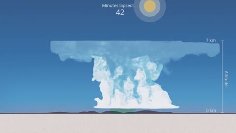
Simulation of an isolated Thunderstorm - Cumulonimbus
R
Rumble man
Simulation of an isolated Thunderstorm - Cumulonimbus
1
comment
2
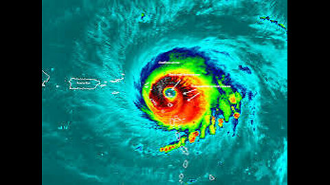
How Do Hurricanes Form? Meteorology - Weather Basics
F5Tornado
Hurricanes are very large and intense storms. But where do these giant storms come from?
Hurricanes are dangerous and can cause major damage from storm surge, wind damage, rip currents and flooding. They can happen along any U.S. coast or in any territory in the Atlantic or Pacific oceans. Storm surge historically is the leading cause of hurricane-related deaths in the United States.
The Saffir-Simpson Hurricane Wind Scale is a 1 to 5 rating based on a hurricane's sustained wind speed. This scale estimates potential property damage. Hurricanes reaching Category 3 and higher are considered major hurricanes because of their potential for significant loss of life and damage. Category 1 and 2 storms are still dangerous, however, and require preventative measures. In the western North Pacific, the term "super typhoon" is used for tropical cyclones with sustained winds exceeding 150 mph. Note that all winds are using the U.S. 1-minute average.
Category One Hurricane
Winds 74-95 mph (64-82 kt or 119-153 km/hr). Very dangerous winds will produce some damage: Well-constructed frame homes could have damage to roof, shingles, vinyl siding and gutters. Large branches of trees will snap and shallowly rooted trees may be toppled. Extensive damage to power lines and poles likely will result in power outages that could last a few to several days. Irene of 1999, Katrina of 2005, and several others were Category One hurricanes at landfall in South Florida.
Category Two Hurricane
Winds 96-110 mph (83-95 kt or 154-177 km/hr). Extremely dangerous winds will cause extensive damage: Well-constructed frame homes could sustain major roof and siding damage. Many shallowly rooted trees will be snapped or uprooted and block numerous roads. Near-total power loss is expected with outages that could last from several days to weeks. Frances of 2004 was a Category Two when it hit just north of Palm Beach County, along with at least 10 other hurricanes which have struck South Florida since 1894.
Category Three Hurricane
Winds 111-129 mph (96-112 kt or 178-208 km/hr). Devastating damage will occur: Well-built framed homes may incur major damage or removal of roof decking and gable ends. Many trees will be snapped or uprooted, blocking numerous roads. Electricity and water will be unavailable for several days to weeks after the storm passes. Unnamed hurricanes of 1909, 1910, 1929, 1933, 1945, and 1949 were all Category 3 storms when they struck South Florida, as were King of 1950, Betsy of 1965, Jeanne of 2004, and Irma of 2017.
Category Four Hurricane
Winds 130-156 mph (113-136 kt or 209-251 km/hr). Catastrophic damage will occur: Well-built framed homes can sustain severe damage with loss of most of the roof structure and/or some exterior walls. Most trees will be snapped or uprooted and power poles downed. Fallen trees and power poles will isolate residential areas. Power outages will last weeks to possibly months. Most of the area will be uninhabitable for weeks or months. The 1888, 1900, 1919, 1926 Great Miami, 1928 Lake Okeechobee/Palm Beach, 1947, Donna of 1960 made landfall in South Florida as Category Four hurricanes.
Category Five Hurricane
Winds 157 mph or higher (137 kt or higher or 252 km/hr or higher). Catastrophic damage will occur: A high percentage of framed homes will be destroyed, with total roof failure and wall collapse. Fallen trees and power poles will isolate residential areas. Power outages will last for weeks to possibly months. Most of the area will be uninhabitable for weeks or months. The Keys Hurricane of 1935 and Andrew of 1992 made landfall in South Florida as Category Five hurricanes.
More Meteorology Videos
https://rumble.com/playlists/JfAj918PQuc
2
comments
3
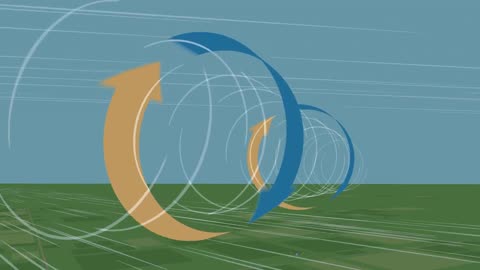
What Causes a Tornado? - Meteorological Basics
F5Tornado
What Causes a Tornado?
The swirling, funnel-shaped winds of a tornado are easily recognizable—and they can be very dangerous. But what causes these unique and violent weather phenomena?
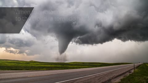
A tornado is a violently rotating column of air that is in contact with both the surface of the Earth and a cumulonimbus cloud or, in rare cases, the base of a cumulus cloud. It is often referred to as a twister, whirlwind or cyclone, although the word cyclone is used in meteorology to name a weather system with a low-pressure area in the center around which, from an observer looking down toward the surface of the Earth, winds blow counterclockwise in the Northern Hemisphere and clockwise in the Southern. Tornadoes come in many shapes and sizes, and they are often (but not always) visible in the form of a condensation funnel originating from the base of a cumulonimbus cloud, with a cloud of rotating debris and dust beneath it. Most tornadoes have wind speeds less than 180 kilometers per hour (110 miles per hour), are about 80 meters (250 feet) across, and travel several kilometers (a few miles) before dissipating. The most extreme tornadoes can attain wind speeds of more than 480 kilometers per hour (300 mph), are more than 3 kilometers (2 mi) in diameter, and stay on the ground for more than 100 km (62 mi)
More Meteorology Videos
https://rumble.com/playlists/JfAj918PQuc
1
comment
4
NOAA: 'The Hurricane Hunters'
F5Tornado
A hurricane hunter is a pilot brave enough to fly an airplane into the middle of a hurricane to gather data on temperature, humidity, pressure, etc. This data is critical for forecasting the intensity and path of hurricanes.
NOAA pilots, planes and researchers fly into the world's worst weather.
Data collected by the agency's high-flying meteorological stations help forecasters make accurate predictions during a hurricane and help hurricane researchers achieve a better understanding of storm processes, improving their forecast models.
P-3 Orion: Into the Storm
Slicing through the eyewall of a hurricane, buffeted by howling winds, blinding rain and violent updrafts and downdrafts before entering the relative calm of the storm’s eye, NOAA’s two Lockheed WP-3D Orion four-engine turboprop aircraft, affectionately nicknamed "Kermit" (N42RF) and "Miss Piggy" (N43RF), probe every wind and pressure change, repeating the often grueling experience again and again during the course of an 8-10 hour mission.
Scientists aboard the aircraft deploy Global Positioning System (GPS) dropwindsondes as NOAA Corps officers pilot and navigate the P-3 through the hurricane. These instruments continuously transmit measurements of pressure, humidity, temperature, and wind direction and speed as they fall toward the sea, providing a detailed look at the structure of the storm and its intensity. The P-3s' tail Doppler radar and lower fuselage radar systems, meanwhile, scan the storm vertically and horizontally, giving scientists and forecasters a real-time look at the storm. The P-3s can also deploy probes called bathythermographs that measure the temperature of the sea.
More More Meteorology Videos
https://rumble.com/playlists/JfAj918PQuc Videos
https://rumble.com/playlists/JfAj918PQuc
5
What is the Enhanced Fujita Tornado Scale - Weather Basics - Meteorology
Earth Wind and Fire
Enhanced Fujita Scale or EF Scale, which became operational on February 1, 2007, is used to assign a tornado a 'rating' based on estimated wind speeds and related damage. When tornado-related damage is surveyed, it is compared to a list of Damage Indicators (DIs) and Degrees of Damage (DoD) which help estimate better the range of wind speeds the tornado likely produced. From that, a rating (from EF0 to EF5) is assigned.
Enhanced Fujita Scale
EFU Unknown No surveyable damage
EF0 65–85 mph Light damage
EF1 86–110 mph Moderate damage
EF2 111–135 mph Considerable damage
EF3 136–165 mph Severe damage
EF4 166–200 mph Devastating damage
EF5 >200 mph Incredible damage
The Enhanced Fujita scale (abbreviated as EF-Scale) rates tornado intensity based on the severity of the damage they cause. It is used in some countries, including the United States, Canada, France, China, and Mongolia
More Meteorology Videos
https://rumble.com/playlists/JfAj918PQuc
6
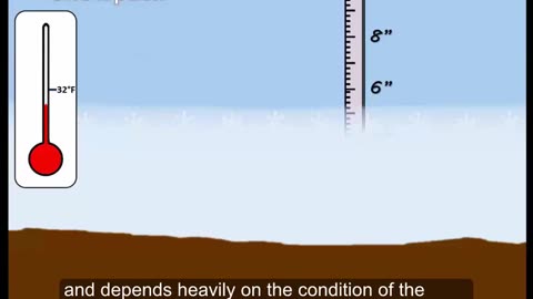
What is a Blizzard? Weather Basics - Meteorology
Earth Wind and Fire
This is a brief video about the conditions needed for a blizzard
A blizzard is a severe snowstorm characterized by strong sustained winds and low visibility, lasting for a prolonged period of time—typically at least three or four hours. A ground blizzard is a weather condition where snow is not falling but loose snow on the ground is lifted and blown by strong winds. Blizzards can have an immense size and usually stretch to hundreds or thousands of kilometres.
More Meteorology Videos
https://rumble.com/playlists/JfAj918PQuc
1
comment
7
The Science of Hail - Meteorology - Weather Basics
Earth Wind and Fire
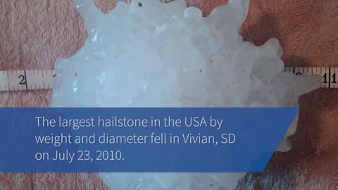
Chunks of ice that fall from the sky can cause serious damage to property, and injuries to people and animals. But how does hail form?
Hail is a form of solid precipitation.[1] It is distinct from ice pellets (American English "sleet"), though the two are often confused.[2] It consists of balls or irregular lumps of ice, each of which is called a hailstone.[3] Ice pellets generally fall in cold weather, while hail growth is greatly inhibited during low surface temperatures.
Estimating Hail Size
Hail size is often estimated by comparing it to a known object. Most hailstorms are made up of a mix of different sizes, and only the very largest hail stones pose serious risk to people caught in the open. When reporting hail, estimates comparing the hail to a known object with definite size are good, but measurements using a ruler, calipers, or a tape measure are best.
Pea = 1/4 inch diameter
Mothball = 1/2 inch diameter
Penny = 3/4 inch diameter
Nickel = 7/8 inch
Quarter = 1 inch — hail quarter size or larger is considered severe
Ping-Pong Ball = 1 1/2 inch
Golf Ball = 1 3/4 inches
Tennis Ball = 2 1/2 inches
Baseball = 2 3/4 inches
Tea cup = 3 inches
Softball = 4 inches
Grapefruit = 4 1/2 inches
More More Meteorology Videos
https://rumble.com/playlists/JfAj918PQuc
3
comments
8
Doppler Weather Radar Basics - Weather Basics - Meteorology
F5Tornado
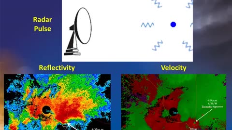
Doppler Weather Radar Basics
A Doppler radar is a specialized radar that uses the Doppler effect to produce velocity data about objects at a distance.[1] It does this by bouncing a microwave signal off a desired target and analyzing how the object's motion has altered the frequency of the returned signal. This variation gives direct and highly accurate measurements of the radial component of a target's velocity relative to the radar. The term applies to radar systems in many domains like aviation, police radar detectors, navigation, meteorology, etc
More Meteorology Videos
https://rumble.com/playlists/JfAj918PQuc
9
How Do Rainbows Form? - Weather Basics
Earth Wind and Fire
How Do Rainbows Form?
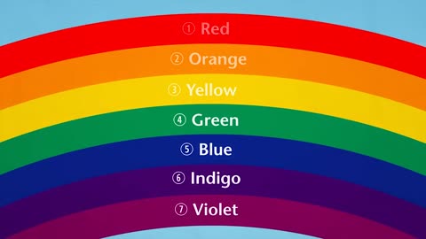
rainbow is an optical phenomenon caused by refraction, internal reflection and dispersion of light in water droplets resulting in a continuous spectrum of light appearing in the sky. The rainbow takes the form of a multicoloured circular arc. Rainbows caused by sunlight always appear in the section of sky directly opposite the Sun. Rainbows can be caused by many forms of airborne water. These include not only rain, but also mist, spray, and airborne dew.
Rainbows can be full circles. However, the observer normally sees only an arc formed by illuminated droplets above the ground,[3] and centered on a line from the Sun to the observer's eye.
In a primary rainbow, the arc shows red on the outer part and violet on the inner side. This rainbow is caused by light being refracted when entering a droplet of water, then reflected inside on the back of the droplet and refracted again when leaving it.
In a double rainbow, a second arc is seen outside the primary arc, and has the order of its colours reversed, with red on the inner side of the arc. This is caused by the light being reflected twice on the inside of the droplet before leaving it.
More Meteorology Videos
https://rumble.com/playlists/JfAj918PQuc
3
comments
10
Thunderstorm Types - Meteorology - Weather
Earth Wind and Fire
Single cell:
These are short lived, and while hail and gusty wind can develop, they are typically not severe. Like all thunderstorms, these can still produce dangerous lightning.
Multi-cell cluster:
These form in clusters with numerous cells that merge together. Their speed can make a difference in the amount of rain an area receives, and they occasionally produce large hail and damaging wind.
Squall line:
A multi-cell line that can extend for hundreds of miles. These can persist for many hours and produce damaging winds and hail.
Supercell:
These powerful storms responsible for most tornadoes in the US. They also produce extreme winds, flash flooding, and very large hailstones.
This video includes footage from:
Author: Grahame Kelaher
Author webpage: https://vimeo.com/user16504279
Licence: ATTRIBUTION LICENSE 3.0 (http://creativecommons.org/licenses/b...)
Downloaded at Mazwai.com
thunderstorm, also known as an electrical storm or a lightning storm, is a storm characterized by the presence of lightning and its acoustic effect on the Earth's atmosphere, known as thunder. Relatively weak thunderstorms are sometimes called thundershowers. Thunderstorms occur in a type of cloud known as a cumulonimbus. They are usually accompanied by strong winds[1] and often produce heavy rain[1] and sometimes snow, sleet, or hail,[1] but some thunderstorms produce little precipitation or no precipitation at all. Thunderstorms may line up in a series or become a rainband, known as a squall line. Strong or severe thunderstorms include some of the most dangerous weather phenomena, including large hail, strong winds, and tornadoes. Some of the most persistent severe thunderstorms, known as supercells, rotate as do cyclones. While most thunderstorms move with the mean wind flow through the layer of the troposphere that they occupy, vertical wind shear sometimes causes a deviation in their course at a right angle to the wind shear direction
Many hazardous weather events are associated with thunderstorms. Under the right conditions, rainfall from thunderstorms causes flash flooding, killing more people each year than hurricanes, tornadoes or lightning. Lightning is responsible for many fires around the world each year, and causes fatalities. Hail up to the size of softballs damages cars and windows, and kills livestock caught out in the open. Strong (up to more than 120 mph) straight-line winds associated with thunderstorms knock down trees, power lines and mobile homes. Tornadoes (with winds up to about 300 mph) can destroy all but the best-built man-made structures.
Where are severe thunderstorms most common?
The greatest severe weather threat in the U.S. extends from Texas to southern Minnesota. But, no place in the United States is completely safe from the threat of severe weather.
What is the difference between a Severe Thunderstorm WATCH and a Severe Thunderstorm WARNING?
A Severe Thunderstorm WATCH is issued by the NOAA Storm Prediction Center meteorologists who are watching the weather 24/7 across the entire U.S. for weather conditions that are favorable for severe thunderstorms. A watch can cover parts of a state or several states. Watch and prepare for severe weather and stay tuned to NOAA Weather Radio to know when warnings are issued.
A Severe Thunderstorm WARNING is issued by your local NOAA National Weather Service Forecast Office meteorologists who watch a designated area 24/7 for severe weather that has been reported by spotters or indicated by radar. Warnings mean there is a serious threat to life and property to those in the path of the storm. ACT now to find safe shelter! A warning can cover parts of counties or several counties in the path of danger.
More Meteorology Videos
https://rumble.com/playlists/JfAj918PQuc
3
comments
11
How Does Rain Form? What is the Water Cycle?
Earth Wind and Fire
How Does Rain Form? What is the Water Cycle?
The water cycle shows the continuous movement of water within the Earth and atmosphere. It is a complex system that includes many different processes. Liquid water evaporates into water vapor, condenses to form clouds, and precipitates back to earth in the form of rain and snow
More Meteorology Videos
https://rumble.com/playlists/JfAj918PQuc
3
comments
12
Hurricanes - Weather Basics - Meteorology 101
F5Tornado
This video covers the basics of what a hurricane is, what fuels the hurricane and why the winds in the eye of a hurricane are so light
More Meteorology Videos
https://rumble.com/playlists/JfAj918PQuc
13
The Science Behind Lightning - Meteorology
Earth Wind and Fire
The Science Behind Lightning
You already know “When Thunder Roars, Go Indoors” and “See A Flash, Dash Inside!” But do you know what causes lightning and thunder in the first place?
More Meteorology Videos
https://rumble.com/playlists/JfAj918PQuc
14
How does snow form? - Meteorology
F5Tornado
We all associate snow with wintry and stormy conditions. But how does it form? In this video Charlie explains how snow forms and how it is different from hail and sleet
Snow comprises individual ice crystals that grow while suspended in the atmosphere—usually within clouds—and then fall, accumulating on the ground where they undergo further changes.[2] It consists of frozen crystalline water throughout its life cycle, starting when, under suitable conditions, the ice crystals form in the atmosphere, increase to millimeter size, precipitate and accumulate on surfaces, then metamorphose in place, and ultimately melt, slide or sublimate away.
Snowstorms organize and develop by feeding on sources of atmospheric moisture and cold air. Snowflakes nucleate around particles in the atmosphere by attracting supercooled water droplets, which freeze in hexagonal-shaped crystals. Snowflakes take on a variety of shapes, basic among these are platelets, needles, columns and rime. As snow accumulates into a snowpack, it may blow into drifts. Over time, accumulated snow metamorphoses, by sintering, sublimation and freeze-thaw. Where the climate is cold enough for year-to-year accumulation, a glacier may form. Otherwise, snow typically melts seasonally, causing runoff into streams and rivers and recharging groundwater.
More Meteorology Videos
https://rumble.com/playlists/JfAj918PQuc
1
comment
15
Storm Spotting: Storm Motion and Positioning- Meteorology
F5Tornado
Being able to safely observe a severe storm is the key to storm spotting. Learn about situational awareness around severe storms and how to put yourself in the best position to watch for important developments.
More Meteorology Videos
https://rumble.com/playlists/JfAj918PQuc
1
comment
The Science Behind Tornadoes - Meteorology
F5Tornado
Tornadoes are one of the most powerful and violent weather phenomena. Although the details of tornado formation are still being researched, there are a few general steps to their formation.
More Meteorology Videos
https://rumble.com/playlists/JfAj918PQuc
2
comments
17
A Tutorial on Cloud Types - Weather 101 - Meteorology
F5Tornado
Weather 101: A Tutorial on Cloud Types
This 5 minute tutorial covers some basic cloud types. Four core cloud categories are discussed, as well as some combinations or hybrids across these categories. Visual depictions of the varying cloud types are shown with an inclusion of time lapse photography to illustrate the formation and dissipation of the clouds
More Meteorology Videos
https://rumble.com/playlists/JfAj918PQuc
weather cloud
weather cloudcroft nm
weather cloud map
weather cloudland ga
weather cloud coverage
apple weather cloud with lines
european weather cloud
aviation weather cloud tops
weather cloud with lines under it
weather cloud peak wilderness
weather cloud symbols
weathercloud app
weathercloud app ios
weather cloud api
weather cloud app android
weathercloud api documentation
weather app cloud with two lines underneath
weather app cloud with snow
weather app cloud with lines under
weather app cloud cover
weather and cloud
apple weather cloud with snow
aviation weather cloud coverage
aviation weather cloud ceiling
aviation weather cloud types
apple weather cloud cover
apple weather cloud with snowflakes
cloud types and weather
weather cloud base
2
comments
The Science Behind Tornadoes - Meteorology
8 months ago
155
Tornadoes are one of the most powerful and violent weather phenomena. Although the details of tornado formation are still being researched, there are a few general steps to their formation.
More Meteorology Videos
https://rumble.com/playlists/JfAj918PQuc
Loading 2 comments...
-
 4:16:41
CatboyKami
4 hours agoStalker 2 Blind playthrough pt1
551 -
 1:06:27
Russell Brand
5 hours agoNeil Oliver on the Rise of Independent Media, Cultural Awakening & Fighting Centralized Power –SF498
144K226 -
 1:39:14
vivafrei
5 hours agoSoros Karma in New York! Tammy Duckwarth Spreads LIES About Tulsi Gabbard! Pennsylvania FLIPS & MORE
80.1K59 -
 1:57:36
The Charlie Kirk Show
4 hours agoInside the Transition + The Bathroom Battle + Ban Pharma Ads? | Rep. Mace, Tucker, Carr | 11.21.24
129K49 -
 59:20
59:20
The Dan Bongino Show
7 hours agoBitter CNN Goes After Me (Ep. 2375) - 11/21/2024
850K3.34K -
 57:28
57:28
TheMonicaCrowleyPodcast
2 hours agoThe Monica Crowley Podcast: Mandate into Action
3.19K -
 1:02:09
TheAlecLaceShow
5 hours agoGuests: Alex Marlow & Terry Schilling | Justice For Laken Riley | Russian ICBM | The Alec Lace Show
31K8 -
 1:51:15
Danny Haiphong
4 hours ago $8.91 earnedMARK SLEBODA & SCOTT RITTER: NATO ATTACKS RUSSIA, PUTIN FIRES ICBM WARNING SHOT AT UKRAINE—WW3 NEXT?
74.9K11 -
 40:47
40:47
Dave Portnoy
8 hours agoThe Unnamed Show With Dave Portnoy, Kirk Minihane, Ryan Whitney - Episode 37
55.8K2 -
 51:53
51:53
The Rubin Report
5 hours agoCrowd Shocked by Ben Affleck’s Unexpected Take on This Massive Change
96.5K70
