CNN: Hurricane Milton Intensifying to Category 5 Will Have a Storm Surge 10 to 15 Feet Above Sea Level
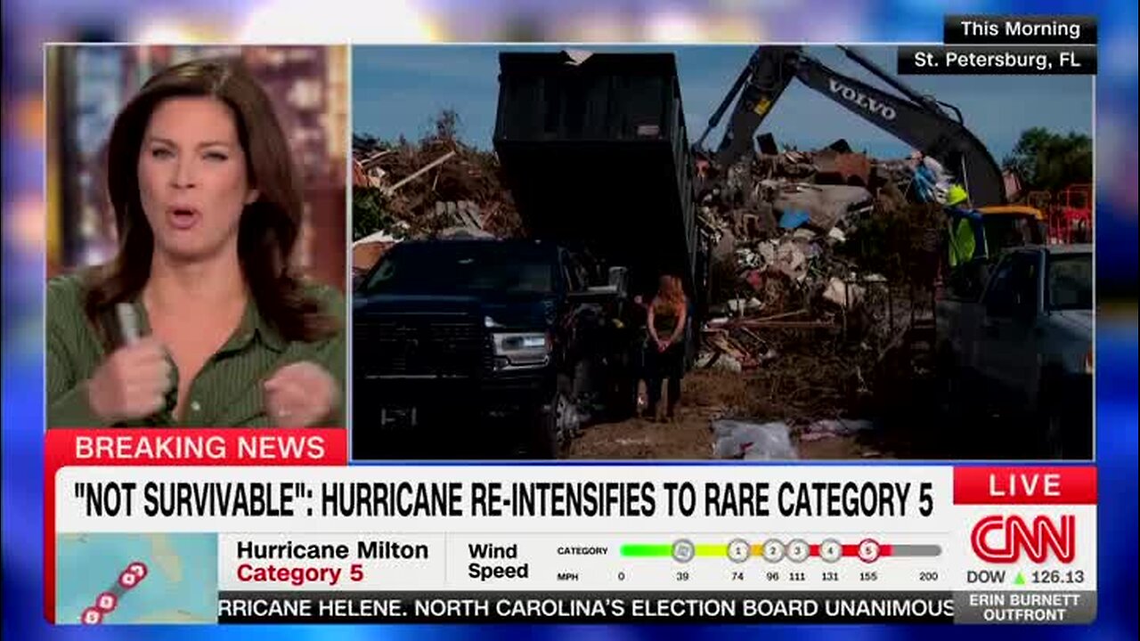
BURNETT: “Small pieces, concrete, wood, things that become missiles with 165-mile-an-hour winds are already dislodged and in piles. It’s horrifying to contemplate what might be about to happen. And and right now, one of the largest evacuations in Florida history is under way. Right now it’s just bumper to bumper. There’s questions about gas. People obviously worried about running out of it. I mean, all of these deeply serious concerns in these final hours ahead of what meteorologists are calling an historic strike. Chad Myers begins our coverage ‘Out Front’ live from the weather center here. And Chad, so tell us exactly what happens here. How soon does this start?”
Myers: “Well, for the people of south Florida, actually, it could start tonight. Some of these storms that are kind of south and west of Key West, those could rotate enough to make a small tornado. It’s small tornado until it hits your house and then it’s not a small tornado anymore, because it did hit the one thing that you cared about. But I think probably 2 o’clock tomorrow afternoon is when we’ll see the first tropical storm winds on the West Coast of Florida, and by this time tomorrow night the entire state is going to have tropical storm force winds, except possibly there in the Panhandle. Hurricane hunters are flying through the storm right now. There’s a little break during the day, that’s why we didn’t get to category 5 earlier, but it’s a 165-miles-per-hour storm. That is higher than it was supposed to be in the 11 o’clock forecast by 15 miles per hour. So this is not slowing down. This is not getting down to that, ‘Oh, we’re going to suck in a bunch of dry air and it’s going to get some cheer.’ This is concerning. This is concerning that this storm is continuing to be this strong for this long. Now we talk about the cone. The cone is still north of Tampa, New Port Richey, all the way down to almost Naples, because it can still wobble. It actually wobbled earlier today, it wobbled a little bit farther to the south, which means that now Anna Maria Island, towards Sarasota, you’re going to get worse weather than you might get up in Dunedin, where the storm could have been closer to you. The big story here, yes, there’s going to be wind, then there’s going to be wind damage, and trees are down and [inaudible] are going to be gone, but why they say to please get out is because of the water. The water will be, and it’s moving — talking about storm surges, it’s not just some lake that kind of fills up your yard. This is moving water that could not down your home and it’s going to be 10 to 15 feet above the normal sea level. All of a sudden, that’s going over Barrier Islands. That’s knocking the way homes that aren’t elevated, that aren’t on stilts, not on pillars, and, yes, we’re going to have this larger — people ask me all day where’s it gonna hit. It’s gonna hit everywhere. This whole purple area, we will see category 3 winds or higher, so millions will be without power.”
BURNETT: “Millions. And, of course, sitting near a high tide, we’ve got the 10 to 15 feet on top of that. As they say, devastating and not survivable. All right, thank you very much, Chad.”
-
 3:38
3:38
Grabien
10 hours agoSharon Stone Trashes Trump at Turin Film Festival: ‘Italy Has Seen Fascism ... My Country Is in Its Adolescence’
271 -
 1:11:10
Steve-O's Wild Ride! Podcast
5 days ago $9.60 earnedDusty Slay Went From Selling Pesticides To Having A Netflix Special - Wild Ride #244
44.2K3 -
 1:16:02
CocktailsConsoles
8 hours agoBE PART OF THE GAME!!| Death Road to Canada | Cocktails & Consoles Livestream
30.9K2 -
 8:19:28
Phyxicx
10 hours agoWe're streaming again! - 11/26/2024
26.4K -
 6:49:31
GamingWithHemp
10 hours agoHanging with Hemp #103
44.1K3 -
 21:24
21:24
DeVory Darkins
1 day ago $11.90 earnedElon Musk and Tucker Carlson SHATTER Left Wing Media
43.7K43 -
 15:13
15:13
Stephen Gardner
7 hours ago🔥Breaking: Trump JUST DID the UNEXPECTED | Tucker Carlson WARNS America!
39.9K82 -
 1:18:01
Glenn Greenwald
12 hours agoWill Trump's Second Term Promote Economic Populism? Matt Stoller On Cabinet Picks To Fight Corporate Power; Should Liberals Cut Off Pro-Trump Friends & Family? | SYSTEM UPDATE #372
179K236 -
 2:26:30
WeAreChange
13 hours agoTrump To Subdue Deranged Opposition! ARRESTS Planned
139K59 -
 1:19:04
JustPearlyThings
13 hours agoWhy MODERN WOMEN Keep REJECTING The Redpill! | Pearl Daily
106K59