Premium Only Content

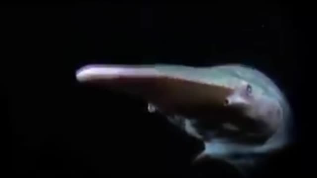
HD camera at the Depth of 10,000meters under the Sea.Glory b to God.
Depth of 10,000 meters under the sea.
**The Challenger Deep**
is the deepest known point of the seabed in the Earth's hydrosphere (the oceans and seas), with a depth of 10,902 to 10,929 m (35,768 to 35,856 ft) by direct measurement from deep-diving submersibles, remotely operated underwater vehicles, and benthic landers and (sometimes) slightly more by sonar bathymetry.//
**
**
Location of Challenger Deep within the Mariana Trench and Western Pacific Ocean//
The Challenger Deep is located in the Western Pacific Ocean, at the southern end of the Mariana Trench near the Mariana Islands group. According to the August 2011 version of the GEBCO Gazetteer of Undersea Feature Names, the Challenger Deep is 10,920 m (35,827 ft) ±10 m (33 ft) deep at 11°22.4′N 142°35.5′E. [1] This location is in the ocean territory of the Federated States of Micronesia.//
**
The depression is named after the British Royal Navy survey ship HMS Challenger, whose expedition of 1872–1876 made the first recordings of its depth. The high water pressure at this depth makes designing and operating exploratory craft difficult. The first descent by any vehicle was by Jacques Piccard and Don Walsh in the manned bathyscaphe Trieste in January 1960; unmanned visits followed in 1996, 1998 and 2009. In March 2012 a manned solo descent was made by film director James Cameron in the deep-submergence vehicle Deepsea Challenger.[2][3][4] Between 28 April and 4 May 2019, the DSV Limiting Factor completed four manned dives to the bottom of Challenger Deep.[5] Between 6 June and 26 June 2020, the DSV Limiting Factor added six completed dives.[6] The deep-sea submersible Fendouzhe (奋斗者, Striver) completed a crewed dive to the bottom of the Challenger Deep on 10 November 2020 with three scientists onboard whilst livestreaming the descent.[7][8][9] Between 1 March and 11 March 2021, the DSV Limiting Factor added four completed dives. As of April 2021 the list of people who descended to Challenger Deep comprises twenty-two people.//
Study of the depth and location of the Challenger Deep Edit
Since May 2000 with the help of non-degraded signal satellite navigation, civilian surface vessels equipped with professional dual-frequency capable satellite navigation equipment can measure and establish their geodetic position with an accuracy in the order of meters to tens of meters whilst the western, central and eastern basins are kilometers apart.[118]//
**
GEBCO 2019 bathymetry of the Challenger Deep and Sirena Deep.
(a) Mariana Trench multibeam bathymetry data gridded at 75 m acquired on‐board the DSSV Pressure Drop overtop the GEBCO 2019 source grid (as shown in Figure 1) and the complete GEBCO 2019 grid with hillshade. EM 124 black contours at 500 m intervals, GEBCO 2019 grey contours at 1,000 m intervals. The white circle indicates the deepest point and submersible dive location, the white triangle indicates the submersible dive location from Sirena Deep, the red spot was the deepest point derived by van Haren et al., (2017).
(b) Challenger Deep.
(c) Sirena Deep.
Bathymetric cross sections A’–A” and B’–B” over Challenger Deep and Sirena Deep displayed in (d) and (e), respectively.
In 2014, a study was conducted regarding the determination of the depth and location of the Challenger Deep based on data collected previous to and during the 2010 sonar mapping of the Mariana Trench with a Kongsberg Maritime EM 122 multibeam echosounder system aboard USNS Sumner. This study by James. V. Gardner et al. of the Center for Coastal & Ocean Mapping-Joint Hydrographic Center (CCOM/JHC), Chase Ocean Engineering Laboratory of the University of New Hampshire splits the measurement attempt history into three main groups: early single-beam echo sounders (1950s–1970s), early multibeam echo sounders (1980s – 21st century), and modern (i.e., post-GPS, high-resolution) multibeam echo sounders. Taking uncertainties in depth measurements and position estimation into account the raw data of the 2010 bathymetry of the Challenger Deep vicinity consisting of 2,051,371 soundings from eight survey lines was analyzed. The study concludes that with the best of 2010 multibeam echosounder //technologies after the analysis a depth uncertainty of ±25 m (82 ft) (95% confidence level) on 9 degrees of freedom and a positional uncertainty of ±20 to 25 m (66 to 82 ft) (2drms) remain and the location of the deepest depth recorded in the 2010 mapping is 10,984 m (36,037 ft) at 11.329903°N 142.199305°E. The depth measurement uncertainty is a composite of measured uncertainties in the spatial variations in sound-speed through the water volume, the ray-tracing and bottom-detection algorithms of the multibeam system, the accuracies and calibration of the motion sensor and navigation systems, estimates of spherical spreading, attenuation throughout the water volume, and so forth.[119]
Both the RV Sonne expedition in 2016, and the RV Sally Ride expedition in 2019 expressed strong reservations concerning the depth corrections applied by the Gardner et al. study of 2014, and serious doubt concerning the accuracy of the deepest depth calculated by Gardner (in the western basin), of 10,984 m (36,037 ft) after analysis of their multibeam data on a 100 m (328 ft) grid. Dr. Hans van Haren, chief scientist on the RV Sally Ride cruise SR1916, indicated that Gardner'sthe western basin), of 10,984 m (36,037 ft) after analysis of their multibeam data on a 100 m (328 ft) grid. Dr. Hans van Haren, chief scientist on the RV Sally Ride cruise SR1916, indicated that Gardner's calculations were 69 m (226 ft) too deep due to the "sound velocity profiling by Gardner et al. (2014)."[116]
In 2018-2019 the deepest points of each ocean were mapped using a full‐ocean depth Kongsberg EM 124 multibeam echosounder abord DSSV Pressure Drop. In 2021 a data paper was published by Cassandra Bongiovanni, Heather A. Stewart and Alan J. Jamieson regarding the gathered data donated to GEBCO. The deepest depth recorded in the 2019 Challenger Deep sonar mapping was 10,924 m (35,840 ft) ±15 m (49 ft) at 11.369°N 142.587°E in the eastern basin. This depth closely agrees with the deepest point (10,925 m (35,843 ft) ±12 m (39 ft)) determined by the Van Haren et al. sonar bathymetry. The geodetic position of the deepest depth according to the Van Haren et al. significantly differs (about 42 km (26 mi) to the west) with the 2021 paper. After post-processing the initial depth estimates by application of a full-ocean depth sound velocity profile Bongiovanni et al. report an (almost) as deep point at 11.331°N 142.205°E in the western basin that geodetically differs about 350 m (1,150 ft) with the deepest point position determined by Van Haren et al. (11.332417°N 142.20205°E in the western basin). After analysis of their multibeam data on a 75 m (246 ft) grid the Bongiovanni et al. 2021 paper states the technological accuracy does not currently exist on low-frequency ship-mounted sonars required to determine which location was truly the deepest, nor does it currently exist on deep-sea pressure sensors.[120]//
In 2021 a study by Samuel F. Greenaway, Kathryn D. Sullivan, Samuel H. Umfress, Alice B. Beittel and Karl D. Wagner was published presenting a revised estimate of the maximum depth of the Challenger Deep based on a series of submersible dives conducted in June 2020. These depth estimates are derived from acoustic echo sounding profiles referenced to in-situ direct pressure measurements and corrected for observed oceanographic properties of the water-column, atmospheric pressure, gravity and gravity-gradient anomalies, and water-level effects. The study concludes according to their calculations the deepest observed seafloor depth was 10,935 m (35,876 ft) ±6 m (20 ft) below mean sea level at a 95% condidence level at 11°22.3′N 142°35.3′E in the eastern basin. For this estimate, the error term is dominated by the uncertainty of the employed pressure sensor, but Greenaway et al. show that the gravity correction is also substantial. The Greenaway et al. study compares its results with other recent acoustic and pressure-based measurements for the Challenger Deep and concludes the deepest depth in the western basin is very nearly as deep as the eastern basin. The disagreement between the maximum depth estimates and their geodetic positions between post-2000 published depths however exceed the accompanying margins of uncertainty, raising questions regarding the measurements or the reported uncertainties.[13]//
Another 2021 paper by Scott Loranger, David Barclay and Michael Buckingham, besides a December 2014 implosion shock wave based depth estimate of 10,983 m (36,033 ft), which is among the deepest estimated depths, also treatises the differences between various maximum depth estimates and their geodetic positions.//
Direct measurements Edit
The 2010 maximal sonar mapping depths reported by Gardner et.al. in 2014 and Greenaway et al. study in 2021 have not been confirmed by direct descent (pressure gauge/manometer) measurements at full-ocean depth.[123]
Expeditions have reported direct measured maximal depths in a narrow range.//
For the western basin deepest depths were reported as 10,913 m (35,804 ft) by Trieste in 1960 and 10,923 m (35,837 ft) ±4 m (13 ft) by DSV Limiting Factor in June 2020.//
For the central basin the greatest reported depth is 10,915 m (35,810 ft) ±4 m (13 ft) by DSV Limiting Factor in June 2020.//
For the eastern basin deepest depths were reported as 10,911 m (35,797 ft) by ROV Kaikō in 1995, 10,902 m (35,768 ft) by ROV Nereus in 2009, 10,908 m (35,787 ft) by Deepsea Challenger in 2012, 10,929 m (35,856 ft) by benthic lander "Leggo" in May 2019, and 10,925 m (35,843 ft) ±4 m (13 ft) by DSV Limiting Factor in May 2019.//
The exact location and the depth of the very deepest spot remain topics of interest to the oceanographic research community. No one has claimed that a measurement of any maximal depth of the Challenger Deep (either by direct CTD pressure measurements or by ensonification) defines either the absolute deepest depth or the geophysical location of the deepest point in the Challenger Deep. Such a claim will require a survey of all three basins by both echosounders and pressure gauges, such that all depths are measured by one set of equipment and use the same correction calculations. Even then, there will remain uncertainty (error bars) of one or two standard deviations in both location and depth. Technology will improve, but uncertainty will continue to drive efforts to fully describe the Challenger Deep.//
-
 2:50
2:50
Scottb1977
3 years agoSix Feet Under - Death Or Glory Playthrough
91 -
 14:21
14:21
ant75
4 years agoUnder water camera fishing
97 -
 1:09:42
Prophetless
3 years agoCamera Tracker In Depth - DaVinci Resolve 17 / Blackmagic Fusion
143 -
 0:45
0:45
ant75
4 years agoUnder water camera time lapse
34 -
 LIVE
LIVE
Slightly Offensive
3 hours ago $2.86 earnedCandace REDPILLS the Masses in BOMBSHELL Theo Von Interview | Guest: Shane Cashman
1,112 watching -
 LIVE
LIVE
megimu32
3 hours agoON THE SUBJECT: IRL Streamers Attacked & Nostalgic Animal Movies That Made Us Cry
460 watching -
 1:00:54
The Tom Renz Show
7 hours agoMore Epstein/FBI, a Scary Trade War, & the Dem Echo Chamber
7.49K1 -
 40:43
40:43
Kimberly Guilfoyle
8 hours agoDems Double Down on Delusion-Why? Live with Tony Kinnett & Bo French | Ep.202
77.8K31 -
 1:28:42
Redacted News
6 hours agoBREAKING! SOMETHING BIG IS HAPPENING IN EUROPE ALL OUT WAR IS COMING AGAINST RUSSIA, TRUMP FURIOUS
121K274 -
 47:50
47:50
Candace Show Podcast
6 hours agoBREAKING: Judge Makes Statement Regarding Taylor Swift's Text Messages. | Candace Ep 155
113K111