Premium Only Content
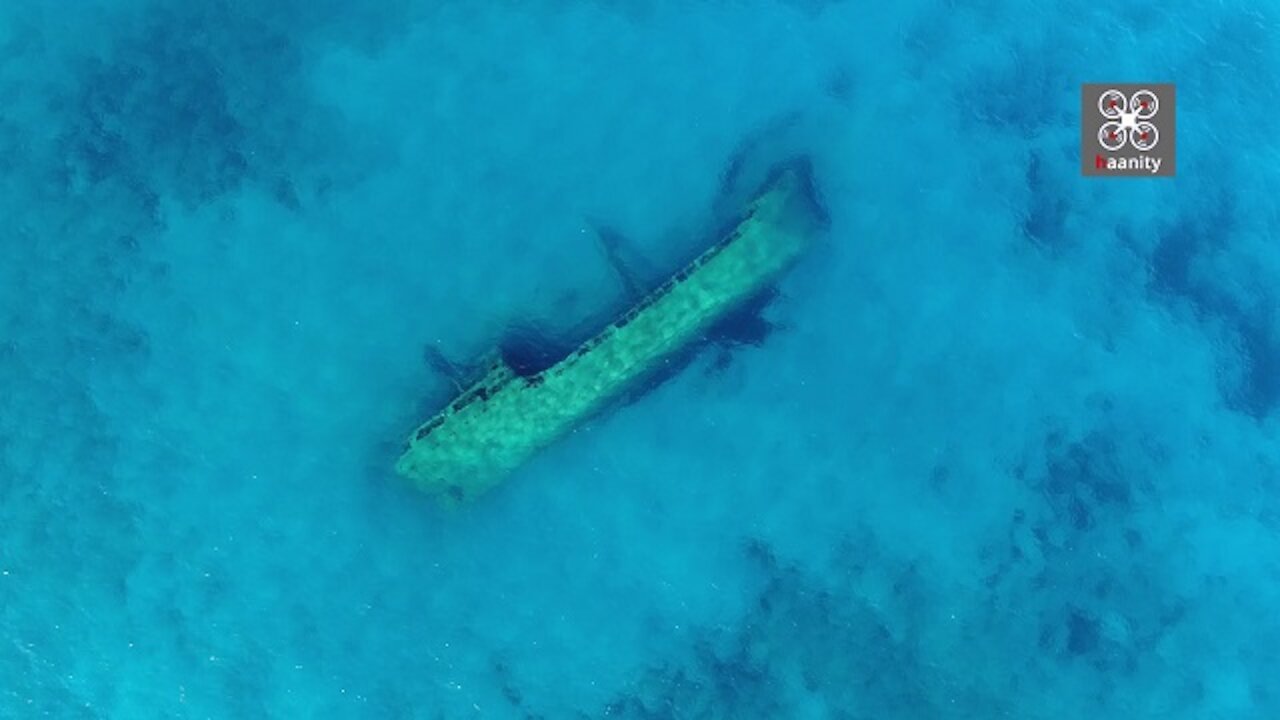
Greek drone footage captures eerie Turkish shipwreck in exotic waters
We fly over an eerie but also beautiful landscape. A Turkish merchant ship, Captain Ismail Haki, has sunk near one of the most dangerous capes in Greece, Cape Malia or Cape Malea. The point where it has "tilted" forever is covered with off-white sand, giving a deep turquoise color that gives a magical result to the already special setting.
Coordinates: https://goo.gl/maps/EAKRGoGLB64RZaWP7
A few words about the shipwreck:
As Mr. Costas Ladas writes: "In the bay of Agia Marina, near Kavo Malia, in Laconia, northeast of Cape Zovolo, sits the cargo ship" Kaptan Ismail Hakki ". A 30-meter boat carrying 578 tons of iron ore seasonal. The ship, for unknown reasons until today, sank on January 30, 1978, almost 100 meters from the shore, at a depth of 12 meters. It belonged to the Deval Shipping Group and was named after the second owner of the company, Ismail Haki, who, when he took over the company in 1952, brought a modern era to the Turkish merchant fleet, converting all of his company's steamships to diesel. Probably, "Kaptan Ismail Hakki" was the first Turkish to be converted to diesel.
The story goes that thanks to the observation of a shepherd who was there at that very time, in Agia Marina, there were no casualties from the shipwreck.
The shepherd lit fires on the only sandy beach in the area, in order to direct the shipwrecks there, thus saving them from their impact on the rocks of Kavomallia. The shipwrecked, as a sign of gratitude to the shepherd for their salvation, donated their boat to the farmers of the area.
The route to reach the beach of Agia Marina, where we will dive, starts from Naples in the direction of Agios Nikolaos. Then to Profitis Ilias, and just before the end of the asphalt, we enter on the left a dirt road quite passable, for conventional cars, to the Petrified Forest. After the forest and just before we reach the church of Agia Marina, we follow the right dirt road that leads to an alley where is the end of our route.
- Special care is needed when preparing us on land, in moving both our own and our equipment, due to the sharp rocks that are around. Fortunately at the edge of the cape there are small stairs that facilitate our entry and exit into the water.
- At a distance of 100 meters from the shore and in a straight line with the natural stream that has been created on the rocks by the sea, the iron carcass of the ship is sunk with its left side on the sandy bottom, with its stern looking at the land and the bow the open sea. The maximum depth reaches 12 meters and the minimum 4 meters, making the shipwreck accessible to scuba divers of all levels, as well as free divers ".
Today it offers an excellent spectacle both from the air and for diving.
-
 2:44
2:44
haanity
3 years agoDrone captures exotic Greek basketball court with stunning views
10.6K5 -
 2:40
2:40
haanity
4 years agoDrone footage captures Greek beach with sandy dunes and clear water
4.5K -
 1:29
1:29
haanity
4 years agoJaw-dropping drone footage discovers exotic secret in Argolis, Greece
19.7K5 -
 3:24
3:24
haanity
4 years agoExotic drone footage of the largest beach in Athens, Greece
4.37K3 -
 1:55
1:55
galwaycinematography
4 years agoDrone footage captures ancient deserted village in Ireland
11.7K4 -
 3:42
3:42
ViralHog
4 years ago $3.90 earnedDrone Captures Beautiful Flock Patterns of Flying Birds
24.1K1 -
 4:48
4:48
TimelessAerialPhotography
4 years agoRelaxing drone footage of frozen lakeshore & lighthouse waves
3.06K4 -
 1:27
1:27
Blagojche
4 years ago $6.33 earnedMesmerizing drone footage shows the true beauty of Macedonia
5973 -
 3:09
3:09
TimelessAerialPhotography
4 years agoStunning winter drone footage of Holland Harbor Lighthouse in Michigan
1.06K2 -
 2:17
2:17
D3V170 | RC and FPV
4 years ago $5.81 earnedDrone footage of Carnival Magic at Half Moon Cay, Bahamas
6918