Premium Only Content
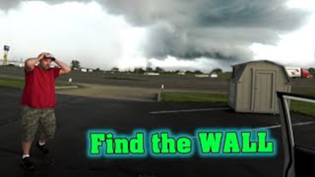
Wall Cloud Identification Storm Chase 2020
As an Amazon Associate I earn from qualifying purchases.
👍 Hand Held Weather Station: https://amzn.to/36zZ5y3
👍 GoPro Action Camera: https://amzn.to/2TJ1Tnv
A wall cloud is a large, localized, persistent, and often abrupt lowering of cloud that develops beneath the surrounding base of a cumulonimbus cloud and from which tornadoes sometimes form. It is typically beneath the rain-free base portion of a thunderstorm, and indicates the area of the strongest updraft within a storm. Rotating wall clouds are an indication of a mesocyclone in a thunderstorm; most strong tornadoes form from these. Many wall clouds do rotate; however, some do not.
Genesis
Wall clouds are formed by a process known as entrained, when an inflow of warm, moist air rises and converges, overpowering wet, rain-cooled air from the normally downwind downdraft. As the warm air continues to en train the cooler air, the air temperature drops and the dew point increases (thus the dew point depression decreases). As this air continues to rise, it becomes more saturated with moisture, which results in additional cloud condensation, sometimes in the form of a wall cloud. Wall clouds may form as a descending of the cloud base or may form as rising scud comes together and connects to the storm's cloud base.
-
 3:56
3:56
Amateur Storm Chasing
4 years agoTornado Sirens of OKC ~ Whelen Rotating 6108 NE 180th ST
9561 -
 15:58
15:58
Amateur Storm Chasing
4 years agoJuly Wall Cloud ~ Amateur Storm Chasing ~ Severe Weather 2020
5443 -
 23:11
23:11
Amateur Storm Chasing
4 years agoStorm Chase into Dryline Front ~ Shelf Cloud ~ Into the Whale's Mouth
372 -
 1:46
1:46
basicbill
4 years ago $0.01 earnedRainbow and Storm Cloud Time-Lapse on June 29, 2020
25 -
 0:25
0:25
yosoykelbysCLBN
4 years ago $0.09 earnedSpectacular storm cloud movement
205 -
 19:58
19:58
Amateur Storm Chasing
4 years ago $0.01 earnedDrive Oklahoma ~ 2020 Thunderstorms ~ Wall Cloud ~ Extreme Weather
707 -
 4:17
4:17
AA1PR
4 years ago5 15 2020 Rutland County VT Storm
20 -
 0:17
0:17
MattAttack72
4 years ago $0.01 earnedFrozen Tree - Oklahoma Ice Storm 2020
53 -
 3:19
3:19
HSWCoreScienceTechnology
5 years agoStorm Chasers: Why Chase Storms
159 -
 6:41
6:41
Amateur Storm Chasing
4 years ago $0.03 earnedStorm Chase Thunderstorm Cell ~ Set to Rush Marathon Music Video
806