Premium Only Content
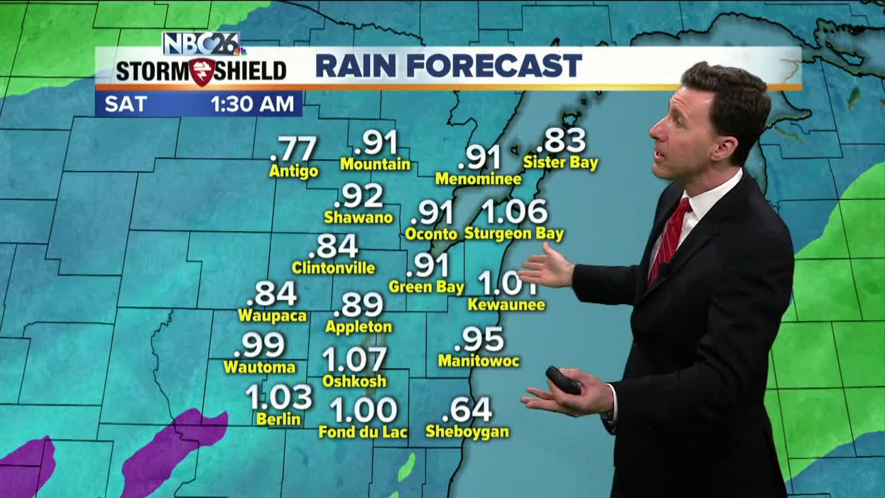
Michael Fish's NBC 26 weather forecast
Today, things will slowly be going downhill as rain rolls into the area. Most of this starts this afternoon with even a few rumbles of thunder possible. Highs today will top out in the mid-40s. This rain or a few T'storms will continue tonight. A widespread 0.50"-1.00" is likely across N.E.W. which could aggravate ongoing flooding & produce additional flooding. That may start to change to a little snow as we head into Friday morning with some minor accumulation possible by then. This looks like a decent rain- and wind-maker kicking up the rivers and moving ice around on Lake Winnebago and the Bay into Friday. A few strong storms are also possible with even a small hail & wind threat. Behind the storm we can expect gusty NW winds to around 40-45 mph. Ice shoves are possible along the eastern shoreline of Green Bay & Lake Winnebago. However this storm tracks, after it exits the region, temperatures will fall into the teens by Saturday Morning with highs possibly not breaking the freezing mark for daytime highs. This should be short lived as more seasonable temperatures returning Sunday.
-
 1:57
1:57
WGBA
1 year agoHow the City of Green Bay is hoping a $1.6M investment will make the community safer for pedestrians
3401 -
 2:00
2:00
WGBA
5 years agoMichael Fish's NBC 26 weather forecast
20 -
 2:26
2:26
WGBA
5 years agoMichael Fish's NBC 26 weather forecast
20 -
 2:13
2:13
WGBA
5 years agoMichael Fish's NBC 26 weather forecast
7 -
 2:12
2:12
WGBA
5 years agoMichael Fish's NBC 26 weather forecast
14 -
 2:37
2:37
WGBA
5 years agoMichael Fish's NBC 26 weather forecast
18 -
 3:02
3:02
WGBA
5 years agoMichael Fish's NBC 26 weather forecast
36 -
 2:33
2:33
WGBA
5 years agoMichael Fish's NBC 26 weather forecast
45 -
 2:41
2:41
WGBA
5 years agoMichael Fish's NBC 26 weather forecast
16 -
 1:55
1:55
WGBA
5 years agoMichael Fish's NBC 26 weather forecast
2