NBC26 Storm Shield Forecast
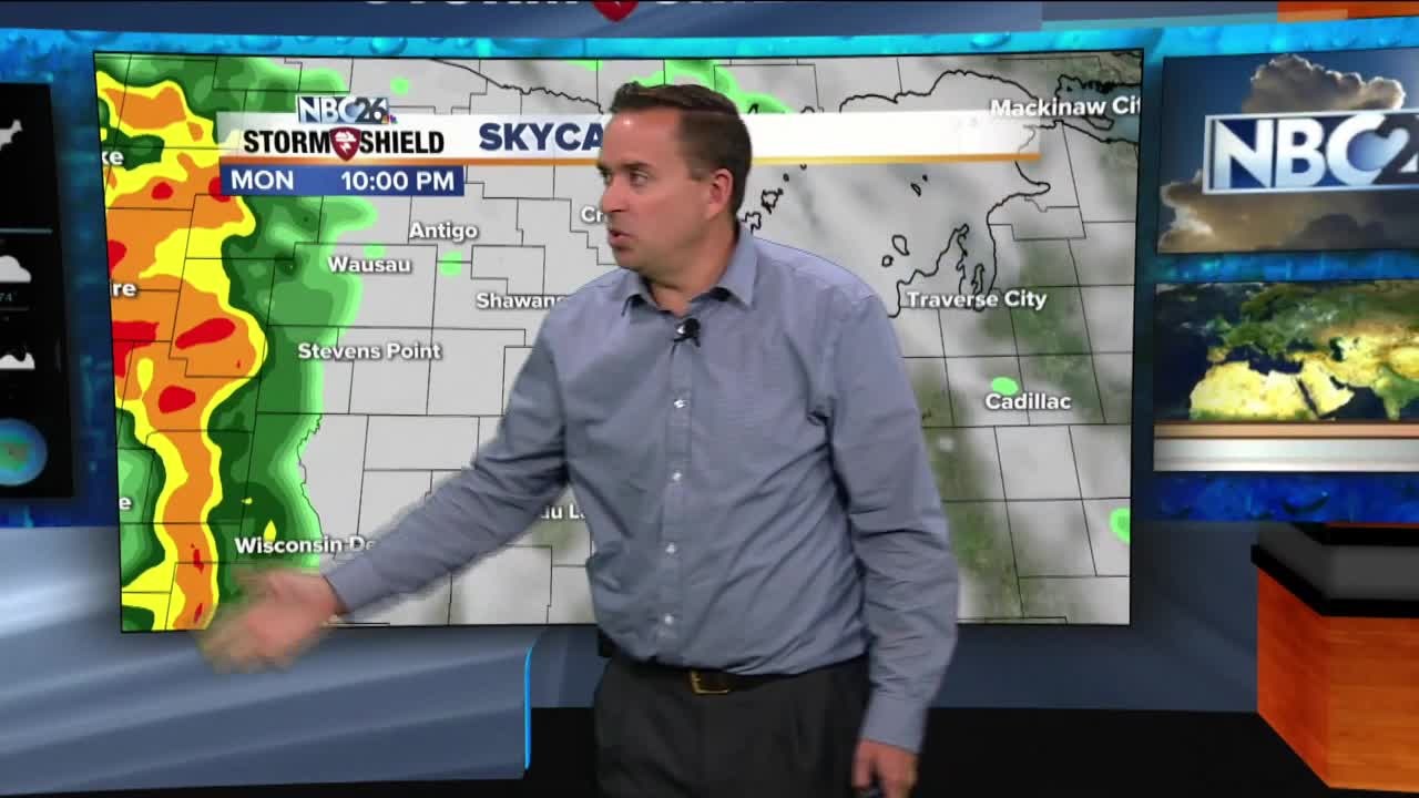
Today will be a relatively cool day again with highs in the mid-60s, but we will have chance of rain once again later in the afternoon. It will get breezy with a 10 to 15 mph southeast wind. Tonight looks to get active with showers and T'storms rolling in, especially later tonight. This is a strong warm front pushing NE. Some of these T'storms could produce some locally heavy downpours so make sure your gutters are cleaned out. Get ready for a warm, humid day on Tuesday with a chance of a morning shower. Highs will top out in the low- to mid-80s and it will be windy. That's going to feel like the middle of summer. Cooler air fills in on Wednesday with temperatures back in the lower 70s with a chance of a few showers or a thunderstorm. We climb into the mid- to upper-70s on Thursday with another chance of showers and storms. A few showers will linger into the early morning Friday, with drying conditions in the afternoon. Highs will be in the mid 60s.
-
 1:57
1:57
WGBA
1 year agoHow the City of Green Bay is hoping a $1.6M investment will make the community safer for pedestrians
3251 -
 3:34
3:34
WGBA
2 years agoGino Recchia NBC26 Weather Forecast
1 -
 3:44
3:44
WGBA
2 years agoGino Recchia NBC26 Weather Forecast
-
 3:09
3:09
WGBA
2 years agoGino Recchia NBC26 Weather Forecast
5 -
 2:52
2:52
WGBA
2 years agoGino Recchia NBC26 Weather Forecast
-
 3:08
3:08
WGBA
2 years agoGino Recchia NBC26 Weather Forecast
-
 2:49
2:49
WGBA
2 years agoGino Recchia NBC26 Weather Forecast
2 -
 3:21
3:21
WGBA
2 years agoGino Recchia NBC26 Weather Forecast
2 -
 3:45
3:45
WGBA
2 years agoGino Recchia NBC26 Weather Forecast
1 -
 3:29
3:29
WGBA
2 years agoGino Recchia NBC26 Weather Forecast
2