
NBC26 Storm Shield weather forecast
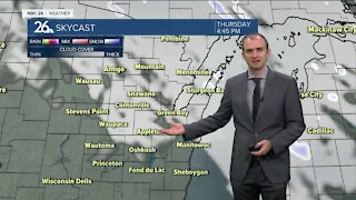
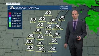
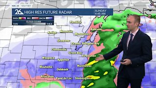
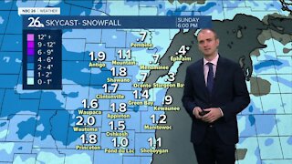
We're going to be warmer today, but with a weak frontal boundary on the way in the afternoon, there may be a stray shower/storm popping along it. Highs will top out in the lower 80s before the winds shift to the NE and cool things down near the lake & bay later in the day. After the slight chance of an evening shower/storm on tonight, but most of the night should be quiet. Lows will be in the low-50s. Get ready for a breezy and warm Friday with highs in the mid/upper 80s. A cold front will be approaching from the NW during the evening & will touch off some thunderstorms. Some storms could be severe with damaging winds & large hail being the main threats. The chance of a few scattered showers or T'storms will continue into Friday night with lows in the mid-50s. Along with some morning clouds & the chance of a little morning rain, we'll be cooler with highs in the 60s on Saturday Sunday will be mainly sunny with the upper 60s to lower 70s. There is a small chance of shower across the north during the early evening. As far as weather records are concerned Saturday is the first day of Meteorological Summer.
-
 1:45
1:45
WGBA
1 year agoStudents excited to start at "huge and beautiful" Vel Phillips Middle School
288 -
 3:20
3:20
WGBA
3 years agoGino Recchia NBC26 Weather Forecast
11 -
 2:44
2:44
WGBA
3 years agoGino Recchia NBC26 Weather Forecast
3 -
 3:03
3:03
WGBA
3 years agoGino Recchia NBC26 Weather Forecast
-
 3:51
3:51
WGBA
3 years agoGino Recchia NBC26 Weather Forecast
6 -
 2:56
2:56
WGBA
3 years agoGino Recchia NBC26 Weather Forecast
-
 3:32
3:32
WGBA
3 years agoGino Recchia NBC26 Weather Forecast
-
 3:27
3:27
WGBA
3 years agoGino Recchia NBC26 Weather Forecast
2 -
 3:43
3:43
WGBA
3 years agoGino Recchia NBC26 Weather Forecast
7 -
 3:54
3:54
WGBA
3 years agoGino Recchia NBC26 Weather Forecast
5