Premium Only Content
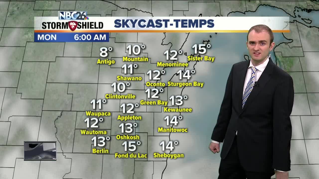
Gino Recchia NBC26 Storm Shield Weather Forecastv
Temperatures this morning were in the negatives and only got into the single digits and lower teens this afternoon. Warmer weather will move in but we will be seeing a very active pattern roll through the Midwest over the coming days. Overnight low temperatures will dip into the single digits tonight with increasing cloud cover. Winds will be out of the northeast around 5 mph. If you are doing any errands tomorrow, try to do them in the morning because snow will begin to fall later in the afternoon. This will be our first snow system of the week. It will continue to snow until late tomorrow night. Temperatures will rise into the lower 20s with northeast winds around 5 to 15 mph. Snowfall accumulation will vary across the area but somewhere between 1 and as much as 4 inches of snow will fall. The highest totals will fall along the Highway 29 corridor with lesser totals farther north and south. A few flurries may fly on Monday as we get ready for our second storm. High temperatures will be in the upper 20s. Snowfall will arrive before sun-break Tuesday. This storm looks to bring in double the amount of snow as Sundays storm. We may end up with 6-10 inches in many areas. Temperatures will be cold enough that everyone will see accumulating snowfall. A few flurries or light snow showers may fall behind this storm on Wednesday. Temperatures will be in the mid 20s. The third storm of the week will move in Thursday night into Friday. This one seems more questionable with how it is going to play out. The storm itself is over the Pacific just east of Hawaii so it has a ways to go. We are seeing different solutions to how this storm materializes. Some of the data is bringing a rain and snow mix to the area with a very strong storm moving through. Another round of data is keeping most of this snowfall south of Wisconsin with just 1-3 inches at most. The weekend appears to be dry with highs in the upper teens both Saturday and Sunday.
-
 1:45
1:45
WGBA
1 year agoFond du Lac Cardinals start the football season with a new $5.3 million nest
263 -
 3:33
3:33
WGBA
3 years agoGino Recchia NBC26 Weather Forecast
6 -
 4:13
4:13
WGBA
3 years agoGino Recchia NBC26 Weather Forecast
31 -
 4:13
4:13
WGBA
3 years agoGino Recchia NBC26 Weather Forecast
41 -
 3:36
3:36
WGBA
3 years agoGino Recchia NBC26 Weather Forecast
10 -
 3:29
3:29
WGBA
3 years agoGino Recchia NBC26 Weather Forecast
12 -
 4:09
4:09
WGBA
3 years agoGino Recchia NBC26 Weather Forecast
11 -
 3:28
3:28
WGBA
3 years agoGino Recchia NBC26 Weather Forecast
11 -
 3:21
3:21
WGBA
3 years agoGino Recchia NBC26 Weather Forecast
8 -
 3:46
3:46
WGBA
3 years agoGino Recchia NBC26 Weather Forecast
13