Gino Recchia NBC26 Storm Shield Weather Forecast
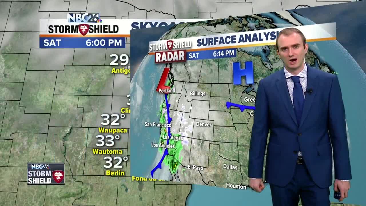
High temperatures today got almost to record level status. Highs got into the upper 40s and even a few localized areas hit 50! We normally see these temperatures at the end of March. A weak cool front swings through tonight putting an end to the mild weather we saw today. Winds will be out of the north around 5 to 10 mph with temperatures in the lower to mid 20s under partly cloudy skies. Sundays highs will only be in the lower 30s with winds coming in out of the northeast around 5 to 10 mph. Skies will start off mostly sunny but then turn mostly cloudy in the afternoon ahead of our next storm system. Sunday night, a low pressure will be tracking in bringing some snow, but that snow will quickly transition to a wintry mix and then rainfall for areas south of Highway 10. Between High way 10 and Highway 29, a wintry mix will continue until 7am when it will then change over to rainfall. North of Highway 29, a wintry mix will continue until the late morning before turning over to rainfall. Snowfall accumulation will occur for areas along and north of Highway 29. The highest totals will be to our far northwest in Northern Oconto, Marinette, and Langlade counties where 3 to 6 inches of snow may fall before it transitions to rainfall. Cooler weather follows suit on Tuesday. High temperatures will rise into the lower to mid 30s witha few light snow showers possible. Although it will turn colder........no big shots of arctic air are in the forecast for the next 7-days.
-
 3:36
3:36
WGBA
1 year agoWill it be necessary to have both the AC & the heat on during the same day??
3161 -
 2:33
2:33
WGBA
3 years agoGino Recchia NBC26 Weather Forecast
15 -
 3:46
3:46
WGBA
3 years agoGino Recchia NBC26 Weather Forecast
13 -
 3:32
3:32
WGBA
3 years agoGino Recchia NBC26 Weather Forecast
17 -
 1:55
1:55
WGBA
3 years agoGino Recchia NBC26 Weather Forecast
9 -
 4:18
4:18
WGBA
3 years agoGino Recchia NBC26 Weather Forecast
11 -
 3:47
3:47
WGBA
3 years agoGino Recchia NBC26 Weather Forecast
1 -
 3:32
3:32
WGBA
3 years agoGino Recchia NBC26 Weather Forecast
6 -
 4:26
4:26
WGBA
3 years agoGino Recchia NBC26 Weather Forecast
1 -
 3:43
3:43
WGBA
3 years agoGino Recchia NBC26 Weather Forecast
3