Michael Fish's NBC26 Storm Shield weather forecast
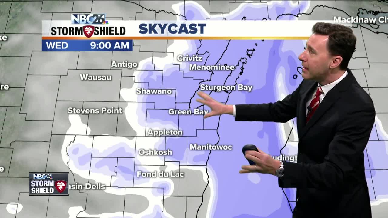
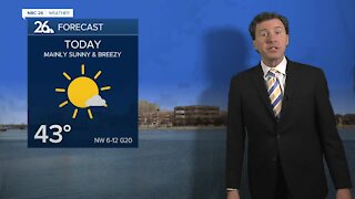
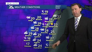
We will have a weak disturbance passing on by today with areas of light snow, flurries or even a little freezing drizzle. Any snow accumulation will be quite minor with only 1/2" or less of accumulation, but that may be just enough to cause a few slippery roads or sidewalks. Highs will top out in the low- to mid-20s with the wind picking up. Tonight, any lingering flurries will come to an end in the evening, otherwise skies will become partly cloudy at times. Lows will be in the mid-teens. Mostly sunny skies are back with us on Thursday as highs get up into the low-30s. Thursday night will actually be kind of mild and dry with lows in the mid-20s. Friday, we're going to be doing some melting with highs popping up into the mid- to upper-30s. Saturday will be the warmest day of the weekend with highs in the low-40s with plenty of sunshine. Sunday we'll also be doing more melting with highs around 40, The next chance of precipitation will be next Monday with a chance of some rain, or a rain/snow mix.
-
 3:36
3:36
WGBA
1 year agoWill it be necessary to have both the AC & the heat on during the same day??
3401 -
 2:33
2:33
WGBA
4 years agoMichael Fish's NBC 26 weather forecast
4 -
 2:19
2:19
WGBA
4 years agoMichael Fish's NBC 26 weather forecast
3 -
 2:26
2:26
WGBA
4 years agoMichael Fish's NBC 26 weather forecast
4 -
 2:24
2:24
WGBA
4 years agoMichael Fish's NBC 26 weather forecast
3 -
 2:27
2:27
WGBA
4 years agoMichael Fish's NBC 26 weather forecast
4 -
 1:57
1:57
WGBA
4 years agoMichael Fish's NBC 26 weather forecast
2 -
 2:31
2:31
WGBA
4 years agoMichael Fish's NBC 26 weather forecast
7 -
 1:50
1:50
WGBA
4 years agoMichael Fish's NBC 26 weather forecast
4 -
 2:27
2:27
WGBA
4 years agoMichael Fish's NBC 26 weather forecast
1