Premium Only Content

Michael Fish's NBC26 Storm Shield weather forecast
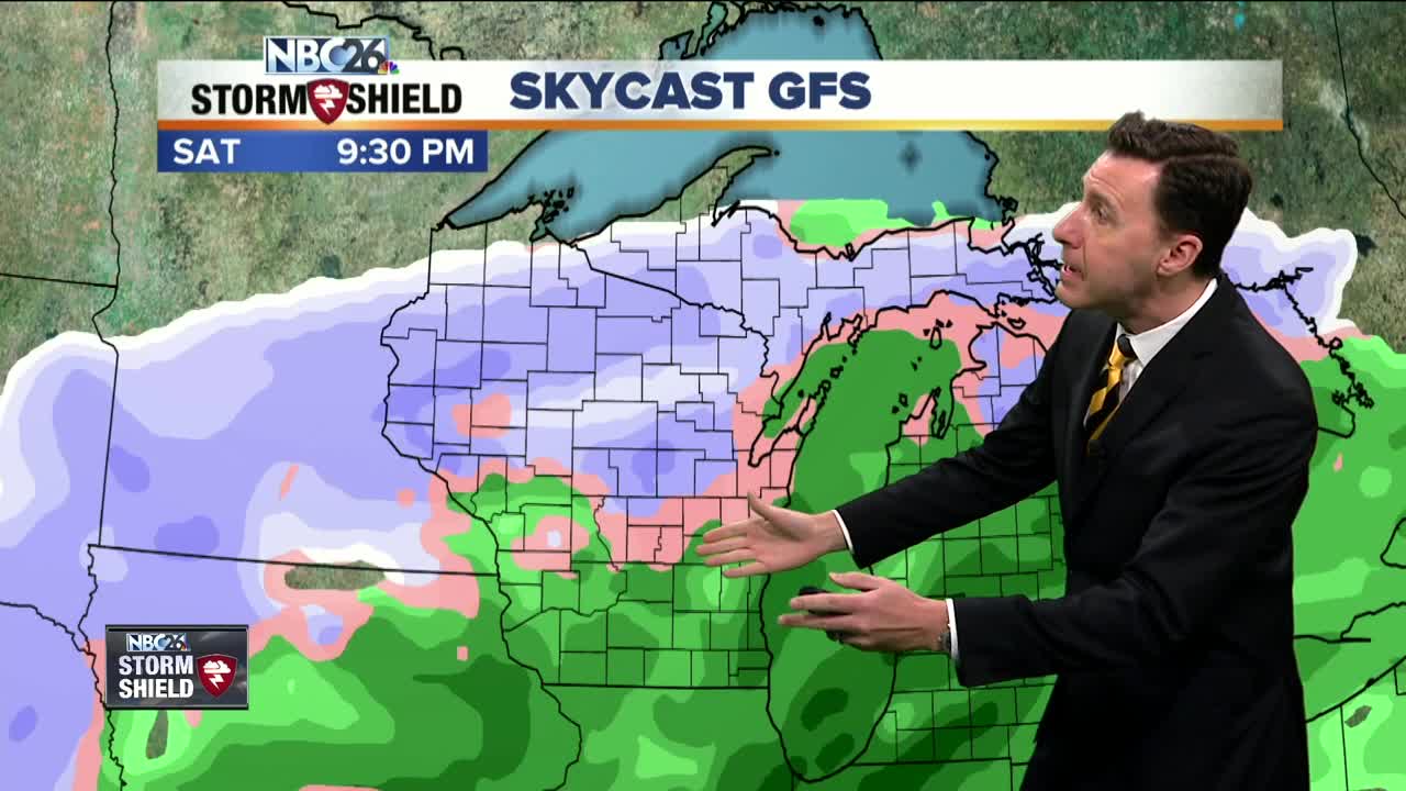
Today looks fine as we do some melting this afternoon. The sun will be coming out at times as the day wears on with afternoon highs in the mid/upper-30s. Tonight, clouds will be on the increase with lows in the mid-20s. A powerful low pressure system will be tracking through as the weekend wears on. The winds will be cranking up on Saturday with a rain/mix/snow developing as the afternoon progresses. This mixture of rain in spots and snow will continue through Saturday night with some snow accumulation still possible, mainly to the NW. Eventually this should change over to mainly snow on Sunday with all of us with some potential snow accumulation. The computer models are struggling a bit as to what the exact temperature profile will be with this system, and that will be key. As of right now, it looks like the farther you live to the northwest, the more snow you may see. A preliminary 1-3" is possible from Green Bay into the Fox Cities, and 3-6" possible northwest of there. This could change as a few other computer models are suggesting the band of snow will be farther south. Highs will top out in the mid/upper 30s & it will be windy. Next week will be on the cool side with a few weak disturbances brushing by the area. Welcome to December.
-
 1:57
1:57
WGBA
1 year agoHow the City of Green Bay is hoping a $1.6M investment will make the community safer for pedestrians
3261 -
 2:33
2:33
WGBA
3 years agoMichael Fish's NBC 26 weather forecast
4 -
 2:19
2:19
WGBA
3 years agoMichael Fish's NBC 26 weather forecast
3 -
 2:26
2:26
WGBA
3 years agoMichael Fish's NBC 26 weather forecast
4 -
 2:24
2:24
WGBA
3 years agoMichael Fish's NBC 26 weather forecast
3 -
 2:27
2:27
WGBA
3 years agoMichael Fish's NBC 26 weather forecast
4 -
 1:57
1:57
WGBA
3 years agoMichael Fish's NBC 26 weather forecast
2 -
 2:31
2:31
WGBA
3 years agoMichael Fish's NBC 26 weather forecast
7 -
 1:50
1:50
WGBA
3 years agoMichael Fish's NBC 26 weather forecast
4 -
 2:27
2:27
WGBA
3 years agoMichael Fish's NBC 26 weather forecast
1