(4K UHD) REVIEWING EACH CAMPSITE @ Poison Butte Campground! | Lower Crooked River | BLM | Prineville
*This Video is 4K UHD - it is made to watch on a Big Screen Smart TV!*
Chapters & Timestamps:
0:00 Sign for Entering Lower Crooked National Wild & Scenic River, Sign for Poison Butte Campground
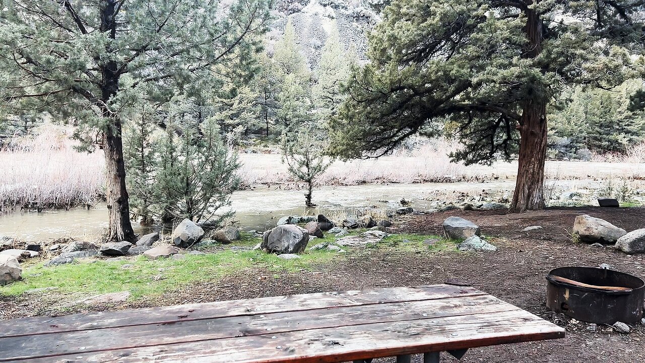
0:18 Campsite #1 *(BEST)*
2:06 Campsite #2
3:38 Day Use Picnic Site
3:53 Campsite #3
4:17 Campsite #4
4:32 Campsite #5
5:24 Kiosk
5:39 Silent Perspectives @ Campsite #1
6:16 Silent Perspectives @ Campsite #2
6:51 Silent Perspectives @ Campsite #5
The Lower Crooked National Wild & Scenic River is an extremely high quality River Canyon Wonderland Zone consisting of 9 Developed Campgrounds, 2 Day Use Areas, 1 Dam, 1 Dedicated Boat Ramp, and 1 World Class Hiking Trail called "Chimney Rock" that ascends to a truly spectacular geological formation. This area is operated by the Bureau of Land Management (BLM), and is in the SW Quadrant of the greater Prineville area to the West of the Prineville Reservoir State Park. *Here is the FULL PLAYLIST that Captures every piece of BLM Infrastructure in this Wonderland Zone:*
https://www.youtube.com/playlist?list=PLuGUSVzluAAlOo4qZIuM2s5e8aRxORCIj
Crooked River is divided into 3 National Wild & Scenic River Designated Smaller Sections - THIS ONE is the greater "Chimney Rock" Segment, named for the geological formation. Chimney Rock is also the name of the Trail, as well as the name of the Campground adjacent to the Trailhead.....clearly Chimney Rock has left its impression and mark on the nomenclature of this high desert wonderland river canyon area. To be clear, THIS ENTIRE SECTION of 9 Developed Campgrounds, 2 Day Use Areas, 1 Dam, 1 Dedicated Boat Ramp, and 1 World Class Hiking Trail is called the "Chimney Rock" Segment of Lower Crooked National Wild & Scenic River.
These Videos were not all made in one day, the size of the entire area and logistics make that impossible. These videos were made on 3/26/24, 4/2/24 and 3/6/25.
-
 3:24
3:24
HikingViking
1 month ago(4K UHD) Hiking Paulina Lakeshore 12 Mile "Grand" Loop (E9) | Newberry National Volcanic Monument
123 -
 LIVE
LIVE
Dr Disrespect
11 hours ago🔴LIVE - DR DISRESPECT - PUBG - 5 CHICKEN DINNERS CHALLENGE
3,804 watching -
 LIVE
LIVE
I_Came_With_Fire_Podcast
10 hours agoSHALL NOT BE INFRINGED| THE TYRANNY OF UNELECTED BUREAUCRATS | XI BOWS
148 watching -
 LIVE
LIVE
SynthTrax & DJ Cheezus Livestreams
12 hours agoFriday Night Synthwave 80s 90s Electronica and more DJ MIX Livestream THE GREAT EDO WARS OF 2067 Edition
329 watching -
 LIVE
LIVE
RalliedLIVE
2 hours ago $0.45 earnedWarzone Domination w/ Ral
188 watching -
 1:10:17
Sarah Westall
4 hours agoWorld Leaders Increasingly Display Panic Behavior as Economic Change Accelerates w/ Andy Schectman
34.5K5 -
 LIVE
LIVE
Motherland Casino
1 hour agoScar x Ayanna
67 watching -
 41:57
41:57
BonginoReport
6 hours agoProtecting Kids From WOKE Ideology in School (Ep. 35) - Nightly Scroll with Hayley Caronia -04/25/25
77.6K24 -
 LIVE
LIVE
SpartakusLIVE
4 hours agoFriday Night HYPE w/ #1 All-American Solo NUKE Hero
133 watching -
 LIVE
LIVE
crystalkittn
29 minutes agohappy friday lets get littt✨ !motherland
30 watching