NBC26 Storm Shield Weather Forecast
6 years ago
3
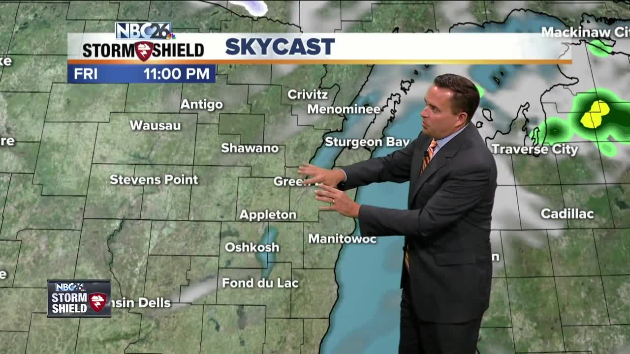
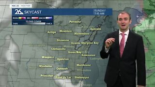
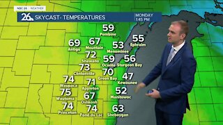
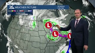
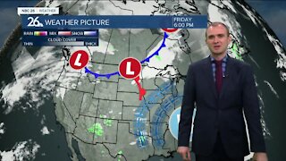
A cold front will push through tonight keeping showers in the area through daybreak. Temperatures will dip down into the mid and lower 40s. A secondary cold front will move through on Friday. A few pop up afternoon showers are possible but the main culprit will be the cold air behind this front. Afternoon highs will be in the mid 50s. Friday night our temperatures will drop into the mid and lower 30s. A few spots could get into the upper 20s. I anticipate a large area of Northern Wisconsin to experience frost by Saturday Morning. The weekend remains chilly with highs in the lower to mid 50s under mostly sunny to partly cloudy skies on Saturday. Rainfall returns to the area Sunday afternoon and continues on and off Monday and Tuesday.
Loading comments...
-
 1:45
1:45
WGBA
1 year agoStudents excited to start at "huge and beautiful" Vel Phillips Middle School
305 -
 3:52
3:52
WGBA
3 years agoGino Recchia NBC26 Weather Forecast
10 -
 3:34
3:34
WGBA
3 years agoGino Recchia NBC26 Weather Forecast
11 -
 4:01
4:01
WGBA
3 years agoGino Recchia NBC26 Weather Forecast
15 -
 3:11
3:11
WGBA
3 years agoGino Recchia NBC26 Weather Forecast
5 -
 3:33
3:33
WGBA
3 years agoGino Recchia NBC26 Weather Forecast
4 -
 3:45
3:45
WGBA
3 years agoGino Recchia NBC26 Weather Forecast
1 -
 4:02
4:02
WGBA
4 years agoGino Recchia NBC26 Weather Forecast
8 -
 3:46
3:46
WGBA
4 years agoGino Recchia NBC26 Weather Forecast
6 -
 3:46
3:46
WGBA
4 years agoGino Recchia NBC26 Weather Forecast
15