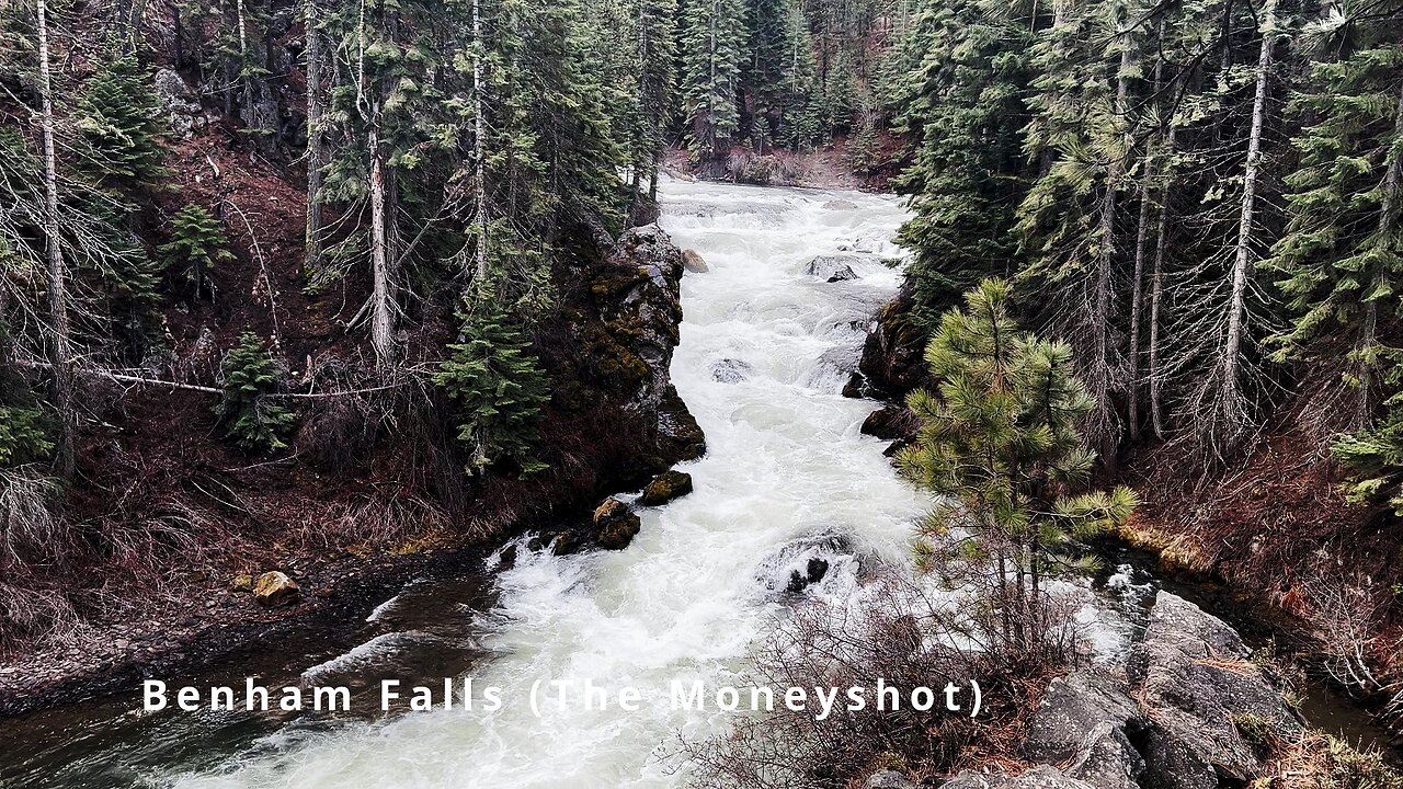
SILENT PERSPECTIVES (4K) of National Wild & Scenic Upper Deschutes River | Bend | Central Oregon
Silent Perspectives of National Wild & Scenic Upper Deschutes River up and down the 8-Mile Shoreline Trail including Benham Falls, Dillon Falls, Upper Falls, Big Eddy etc. near Bend in Central Oregon! Each 4K Clip is original and no Clip appears twice.
In my opinion, there are about 8 Miles of PREMIUM River Shoreline Hiking on Deschutes River Trail along National Wild & Scenic Upper Deschutes River, Deschutes National Forest, Central Oregon.
This is EASILY a TOP 5 River Shoreline Hike in the Great State of Oregon! There are 3 Strategic Approaches to Capture/Tackle this EPIC area:
1) 8 Mile Point-to-Point Hike from Meadow Day Use Area to Sun-Lava Path Trailhead (called East Benham Falls Trailhead on Google Maps), in either Direction, need to arrange transportation at end of Hike!
2) 16 Mile Out & Back Hike from Meadow Day Use Area to Dillon Falls to Benham Falls to Sun-Lava Path Trailhead (called East Benham Falls Trailhead on Google Maps), in either Direction, no transportation logistics required, the Superstar Hiker Method!
3) Break Deschutes River Trail up into 2 separate more leisurely 8-Miles'ish Out & Back Hikes using Dillon Falls as the Midpoint:
a) Meadow Day Use Area Trailhead to Dillon Falls & Back.
b) Sun-Lava Path Trailhead (called East Benham Falls Trailhead on Google Maps) to Dillon Falls & Back.
On April 22, 2022, I Hiked 8 Miles Point-to-Point from Sun-Lava Path Trailhead (called East Benham Falls Trailhead on Google Maps) heading North to Benham Falls, Slough Day Use Area, Dillon Falls, Aspen Day Use Area, Big Eddy, Upper Falls, Lava Island Day Use Area, Lava Island to Meadow Day Use Area. It was a Low of 29F. Here is the FULL HIKE Video Link of that Hike:
On May 6, 2022, I Hiked 8 Miles Point-to-Point from Meadow Day Use Area Trailhead heading South to Lava Island, Lava Island Day Use Area, Upper Falls, Big Eddy, Aspen Day Use Area, Dillon Falls, Slough Day Use Area & Benham Falls to Sun-Lava Path Trailhead (called East Benham Falls Trailhead on Google Maps). It was a Low of 33F. There was a freak Hail Storm that added to the experience:
-
 3:13
3:13
HikingViking
14 days agoFLY FISHING BACKCOUNTRY CAMPING DREAM Campsite #94.9 Trout Creek Trail Lower Deschutes River BLM 4K
1282 -
 1:19:38
The Rubin Report
4 hours agoCNN Host Brutally Mocked for Trying to Profit Off of What He Called a ‘Conspiracy’
63.3K38 -
 2:00:42
Benny Johnson
20 hours ago🚨BREAKING: Epstein List, Flight Logs RELEASED Any Minute By Trump | ELITES IN PANIC
135K130 -
 2:10:17
Steven Crowder
6 hours agoEpstein File Watch & DOGE’s $17M Muppet Show Explained
471K335 -
 1:04:22
Timcast
5 hours agoTrump Orders ALL TRANS MILITARY Discharged, Trans Person CAUGHT With BOMBS At Tesla Dealership
130K135 -
 2:01:41
LFA TV
19 hours agoPAYBACK = JUSTICE! | LIVE FROM AMERICA 2.27.25 11AM
73.8K23 -
 DVR
DVR
Bannons War Room
9 days agoWarRoom Live
2.42M420 -
 2:17:39
Matt Kohrs
14 hours agoBREAKING MARKET NEWS: Bounce or Bust?! || The MK Show
84.7K2 -
 47:26
47:26
BonginoReport
7 hours agoEpstein Files Drop Today-But How Much Will They Reveal? (Ep.149) - 02/27/2025
156K177 -
 2:59:16
Wendy Bell Radio
10 hours agoThe Left Is Wrong About Everything
121K62