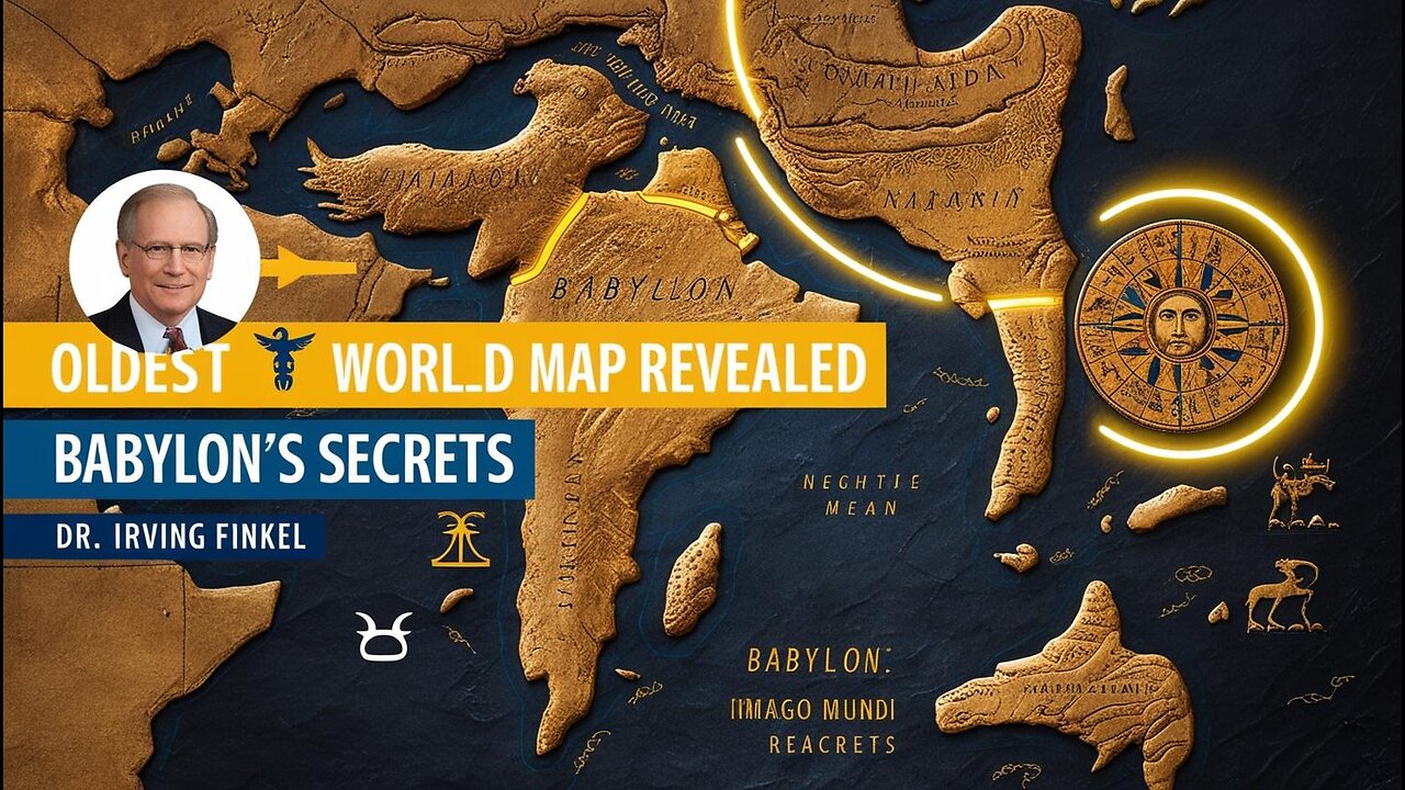
Imago Mundi Oldest Surviving World Map from Babylon Reveals Secrets of Geography & Mythology
The Imago Mundi is the oldest surviving world map, dating back to the 5th century BCE and discovered in Babylon (modern-day Iraq). This ancient Babylonian map provides a fascinating window into how ancient civilizations understood geography, astronomy, and mythology. The map not only charts the physical world but also reveals spiritual and cosmic beliefs from one of the world’s most advanced early societies.
Join us as we uncover the secrets of the Imago Mundi, exploring the Babylonian worldview of geography, mythical creatures, and celestial bodies depicted on this incredible clay tablet. Learn how the Babylonians integrated geography and mythology to represent their world and cosmos.
Subscribe for more insights into ancient history and incredible discoveries! 🌍✨
-
![CIA Documents Implicate The Soros’ As Ukraine War Criminals. Putin Agrees [EP 4467-8AM]](https://1a-1791.com/video/fwe1/b9/s8/1/g/A/g/r/gAgry.0kob-small-CIA-Documents-Implicate-The.jpg) LIVE
LIVE
The Pete Santilli Show
14 hours agoCIA Documents Implicate The Soros’ As Ukraine War Criminals. Putin Agrees [EP 4467-8AM]
2,622 watching -
 1:55:20
TheDozenPodcast
19 hours agoPrison Officer EXPOSES deaths in custody: Sam Samworth
6.85K2 -
 25:23
25:23
Fit'n Fire
19 hours ago $0.30 earnedThe Krink at Home Part 2 - PSA 300 Blackout Krink vs PSA 5.56 Krink
3.17K3 -
 1:01:29
PMG
17 hours ago $1.85 earnedTrump's Speech, SCOTUS Forces USAID Payments, and Justice For MRNA Vaccine Victims
9.88K5 -
 4:23:59
STARM1X16
13 hours agoSunday Night Duos
86.1K4 -
 1:02:11
The Dan Bongino Show
1 day agoSunday Special with Vince Coglianese, Rep. Tim Burchett, Rep. Byron Donalds & Vivek Ramaswamy
219K354 -
 2:29:38
TheSaltyCracker
13 hours agoPiss Off War Pigs ReeEEeE Stream 03-09-25
223K403 -
 1:03:55
Sarah Westall
15 hours agoCanada Media Mind Control to increase Assisted Suicide, Confusion & Enslavement w/ Jasmin Laine
84K18 -
 2:41:11
Canal Paulo Figueiredo
2 days agoPedro Valente Debunks The Myths of Jiu-Jitsu History
81.8K9 -
 2:01:46
vivafrei
15 hours agoEp. 254: China to Pay $24 BILLION? Who Owns Embryos? Tulsi was RIGHT on Syria! Prorogation & MORE!
193K170