Premium Only Content

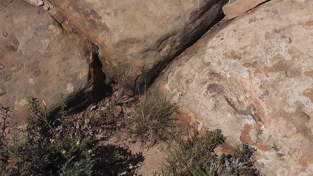
Megalithic Blocks with 90 degree angles. Evidence of Advanced Technology over 12,800 years old.
Clip 22 - Day 1 Straight Lines crisscross the entire area in 90 degree angles.
And all of the straight lines strongly indicate a straight flat face going over 30 feet deep as the edges of these blocks, where exposed, show this to be the norm on this plateau. Giant megalithic blocks with a bread-like top stacked next to one another or possibly created in place. As to why, I believe it was to preserve the land from the giant flood this civilization foresaw coming, around the time of the Younger Dryas (12,800 years ago). Two giant floods (Meltwater pulse 1A and 1B) that is now believed to create the scablands of Washington, as well as the Grand Canyon in days/weeks instead of millennia. And these same floods are agreed by the YT author as plausible for Monument Valley which sits just below this plateau with evidence of thousands of giant megalithic blocks and rectangles.
https://www.youtube.com/watch?v=RwBPWjrRnhM
I believe an advanced civilization saw this cataclysm approaching and made row upon row of these blocks. Especially when there is evidence showing a sealant is covering each 30x30 flat face in between the blocks that holds out water to this day. And we may be just looking at the remnants but even so there is a large area with similar lines and flat sides covering a 27 x14 mile area.
But don’t go searching Muley Point East in Utah on Google Earth because you won’t see what I’m going to show you. This is because Google Earth has now ALTERED the edges of this plateau to seem more natural. If you want to see more evidence of this you can see it on the back of my book on Amazon called “Google Earth Lies”.
-
 LIVE
LIVE
Vigilant News Network
14 hours agoBUSTED: O’Keefe Exposes Secret Pentagon Plot to Sabotage Trump’s Return | The Daily Dose
1,482 watching -
 LIVE
LIVE
2 MIKES LIVE
11 hours agoTHE MIKE SCHWARTZ SHOW with DR. MICHAEL J SCHWARTZ 01-16-2025
205 watching -
 43:10
43:10
PMG
11 hours agoHannah Faulkner and Jeff Younger | Father fights for his son!
2841 -
 1:24:14
Game On!
14 hours ago $3.41 earnedTaylor Swift SHOCKS Chief fans! Does NOT want Travis Kelce to retire!
25.9K8 -
 4:27
4:27
Reforge Gaming
14 hours agoTHIS will not save Ubisoft.
42.4K4 -
 7:35
7:35
Tactical Advisor
1 day agoNEW Springfield Prodigy Compact (FIRST LOOK)
67.8K7 -
 16:45
16:45
IsaacButterfield
1 day ago $6.28 earnedWoke TikToks Are DESTROYING The World
37.1K33 -
 1:09:27
State of the Second Podcast
18 hours agoThis is Why We Don’t Trust Politicians (ft. @stones2ndsense)
31.2K4 -
 10:19
10:19
Chrissy Clark
15 hours agoCNN’s BILLION Dollar Defamation Trial
34.2K11 -
 1:00:27
Trumpet Daily
22 hours ago $6.26 earnedCongress Humiliates Itself - Trumpet Daily | Jan. 15, 2025
36.4K16