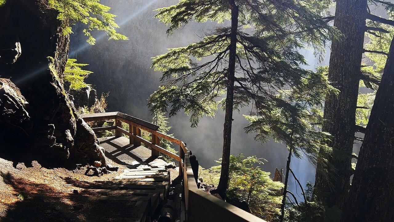
FULL HIKE (4K) to Salt Creek Falls, 2nd Tallest Waterfall in Oregon! | Upper Middle Lower Viewpoints
Chapters & Timestamps:
0:00 Approach to Upper Viewpoint of Salt Creek Falls
0:38 *Upper Viewpoint of Salt Creek Falls*
1:05 Forest Trailhead down to Middle & Lower Viewpoints of Salt Creek Falls
2:15 *Middle Viewpoint of Salt Creek Falls*
2:39 Descending down the Forest towards Lower Viewpoint of Salt Creek Falls
4:09 *Approach to Lower Viewpoint of Salt Creek Falls*
5:14 *Silent Perspectives* Montage of 8 Unique 4K Clips of Lower, Middle & Upper Viewpoints of Salt Creek Falls
This was a Day-Hike (November 6, 2024) in the Willamette Pass area of Central Oregon, Willamette National Forest, Hiking Salt Creek Falls Trail. The Salt Creek Falls Observation Site & Picnic Area is a National Fee Area, NW Forest Pass accepted. The Area is divided into two distinct Hikes - the easier one to the Right is Salt Creek Falls Trail to Upper, Middle & Lower Viewpoints, approximately 0.6 Miles and around 200 FT Elevation Gain. *That Short Hike Only is This Video!* You can also go to the Left and do the Diamond Creek Falls Loop, including Shoreline Access to Too Much Bear Lake, which is a 3.2 Mile, 500+ FT Elevation Gain Loop on it's own. The BEST WAY to Hike this Area is to combine both Waterfall Hikes into a Super Loop and see it all in one go, which is still a relatively modest Hike of around 3.9 Miles and 750 FT Elevation Gain.
In Conclusion, there are three ways to Hike/Explore/Tackle this area:
1) Salt Creek Falls Trail ONLY - EASIEST OPTION - 0.6 Miles, 200+ FT Elevation Gain *THIS FULL HIKE IS CAPTURED IN THIS VIDEO!*
2) Diamond Creek Falls Loop & Too Much Bear Lake ONLY - MODERATE OPTION - 3.2 Miles, 500+ FT Elevation Gain
3) THE BEST WAY - One Super Loop Combining ALL Highlights - Salt Creek Falls, Diamond Creek Falls Loop & Too Much Bear Lake - HARDEST OPTION - 3.9 Miles, 750 FT Elevation Gain - *Please Note these Hiking Stats are still relatively modest in the grander scheme of Adventure Hiking, keeping it real.*
Lastly, there is another option to Hike South to Vivian Lake, but that is more of a Forest Hike away from this infrastructure that just happens to share the Parking Trailhead, so I won't go into detail on that Hike here.
-
 0:24
0:24
HikingViking
1 month ago(4K UHD) North American River Otters @ Paulina Lake! | Hiking Newberry National Volcanic Monument
1061 -
 LIVE
LIVE
RiftTV/Slightly Offensive
2 hours agoTotal Indian TAKEOVER: Has The WEST Completely FALLEN? | Guest: Josh Denny
706 watching -
 1:02:31
BonginoReport
5 hours agoDeportations Keep “Frightened” Michelle Obama Awake at Night (Ep. 37) - Nightly Scroll with Hayley
82.4K138 -
 9:46
9:46
Mrgunsngear
1 hour agoHow To Turn Your Glock Into A PCC
1933 -
 16:12
16:12
T-SPLY
10 hours agoJeff Bezos Is Now Enemy #1 For The Trump Administration
59.6K58 -
 12:24
12:24
Tundra Tactical
2 hours agoThe SIG Roast to ND Them All
6.94K4 -
 LIVE
LIVE
Adam Does Movies
2 days agoTalking Movie News & Just Chatting About Films - LIVE!
128 watching -
 LIVE
LIVE
megimu32
1 hour agoON THE SUBJECT: 1 Million Views Party! Diddy Drama, Marvel Weirdness, and Total Prom Chaos
140 watching -
 1:18:44
Kim Iversen
5 hours agoMagnetic Pole Shift: Europe’s Blackout Is Just the Beginning | 90° Earth Flip Coming
73.2K197 -
 2:44:58
Laura Loomer
4 hours agoEP118: LIVE COVERAGE: Trump Celebrates 100 Days In Office At Michigan Rally
47K22