Premium Only Content

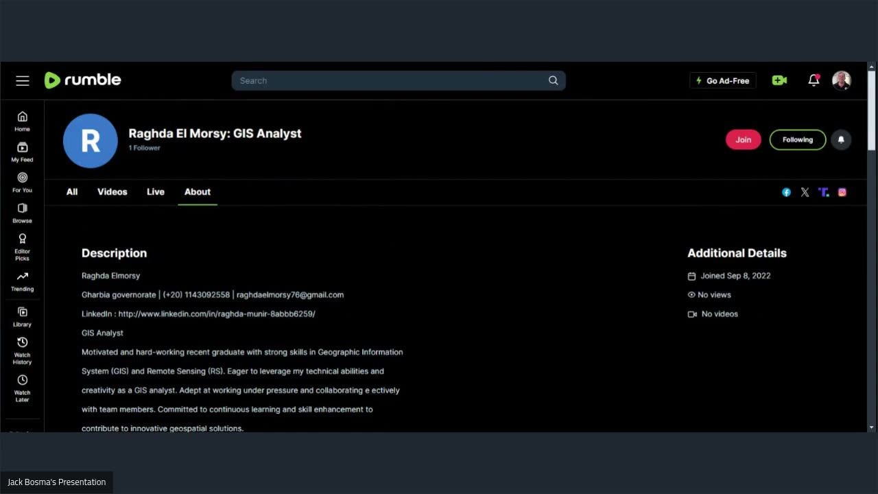
Raghda El Morsy: GIS Analyst
Raghda El Morsy: GIS Analyst
Raghda Elmorsy
Gharbia governorate | (+20) 1143092558 | raghdaelmorsy76@gmail.com
LinkedIn : http://www.linkedin.com/in/raghda-munir-8abbb6259/
GIS Analyst
Motivated and hard-working recent graduate with strong skills in Geographic Information
System (GIS) and Remote Sensing (RS). Eager to leverage my technical abilities and
creativity as a GIS analyst. Adept at working under pressure and collaborating e ectively
with team members. Committed to continuous learning and skill enhancement to
contribute to innovative geospatial solutions.
Education
Bachelor of Surveying, Geographic Information System and Remote Sensing
[Mansoura University – 2024] -GPA :3.44
Core Proficiencies
GIS software : ArcMap , ArcGIS Pro , ArcGIS online
Programming : HTML5 , CSS3 , Bootstrap5 ,JavaScript , Leaflet , Google Earth Engine
Microsoft O ice : word , Access , Power Point , Excel
Survey : AutoCAD , Surfer
Internship
trainee -GIS Bloggers
September 2023 – January 2024
Successfully completed the GIS Bloggers Intensive Course, which provided in-depth
training on ArcGIS Pro, ArcGIS Desktop, and ArcGIS Online.
Acquired hands-on experience in building and managing GIS databases, conducting
spatial analyses, and producing maps.
Explored and applied essential tools and resources for acquiring spatial data,
attribute information, and satellite imagery.
Academic Projects
Identification of optimal wind turbines sites in Fayoum
Graduation Project (October 2023 – December 2023)
Collaborated with my team to gather and analyze weather data, focusing on wind
and atmospheric pressure.
Created detailed wind and pressure maps to assess the weather conditions of the
area.
Developed dashboards to visualize wind direction and speed, enhancing data
interpretation.
Designed a story map to provide a comprehensive study of the area.
Produced a 3D terrain model to better understand the geographical features of
Fayoum
Education Services Assessment for Talkha
Graduation Project (February 2024 – May 2024)
Collaborated with my team to collect and compile data on schools in the Talkha
area, ensuring accurate entry into Excel.
Georeferenced the schools on a map, enabling spatial analysis of educational
infrastructure.
Conducted statistical analysis to identify patterns and created geostatistical maps
for the region.
Gathered network-related information and developed a network map for further
analysis.
Designed a dashboard to visualize school locations and student populations.
Utilized Experience Builder to present the project on a web-based platform.
Shoreline Study of Burullus Lake
Graduation Project (February 2024 – May 2024)
Collected satellite images from various sources for multiple years to support the
shoreline study.
Performed geometric and atmospheric corrections on the images to ensure
accuracy.
Extracted and compiled shoreline data for di erent years to analyze changes
over time.
Conducted spectral indices analysis using Google Earth Engine to assess the
shoreline and surrounding areas.
Executed land use and land cover analysis with Google Earth Engine and ENVI
software.
Language Proficiency
Arabic: Native
English: Advanced (C1)
Let's collaborate!
Thanks,
Jack Bosma
https://meetn.com/jackbosma
tutorjacknetwork@gmail.com
"Inspect what you expect."
-
 2:10:37
Steven Crowder
4 hours ago🔴 How Trump Buried Leftwing Media & Conspiracy Talk
307K195 -
 13:57
13:57
TimcastIRL
4 hours agoMANIFESTO LEAKS, PROVING CEO Assassin Suspect Is NOT A Smart Guy
35.1K56 -
 1:12:48
Caleb Hammer
19 hours agoWannabe Trans Victim Steals Money From EVERY Friend | Financial Audit
10.8K5 -

Grant Stinchfield
1 hour agoThe Truth About the Drone Invasion and What Our Military Really Knows
7771 -
 1:10:22
Trumpet Daily
2 hours agoInterview with Lee Smith - Trumpet Daily | Dec. 11, 2024
6.73K2 -
 36:28
36:28
Tudor Dixon
1 hour agoHow the Elites Got Tricked in the Presidential Race | The Tudor Dixon Podcast
10.4K1 -
 2:03:14
LFA TV
15 hours agoDEPORTATIONS TO START IN CHICAGO! | LIVE FROM AMERICA 12.11.24 11am EST
25.2K26 -
 44:27
44:27
MYLUNCHBREAK CHANNEL PAGE
17 hours agoThe Civilization They Erased?
25.6K12 -
 1:38:18
Graham Allen
5 hours agoCEO Shooter ARRESTED! Was It Really Him? + Biden Sends Another $50 BILLION To Ukraine!!
108K83 -
 LIVE
LIVE
Vigilant News Network
18 hours agoDeadly Mystery Disease Triggers Urgent WHO Investigation | The Daily Dose
988 watching