FREAK HEAVY HAIL STORM Hiking Deschutes River Trail Lava Rock Volcanic Wonderland! Central Oregon 4K
In my opinion, there are about 8 Miles of PREMIUM River Shoreline Hiking on Deschutes River Trail along National Wild & Scenic Upper Deschutes River, Deschutes National Forest, Central Oregon.
This is EASILY a TOP 5 River Shoreline Hike in the Great State of Oregon! There are 3 Strategic Approaches to Capture/Tackle this EPIC area:
1) 8 Mile Point-to-Point Hike from Meadow Day Use Area to Sun-Lava Path Trailhead (called East Benham Falls Trailhead on Google Maps), in either Direction, need to arrange transportation at end of Hike!
2) 16 Mile Out & Back Hike from Meadow Day Use Area to Dillon Falls to Benham Falls to Sun-Lava Path Trailhead (called East Benham Falls Trailhead on Google Maps), in either Direction, no transportation logistics required, the Superstar Hiker Method!
3) Break Deschutes River Trail up into 2 separate more leisurely 8-Miles'ish Out & Back Hikes using Dillon Falls as the Midpoint:
a) Meadow Day Use Area Trailhead to Dillon Falls & Back.
b) Sun-Lava Path Trailhead (called East Benham Falls Trailhead on Google Maps) to Dillon Falls & Back.
On April 22, 2022, I Hiked 8 Miles Point-to-Point from Sun-Lava Path Trailhead (called East Benham Falls Trailhead on Google Maps) heading North to Benham Falls, Slough Day Use Area, Dillon Falls, Aspen Day Use Area, Big Eddy, Upper Falls, Lava Island Day Use Area, Lava Island to Meadow Day Use Area. It was a Low of 29F. Here is the FULL HIKE Video Link of that Hike:
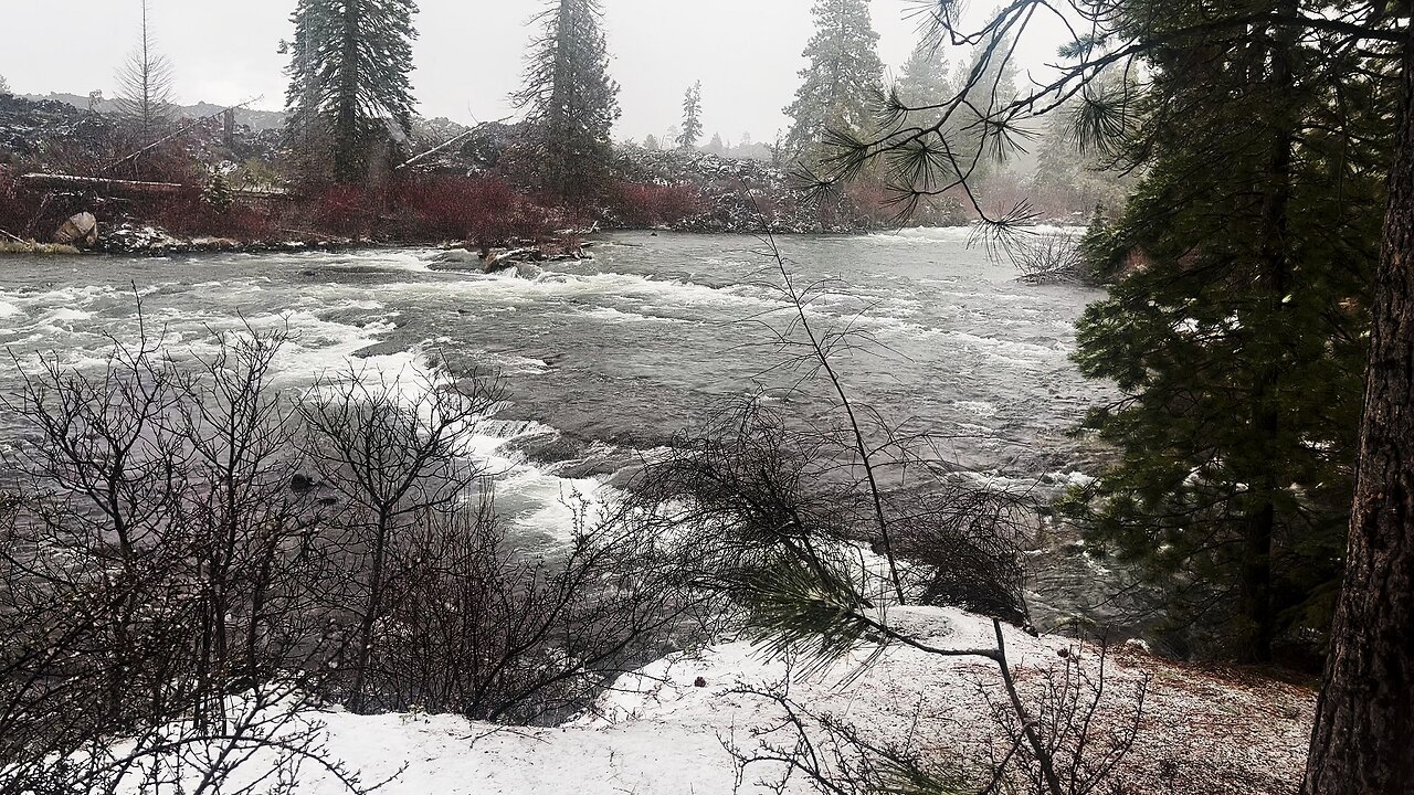
On May 6, 2022, I Hiked 8 Miles Point-to-Point from Meadow Day Use Area Trailhead heading South to Lava Island, Lava Island Day Use Area, Upper Falls, Big Eddy, Aspen Day Use Area, Dillon Falls, Slough Day Use Area & Benham Falls to Sun-Lava Path Trailhead (called East Benham Falls Trailhead on Google Maps). It was a Low of 33F. There was a freak Hail Storm that added to the experience:
-
 0:55
0:55
HikingViking
1 month agoHERD OF DEER @ Steelhead Falls Trailhead! | Deschutes Canyon River FALL AUTUMN | Central Oregon | 4K
1641 -

BonginoReport
3 hours agoNikki Haley's Hatred of Tulsi Gabbard Just Made Me a Bigger Fan (Ep.90) - 11/21/24
25.3K40 -
 28:41
28:41
Professor Nez
8 hours ago🚨BLOOD on their HANDS! The Man Biden & Kamala Flew In Finally Faces JUSTICE for Laken Riley
19.7K9 -
 1:22:22
Game On!
13 hours ago $6.79 earnedRussell Wilson MVP? TNF Steelers vs Browns Game of the Year!
40.2K -
 13:57
13:57
This Bahamian Gyal
14 hours agoSo, now MIKA and JOE want to work with HITLER? Sunny Hostin was right!
25.7K30 -
 59:38
59:38
The Tom Renz Show
16 hours ago"MAGA & Unity With Pastor Bernadette Smith"
15.7K1 -
 2:12
2:12
Memology 101
13 hours ago $3.22 earnedTYT's Cenk Uygur DESTROYS deluded self-proclaimed election Nostradamus over FAILED prediction "keys"
13.7K12 -
 2:11
2:11
BIG NEM
14 hours agoMeet the NATIVE Tribe Of The Balkans Nobody Talks About
20.8K2 -
 2:40:31
Fresh and Fit
12 hours agoAre You Smarter Than A 5th Grader? After Hours
203K79 -
 4:07:42
Alex Zedra
18 hours agoLIVE! Scary Games with the Girls
172K6