NBC26 Storm Shield Weather Forecast
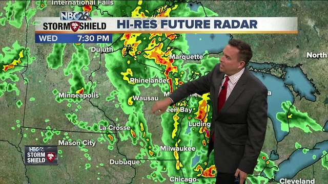
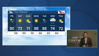
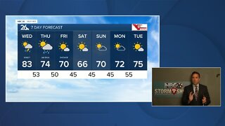
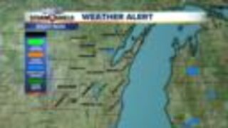
The remnants of "Alberto" will impact our weather into the overnight hours. Scattered showers and embedded storms will continue. With plenty of available moisture with this system, we could see some locally heavy downpours should you end up under one of these showers. These scattered showers/storms will gradually end by daybreak on Thursday. Lows will be in the mid-60s. Thursday, a weak area of low pressure will be heading through the area. This will bring a chance of scattered showers and T'storms as the day progresses. Highs will be pretty warm again with highs in the mid 80s to around 90 in a few spots. Any of this precipitation will depart on Thursday night with more comfortable lows in the upper-50s. Friday, we'll be cooling things down, but it should be quiet with highs struggling to make it to 70. Gusty NE winds will keep it cooler near the Lake & Bay. The weekend looks much cooler......compared to what we've been seeing. Saturday looks dry but showers/storms return on Sunday. . Highs Saturday will be in the low-70s and it looks like upper 60s to lower 70s for Sunday.
-
 1:45
1:45
WGBA
1 year agoFond du Lac Cardinals start the football season with a new $5.3 million nest
275 -
 3:24
3:24
WGBA
4 years agoNBC26 Storm Shield Forecast
6 -
 3:24
3:24
WGBA
4 years agoNBC26 Storm Shield Forecast
8 -
 1:29
1:29
WGBA
4 years agoNBC26 Storm Shield Forecast
7 -
 4:01
4:01
WGBA
4 years agoNBC26 Storm Shield Forecast
15 -
 3:38
3:38
WGBA
4 years agoNBC26 Storm Shield Forecast
12 -
 3:17
3:17
WGBA
4 years agoNBC26 Storm Shield Forecast
11 -
 1:32
1:32
WGBA
4 years agoNBC26 Storm Shield Forecast
4 -
 3:35
3:35
WGBA
4 years agoNBC26 Storm Shield Forecast
7 -
 3:51
3:51
WGBA
4 years agoNBC26 Storm Shield Forecast
7