Premium Only Content

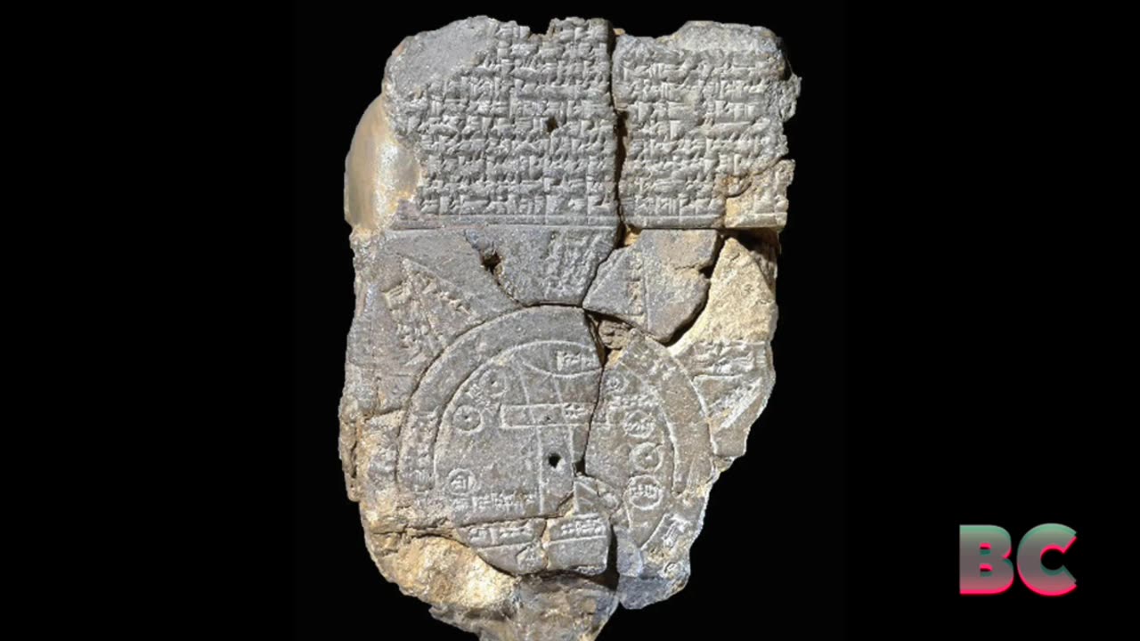
Babylonian Map of the World: The oldest known map of the ancient world
The Babylonian Map of the World, also known as the Imago Mundi, is the oldest known map of the ancient world, dating back to the sixth century B.C. It is a clay tablet from Abu Habba (Sippar), an ancient Babylonian city in modern-day Iraq.
The map depicts the world as a disc surrounded by a ring of water called the Bitter River, with Babylon and the Euphrates River at its center.
The tablet features cuneiform inscriptions detailing various locations and regions, as well as a description of the world’s creation by the god Marduk, Live Science has reported.
Links for B.C.
Visit My Website
https://bcbegley.com
Follow Me On Facebook
https://www.facebook.com/B.C.Begley
Subscribe To My Patreon
https://www.patreon.com/bcbegley
Watch Me On YouTube
https://www.youtube.com/channel/UCGoUf-QQTlTN-BIh3ERCE9A
Follow Me On Twitter
https://twitter.com/BC_News1
Watch Me On Rumble
https://rumble.com/c/c-280191
Follow Me On Gab
https://gab.com/BC_Begley
Follow Me On Truth Social
https://truthsocial.com/@BC_Begley
-
 1:08
1:08
B.C. Begley
1 day agoEU investigates TikTok over alleged Russian meddling in Romanian vote
49 -
 LIVE
LIVE
vivafrei
4 hours agoLock Liz Cheney Up! Spending Bill MADNESS! Not Just Pork, but GAIN OF FUNCTION! & MORE! Viva Frei
4,057 watching -
 55:51
55:51
The Dan Bongino Show
4 hours agoWe Are NOT Falling For This Again (Ep. 2391) - 12/19/2024
468K1.82K -
 LIVE
LIVE
The Charlie Kirk Show
1 hour agoAmericaFest: Day 1 | Bannon, Maloney, Posobiec, O'Keefe | 12.19.24
7,483 watching -
 LIVE
LIVE
TheAlecLaceShow
3 hours agoGuests: AG Andrew Bailey & Dr. Michael Schwartz | DOGE Shuts Down Speaker’s CR | The Alec Lace Show
124 watching -
 LIVE
LIVE
hambinooo
46 minutes agoPUBG DOMINATION
92 watching -
 1:03:06
The Rubin Report
2 hours ago‘Piers Morgan’ Goes Off the Rails as 'TYT' Host Attacks Dave with Nasty Insults
29.4K56 -
 1:47:50
Steven Crowder
3 hours agoLWC Christmas Special 2024 | Giving Back with Santa Crowder
101K199 -
 LIVE
LIVE
The Dana Show with Dana Loesch
1 hour agoTRUMP SLAMS SPENDING DEAL | The Dana Show LIVE On Rumble!
619 watching -
 35:43
35:43
Grant Stinchfield
1 hour agoThe C.R. in One Page, Anything Longer is the Deep State Exposed
3.53K2