🍁 Discovering The Ottawa River #Pathway Recreational Trails 🌴
🍋🟩 Healthy4Life - 10 Trails On The Pathway.
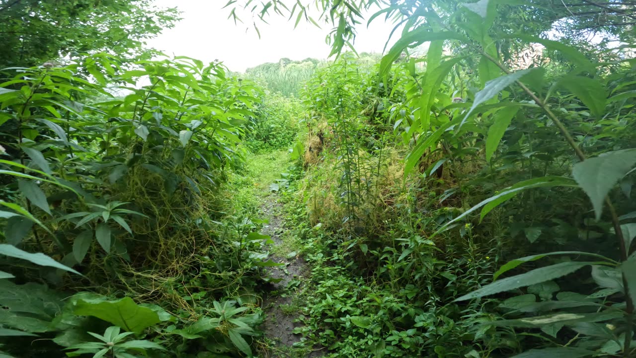
About 30 km of the Trans Canada Trail wends its way from Kanata through the Greenbelt west of Ottawa and along the Ottawa River to downtown Ottawa.
From there the trail continues eastward across the Alexandra Bridge to Quebec.
You can start at the Vanier Parkway and St. Patrick st. and follow the river for the National Capital Commission 30km. Information provided by the National Capital Commission.
Ontario Trails do not own or manage any trails. Check with the identified manager before using this trail. Do not trespass, allowed uses only.
For more information on the great sport of snowshoeing...
The Capital Pathway is a 220-kilometre network of recreational trails that interconnects many parks, waterways, and sites in Ottawa, Ontario, and Gatineau, Quebec1. The pathway, also known as the Bike Path, was primarily developed by the National Capital Commission (NCC), a crown corporation established in 19591.
The first section of the pathway, the Ottawa River Pathway, was constructed in the early 1970s1. Over the years, the network has expanded to include various routes such as the Rideau Canal Pathway and the Rideau River Pathway1. The pathway offers a continuous route through the National Capital Region, making it one of the most extensive pathway networks in North America2.
The Capital Pathway is used for walking, jogging, cycling, and other recreational activities, providing a scenic and safe way to explore the region2. It connects numerous landmarks, including the Canadian War Museum, Parliament Hill, and Gatineau Park.
-
 7:07
7:07
Hiking🚶Every🥾 School🚸 House🏚️ Trail🌴In Ottawa 🍁Canada
10 days ago❄️2025☃️02-19☀️-31🎿 Winter Edition Hiking Mud Lake Trails Part 4 In Ottawa Ontario🍁Canada 🦧
1393 -
 1:02:42
Donald Trump Jr.
7 hours agoMAHA Means Business, Interview with Calley Means | TRIGGERED Ep.237
87.1K41 -
 57:50
57:50
BonginoReport
4 hours agoFAKE News In A Downward Ratings Spiral - Nightly Scroll w/ Hayley Caronia (Ep.36)
55.6K29 -
 LIVE
LIVE
The Jimmy Dore Show
3 hours agoTrump Tariffs Working As Planned? Trump Open to Raising Taxes on the Rich! w/ Stephen Gardner
10,430 watching -
 7:58:02
Dr Disrespect
9 hours ago🔴LIVE - DR DISRESPECT - TRIPLE THREAT CHALLENGE - WZ, PUBG, FORTNITE
137K11 -
 LIVE
LIVE
LIVE WITH CHRIS'WORLD
6 hours agoLIVE WITH CHRIS’WORLD - HERE IS THE KEY TO 100 DAYS OF SUCCESS!
188 watching -
 1:54:45
Wayne Allyn Root | The Root Reaction
3 hours agoThe Root Reaction | 28 April 2025
13.5K1 -
 LIVE
LIVE
GrimmHollywood
8 hours ago🔴LIVE • GRIMM HOLLYWOOD • SHADOW OF THE ERDTREE FIRST PLAYTHROUGH • PART 1
73 watching -
 55:51
55:51
LFA TV
1 day agoThat Big, Beautiful Wall Around the Vatican | TRUMPET DAILY 4.28.25 7PM
11.8K2 -
 1:19:06
Kim Iversen
6 hours agoEpstein Victim DEAD at 41, Ruled Suicide. Suspicious? | The Left DOUBLES DOWN on Extremism
65.4K32