Beyond The Ice Wall Of Antarctica... Revealed Real True Secrets Hidden In Antarctica
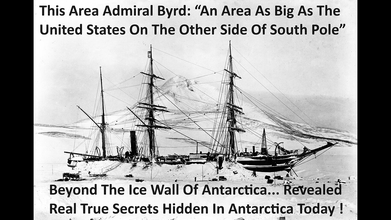
All Our Antarctic Video's Reveals Real Secrets Hidden In Antarctica And The Bible. Sorry Antarctica We're Closed Our Hidden Flat Earth. This Area Admiral Byrd: “An Area As Big As The United States on the Other Side of the South Pole” According most flat earthers, there’s no such thing as the continent of Antarctica. In their imagination, Antarctica is not a continent, but a long ice wall enclosing the Earth. Without having anything to prove that assumption, they look anywhere for any quote they can mine and stumbled into this quote by Admiral Byrd “Strangely enough, there is left in the world today, an area as big as the United States, that’s never been seen by a human being. And that’s beyond the pole, on the other side of the south pole from Little America.”
A wealth of mystery lies hidden within the 6+ million cubic miles of ice that dominate the surface of Antarctica. It's a continent shrouded in speculation, misinformation and wartime intrigue. The fascinating documentary titled "The Real Secrets Hidden in Antarctica... Revealed" sets out to expose the juiciest of these potential cover-ups.
The film outlines the suspicious history of the continent, geographical inconsistencies, and unexplained anomalies discovered through satellite imagery. The evidence seems to suggest that the region was more tropical at one time, and could hold meaningful clues as to our ancient existence on this planet.
The filmmakers defend this assertion by illustrating the discovery of man-made artifacts by early explorers, areas where vegetation is thought to have once thrived, and large quantities of exotic life buried miles underneath the frozen surface.
Much of the film's narrative revolves around the formidable presence of international military forces on the continent, including those of the United States, Britain, Russia, and even the Nazis during World War II. History shows us that the continent is of tremendous strategic value to military interests. Rumors persist that secret bunkers may have existed there in years past, and that they might have even sheltered Hitler in the aftermath of the war.
The film contends that beneath the innocuous guise of weather and penguin research, the United States might have taken advantage of the continent's vast uranium resources by constructing obscured nuclear testing and missile sites.
More mysteries lie ahead as the film details additional top secret efforts that are thought to have occurred in Antarctica, including the study and manipulation of weather patterns, the storage of mass amounts of food, and the construction of elaborate underground tunnel and transport systems.
The film will certainly appeal to conspiracy theory enthusiasts, but it is executed with great journalistic authority. It's a comprehensive portrait of the continent's rich environmental character, its many decades of geo-political importance, and the enigmatic qualities that attract both legitimate and nefarious entities.
"The Real Secrets Hidden in Antarctica... Revealed" is impressively adorned with many credible news clippings, stock clips and archived interviews which support its conspiratorial claims.
Rare And Top Secrets Real Video From M.I.R. Space Station of the North Pole Septentrionalium Terrarum descriptio - Magnetic Stone The Rupes Nigra ("Black Rock") 1595 First Edition Mercator Map of the Arctic (1st Map of the North Pole) Hello my friends.
Magnetic Stone Rupes Nigra Huge Magnetic Rock 180km In Diameter At North Pole - https://rumble.com/v3e220t-magnetic-stone-rupes-nigra-huge-magnetic-rock-180km-in-diameter-at-north-po.html
thanks for writing us... Magnetic Stone The Rupes Nigra ("Black Rock") at the north pole and 33 miles around and 8 mile high and is above the clouds... you are not post to see it. the us government will stop from going to the north pole at all to see it. this is a video from Mir a Russian space station... thanks
Mir was a modular balloon space station that operated in low Earth orbit from 1986 to 2001, operated by the Soviet Union and later by Russia.
This Is A Very Rare And Top Secrets Real Video From M.I.R. Space Station of the North Pole Septentrionalium Terrarum descriptio - Magnetic Stone The Rupes Nigra ("Black Rock") 1595 First Edition Mercator Map of the Arctic (1st Map of the North Pole) Hello my friends. this is an ancient map of the north pole. The North Pole as a magnetic mountain goes back at least to Roman times. the North Pole as a magnetic mountain surrounded by a circular continent divided by four powerful rivers from maps Martin Behaim's 1492 globe shows, at the arctic pole there is a high magnetic rock, thirty-three German miles in circumference. A surging sea surrounds this rock, as if the water were discharged downward from a vase through an opening. Around it are islands, two of which are inhabited."
A glance at the North Pole and its mythology, from whirlpools and giants to the indrawing sea and the Rupes Nigra.
https://www.arcus-atlantis.org.uk/horizons/magnetic-north.html
HYPERBOREA was a fabulous realm of eternal spring located in the far north beyond the home of the north wind. Its people were a blessed, long-lived race untouched by war, hard toil and the ravages of old age and disease.
While there is no explicit mention of Antarctica as a continent in the Bible, some interpretations suggest that certain passages may allude to its existence or describe regions that could be analogous to modern-day Antarctica.
Job 38:29-30: “From whose womb came the ice? And the frost of heaven, who hath gendered it? The waters are hid as with a stone, and the face of the deep is frozen.” Some commentators have linked this passage to the frozen tundra and glaciers of Antarctica, although this interpretation is not universally accepted.
Psalm 107:23-24: “They that go down to the sea in ships, that do business in great waters; These see the works of the Lord, and his wonders in the deep.” Some have speculated that this passage might refer to the icy waters surrounding Antarctica, although the context suggests a broader reference to the ocean’s power and majesty.
Ancient Biblical Accounts and Analogues
The Elysian Fields: In ancient Greek mythology, the Elysian Fields were a paradise for heroes and virtuous individuals. Some biblical scholars have drawn parallels between this concept and the biblical notion of a “New Heaven and a New Earth” (Revelation 21:1). While not directly referencing Antarctica, this analogy could be seen as a precursor to the idea of a distant, unexplored region, like Antarctica, being a gateway to a spiritual realm.
The Wilderness and the Ends of the Earth: The Bible describes the wilderness as a place of testing and spiritual growth (e.g., Psalm 107:4-9, Hebrews 11:38-40). Similarly, the “ends of the earth” (e.g., Isaiah 49:6, Acts 13:47) might be seen as a metaphorical or spiritual boundary, rather than a literal geographical location. This concept could be applied to Antarctica, which, in ancient times, would have been perceived as a distant, unknown, and inhospitable region.
Based on historical records, the first photo taken in Antarctica was likely taken during the Australasian Antarctic Expedition (1911-1914) led by Douglas Mawson. The expedition’s photographer, Frank Hurley, captured numerous images during the expedition, including scenes of the Antarctic landscape, wildlife, and crew members.
One of Hurley’s photographs, dated around 1912-1913, shows a group of expedition members, including Captain Lawrence Oates, standing on the frozen sea with Adelie Land in the background. This image is considered one of the earliest known photographs taken in Antarctica.
https://rumble.com/playlists/VWrYI5hUUF4 - All Our Antarctic Video's Reveals Real Secrets Hidden in Antarctica. Sorry Antarctica We're Closed Our Hidden Flat Earth This Area Admiral Byrd: “An Area As Big As The United States on the Other Side of the South Pole” According most flat earthers, there’s no such thing as the continent of Antarctica. In their imagination, Antarctica is not a continent, but a long ice wall enclosing the Earth.
It’s worth noting that photography technology during this era was limited, and early cameras were often cumbersome and prone to malfunction. Therefore, it’s possible that other photographers may have taken photos in Antarctica before Hurley, but these images may have been lost or destroyed over time. Nevertheless, Hurley’s photographs remain an important historical record of the Australasian Antarctic Expedition and its achievements.
https://www.coolantarctica.com/Antarctica%20fact%20file/History/best-historic-pictures.php
On March 29th, 1902, Erich von Drygalski made history by becoming the first person to fly over Antarctica. He accomplished this feat using a hydrogen-filled reconnaissance balloon, reaching an altitude of 490m (1600 feet). This pioneering achievement marked a significant milestone in Antarctic exploration.
Balloons over Antarctica On Tuesday, February 4th 1902 the crew of Scott’s ship Discovery were anchored in a small cove in McMurdo Sound, Antarctica.
The day before they had off-loaded 17 cylinders and other equipment. The cylinders contained hydrogen. At 11 am Scott was the first man to ascend by balloon in Antarctica, a flight that almost proved fatal when he threw out too much ballast.
He rose to a height of 180 m (600 ft) and all he could see was whiteness stretching indefinitely into the distance. Shackleton, his third in command, was the next to go up and took the first photos of the ice shelf, thoroughly enjoying himself in the process.
Only one other flight was managed by Able Seaman Heald before the wind came up and further flights were abandoned. The balloon, affectionately known as Eva, developed tears in its fabric and became un-serviceable thus ending a brief history of Antarctic ballooning.
At a cost of £1300 pounds it was probably a waste of money given its limited usefulness. However, it was a first, and humans have to try things in the spirit of adventure, so I wouldn’t call it a failure. Let’s give them credit for trying. They were very brave men.
Though Sir Robert Falcon Scott beat him by a small margin, Professor Erick Von Drygalski was the second person to ascend in a hydrogen balloon over Antarctica during the German National Antarctic Expedition (1901-1903). The balloon was only used twice but they did manage to get some great photos and reached a height of 490 metres (1607 ft)
Von Drygalski’s ship (Gauss) had become trapped in the ice about 75km from the mainland and they would spend the winter there, but the scientists made good use of their time, carrying out a vast amount of scientific work on the ice as well as some sledge journeys inland.
German National Antarctic Expedition - Gauss - Erich von Drygalski - 1901-03
The voyage of the Gauss led by Erich von Drygalski was the German response to the call of the Sixth International Geographical Congress to the International scientific community to explore Antarctica.
Erich von Drygalski, a Professor of geography and geophysics at the University of Berlin was chosen to lead the expedition as he had previous polar experience on an expedition to Greenland. He had a good track record of being able to carry out serious scientific studies in polar conditions.
The expedition was fully funded by the German government, including the building of a new ship for the purpose, the Gauss, named after the great German scientist Karl Friedrich Gauss. The ship cost 500,000 Marks (around £25,000), she was a barquentine, 152 feet long with a beam of 37 feet and a 325hp auxiliary engine (sail was still the main means of propulsion). The ship seemed to be a fine vessel at first. She was spacious and strong, each officer and scientist had his own cabin, there were two dining and social areas. The bow and stern were finished with steel reinforcement and there were fine woods throughout. Unfortunately however, she was less impressive in action, she was slow, uncomfortable in rough seas, dark on the inside and oppressively hot in the tropics.
The Gauss left Kiel on August the 11th 1901 for Antarctica. She was to research the sector between 60° and 90° East as that was close to where the south magnetic pole was and little was known of the area. The Gauss reached isles Kerguelen (a set of sub Antarctic Islands) on January the 2nd 1902. On January 31 the Gauss left Kerguelen for Antarctica and seven days later they sighted their first iceberg.
Land was sighted on the 21st of February, edged with ice cliffs 40-50 metres (130-165 feet) high where it met the sea and rising in the distance to over 300 metres. This was named Kaiser Wilhelm II Land (now called the Wilhelm II Coast). The Gauss tried to sail on further, but became trapped by forming sea-ice. The crew tried to blast a way out using explosives, but without success and by the 2nd of March it was clear that the Gauss became trapped for the winter, 74 kilometres (46 miles) from the coast.
Drygalski was primarily a scientist, not a glory seeker or self-publicist, his intention was to discover as much as he possibly could about the sector of Antarctica he was in, records of latitude were of no interest. The scientific members of the crew gladly set about doing what they could with the time they had while trapped in the ice. Huts were set up for observations of magnetic, meteorological and astronomical phenomena. Holes were drilled through the ice to dredge the sea-floor and rocks collected from nearby icebergs.
The Gauss had a dog team aboard, though sledging journeys were delayed for a while to let the ice thicken and become reliable for travelling. The first sledging party headed south on the 18th of March, returning 8 days later to report a 300m (1,000ft) mountain at latitude 66°40' S, 50 miles from the ship, this was named Gaussberg.
Drygalski became the second man to fly in Antarctica when he made the first ascent in a hydrogen-filled reconnaissance balloon on March the 29th to a height of 490m (1,600 feet), he would have been the first but was beaten by a narrow margin when Scott ascended in a balloon over the Ice Barrier on the 4th of February the same year on the Discovery expedition on the opposite side of the continent.
"It was so warm up there I could even take off my gloves...the sight from this altitude was grandiose. I could see newly discovered Gaussberg and...gave my description via telephone to the deck of the ship. It was the only ice-free landmark in the surrounding area".
The balloon was used later the same day by Ruser and Phillipi and the results of their observations of pack to the north used to plan for the future. The balloon was packed away after the second flight and not used again.
Gaussberg tuned out to be the furthest south reached by the expedition, more trips were made there in April before the winter set in fully and an igloo, meteorological hut and supply depot left. Drygalski climbed the summit of Gaussberg on the final trip and described a landscape made entirely of ice other than the rocky outcrop of Gaussberg itself.
Winter arrived and the men busied themselves as best they could. The ship was well supplied and there was enough private and public space. Lectures were arranged and clubs sprang up, a glee-club, smoking club, card-clubs and a midwinter celebration arranged. Though the men found that the winter had its hardships and became depressed due to the lack of daylight and the cold and storms outside which frequently confined them to the ship, they survived as well as any other contemporary winterers.
Drygalski had hoped to be able to attain 72° or 73°S but circumstances in the spring meant that this idea was abandoned. He thought there was no good scientific reason to travel further south than Gaussberg He had read about the circumstances of the crew of the Belgica and the difficulty they had in escaping the ice. While the Belgica was trapped in ice around 2m (7 feet) thick, the Gauss was in ice that was 5-6m thick (16-19 feet), and on top of this were snowdrifts of up to 12m (40 feet). Members of the Belgica expedition had noticed that dark objects melted the ice under them due to the heat they absorbed from the sun, so Dygalski gave orders for all ashes and other waste to be saved.
Spring arrived and seals and birds were seen in large numbers again. The ice had started to break up, but the ship was about 600m (2,000 feet) away from open water. Explosives and long ice saws were put to use to try and cut a channel to the open water, but without success. Drygalski ordered the saved ashes and other waste to be spread along a line from the ship to open water and it started to have an effect.
"Success came immediately. The ice under the dirt started to melt. Within a month we had a long water channel almost two metres deep. Although there were still four to five metres of ice underneath, the channel widened constantly"
Release seemed to be ever closer, but on the 21st of January 1903 a heavy gale closed the channel and drifted snow over the open water areas as if they had never been there. A week later on the 28th of January, the whole area was on the move and Drygalski ordered that all equipment on the ice be brought back on board, the Gauss was now drifting with the ice, though still trapped within it.
On February the 8th, Drygalski wrote
"we suddenly felt two sharp jolts in rapid succession...it was like a revelation, and with a cry 'the ice is breaking', I jumped out on to the deck".
A break had opened to open water and the Gauss was carefully steered out along it. The ship then started to cruise along the Antarctic coast seeking out a suitable site to spend the second winter, though no such safe site was found and by April with the season fast advancing, Drygalski made the decision to leave Antarctica for that season writing:
"It was a most difficult decision, certainly the most difficult one I had to make, but it was necessary. There was no safe place to spend the winter here..."
The ship sailed once again for the Kerguelan Islands and then continued on to Cape Town in South Africa docking on the 9th of June. From there Drygalski sent a request to Berlin for another winter to be spent in Antarctica. His request was denied, most probably as the Kaiser was disappointed that no new territory of significance had been discovered, nor was there any sensational adventure to report. The Gauss sallied northwards again reaching Kiel on November the 23rd 1903. She was sold to Canada to help pay for the expedition.
As a scientific voyage the expedition had been a huge success and the achievements received high praise from the scientific community. Twenty volumes of reports were published from 1905-1931 (they certainly occupy more library shelf space then those of any comparable voyage I have seen). The expedition provided strong evidence for the existence of the Antarctic Convergence, six hundred miles of coastline had been surveyed and 1,440 species of living organism endemic to the Antarctic were described.
As an expedition of public interest however it was far overshadowed by others around the same time that had reached higher latitudes (closer to the Pole). What was not publicly appreciated was that the Gauss had been to a totally new region, never previously visited where she was working alone and making public completely new discoveries. Compared to more sensationalist adventures even if little is actually achieved and then soon surpassed, the lay-man sees a new species or ten of obscure fauna or carefully described scientific observation as of little value.
Erich von Drygalski’s Antarctic Expeditions On February 9, 1865, German geographer, geophysicist and polar scientist Erich Dagobert von Drygalski was born. Drygalski discovered a volcano, free of ice, on the Antarctic continent. He named it Gaussberg, after the name of his research ship Gauss in which he led the German South Polar Expedition (1901-03).
Background Erich von Drygalski
Erich von Drygalski was born in Köningsberg, East Prussia. At age 17, Drygalski began to study mathematics and natural science at the University of Königsberg, but soon went to Bonn in order to attend the lectures of Ferdinand von Richthofen, whom he followed in 1883 to Leipzig and in 1886 to Berlin. He graduated with a doctorate thesis about ice shields in Nordic areas. Between 1888 and 1891, he was an assistant at the Geodetic Institute and the Central Office of International Geodetics in Berlin. He habilitated 1889 for geography and geophysics with the collected scientific evidence. In 1898, Drygalski became associate professor and 1899 extraordinary professor for geography and geophysics in Berlin.
Antarctic fever
Near the end of the nineteenth century ‘Antarctic fever’ broke out in western Europe and the summer of 1891 and in 1892–1893 Drygalsky led the preliminary and main expeditions of the Berlin Geographical Society to western Greenland. One expedition wintered during the winter between 1892 and 1893 in Western Greenland. This expedition established Drygalski’s international reputation. In 1898 the German South Polar Commission suggested a national expedition to Antarctica, which was tirelessly advocated and supported by Georg von Neumayer. As Professor of Geography and Geophysics at the University of Berlin, Drygalski was subsequently chosen to be the leader of the expedition. Financing was not an issue but the Commission felt one ship would be all that was necessary so Drygalski asked for and received permission to build a new vessel – The Gauss – rather than modify an existing ship.
14 Months trapped at 66° 5′ South
On August 11, 1901, the Gauss left Kiel for the south with a crew of 32 men, among them also 5 scientists including Drygalsky. Its goal was to explore the unknown area of Antarctica lying south of the Kerguelen Islands. A small party of the expedition was also stationed on the Kerguelen Islands, where they arrived in early January 1902, while the main party proceeded further south. Gauss was carrying a balloon which allowed Drygalski to become the first man to fly over the Antarctic. Drygalski also paid a brief call to Heard Island and provided the first comprehensive scientific information on the island’s geology, flora and fauna. Despite being trapped by ice at latitude 66° 5′ for nearly fourteen months until February 1903, the expedition discovered new territory in Antarctica, the Kaiser Wilhelm II Land with the Gaussberg. A second overwintering was not possible and therefore no further advance to the south. Drygalski therefore ordered a northern course, and after returning Cape Town, South Africa, on June 9, 1903, Drygalski asked for a new expedition to the German Government, but it was denied, so the crew put heading to Germany. Emperor Wilhelm II complained that the Gauss had only reached 66° 5′, while a British expedition already proceeded up to 82° 17′. Upon arrival to Kiel on 23 November, Drygalski was found with frustration that his expedition was not sufficiently valued, although he would still feel really satisfied.
25 Years to document the Expedition
In 1898 Drygalski received the silver Carl Ritter Medal and in 1904 the golden Gustav-Nachtigal-Medal of the Gesellschaft für Erdkunde zu Berlin in recognition of his achievements as leader of the 1st German Antarctic expedition. Drygalsky refused to take part in the “Race to the South Pole” and concentrated of his scientific publications. Although the expedition’s report appeared soon after its return (Zum Kontinent des Eisigen Südens, 1904[4]), the scientific conclusions were fully developed only after almost thirty years of indefatigable labor by Drygalski and his co-workers. Between 1905 and 1931, he published twenty volumes and two atlases documenting the expedition.
Later Years and Death
In 1906 he accepted a call to the newly established chair of geography at the University of Munich, which he made highly regarded and held until his retirement in 1935. He also presided the Geographic Institute, founded by him, until his death. In 1910, he also took part in Count Ferdinand von Zeppelin’s expedition to Spitsbergen and participated in other expeditions to North America and northeastern Asia. In 1933, The Royal Geographical Society awarded Drygalsky with the Patron’s medal. Erich von Drygalsky died 1949 in Munich.
https://longnow.org/ideas/the-truth-about-antarctica/
The German National Antarctic Expedition 1901-1903 The Germans in Antarctica
This was the first German Antarctic expedition and is also known as the Gauss expedition (after their ship the ‘Gauss’).
Fully funded by the German government and led by Professor Erick Von Drygalski, a geologist from the University of Berlin, the expedition’s aim was to carry out scientific exploration in a large area in the vicinity of the South Magnetic Pole.
Their ship, the Gauss, was purpose-built for its Antarctic role and well-appointed throughout though it was slow, uncomfortable in bad weather and somewhat dark inside.
The expedition reached the Kerguelen Islands where they dropped a small scientific party, then continued south, briefly visiting Heard Island before sighting the Antarctic mainland.
The ship would eventually be trapped in the ice about 75km from the mainland and spend the winter there but the scientists made good use of their time, carrying out a vast amount of scientific work on the ice as well as some sledge journeys inland.
All up the ship was trapped for 14 months. Von Drygalski knew that dark material absorbed heat and tended to melt the ice beneath it so he kept all the ash and soot from the engines and at one point laid it on the ice to create a melted path to break free of the ice.
It worked well but before the task could be completed a sudden heavy gale and snow closed the passageway. It would be another couple of weeks before they would break free.
Though Sir Robert Falcon Scott beat him by a small margin, Von Drygalski was the second person to ascend in a hydrogen balloon over Antarctica. The balloon was only used twice but they did manage to get some great photos and reached a height of 490 metres..
This scientific expedition managed to discover a totally new region of Antarctica which they named Kaiser Wilhelm II land (later to be called Wilhelm II Coast), survey 1000 km of coastline and describe 1,440 Antarctic species.
The expedition also provided strong evidence for the existence of the Antarctic Convergence, where cold southern waters meet the relatively warmer waters of the subantarctic. The convergence circles Antarctica and is a highly productive marine environment.
Between 1905 and 1931, Von Drygalski published 20 scientific volumes and 2 atlases documenting their discoveries. Bravo.
An Arctic Timeline : 1496-1962
The exploration of the North has extended over five hundred years and rather than finding a northwest passage to the eastern trade, it discovered a great fur trade and valuable fisheries, and even great oil fields. Early crews were often separated from their homes for years and some never returned. While hopes of finding a northwest passage was the initial objective, the ice conditions discouraged expectations of success. In the past, the problems of reaching the North Pole have been subordinate to the hope of finding, via that route, a water way to the east, and though the early north polar attempts failed in their main purpose, they resulted in the discovery of new lands and industries.
Traveling in vulnerable wooden ships first powered only by sails, they gradually changed to powerful new and innovative vehicles and a commercial trade in the north was established. But even from the beginning of polar exploration the ships that sailed with orders to attain the North Pole have been in number and importance the exception, not the rule. Attempts to reach the North Pole itself followed using stronger ships with newer designs as a base for the dashes to the almost mythical prize. Balloons and the new dirigibles were tried, followed by airships and submarines. When the Pole itself was finally reached, it proved to be a vain goal since it was just a point on the ice above a moving body of water.
The oceans of the Arctic basin and the frozen lands around it are now recognized as important study areas, and over the years virtually all exploration parties became directed toward studies of some kind.
1496: Henry VII granted "Letters patent" to John Cabot and his three sons to make voyages of discovery in "northern, eastern or western seas." The original charts and manuscripts of John Cabot and his son Sebastian have, for the most part, disappeared.
1576: Martin Frobisher's first voyage. An attempt would be made to reach Cathay through a passage to the northwest. Vessels used were two small barks, MICHAEL and GABRIEL. Frobisher, aboard the GABRIEL, crossed (now) Davis Strait between Greenland and (now) Baffin Island. They explored the vicinity of (now) Frobisher's Bay. They encountered Inuit, described as being "like to Tartars, with long blacke haire, broad faces and flatte noses and tawnie in colour, wearing Seale skinnes, and so doe the women, not differing in the fashion, but the women are marked in the face with blewe streekes downe the cheekes, and round about the eyes." On this first expedition, a rock was picked up as a souvenir in Frobisher's Bay and upon the expedition's return, the rock was assayed and said to contain gold.
1577: Martin Frobisher's second voyage to (now) Frobisher's Bay, under the auspices of the Cathay Company. The expedition was to continue the search for the Northwest Passage and to mine more of the 'gold'-bearing ore discovered the year before. The expedition remained in the bay for five weeks from 17 July to 23 August 1577 and mined about 200 tons of the ore. The AYDE, MICHAEL and GABRIEL returned to England, bringing an Eskimo man (Kalicho), woman (Arnaq) and child (Nutaaq) to Bristol. The man and woman died and were buried at St. Stephen's Church while the child died in London and was buried at St. Olaves, Hart Street.
1578: Martin Frobisher's third voyage to the Arctic. Commanding the AYDE, Frobisher led a fleet of fifteen vessels to (now) Frobisher's Bay. Over 100 miners from Cornwall and the Forest of Dean were to form a wintering party on a small island under the leadership of Captain Edward Fenton. Poor weather prevented the fleet from keeping together. Frobisher, together with several other vessels, sailed up what he called the "Mistaken Straightes," now called Hudson Strait. Most of the fleet was eventually reunited in the region where 1200 tons of "black ore" was extracted and loaded onto the ships. Upon their return to England, the ore proved to be worthless and the Cathay Company went bankrupt. Frobisher did not return to the Arctic but did retrieve his reputation firstly with Drake in the West Indies and later by his conduct as one of the main commanders of the English fleet that defeated the Spanish Armada of 1588.
1585: John Davis's first voyage in search of the Northwest Passage. The expedition, aboard the two small vessels SUNSHINE and MOONSHINE, made its first northern landfall on the east coast of Greenland. They sailed across (now) Davis Strait to (now) Baffin Island. They came ashore at (now) Cumberland Sound where two sledges were discovered "made like ours in Englande." Despite signs of inhabitants, none were encountered.
1586: John Davis's second voyage to the Arctic. The vessels MERMAID, SUNSHINE, MOONSHINE and pinnace NORTH STAR sailed up the west coast of Greenland and encountered the "people of the country" in the vicinity of Gilbert Sound, later named Godthaab Fiord. In August, they sailed westwards from Greenland, finding land on southeast Baffin Island. Two of the ship's company were surprised and killed by the "Savages" ashore.
1587: John Davis's third voyage toward the Northwest Passage. Sailing aboard the barks SUNSHINE, ELIZABETH and the pinnace ELLEN, Davis and his crews traveled up the west coast of Greenland, trading with the Greenlanders as they went. After reaching the relatively high latitude of 72° 12' North, Davis turned to the west and sighted Cumberland Sound on Baffin Island which he discovered on his first voyage. They coasted the south shore of Cumberland Sound and re-entered Davis Strait in latitude 64° North. They continued south with the Labrador current, passing a "very great gulfe" which was no doubt Hudson Strait. Upon reaching the vicinity of Labrador, they set sail across the Atlantic for Dartmouth.
1602: George Waymouth, sent by the East India Company, may have proceeded along Hudson Strait for a good distance. His vessel, DISCOVERY, is one of the earliest of a line of exploring ships bearing that name.
1610: Henry Hudson, aboard DISCOVERY, sailed westward for 450 miles through a long strait and into a great bay, both of which now bear Hudson's name. Hudson turned south and the vessel was forced to winter at the southern end of the bay because of ice. They escaped from the ice in June 1611 but soon afterwards a mutiny took place after which Hudson, his son, the sick and the Hudson loyalists were all set adrift in a boat. They were never seen again. Two of the mutineers were killed by the Eskimos at the western end of Hudson Strait while many others died on the voyage home. Stories related by the survivors were believable so all were left unpunished.
1611: Thomas Button sailed on the RESOLUTION, with the DISCOVERY in company. This voyage was to follow-up Hudson's discoveries. Two of the mutineers on Hudson's expedition, Prickett and Bylot, were among the ship's company. Part of the west coast of Hudson Bay was charted and Port Nelson, where they wintered-over, was named after one of the mates who was buried there. The RESOLUTION was crushed by the ice and sank. The DISCOVERY sailed north to what was called Sir Thomas Roe's Welcome, between Southampton Island and the east coast of America, before turning for England. A considerable length of coastline was charted on this expedition. It was also determined that no westward passage from Hudson Bay existed.
1615: Robert Bylot and William Baffin, in the DISCOVERY, sailed through Hudson Strait but found no passage northward through what became known as Frozen Strait.
1619-20: Backed by the King of Denmark, Jens Munk fails to discover the Northwest Passage. His two ships wintered near the site of the later Hudson's Bay Company post, Fort Prince of Wales, on the Churchill River.
1631-32: Two independent voyages are made through Hudson Strait and into Hudson Bay in a further attempt to find a northwest passage through this route. Captain Thomas James commanded the HENRIETTA MARIA while Captain Luke Foxe commanded the CHARLES. James Bay, at the head of Hudson Bay, and Foxe's Channel were named after the two captains.
1668: The small vessel NONSUCH sails from London through the Hudson Strait and into Hudson Bay. Her voyage opens a sea route for trade in furs with the local Indians.
1670: By royal charter, incorporation of the Hudson's Bay Company is established. King Charles II appoints his nephew, Prince Rupert, their Governor and grants the "sole trade and commerce of all those Seas Streightes Bayes Rivers Lakes Creekes and Soundes in whatsoever latitude they shall bee that lye within the entrance of the Streightes commonly called Hudson's Streightes, together with all the Landes and Territorys upon the Countryes Coasts and confynes of the Seas Bayes Lakes Rivers Creekes and Soundes aforesaid that are not actually possessed by or granted to any of our Subjectes or possessed by the Subjectes of any other Christian Prince or State." The vast territory, to be known as Rupert's Land, would comprise nearly 40% of modern Canada. Three wooden forts are built on James Bay in 1685.
1719: Provisioned by the Hudson's Bay Company, elderly Captain James Knight leads two ships in search of "minerals and to traverse the 'Strait of Anian.'" This was a mythical strait attributed to unreliable charts and globes of the time. They departed from Gravesend on the lower Thames in June 1719 and were never seen again.
1741-42: Commanded by Captain Christopher Middleton, the FURNACE and DISCOVERY sail for Hudson's Bay on June 8, 1741. The vessels winter at Sloop Cove, between the Hudson's Bay Company's fort, named after the Prince of Wales, and the recently vacated Old Factory on the Churchill River. The expedition set sail the following year towards the north where they navigated the uncharted and ice-infested waters of Sir Thomas Roe's Welcome (now Roe's Welcome Sound), between the west coast of Southampton Island and the east coast of North America. They reach a deep bay whose upper reaches touch the Arctic Circle. Middleton names it Repulse Bay as there was no passage there.
1746-47: An attempt to find the Northwest Passage is privately organized by Arthur Dobbs, a member of the Irish House of Commons. The expedition is supported by a group of merchants who form the North West Committee. Commanded by William Moor in the DOBBS and Francis Smith in the CALIFORNIA, the expedition "carried out some useful exploration in difficult conditions, but ... every move, it seemed was dogged by disagreement, ineptitude and controversy."
1770-72: On behalf of the Hudson's Bay Company, the Governor of Fort Prince of Wales, Moses Norton, instructs Samuel Hearne to find and trace the Coppermine River to ascertain whether or not a route exists from Hudson Bay to the Pacific Ocean via the continent of North America. According to the Orders and Instructions, Hearne is "to trace to the mouth, and there determine the latitude and longitude as near as you can; but more particularly so, if you find it navigable, and that a settlement can be made there with any degree of safety, or benefit to the Company." Hearne was accompanied by a group of Northern (Chipewyan) Indians, led by a chief named Matonabbee. The successful journey departed on December 7, 1770 with the women carrying heavy loads together with their infants. Meanwhile, the men hunted and sometimes ate while the women went hungry. They reached the Coppermine River on July 14, 1771 but found the river too dangerous to navigate. On July 17 they surprised a group of Inuit fishing on the river. The Chipewyan Indians showed no mercy towards the Inuit, massacring them and destroying their tents, kettles and every other provision necessary to sustain life in this harsh environment. Shortly after the massacre, Hearne reaches the mouth of the river. He found the vicinity "full of islands and shoals" with unbroken sea ice off in the distance. The tide was out so the water tasted fresh but the bones of whales and sealskins at the Eskimo encampment convinced him that he had reached the "Northern Ocean." As a consequence, he became the first European to accomplish this feat. The significance of this expedition was to prove that no passage existed through the American continent south of the Arctic Circle.
1776-80: Captain James Cook's third voyage of discovery, commanding HMS RESOLUTION and HMS DISCOVERY, with the object of finding the Northwest Passage via the Pacific Ocean. Unfortunately, "armchair cartographers" had drawn their maps and charts from theory, rather than surveys, which frustrated Cook and his officers while coasting southern Alaska. Cook's ships penetrated as far as Icy Cape on the coast of Alaska. This route into the Arctic, forged by the RESOLUTION and DISCOVERY, would later be taken by the ships of the Royal Navy.
1789: Alexander Mackenzie, a young partner in the North West Company, is driven by the need for a trading route to the Pacific after being displaced from the vicinity of Detroit due to the American Revolution. Mackenzie is accompanied by four French Canadian voyageurs, a Chipewyan Indian by the name of "English Chief," a number of Indian's wives and a young German, John Steinbruck. The expedition departs from Fort Chipewyan, on the southern shore of Lake Athabasca, on June 3, 1789. They reach a great river (subsequently named after Mackenzie), extending northward from the Great Slave Lake. The river is followed all the way to the Arctic Ocean which is reached on July 14, 1789, the same date as the outbreak of the French Revolution.
1792-94: Captain George Vancouver explores and surveys the northwest coast of America. It is subsequently proven that no navigable waterway exists between the Pacific and Atlantic oceans in temperate latitudes.
1817: William Scoresby, a young whaling captain and son of William Scoresby, Sr., inventor of the crow's nest, makes a voyage to Greenland where he finds "2000 square leagues of the surface of the Greenland Sea, between the parallels of 74° and 80° North, perfectly void of ice which is usually covered with it."
1818: In command of the ISABELLA, John Ross makes his first voyage in search of the Northwest Passage. Lt. Edward Parry, second in command, accompanies Ross in the ALEXANDER. Astronomer on the expedition is Captain Edward Sabine. They turn back at Lancaster Sound.
1819: In command of the DORTHEA, David Buchan seeks the North Pole via Spitzbergen. Lt. John Franklin is second in command aboard the TRENT.
1819-20: In command of the HECLA, William Edward Parry leads his first expedition in search of the Northwest Passage. Lt. Matthew Liddon is second in command aboard the GRIPER. A Parliamentary Act passed in 1818 "authorized the [payment of] ... five thousand pounds to the officers and men of the first ship to cross the 110th meridian of west longitude to the north of America by sailing within the Arctic Circle." Parry was the first to qualify when they proceeded westwards along what is now called Parry Channel, passing 110° West longitude in September 1819. They subsequently reach and name Melville Island after the First Lord of the Admiralty.
1819-21: In conjunction with Edward Parry's voyage, John Franklin leads his first overland expedition to Point Turnagain, in search of the Northwest Passage. The expedition ends in disaster with eleven members of the expedition losing their lives.
1821-23: In command of the FURY, Edward Parry leads his second voyage in search of the Northwest Passage. Second in command is George Lyon aboard the HECLA. The ice master of the HECLA dies of scurvy.
1824-25: Once again HECLA and FURY sail north under Edward Parry's command in search of the Northwest Passage. This, Parry's third voyage, would prove to be his final voyage to the Canadian Arctic. The FURY is grounded during a storm on July 30, 1825 and subsequently abandoned on Fury Beach at Somerset Island.
1825-27: John Franklin's second land expedition to the mouth of the Coppermine River. Together with John Richardson, he explores and maps more than a thousand miles of coastline from Coronation Gulf to Icy Cape, Alaska.
1827: On June 1, Edward Parry, aboard HECLA, leaves Spitzbergen on an attempt to reach the North Pole. Second in command is James Clark Ross. He reaches 82° 45' North and establishes a Farthest North that will stand for 50 years.
1825-28: The Admiralty dispatches BLOSSOM to the north Pacific. The expedition, under the command of F.W. Beechey, is instructed to await the emergence of Parry's HECLA and FURY into the north Pacific. Also anticipated is the arrival of Franklin's boats from his overland expedition. They reach Captain Cook's Icy Cape and proceed along the coast. Point Barrow is discovered and named after Sir John Barrow of the Admiralty, "to mark the progress of northern discovery on each side of the American continent which has been so perseveringly advocated by that distainguished member of our naval administration."
1829-33: John Ross's second expedition in search of the Northwest Passage. The expedition is privately sponsored by gin merchant Felix Booth. With the help of Eskimos, Ross and his crew survive through four Arctic winters.
1833: George Back, together with Richard King, leads an expedition to the Great Fish River in search of John Ross.
1837-39: A Hudson's Bay Company overland expedition is led by Peter Dease and Thomas Simpson. They survey most of the remaining unknown areas of the Northwest Passage.
1845-47: Tragedy befalls John Franklin and his men as he commands EREBUS and TERROR on a search for the Northwest Passage. Franklin is last seen by a whaling ship on June 25, 1845. Neither he nor any of the other 128 men would be seen alive again. Between 1848 and 1859 more than 50 expeditions are mounted to find him, with enormous sums of money spent on the search. The British Government spent approximately £675,000, Lady Franklin £35,000, the United States Government $150,000 and Henry Grinnell, president of the American Geographical Society, $100,000.
1848: The search for the Franklin expedition begins early in 1848. The First Lord of the Admiralty offers £10,000 to anyone who can merely discover what happened to Franklin and his lost ships, EREBUS and TERROR. The Admiralty proposed a 3-pronged attack from the east, west and south to find Franklin: two ships would enter the archipelago from the east by way of Lancaster Sound and Barrow Strait and then move west to Melville Island and Banks Land and then proceed south. (See James Clark Ross below). Two more ships would sail around Cape Horn hoping to rendezvous that July in Bering Strait to explore the western Arctic. (See Pullen below). Finally, a land expedition would travel to the Canadian northwest and follow the Mackenzie River north to the Arctic coast and then eastward along the rim of Wallaston Land and Victoria Land (See John Richardson below). It was expected that both of the naval expeditions would meet up with the land expedition.
1848-49: James Clark Ross, now at the end of his career, is instructed to follow Franklin's route through Barrow Strait and then south or southwest in search of the lost expedition. His two senior officers, Leopold M'Clintock and Robert McClure, will become Arctic heroes. The expedition ships, ENTERPRISE and INVESTIGATOR, are blocked by impassable ice north of Somerset Island. They are frozen in for eleven months at Port Leopold on the northwest tip of the island. They return to England, both officers and men having suffered badly from scurvy. Six of his company of sixty-four die on the expedition.
1848-51: John Richardson, at the age of sixty, leaves his family and embarks from Liverpool for North America in search of his old friend, John Franklin. Dr. John Rae is second in command of the overland expedition. After lodging together at Fort Confidence during the winter of 1848-49, Richardson returns to England, leaving Rae to follow the Mackenzie River to the Arctic coast and then explore eastward along the rim of Wallaston Land and Victoria Land. On Rae's third journey into the Arctic (now 1851), he proves that Wallaston Land and Victoria Lands are actually one and the same. Two fragments of wood are found that clearly came from a Royal Navy vessel. It would be years before anyone realized that they were most certainly from one of the Franklin expedition ships.
1848-51: Lt. W.J.S. Pullen commanding the expedition vessel HMS HERALD, together with the PLOVER and NANCY, reach Bering Strait. From here, he commands 5 small boats in an effort to go east, exploring the Arctic coastline to the Mackenzie Delta.
This Is End Part One Of The Text From This Video Above And See Part Two Of The Text In The Video Below... Thank You.
Norge Polar Flight 1926 & Richard Byrd In Ny-Ålesund Expedition A True Competition - https://rumble.com/v57vwe4-norge-polar-flight-1926-and-richard-byrd-in-ny-lesund-expedition-a-true-com.html
Why Huge Magnetic Rock North Pole Magnetic Stone An Arctic Timeline 1496-1962
Why Huge Magnetic Rock North Pole Septentrionalium Terrarum descriptio - Magnetic Stone The Rupes Nigra ("Black Rock") 1595 First Edition Mercator Map of the Arctic (1st Map of the North Pole) Hello my friends.
https://en.wikipedia.org/wiki/Little_America_(exploration_base)
https://en.wikipedia.org/wiki/List_of_Antarctic_expeditions
https://en.wikipedia.org/wiki/Heroic_Age_of_Antarctic_Exploration
So NASA Decades Old Moon Landing Hoax Is When Neil Armstrong and Buzz Aldrin took their first steps on the moon in July 1969, the world was suddenly split into two categories – those who believe the Apollo 11 landings, and those who don’t. We’ll investigate both sides of this debate – in fact 52% of the British public still believe the landings were an elaborate hoax designed to trump Russia in the space race!
In this show we’ll search for a definitive answer by recreating the moon landing for ourselves, testing the various competing theories against each other. Featuring interviews with leading experts, conspiracy theorists, archive material and highly detailed reconstructions of the landing, we put this debate to bed once and for all.
NASA faked the historic Apollo 11 Moon landing footage with the help of Hollywood veteran director Stanley Kubrick, book author and filmmaker Jay Weidner has shockingly claimed. When NASA astronauts Neil Armstrong and Buzz Aldrin landed on the Moon on April 20, 1969, more than 500 million watched around the globe with bated breath. But the monumental moment in the history of mankind is often overshadowed by conspiracy theories claiming the Moon landing was faked. As the 50th anniversary of the Moon landing approaches, the number of conspiracist questioning NASA’s official version of events is on the rise. Mr Weidner, who directed the documentary Kubrick's Odyssey, has astonishingly claimed footage of the Apollo 11 landing was directed by Mr Kubrick. However, even more surprisingly, the filmmaker said NASA did go to the Moon – but the footage broadcast around the world was a hoax.
Stanley Kubrick Fake Apollo 11 Moon Landing Was A Hoax By The U.S.A. Government - https://rumble.com/v2s6afk-stanley-kubrick-fake-apollo-11-moon-landing-was-a-hoax-by-the-u.s.a.-govern.html
NASA faked the historic Apollo 11 Moon landing footage with the help of Hollywood veteran director Stanley Kubrick, book author and filmmaker Jay Weidner has shockingly claimed.
Flat Earth Trilogy True World & Learning Curve And Epic Deception Complete Video - https://rumble.com/v4c13d8-flat-earth-trilogy-true-world-and-learning-curve-and-epic-deception-complet.html
Flat Earth Trilogy So I'm Not Saying The Earth Is Flat Or Anything... But This Is Very Interesting Evidence and I learned a lot, just like I learned a lot with the heliocentric model and the view of the solar system. Both models are useful for purposes of history and knowledge. Biblical Flat Earth Exposing a World of Lies, Everything you know is Wrong.
“I think that physicists need to be more involved,” he says. “There’s really no excuse for us to just sit back and laugh at them. Because while we’re laughing, they are recruiting people to believe these crazy things.”
If a scientific conspiracy theory is funny, that doesn’t mean it’s a joke at all.
In astronomy, the perception that Earth is flat leads to the deduction that it must actually be flat; the antimoon, NASA conspiracy and all the rest are just rationalizations for how that might work in practice.
Those details make the flat-earthers' theory so elaborately absurd it sounds like a joke, but many of its supporters genuinely consider it a more plausible model of astronomy than the one found in textbooks. In short, they aren't kidding.
For the flat-earther convinced that all these countries put aside their political tensions in order to maintain the fiction of a spherical Earth, there are also ways to check on the planet's shape with one's own eyes. One of the simplest is to go to a harbor and watch the ships depart. As a ship disappears over the horizon, the bottom of the ship will go first, followed gradually by the mast. But if you zoom in with a 100 time zoom or a high power telescope you will see the whole ship again 20 to 30 miles away from you still in the photo... so yes the earth is flat.
NASA Admits Apollo 11 Moon Landing is a Hoax After Mentions Space Is Not Real - https://rumble.com/v3depjq-nasa-admits-apollo-11-moon-landing-is-a-hoax-after-mentions-space-is-not-re.html
NASA Admits Apollo 11 Moon Landing is a Hoax in 1976 this was the fifth crewed mission of NASA's Apollo program. All files and computer tapes are now missing and launched by a Saturn V rocket from Kennedy Space Center on Merritt Island, Florida, on July 16, 1969. The Apollo spacecraft had three parts: a command module with a cabin for the three astronauts, a service module that supported the command module with propulsion, electrical power, oxygen, and water, and a lunar module that had two stages a descent stage for landing on the Moon and an ascent stage to place the astronauts back into lunar orbit. Commander Neil Armstrong and lunar module pilot Buzz Aldrin landed the Apollo Lunar Module Eagle on July 20, 1969, at 20:17 UTC, and Armstrong became the first person to step onto the Moon's surface six hours and 39 minutes later, on July 21 at 02:56 UTC. All three astronauts spent 8 days, 3 hours, 18 minutes, and 35 seconds in space and traveled a total of 953,054 miles.
NASA Admits Rocket Launch Satellite Are Really Balloon Hoax Chinese Spy Balloon - https://rumble.com/v3dgrpn-nasa-admits-rocket-launch-satellite-are-really-balloon-hoax-chinese-spy-bal.html
NASA Admits Rocket Launch Satellite Are Really Balloon Hoax And Do you have a hard time convincing your friends and loved ones that NASA is fake? So do we, so we've put together this video which contains the best proofs on the internet that NASA is taking our money and used to deceive the world about what the world is. Share this video to wake everyone up to the greatest deception of our time!
NASA Admits Fake International Space Station A Global World Wide Satellite Hoax - https://rumble.com/v3dm5uj-nasa-admits-fake-international-space-station-a-global-world-wide-satellite-.html
NASA Admits Its All Fake National Aeronautics and Space Administration On July 29, 1958, President Dwight D. Eisenhower signed the National Aeronautics and Space Act into law, establishing the National Aeronautics and Space Administration (NASA), a civilian agency responsible for coordinating America's activities in space. The agency absorbed the earlier National Advisory Committee for Aeronautics (NACA), which was a U.S. federal agency founded on March 3, 1915, to undertake, promote, and institutionalize aeronautical research. NASA has since sponsored space expeditions, both human and mechanical, that have yielded vital information about the solar system and universe. During the 1960s, NASA started its space science and interplanetary probe program, with the Mariner program being its flagship program, launching probes to Venus, Mars, and Mercury in the 1960s. The Jet Propulsion Laboratory was the lead NASA center for robotic interplanetary exploration, making significant discoveries about the inner planets.
NASA Admits Faking Space Part 1 The Space Program Is Faked Yes It's A Conspiracy - https://rumble.com/v3dqlbc-nasa-admits-faking-space-part-1-the-space-program-is-faked-yes-its-a-conspi.html
NASA Admits Faking Space Part 1 The Space Program and shows provable deception in the space program. NASA is a corrupt government organization. It gets worse. NASA was started to create the illusion of going into so-called (non-existent) "outer space". The truth is that no one or nothing has ever been to the fantasy known as "outer space".
NASA has successfully launched 166 crewed flights, but three have ended in failure, causing the deaths of seventeen crew members in total: Apollo 1, STS-51-L (the Challenger disaster) killed seven crew members in 1986, and STS-107 (the Columbia disaster) killed seven more in 2003. The accomplishments of Apollo are among humankind's greatest, with six missions landing men on the moon between 1969 and 1972, the only time humans have ventured onto another celestial body. However, the program was marred by NASA's first tragedy on the ground (Apollo 1) and a near tragedy in space (Apollo 13).
NASA Admits Faking Space Part 2 Bonus Proof Stephen Hawking Is A Fraud Conspiracy - https://rumble.com/v3dssxw-nasa-admits-faking-space-part-2-bonus-proof-stephen-hawking-is-a-fraud-cons.html
NASA Admits Faking Space Part 2 The Space Program and shows provable deception in the space program. NASA is a corrupt government organization. It gets worse. NASA was started to create the illusion of going into so-called (non-existent) "outer space". The truth is that no one or nothing has ever been to the fantasy known as "outer space".
NASA Admits To Best Fails And NASA Fraud Compilation Unrefuted Proof Of Wires - https://rumble.com/v3dxnnb-nasa-admits-to-best-fails-and-nasa-fraud-compilation-unrefuted-proof-of-wir.html
There's a lot more proof of deception out there, but I wanted to compile the most obvious ones and keep them in one place. I'm discovering that a lot of the original links to such footage are no longer working as they are being deleted. The footage is from space channels, so they aren't just targeting truther channels with the deletion of entire channels. I will post the most up to date links, but some of the originals are gone.
https://en.wikipedia.org/wiki/Moon_landing_conspiracy_theories
One giant ... lie? Why so many people still think the moon landings were faked.
Real ISS Space Station Maniac Conspiracy Theorists Think It Is Actually Underwater ! - https://rumble.com/v4c47q9-real-iss-space-station-maniac-conspiracy-theorists-think-it-is-actually-und.html
The Real International Space Station Program brings together international flight crews, multiple launch vehicles, globally distributed launch and flight operations, training, engineering, and development facilities, communications networks, and the international scientific research community. The International Space Station (ISS) is a 460-ton, permanently crewed platform orbiting 250 miles above Earth. It took 10 years and more than 30 missions to assemble, resulting in unprecedented scientific and engineering collaboration among five space agencies representing 15 countries.
Real Hubble Telescope Repair Mission Is Not Real Conspiracy Theorists NASA-SOFIA - https://rumble.com/v4chck3-real-hubble-telescope-repair-mission-is-not-real-conspiracy-theorists-nasa-.html
So Is The Real Hubble Telescope Repair Mission True Or Is It Not Real ? Embark on an extraordinary journey through the captivating saga of the Under Water Hubble Space Telescope Pool ?, from its ambitious launch to the critical repairs in fake space. Explore the story of a tiny flaw that led to blurred images and the heroic efforts of astronauts to rescue this iconic telescope. It's a remarkable tale of human ingenuity, unwavering perseverance, and the relentless quest to unravel the universe's deepest mysteries.
Real Hubble Telescope Conspiracy Theorists Think It's Actually NASA-SOFIA Airplane - https://rumble.com/v4cmncu-real-hubble-telescope-conspiracy-theorists-think-its-actually-nasa-sofia-ai.html
Real Hubble Telescope Conspiracy Theorists Think Why is it that NASA has a plane called SOFIA in the sky with a telescope that can see much more into space than the famously known Hubble? Let’s start with Hubble: The NASA/ESA Hubble Space Telescope is a space telescope (surprise!) in low-Earth orbit, launched into space in 1990 - it is a cooperation between NASA and the European Space Agency ESA. It has a 2.4-metre mirror and instruments to observe the Universe in the ultraviolet, the optical and the near infrared. Using Hubble astronomers were able to peer into the distant Universe - much further than with any other telescope.
Secret Behind Hubble's 100 Incredible Gorgeous Space Photoshop Extraordinary Etc. - https://rumble.com/v4cqa7i-secret-behind-hubbles-100-incredible-gorgeous-space-photoshop-extraordinary.html
The Secret Behind All Of NASA's Gorgeous Space Photos Glowing, Whirling, Pinwheeling Wonder That Is The Spiral Galaxy! Bursts of gas & cosmic dust form one of the most iconic forms of Galaxies. Here's a look at a beautiful spiral galaxy, located 30 million light-years away in the constellation From the glossy, high-res photos, you'd think outer space is a diamond-studded smear of billowing clouds, mixing together like slick oil and rain in a swirling gutter with glass shards and flecks of concrete.
All 6 Apollo Landing Sites Through My Telescope Moon Landing Was A Hoax U.S.A. - https://rumble.com/v4cshlc-all-6-apollo-landing-sites-through-my-telescope-moon-landing-was-a-hoax-u.s.html
All 6 Apollo Landing Sites Evidence NASA Faked Apollo Moon Landing Hoax and Since its founding in 1958, NASA has pushed the boundaries of scientific and technical limits to explore the unknown for all the citizens of our planet. Discover the history of our human spaceflight, science, technology, and aeronautics programs.
Evidence NASA Faked Apollo Moon Landing Hoax How They Do It Complete Video - https://rumble.com/v48btzf-evidence-nasa-faked-apollo-moon-landing-hoax-how-they-do-it-complete-video.html
Evidence NASA Faked Apollo Moon Landing Hoax and Since its founding in 1958, NASA has pushed the boundaries of scientific and technical limits to explore the unknown for all the citizens of our planet. Discover the history of our human spaceflight, science, technology, and aeronautics programs.
Sorry Antarctica We're Closed Our Hidden Flat Earth This Area Is As Big As U.S.A. - https://rumble.com/v3e0jrw-sorry-antarctica-were-closed-our-hidden-flat-earth-this-area-is-as-big-as-u.html
Sorry Antarctica We're Closed Our Hidden Flat Earth This Area Admiral Byrd: “An Area As Big As The United States on the Other Side of the South Pole” According most flat earthers, there’s no such thing as the continent of Antarctica. In their imagination, Antarctica is not a continent, but a long ice wall enclosing the Earth. Without having anything to prove that assumption, they look anywhere for any quote they can mine and stumbled into this quote by Admiral Byrd “Strangely enough, there is left in the world today, an area as big as the United States, that’s never been seen by a human being. And that’s beyond the pole, on the other side of the south pole from Little America.”
-
 18:38
18:38
What If Everything You Were Taught Was A Lie?
11 days agoU.S.A. Government Will Kill You For Money America The Great Police State Thousands Dead
3.45K7 -
 LIVE
LIVE
The Dana Show with Dana Loesch
1 hour agoThe Dana Show LIVE From SHOT Show | Day 3
582 watching -
 1:02:50
The Dan Bongino Show
4 hours agoAre You Tired Of Winning Yet? (Ep. 2408) - 01/24/2025
448K1.04K -
 48:57
48:57
The Rubin Report
1 day ago'Real Time' Crowd Stunned as Bill Maher Gives a Brutal Message to Democrats with Adam Carolla
53.9K37 -
 1:01:52
Dr. Eric Berg
3 days agoThe Dr. Berg Show LIVE January 24, 2025
26.4K7 -
 38:56
38:56
Tudor Dixon
3 hours agoFrom Mob Life to Redemption with Michael Franzese | The Tudor Dixon Podcast
2.71K -

The Shannon Joy Show
2 hours ago🔥🔥LIVE - Exclusive With Paul Stone! The Race For REAL. Trump’s Tariff Talk Sparking Mega Interest Gold, Silver, Land & Hard Assets🔥
9.58K -
 1:01:38
The Big Mig™
1 hour agoGlobal Finance Forum From Bullion to Borders
10.2K2 -
 11:50
11:50
MrBigKid
4 hours agoQuality AR15 for all? Cox Arms EMR-1 (Every Man's Rifle)
7.89K -
 53:25
53:25
tether
9 days agoStability and Freedom in Chaos: The Story of Tether USD₮ | Tether Documentary (USDT)
13.9K