Premium Only Content

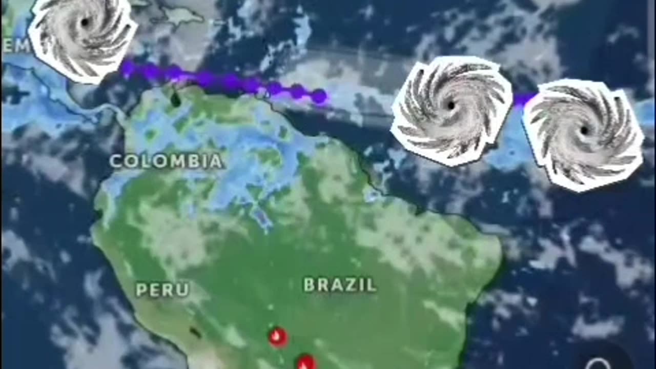
another... TRIPLE THREAT!
Tropical Weather Outlook
NWS National Hurricane Center Miami FL
800 AM EDT Fri Jun 28 2024
For the North Atlantic... #CaribbeanSea and the Gulf of Mexico:
1. Western Caribbean/Southwestern #GulfofMexico (AL94):
A broad area of low pressure over the western Caribbean Sea
associated with a tropical wave continues to produce widespread
shower and thunderstorm activity. Development of this system is not
expected today while it moves west-northwestward at around 15 mph,
and an #Air Force reconnaissance mission planned for today has been
canceled. The disturbance is then expected to move westward over the
Yucatan Peninsula and emerge over the Bay of Campeche late Saturday
or early Sunday, at which point some development will be possible.
Regardless of development, heavy rainfall associated with the
tropical wave will affect portions of Central America and Mexico
through the #weekend
* Formation chance through 48 hours...low...30 percent.
* Formation chance through 7 days...low...30 percent.
2. Central #Tropical #Atlantic (AL95):
A low pressure system located about 1500 miles east-southeast of the
Windward Islands is gradually becoming better defined. Showers and
thunderstorms are also showing signs of organization, and a tropical
depression or #tropicalstorm will likely form later today or on
Saturday. This system is expected to move westward at 15 to 20 mph
and approach the Lesser #Antilles by the end of the weekend.
Interests there should monitor the progress of this system. For
more information, including gale warnings, see High Seas #Forecasts
issued by the National Weather Service.
* Formation chance through 48 hours...high...90 percent.
* Formation chance through 7 days...high...90 percent.
3. Eastern Tropical Atlantic:
A tropical wave centered several hundred miles south-southwest of
the #CaboVerde #Islands is producing disorganized showers and
thunderstorms. Some slow development of this system is possible
next week while it moves generally westward across the central
and western tropical Atlantic at 15 to 20 mph.
* Formation chance through 48 hours...low...near 0 percent.
* Formation chance through 7 days...low...20 percent.
High Seas Forecasts issued by the National Weather Service
Forecaster Cangialosi/Zelinsky
#Hurricane #tornadoes #tornado #tropicalstorm #wind #rain #weather #TiffanysContent #rainfall #ocean #islands #thunderstorms #Beryl #Hurricanes #hurricaneberyl #nhc #zoomearth #earth
www.nhc.noaa.gov
www.zoom.earth.com
-
 LIVE
LIVE
Redacted News
27 minutes agoNATO Warmongers Trying to SCREW Trump's Peace Plans in Ukraine by Sending 100K Troops Front Lines?
7,481 watching -
 LIVE
LIVE
Candace Show Podcast
36 minutes agoSelena Gomez Cries & More Ryan Reynolds' Lies | Candace Ep 139
4,638 watching -
 LIVE
LIVE
Revenge of the Cis
1 hour agoEpisode 1435: Mexican Sad Dance
1,296 watching -
 1:57:27
The Quartering
5 hours agoTrump Goes Nuclear, JD Vance Humiliates Woke Reporter, Youtube's New Hate Speech Rules & More
42.1K18 -
 1:41:10
Tucker Carlson
4 hours agoMatt Taibbi: All the Top Secret Information Trump Is Releasing & What He Should Declassify Next
157K139 -
 LIVE
LIVE
Film Threat
16 hours agoVERSUS: DO OSCARS MATTER? AND SECTION 31 | Film Threat Versus
235 watching -
 LIVE
LIVE
Scammer Payback
1 hour agoCalling Scammers Live
377 watching -
 16:06
16:06
China Uncensored
2 hours agoChina is SO Much WEAKER Than You Think
4.4K8 -
 1:03:33
Randi Hipper
6 hours agoBITCOIN SLIDES CAUSING MASSIVE LIQUIDATIONS! LATEST PRICE UPDATE
4.08K2 -
 10:14
10:14
Silver Dragons
1 hour agoSomething WEIRD is Happening With Silver Right Now
170