Premium Only Content

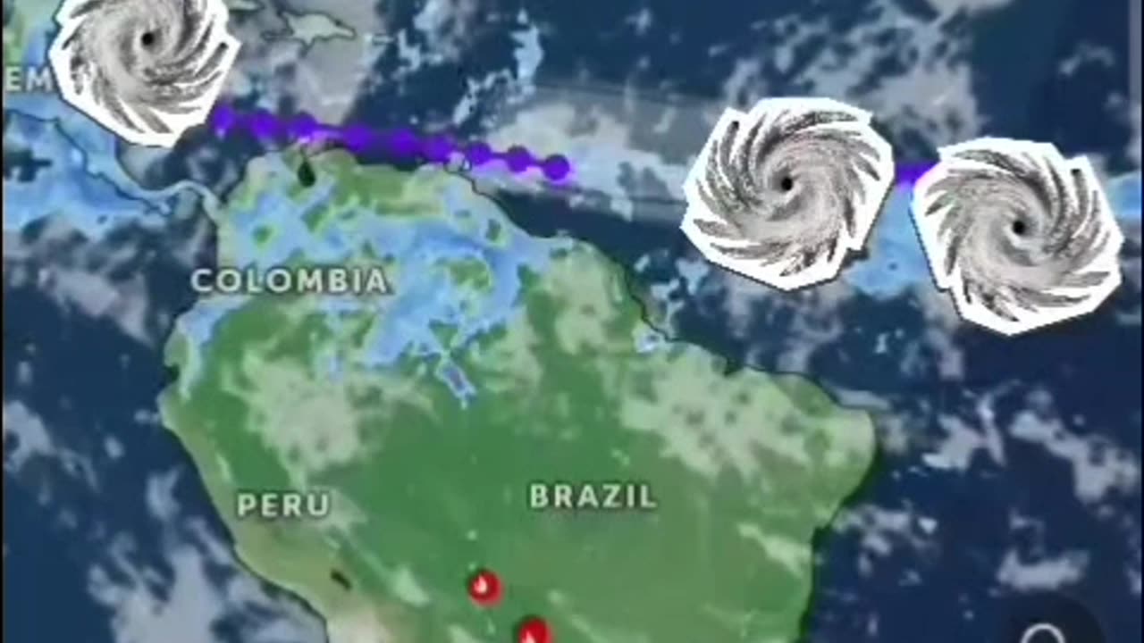
another... TRIPLE THREAT!
Tropical Weather Outlook
NWS National Hurricane Center Miami FL
800 AM EDT Fri Jun 28 2024
For the North Atlantic... #CaribbeanSea and the Gulf of Mexico:
1. Western Caribbean/Southwestern #GulfofMexico (AL94):
A broad area of low pressure over the western Caribbean Sea
associated with a tropical wave continues to produce widespread
shower and thunderstorm activity. Development of this system is not
expected today while it moves west-northwestward at around 15 mph,
and an #Air Force reconnaissance mission planned for today has been
canceled. The disturbance is then expected to move westward over the
Yucatan Peninsula and emerge over the Bay of Campeche late Saturday
or early Sunday, at which point some development will be possible.
Regardless of development, heavy rainfall associated with the
tropical wave will affect portions of Central America and Mexico
through the #weekend
* Formation chance through 48 hours...low...30 percent.
* Formation chance through 7 days...low...30 percent.
2. Central #Tropical #Atlantic (AL95):
A low pressure system located about 1500 miles east-southeast of the
Windward Islands is gradually becoming better defined. Showers and
thunderstorms are also showing signs of organization, and a tropical
depression or #tropicalstorm will likely form later today or on
Saturday. This system is expected to move westward at 15 to 20 mph
and approach the Lesser #Antilles by the end of the weekend.
Interests there should monitor the progress of this system. For
more information, including gale warnings, see High Seas #Forecasts
issued by the National Weather Service.
* Formation chance through 48 hours...high...90 percent.
* Formation chance through 7 days...high...90 percent.
3. Eastern Tropical Atlantic:
A tropical wave centered several hundred miles south-southwest of
the #CaboVerde #Islands is producing disorganized showers and
thunderstorms. Some slow development of this system is possible
next week while it moves generally westward across the central
and western tropical Atlantic at 15 to 20 mph.
* Formation chance through 48 hours...low...near 0 percent.
* Formation chance through 7 days...low...20 percent.
High Seas Forecasts issued by the National Weather Service
Forecaster Cangialosi/Zelinsky
#Hurricane #tornadoes #tornado #tropicalstorm #wind #rain #weather #TiffanysContent #rainfall #ocean #islands #thunderstorms #Beryl #Hurricanes #hurricaneberyl #nhc #zoomearth #earth
www.nhc.noaa.gov
www.zoom.earth.com
-
 3:40:59
FreshandFit
6 hours agoAfter Hours w/ Girls
100K31 -
 2:06:07
TimcastIRL
8 hours agoDemocrats LOSE IT Over SECOND Liberal Judge ARRESTED By Trump Admin | Timcast IRL
198K162 -
 1:26:16
Man in America
22 hours agoEXPOSED: Trump's COVERT War Against the European Banking Cartel w/ Tom Luongo
69.3K42 -
 1:45:48
Glenn Greenwald
11 hours agoGlenn Reacts to News of the Week; Plus: Audience Q&A | SYSTEM UPDATE #443
104K77 -
 11:05:38
Dr Disrespect
16 hours ago🔴LIVE - DR DISRESPECT - PUBG - 5 CHICKEN DINNERS CHALLENGE
214K20 -
 3:23:12
I_Came_With_Fire_Podcast
15 hours agoSHALL NOT BE INFRINGED| THE TYRANNY OF UNELECTED BUREAUCRATS | XI BOWS
42.4K8 -
 4:19:36
SynthTrax & DJ Cheezus Livestreams
17 hours agoFriday Night Synthwave 80s 90s Electronica and more DJ MIX Livestream THE GREAT EDO WARS OF 2067 Edition
72.7K10 -
 4:45:15
RalliedLIVE
7 hours ago $1.73 earnedWarzone Domination w/ Ral
52.2K -
 1:10:17
Sarah Westall
9 hours agoWorld Leaders Increasingly Display Panic Behavior as Economic Change Accelerates w/ Andy Schectman
79K15 -
 59:54
59:54
Motherland Casino
6 hours ago $1.81 earnedScar x Ayanna
31.9K5