Premium Only Content
This video is only available to Rumble Premium subscribers. Subscribe to
enjoy exclusive content and ad-free viewing.

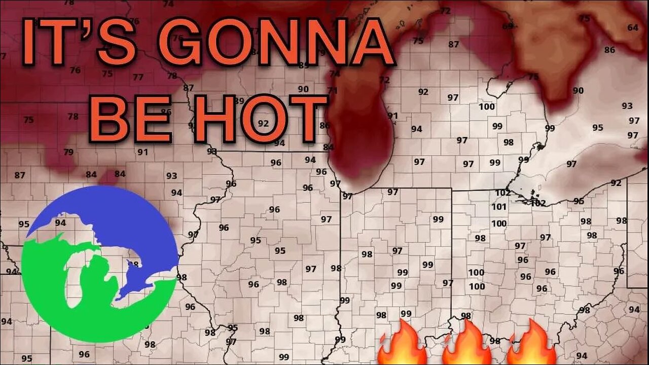
Significant Heat Wave To Bake Great Lakes Next Week
7 months ago
320
Science
Strange Weather
Storm Chasing
Storm Chaser
Tornado
Lightning
Severe Weather
Travel
Great Lakes
Michigan
Indiana
A broad ridge over the CONUS right now will shift eastward, stagnate, and strengthen over the northeastern U.S. on Sunday. This stagnated eastern ridge will create the ideal scenario for hot and humid weather, which will contribute to air temperatures in the 90s and feels like temperatures exceeding 100 days. These conditions are expected through the entirety of next week, with the possibility of an isolated shower or thunderstorm developing in the hot, humid, and unstable air mass despite lacking wind shear and lift. Rapid onset drought conditions will be possible in Indiana and Ohio as rain will only be isolated and not widespread.
Loading comments...
-
 1:12:34
Great Lakes Weather
6 months ago $0.19 earnedLIVE STORM CHASE in the Great Lakes Region
425 -
 2:54:30
Donald J. Trump
7 hours agoCommander-In-Chief Ball
308K124 -
 DVR
DVR
GOP
1 day agoPresident Trump Speaks at the Commander-In-Chief Ball
140K30 -
 1:45:10
Glenn Greenwald
9 hours agoTrump is Inaugurated & Immediately Issues Executive Orders; Biden Pardons His Family, Liz Cheney, Fauci; Michael Tracey DC Interviews | SYSTEM UPDATE #392
158K177 -
 2:03:43
Kim Iversen
9 hours agoTrump’s Triumphant Return: Breaking Down Trump’s Bold 2025 Agenda | The TikTok Ban Backlash: Who Wins, Who Loses?
91.2K39 -
 3:45:23
Benny Johnson
10 hours ago🚨 Watch President Trump FREE January 6th Political Prisoners LIVE Right Now | Stadium ROARS
261K280 -
 5:19:30
Donald J. Trump
13 hours agoDonald J. Trump Attends the Presidential Parade
600K360 -
 DVR
DVR
GOP
1 day agoDonald J. Trump Attends the Presidential Parade
329K85 -
 11:51:52
Right Side Broadcasting Network
7 days agoLIVE REPLAY: Inauguration of the 47th President Donald Trump, and Presidential Parade - 1/20/25
1.28M571 -
 4:25:55
Kimberly Guilfoyle
12 hours agoLive Inauguration Day Coverage
179K52