Michael Fish's NBC26 Storm Shield weather forecast
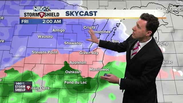
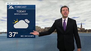
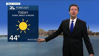
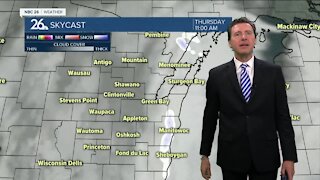
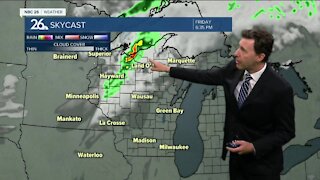
Today will be mostly cloudy with a chance of a few flurries or a bit of light snow, mainly to the southwest. Highs will be in the in the low/mid-30s. We have a wintry mix on the way a little later tonight. The farther you live to the northwest, the more this would be mainly just snow. Either way this will make travel a little slower later on tonight. Lows will bottom out in the upper-20s. This wintry mix of light snow, freezing rain, rain and sleet tapers off Friday morning. This does NOT look like it will be as robust of an ice accumulator as our event a couple mornings ago. Highs Friday will be popping back up to close to 40 so we will be melting any wintry accumulation. Speaking of which, any snow accumulation should stay light by the time this is done with maybe a Tr.-1" with possibly 1-3" off to the north. This could change a bit. Saturday, a stronger low pressure will be approaching the area, with the chance of precipitation increasing, but as of right now, the bulk of this would fall at night. For most of us, this looks to fall as mainly rain, but could change over to a wintry mix later at night. If you live well off to the NW, you will see a little more in the way of snow accumulation. Highs will top out in the low-40s during the daytime hours. Most of that should be out of here by Sunday. Temps will stay above normal into March!!
-
 1:45
1:45
WGBA
1 year agoFond du Lac Cardinals start the football season with a new $5.3 million nest
255 -
 1:39
1:39
WGBA
4 years agoMichael Fish's NBC 26 weather forecast
2 -
 2:34
2:34
WGBA
4 years agoMichael Fish's NBC 26 weather forecast
3 -
 2:42
2:42
WGBA
4 years agoMichael Fish's NBC 26 weather forecast
1 -
 1:52
1:52
WGBA
4 years agoMichael Fish's NBC 26 weather forecast
5 -
 2:35
2:35
WGBA
4 years agoMichael Fish's NBC 26 weather forecast
2 -
 1:42
1:42
WGBA
4 years agoMichael Fish's NBC 26 weather forecast
10 -
 2:05
2:05
WGBA
4 years agoMichael Fish's NBC 26 weather forecast
4 -
 2:26
2:26
WGBA
4 years agoMichael Fish's NBC 26 weather forecast
5 -
 2:00
2:00
WGBA
4 years agoMichael Fish's NBC 26 weather forecast
5