Premium Only Content
This video is only available to Rumble Premium subscribers. Subscribe to
enjoy exclusive content and ad-free viewing.

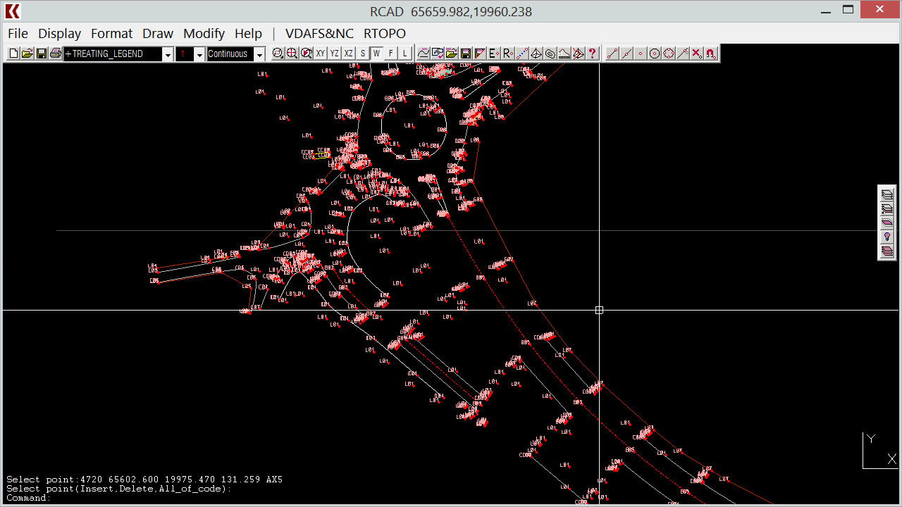
RTOPO Hydrology CAD for topography, Editing XYZ point files
1 year ago
22
Science
Education
CAD software
topography software
XYZ editor
XYZ point
surveying software
xyz point cloud
landxml converter
point editor
longitudinal profile
Simple, powerful and inexpensive CAD software for surveying. You can do triangulation, isolines, color-filled contour maps, sections, intersections, volume, editing XYZ files, simulation of rainwater runoff (see https://rumble.com/v3tosh4-rtopo-hydrology-simulating-rainwater-runoff.html) and much more. You can represent 4D points cloud and process hundreds of thousands of points or triangles, even on less powerful PCs.
You can see how to modify a XYZ point file. RTOPO can edit interactively the points (modify, delete or add), can modify the coordinates, the code and the position (in 3DPOLY or SPLINE).
http://rcad.eu/rtopo/
Watch the subtitles for better understanding.
Loading 1 comment...
-
 56:39
56:39
SLS - Street League Skateboarding
5 days agoHIGHEST SCORING KNOCKOUT ROUND OF ALL TIME! Felipe Gustavo, Dashawn Jordan, Filipe Mota & more...
8 -
 14:26
14:26
Breaking Points
1 day agoWOKE VS BASED?: Saagar And Ryan Play A Game
1.23K3 -
 LIVE
LIVE
SoundBoardLord
4 hours agoThe Red Dead Journey Continues!!!
238 watching -
 LIVE
LIVE
The Officer Tatum
56 minutes agoLIVE: Delta Airlines CRASH BLAMED On Trump, Ashley St. Claire Had Elon's BABY? + More | Ep 63
700 watching -
 1:38:08
vivafrei
3 hours agoAOC goes Full Criminal Lover? Mehdi Hasan Goes Full Terrorist? Another Plane Crash & MORE! Viva Frei
12.9K7 -
 1:52:19
Russell Brand
2 hours agoLIVE FROM MAR A LAGO: US, Russia & China to Negotiate While UK Ramps Up in Ukraine – SF539
69.4K32 -
 1:59:46
The Charlie Kirk Show
2 hours agoThe Biggest Fraud in History? + Russian Peace Talks + Unhappy Boomers? | Gingrich, Rasmussen | 2.18
61.5K20 -
 58:11
58:11
The Dan Bongino Show
5 hours agoThis Is What Winning In Politics Looks Like (Ep. 2425) - 02/18/2025
579K959 -
 2:16:49
Steven Crowder
5 hours ago🔴 WINNING: Why Trump Has John Oliver & All of Europe Freaking Out
436K251 -
 1:04:20
Timcast
4 hours agoDemocrats Plan COUP In NYC After Mayor Defends Trump, Lets ICE Deport Criminals | Timcast LIVE
88.1K44