Premium Only Content

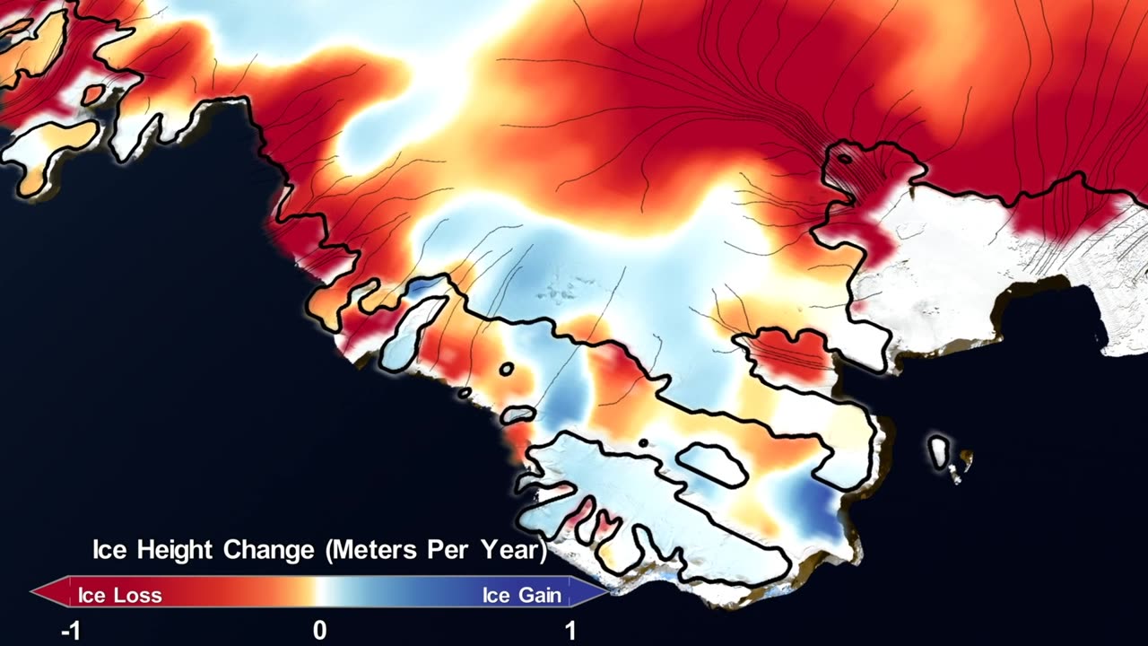
Charting the Frozen Frontier: NASA's Mission Maps 16 Years of Ice Loss 🌊
Embark on an icy odyssey through time and space as we unveil NASA's remarkable mission to map 16 years of ice loss in our video, "Charting the Frozen Frontier: NASA's Mission Maps 16 Years of Ice Loss 🌊🛰️."
In this video, we'll guide you through the groundbreaking endeavor of monitoring Earth's changing ice sheets and glaciers, a mission vital for understanding the impacts of climate change. Through captivating visuals and expert insights, you'll witness the science and wonder behind this critical research.
Delve into the significance of tracking ice loss, its implications for sea-level rise, and the cutting-edge technology that makes it possible. Gain a deeper appreciation for the dedication and innovation driving NASA's commitment to understanding our planet.
This video is your portal to the forefront of Earth science, where NASA's missions provide invaluable data to address some of our planet's most pressing challenges. Subscribe now to stay connected with the latest findings about ice loss and continue your journey through the wonders of Earth and beyond. 🌊🌍🔭
#NASA #IceLossMapping #EarthScience #ClimateChange #SatelliteObservations #ScientificDiscovery #GlacialResearch #EnvironmentalMonitoring #SpaceExploration
-
 1:03:33
The Dan Bongino Show
20 hours agoSunday Special with Mike Benz, Michael Knowles, Rep. Tim Burchett and Rep. Andy Harris - 02/23/25
288K908 -
 1:36:21
Sarah Westall
7 hours agoViolence Erupting in the Panama Canal, Identifying Enemy Infiltration, Psyops Ongoing w/ Michael Yon
39.6K28 -
 1:56:25
Nerdrotic
10 hours ago $13.72 earnedThe Red Pyramid's Hidden Secrets | Forbidden Frontier #091
53.1K13 -
 2:08:53
vivafrei
18 hours agoEp. 252: Liberals DISQUALIFY Candidate from Race! DOGE Wins & Loses; Rumble Sues BRAZIL! & MORE!
138K234 -
 1:15:12
Josh Pate's College Football Show
9 hours ago $18.15 earnedCFB’s Top 12 Programs | TV Executives & Our Sport | USC Changes Coming | Early Championship Picks
73.7K2 -
 LIVE
LIVE
Vigilant News Network
13 hours agoUK Government BUSTED in Secret Plot to Extract Your Data | Media Blackout
1,693 watching -
 1:03:32
Winston Marshall
3 days ago"War On Children!" The DEMISE Of The West Starts With Schools - Katharine Birbalsingh
116K66 -
 48:02
48:02
Survive History
16 hours ago $7.38 earnedCould You Survive as a Sharpshooter in the Napoleonic Wars?
65.2K3 -
 12:03
12:03
Space Ice
16 hours agoSteven Seagal's China Salesman - Mike Tyson Knocks Him Out - Worst Movie Ever
48.1K17 -
 11:37
11:37
Degenerate Jay
16 hours ago $16.23 earnedJames Bond Needs Quality Over Quantity From Amazon
101K8