Neelum Valley, Azad Kashmir, Sharda, Kel, Arang Kel, Taobat travel documentary
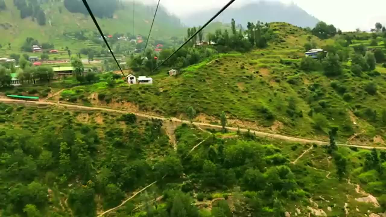
In this vlog we take you through some beautiful tourist places of Neelum Valley, Azad Kashmir. Our journey starts from Muzaffarabad and we travel through areas such as Athmuqam, Sharda, Kel, Arrang Kel and Taobat. We came across some spectacularly beautiful and scenic places while travelling through Neelum Valley. In this video you will see: tourist places in Neelum Valley, architectural design of houses in Neelum and some excerpts of Kashmiri people in Neelum Valley. You will also see magnificent Neelum River flowing between Azad Kashmir and the Indian Occupied Kashmir, serving as the Line of Control.
Neelum District (also spelt as Neelam; Urdu: ضلع نیلم), is the northernmost district of Azad Kashmir, Pakistan. Taking up the larger part of the Neelam Valley, the district has a population of 191,000 (as of 2017). It was badly affected by the 2005 Kashmir earthquake.
The Neelum River was known before Partition as Kishan Ganga and was subsequently renamed after the village of Neelam. It flows down from the Gurez Valley in Indian Occupied Jammu and Kashmir and roughly follows first a western and then a south-western course until it joins the Jhelum River at Muzaffarabad. The valley is a thickly wooded region with an elevation ranging between 4,000 feet (1,200 m) and 7,500 feet (2,300 m), the mountain peaks on either side reaching 17,000 feet (5,200 m).[5] Neelum Valley is 144 kilometres (89 mi) long.
Most of the valley is taken up by the Neelum District(Urdu: ضلع نیلم). The district is bordered on the south-west by Muzaffarabad District, which also encompasses the lower reaches of the valley; to the north-west beyond the mountains lies the Kaghan Valley in Khyber Pakhtunkhwa's Mansehra District; to the north and north-east are the Diamer, Astore and Skardu districts of Gilgit-Baltistan. To the south and east are the Kupwara and Bandipora districts of Indian Kashmir. The Line of Control runs through the valley – either across the mountains to the south-east, or in places right along the river, with several villages on the left bank falling on the Indian side of the border.
Tourist attractions include:
Arang Kel
Athmuqam
Chitta Katha Lake
Dhani Waterfall
Dowarian
Ratti Gali Lake
Halmat
Kel
Keran
Kutton
Sharda
Taobat
Jagran
-
 25:53
25:53
Stephen Gardner
6 hours ago🔥BREAKING: Trump HATING LAWYER busted in $17 million money laundering scheme!
23.6K88 -
 20:10
20:10
CartierFamily
13 hours agoAndrew Schulz DESTROYS Charlamagne’s WOKE Meltdown on DOGE & Elon Musk!
103K93 -
 33:56
33:56
The Why Files
9 days agoLegend of the 13 Crystal Skulls | From Mars to the Maya
57.9K37 -
 2:56:14
TimcastIRL
6 hours agoEPSTEIN Files DROP, FBI GOES ROGUE, AG Says They COVERED UP Epstein Case w/Amber Duke | Timcast IRL
176K93 -
 1:39:23
Kim Iversen
7 hours ago"Canada's Trump" Is Trudeau’s Worst Nightmare: Is Maxime Bernier the Future of Canada?
69.6K72 -
 DVR
DVR
Bannons War Room
10 days agoWarRoom Live
2.66M446 -
 16:06
16:06
The Rubin Report
13 hours agoProof the Islamist Threat in England Can No Longer Be Ignored | Winston Marshall
85.7K82 -
 2:07:07
Robert Gouveia
10 hours agoFBI Files Coverup! Bondi FURIOUS; SCOTUS Stops Judge; Special Counsel; FBI Does
110K84 -
 56:15
56:15
Candace Show Podcast
11 hours agoBREAKING: My FIRST Prison Phone Call With Harvey Weinstein | Candace Ep 153
168K112 -
 1:56:39
Flyover Conservatives
9 hours agoROBIN D. BULLOCK | Prophetic Warning: 2030 Is Up for Grabs – If We Don’t Act Now, Disaster Awaits! | FOC SHOW
57.9K10