Premium Only Content
This video is only available to Rumble Premium subscribers. Subscribe to
enjoy exclusive content and ad-free viewing.

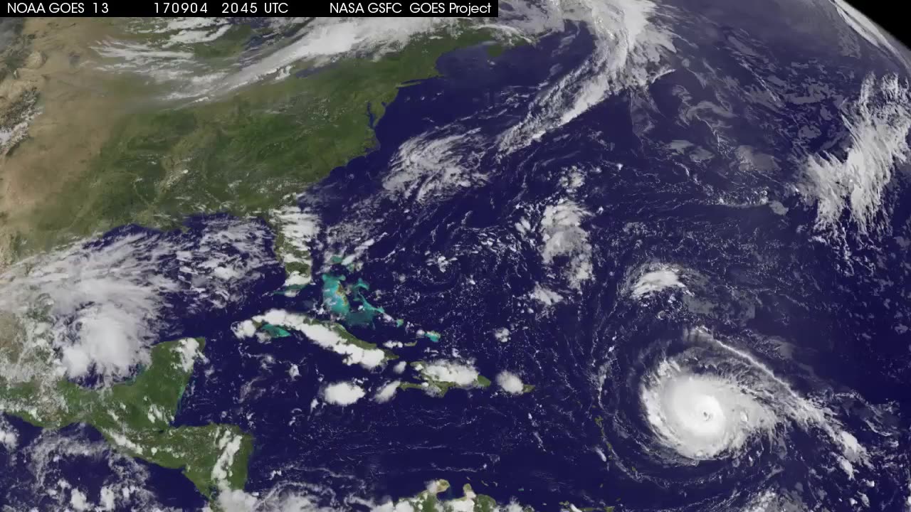
Satellite Animation Sees Major Hurricane Irma Approaching Leeward Islands
1 year ago
1
This animation of NOAA's GOES East satellite imagery from Sept. 2 at 7:45 a.m. EDT (1145 UTC) to Sept. 5 ending at 7:15
a.m. CDT (1115 UTC) shows Hurricane Irma move west toward the Leeward Islands and strengthen to a Category 5 storm on Sept. 5. Credit: NASA-NOAA GOES Project
Loading comments...
-
 3:03:44
The Why Files
3 days agoCOMPILATION: Pyramids, Mounds and Mountains
51.7K58 -
 2:00:15
Badlands Media
1 day agoThe Liberty Den Ep. 131
101K21 -
 2:05:26
TimcastIRL
9 hours agoTrump NUKES IRS, Mass Fed Layoffs, Democrats REVOLT Over 200k Layoffs w/Roma Nation | Timcast IRL
123K161 -
 1:39:03
Roseanne Barr
13 hours ago $29.13 earnedAdam Carolla! | The Roseanne Barr Podcast #87
112K25 -
 1:29:04
Glenn Greenwald
12 hours agoTrump, Vance & Musk Announce a Radically New Foreign Policy Framework; Prof. Norman Finkelstein on Gaza's Future, the Cease-Fire Deal & Fallout from the U.S./Israeli War | SYSTEM UPDATE #407
142K92 -
 4:15:00
Nerdrotic
14 hours ago $47.63 earnedCaptain Falcon America REVIEW, Disney Ending DEI? Rings of Power RETURNS | Friday Night Tights #341
208K36 -
 9:34:03
FusedAegisTV
22 hours agoMario Galaxy, Batman, Real Talk/Politics, & MORE - V-Day 💗 Friday Variety Stream!
55.9K1 -
 1:10:49
Vigilant News Network
10 hours agoRFK Jr. Drops a Stunning Announcement | The Daily Dose
76.2K42 -
 49:49
49:49
Candace Show Podcast
13 hours agoEXCLUSIVE: Blake & Ryan’s Desperate Legal Strategy Exposed! | Candace Ep 147
189K133 -
 1:32:20
2 MIKES LIVE
11 hours ago2 MIKES LIVE #180 with guest Kyle Rittenhouse!
52.9K4