Premium Only Content

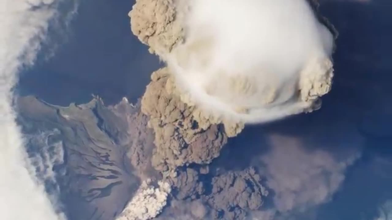
Volcanic eruption view from international space
This
NASA's Volcano Observations
As of my last update in September 2021, there have been multiple volcanic eruptions that NASA has captured from space over the years. Satellites equipped with different imaging sensors provide crucial information about volcanic eruptions, their ash plumes, and the resultant impacts. Some of the most famous images have been captured by satellites like Terra, Aqua, and Landsat, among others.
For instance, the eruption of Mount Raung in Indonesia in 2015, the eruption of the Sarychev Peak in Russia in 2009, and the 2010 eruption of Eyjafjallajökull in Iceland, which caused significant disruption to European air travel, were all captured from space.
However, if there's a specific volcanic eruption after 2021 that you are referring to, I would not have information on that. You would need to consult a more recent source or specify which eruption you're asking about from before 2021.
-
 30:55
30:55
Tundra Tactical
12 hours ago $9.60 earnedFaith, Family, Gun Rights : Tundra Tactical Interviews Erich Pratt Vice President Of GOA
51.4K3 -
 4:13:39
Nobodies Gaming
14 hours ago $32.02 earnedNobodies : Rumble Gaming MARVEL RIVALS
179K11 -
 24:08
24:08
MYLUNCHBREAK CHANNEL PAGE
1 day agoUnder The Necropolis - Pt 4
168K31 -
 19:52
19:52
Adam Does Movies
11 hours ago $4.92 earnedEmilia Pérez Movie Review - It's Uniquely Awful
48.9K3 -
 20:07
20:07
BlackDiamondGunsandGear
17 hours agoSPRINGFIELD ECHELON COMPACT / NOT GOOD
48.8K3 -
 1:05:06
Man in America
17 hours agoThe Terrifying Truth Behind Chemical Fog, Wildfire Smoke & Chemtrails w/ Dr. Robert Young
48.4K64 -
 2:54:47
Tundra Tactical
10 hours ago $14.46 earnedSHOT Show 2025 Wrap Up!! On The Worlds Okayest Gun Live Stream
77K4 -
 LIVE
LIVE
Right Side Broadcasting Network
1 day agoLIVE REPLAY: President Donald J. Trump Holds His First Rally After Inauguration in Las Vegas - 1/25/25
3,386 watching -
 2:55:24
Jewels Jones Live ®
1 day agoWEEK ONE IN REVIEW | A Political Rendezvous - Ep. 107
137K45 -
 1:33:29
Michael Franzese
1 day agoTrump Wastes No Time: Breaking Down Trump’s First Week Executive Orders | LIVE
144K120