Neelum Valley, Jammu and Kashmir, Sharda, Kel, Arang Kel, Taobat travel documentary Urdu travel vlog
Watch this video in 1080p HD for the best quality
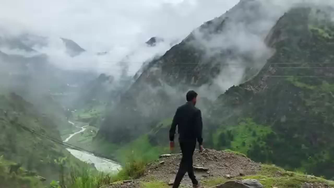
In this vlog we take you through some beautiful tourist places of Neelum Valley, Pakistan occupied Kashmir. Our journey starts from Muzaffarabad and we travel through areas such as Athmuqam, Sharda, Kel, Arrang Kel and Taobat. We came across some spectacularly beautiful and scenic places while travelling through Neelum Valley. In this video you will see: tourist places in Neelum Valley, architectural design of houses in Neelum and some excerpts of Kashmiri people in Neelum Valley. You will also see magnificent Neelum River flowing between pakistan occupied Jammu and Kashmir and the Indian Occupied Kashmir, serving as the Line of Control.
Neelum District (also spelt as Neelam; Urdu: glis pl), is the northernmost district of Azad Kashmir, Pakistan. Taking up the larger part of the Neelam Valley, the district has a population of 191,000 (as of 2017). It was badly affected by the 2005
Kashmir earthquake.
The Neelum River was known before Partition as Kishan Ganga and was subsequently renamed after the village of Neelam. It flows down from the Gurez Valley in Indian Occupied Jammu and Kashmir and roughly follows first a western and then a southwestern course until it joins the Jhelum River at Muzaffarabad. The valley is a thickly wooded region with an elevation ranging between 4,000 feet (1,200
m) and 7,500 feet (2,300 m), the mountain peaks on either side reaching 17,000 feet (5,200 m). [5] Neelum Valley is 144 kilometres (89 mi) long.
Most of the valley is taken up by the Neelum District(Urdu: ali glo). The district is bordered on the south-west by Muzaffarabad District, which also encompasses the lower reaches of the valley; to the north-west beyond the mountains lies the Kaghan Valley in Khyber Pakhtunkhwa's Mansehra District; to the north and north-east are the Diamer, Astore and Skardu districts of Gilgit-Baltistan. To the south and east are the Kupwara and Bandipora districts of Indian Kashmir. The Line of Control runs through the valley - either across the mountains to the south-east, or in places right along the river, with several villages on the left bank falling on the Indian side of boarder
Tourist attractions include:
Arang Kel
Athmugam
Chitta Katha Lake
Dhani Waterfall
Dowarian
Ratti Gali Lake
Halmat
Kel
Keran
Kutton
Sharda
Taobat
Jagran
-
 LIVE
LIVE
Slightly Offensive
2 hours agoELITES Go DEFCON3 on Kanye West, Cancel Culture 2.0 BEGINS! | Nightly Offensive
1,130 watching -
 58:56
58:56
The StoneZONE with Roger Stone
1 hour agoWhy Obama and the Democrats Fear the Blagojevich Pardon | The StoneZONE w/ Roger Stone
13.6K2 -
 DVR
DVR
Josh Pate's College Football Show
1 hour ago $0.25 earnedSEC Program Rankings | Next Elite Program | CFB Ratings vs NFL Ratings | 2025 Breakout QBs
9.5K -
 53:28
53:28
Candace Show Podcast
8 hours agoBecoming Brigitte: Jean-Michel Trogneux | Ep 4
127K67 -
 58:47
58:47
Edge of Wonder
5 hours agoRigging the Game: Super Bowl Controversy & Fake Alien Invasion Commercial
13.6K3 -
 11:37
11:37
Tundra Tactical
3 hours ago $0.80 earnedHeroes in Texas Stop DEADLY School Shooting!
13K3 -
 41:45
41:45
Chrissy Clark
2 hours agoFEMA’s Corruption EXPOSED, Trump Assassination Update, & The Rebrand Reveal I Underreported Stories
18.4K5 -
 1:15:50
The Big Mig™
4 hours agoCelebrate American Exceptionalism 2025 w/ Mary Flynn O’Neill
23K3 -
 1:23:59
Redacted News
5 hours agoBREAKING! CORRUPT FBI CAUGHT HELPING ILLEGALS AVOID ICE ARRESTS, HOMAN READY TO PROSECUTE | Redacted
138K180 -
 1:18:39
Awaken With JP
1 day agoThe Latest in the Resurrection of America - LIES Ep 78
109K35