Premium Only Content

Nasa Landsat Earth observation satellites
NASA Landsat is a series of Earth observation satellites operated by the National Aeronautics and Space Administration (NASA). The first Landsat satellite, Landsat 1, was launched in 1972.
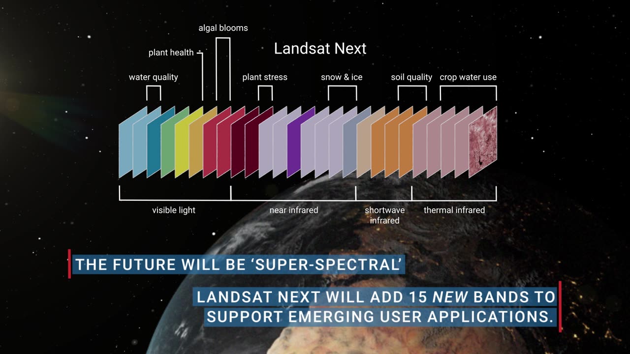
The Landsat satellites are equipped with multispectral scanners and cameras that capture images of the Earth's surface. These images are used for various applications, including monitoring changes in land cover, mapping deforestation, tracking urban growth, and assessing the health of agricultural crops.
The most recent satellite in the series, Landsat 9, was launched on September 27, 2021. It is equipped with advanced sensors that provide higher quality and more accurate images than previous Landsat satellites.
The data collected by Landsat satellites is freely available to the public, allowing scientists, researchers, and other users to study and analyze changes in the Earth's environment over time. This data is also used for disaster response, resource management, and climate change research.
Landsat satellites have been instrumental in monitoring changes in the Earth's surface over the past several decades, providing valuable information for understanding and managing our planet's resources and environment.
https://rumble.com/v3b6ng6-nasas-latest-sun-discoveries-is-the-detection.html
-
 LIVE
LIVE
Rebel News
55 minutes ago $0.85 earnedPoilievre on Canada's 'dangerous future', Singh dodges again, China targets Tory | Rebel Roundup
642 watching -
 LIVE
LIVE
TheAlecLaceShow
2 hours agoGuests: General Flynn & Dr. Michael Schwartz | Pope Francis Died | Hegseth Out? | The Alec Lace Show
132 watching -
 32:25
32:25
Adam Carolla
6 hours ago $1.67 earnedMenendez Brothers update and one's tie to Rose O'Donnell | The Adam Carolla Show | #news
8.01K1 -
 DVR
DVR
The Shannon Joy Show
3 hours ago🔥🔥Hacked & Stacked: Musk Aligned Tech Bros Poised To Cash In On ‘DOGE Hackathon At IRS’ Amidst Growing Health Concerns About Data Processing Centers & EMF Radiation - Special Report On EMF With Dr. Basima Williams🔥🔥
20.6K -
 32:00
32:00
Grant Stinchfield
1 hour ago $1.01 earnedDeep State Payday: Fauci’s $15M Windfall Raises Alarms Over COVID Corruption
13.8K1 -
 1:07:16
Blockchain Basement
2 hours agoTrump Bitcoin ETF CONFIRMED! (NEW SEC Chair Is HERE)
11.9K -
 1:04:07
The Rubin Report
2 hours agoElizabeth Warren Humiliated as Her Lying to Host Backfires Spectacularly
49.8K64 -
 1:37:35
Benny Johnson
2 hours agoDefense Sec Pete Hegseth Hands DOJ Evidence Of Leakers SABOTAGING Trump | Charges Incoming?!
68.7K54 -
 47:39
47:39
BitLab Academy
2 hours ago $0.33 earned$100k Bitcoin Next? Altcoins To Pump Next | Crypto Bulls Back In Charge!?
13.5K1 -
 LIVE
LIVE
LFA TV
16 hours agoLIVE PRESS CONFERENCE WITH KAROLINE LEAVITT | ALL DAY LIVE STREAM - 4/22/25
3,642 watching