Premium Only Content

NASA ARSET: Basics of Synthetic Aperture Radar (SAR) Video 1/4
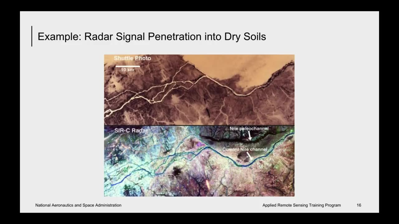
A limitation of optical satellite remote sensing is that it depends on cloudless, well-illuminated areas to produce quality data. This is especially problematic for collecting data during nighttime, around storms, and in densely-forested areas. Synthetic Aperture Radar (SAR) is a solution to many of these obstacles. SAR can observe the Earth's surface day and night, through most weather conditions, and the signal can penetrate the vegetation canopy. There are a number of existing SAR datasets from current and past airborne and satellite missions, as well as exciting upcoming missions. This online webinar will focus on building the skills needed to acquire and understand SAR data, including polarimetric and interferometric SAR (PolSAR and InSAR), as well as potential applications.
Learning Objectives: By the end of the training, attendees will be able to interpret the information in SAR images, recognize distortions that need to be corrected in SAR images, describe the basics of PolSAR and the information provided by different polarizations, and describe the basics of InSAR and the information in an interferogram.
You can access all training materials (presentations and homework assignments) from this webinar series on the training webpage: https://arset.gsfc.nasa.gov/disasters/webinars/intro-SAR
Course Format: Four, one-hour sessions
Audience: Remote sensing users from local, regional, state, federal, and international organizations interested in using SAR for terrestrial applications such as inundation mapping, fire scar detection, land cover land use change studies, or surface deformation
-
 LIVE
LIVE
The Why Files
5 hours agoLIVE: The Why Files 24/7 Stream n' Chat
2,380 watching -
 55:15
55:15
Russell Brand
22 hours agoThe Truth About Big Pharma & COVID with Dr. Aseem Malhotra
116K6 -
 1:19:48
The Rubin Report
6 hours agoWhat the Trump Administration Must Do Instead of Revenge | Peter Thiel
70.8K76 -
 1:59:00
Steve-O's Wild Ride! Podcast
3 days ago $32.87 earnedPatrick Bet-David DESTROYS Steve-O's Dad - Wild Ride #252
107K40 -
![[XboxONE] GRINDING 1000g FC24](https://1a-1791.com/video/fwe1/01/s8/1/y/k/I/o/ykIoy.0kob-small-XboxONE-GRINDING-1000g-FC24.jpg) 3:29:15
3:29:15
deathbee
9 hours ago[XboxONE] GRINDING 1000g FC24
68.2K2 -
 1:08:32
Winston Marshall
1 day agoThe HIDDEN Agenda: Congresswoman Hageman UNCOVERS USAID Fraud, Censorship and Human Trafficking
98.7K122 -
 8:16
8:16
CarlCrusher
22 hours agoThe True Story of Stranger Things and the Montauk Project Origins
53.4K11 -
 10:05
10:05
ariellescarcella
1 day agoNo, You're Not Having A 'Gender Crisis' You're Just Bored
60.9K35 -
 41:08
41:08
The Finance Hub
1 day ago $14.60 earnedBREAKING: DONALD TRUMP JR. SHOCKS THE WORLD!
54.7K98 -
 8:04
8:04
BIG NEM
1 day agoHow Your Mind SHAPES Reality! 🧠 Epigenetics, Psychedelics & Quantum Physics Explained!
58.2K5