Premium Only Content
This video is only available to Rumble Premium subscribers. Subscribe to
enjoy exclusive content and ad-free viewing.

The Apollo 12 Landing on Moon
1 year ago
6
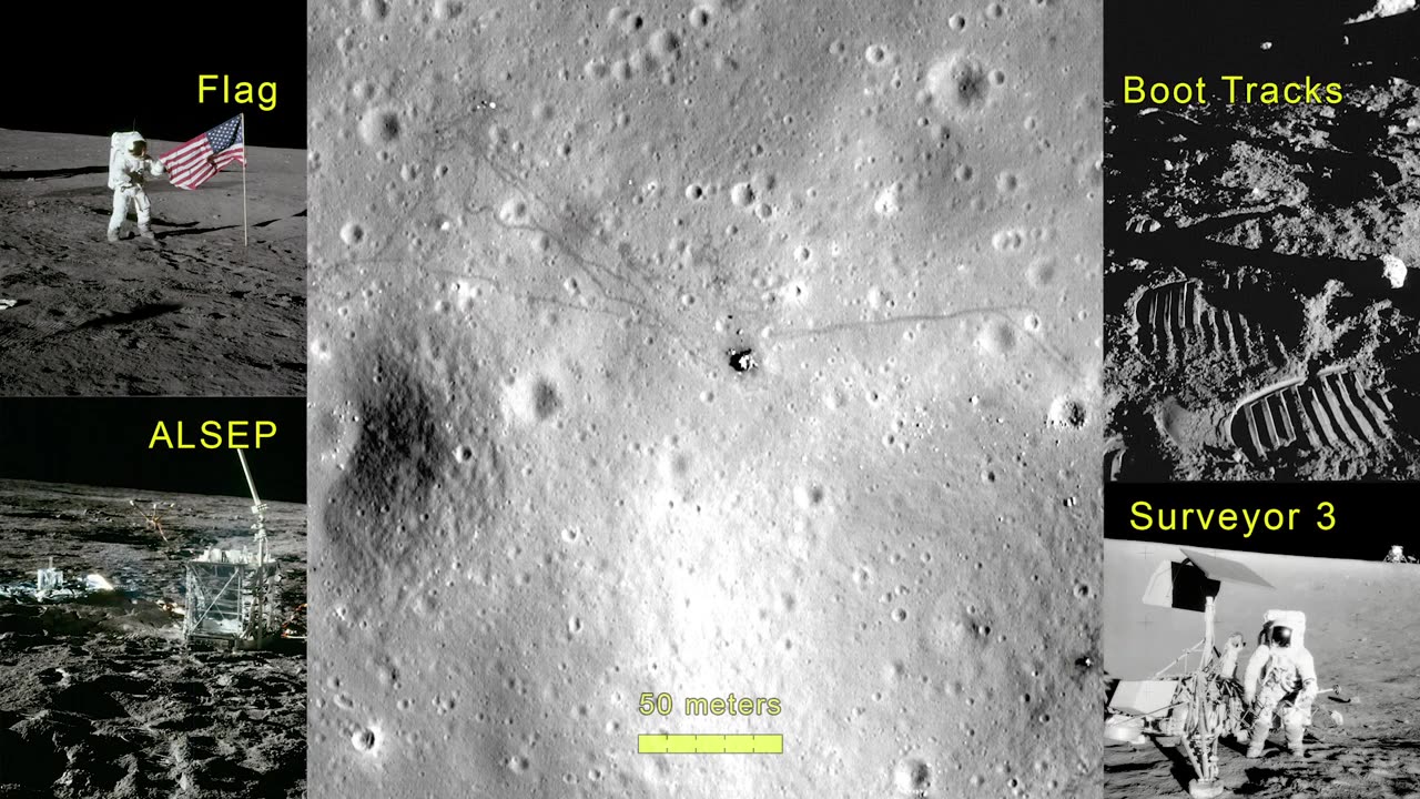
This video showcases the Apollo 12 landing site, visualized in three dimensions using photography and a stereo digital elevation model from the Lunar Reconnaissance Orbiter Camera. The locations of the flag shadow, experiment package, astronaut paths, and the Surveyor 3 spacecraft are marked. This visualization uses LROC NAC image M175428601 (40 cm per pixel) and a digital terrain model derived from NAC stereo image pairs (2 meters per pixel) to fly over the Apollo 12 landing site. Because the Lunar Module in the NAC image looks oddly flat when viewed at an oblique angle, a 3D model of the descent stage was added.
Loading comments...
-
 27:28
27:28
Glenn Greenwald
3 hours agoGlenn Reacts to Trump's Gaza Take Over: System Update Special
36.4K86 -
 LIVE
LIVE
Sarah Westall
32 minutes agoFreezing USAID & its Operations in Ukraine: A Massive Money Laundering Organization? w/ Sam Anthony
374 watching -
 DVR
DVR
Redacted News
3 hours agoBREAKING! EPSTEIN LIST INCOMING UNDER AG PAM BONDI? DEMOCRATS FREAKING OUT, PRINCE ANDREW NERVOUS
104K111 -
 52:02
52:02
Candace Show Podcast
5 hours agoBecoming Brigitte: An Inaccessible Past | Ep 2
84.5K108 -
 LIVE
LIVE
2 MIKES LIVE
3 hours ago2 MIKES LIVE #176 News Breakdown Wednesday!
127 watching -
 LIVE
LIVE
I_Came_With_Fire_Podcast
4 hours agoGAZA TAKEOVER | USAID EXPLAINED | TARIFF TAKEDOWN
305 watching -
 LIVE
LIVE
The Based Mother
5 hours agoFULL OF IT! Crooked politicians say they care about children. Their actions tell a different story.
79 watching -
 1:54:12
Right Side Broadcasting Network
8 hours agoLIVE: President Trump Signs EOs; Pete Hegseth Meets with Netanyahu - 2/5/25
99.7K45 -
 1:51:41
Dr. Drew
6 hours agoPsychics Investigate DC Black Hawk & Philadelphia Medical Plane Crashes w/ Zach Vorhies + Eddie Conner & Andrew Anderson – Calling Out w/ Susan Pinsky – Ep 166
55.9K15 -
 1:03:04
In The Litter Box w/ Jewels & Catturd
22 hours agoDemocrats Come Unglued | In the Litter Box w/ Jewels and Catturd Ep. 735 - 2/5/2025
68.4K63