Premium Only Content

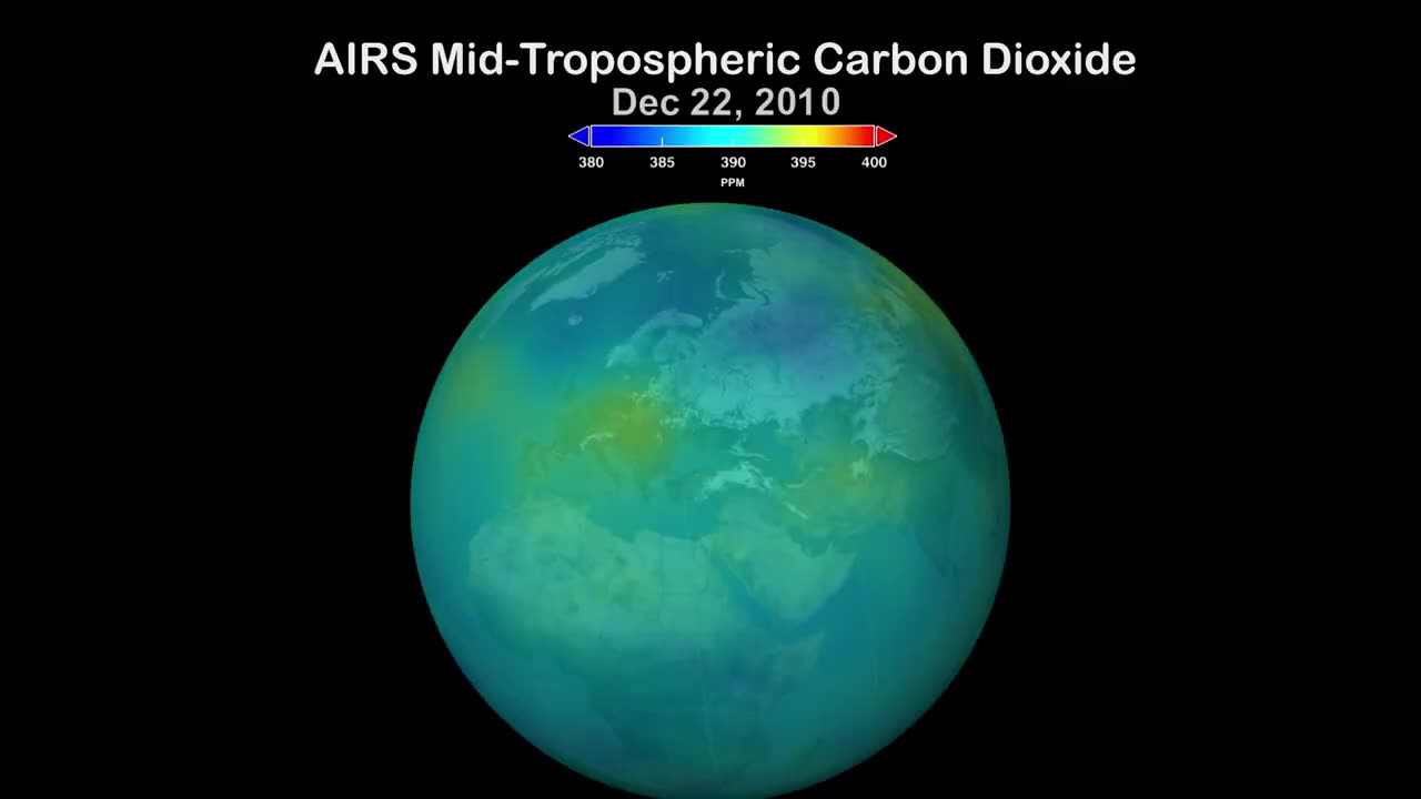
NASA's AIRS programme improves our knowledge of the planet's climate.
After 20 years of Earth-scanning, NASA's Aqua satellite's Atmospheric Infrared Sounder (AIRS) sensor now has a sufficient body of data to aid in the study of climate change. Forecasts for weather and our knowledge of Earth's climate are being improved by AIRS data on the atmosphere. 3D maps of air and surface temperature, water vapour content, and cloud characteristics are produced using AIRS' infrared technology. The electromagnetic spectrum's infrared region contains a wealth of data on gases, particularly greenhouse gases like ozone and carbon dioxide. The availability of quick worldwide coverage is a benefit of having such an equipment in orbit. The 'fingerprint' of the atmosphere at a certain time and location created by AIRS data is used to create climate records for future generations. On May 4, 2002, NASA's Aqua spacecraft, which included AIRS, was put into orbit around the Earth. learn more about the mission, visit: https://airs.jpl.nasa.gov
-
 1:08:07
Bek Lover Podcast
3 hours agoInteresting Times with Bek Lover Podcast
10.1K -
 1:51:12
Tate Speech by Andrew Tate
6 hours agoEMERGENCY MEETING EPISODE 105 - UNBURDENED
143K68 -
 1:01:18
Tactical Advisor
9 hours agoBuilding a 308 AR10 Live! | Vault Room Live Stream 016
104K7 -
 2:17:02
Tundra Tactical
1 day ago $25.20 earnedTundra Nation Live : Shawn Of S2 Armament Joins The Boys
226K29 -
 23:22
23:22
MYLUNCHBREAK CHANNEL PAGE
2 days agoUnder The Necropolis - Pt 5
181K67 -
 54:05
54:05
TheGetCanceledPodcast
1 day ago $14.32 earnedThe GCP Ep.11 | Smack White Talks Smack DVD Vs WorldStar, Battle Rap, Universal Hood Pass & More...
180K36 -
 8:30
8:30
Game On!
13 hours ago $0.42 earnedLakers BLOCKBUSTER trade! Luka Doncic is coming to LA!
17K2 -
 48:29
48:29
hickok45
17 hours agoSunday Shoot-a-Round # 266
15.7K9 -
 15:18
15:18
SternAmerican
3 days agoStern American with Sam Anthony from YourNews.com
10.9K -
 1:03:13
PMG
1 day ago $1.02 earnedRFK, Tulsi & Kash Hearings, the Plane Crash in the Potomic, & Ozempic
10.4K1