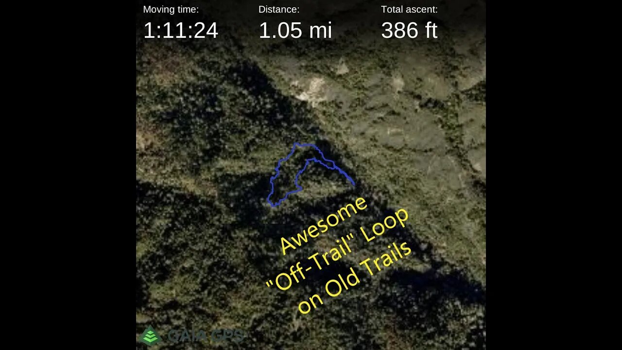
Awesome "Off-Trail" Loop Hike on Old Trails
Time to put all this exploring and hill shade map knowledge to the test and see if I can link up a series of old roads and trails to make a loop,
There are signs the trail that forks off of the road on the north side of the GeoCache hill continued up a ridge to where Charcoal Road is today. Only way to know for sure is to drop down the ridge and look for "ground truth".
I'm finding more of these old trails and they all seem to have similar routing. They'll start off following along the side of a creek up a canyon. Then at some point, they'll start ascending a ridge, going straight up, until they join in with another road or trail. There are almost no switchbacks, no grade reversals, no drainage cuts like modern trails have. I suspect these are very old trails, likely from the pre-contact days.
USGS National Map Viewer w/ Hill Shade layers:
https://apps.nationalmap.gov/viewer/
This whole area is part of a single 40 acre parcel of land that the Open Space district purchased around 2001, per the newspaper article. I haven't been able to find out about anything that was located here prior to district clearing the land shortly after acquisition. Here's a demolition project for an adjoining parcel of land, acquired from the same owner in 2013, that was cleared in 2014:
https://www.openspace.org/sites/default/files/CGI-BIN/agendas_minutes/2014.07.23_Lobner_AwardofContract_Demolition_r-14-97.pdf
More to come...
Subscribe for more content like this
Comment, rate, share & click the bell icon
And as always, thanks for watching
#USGS #HillShade
-
 LIVE
LIVE
PudgeTV
8 hours ago🟣 The Legend of Zelda: Majora's Mask | Retro Gaming on Rumble
105 watching -
 2:31:02
vivafrei
22 hours agoEp. 258: Taibbi Sues for Defamation! Trump Tariff Madness! Russell Brand, Greenpeace Verdict & MORE!
185K255 -
 2:27:12
Nerdrotic
14 hours ago $43.15 earnedCIA JFK Assassination Documents | Forbidden Frontier 097
138K75 -
 4:02:43
Alex Zedra
11 hours agoLIVE! Verdansk all night <3
65.3K15 -
 1:22:13
Sarah Westall
14 hours agoTruth about Gila Monster Snake Venom & the Miracle of Peptides for Human Health w/ Dr. Diane Kazer
113K30 -
 2:18:43
Tundra Tactical
12 hours ago $5.52 earned$3200 ZEV HEARTBREAKER Contest!!!
60.9K2 -
 6:24:39
EuphioniaStudio
11 hours ago $7.15 earnedIt's BAAAASED, MARIO! | Mario Party 4
56.8K6 -
 2:48:34
Adam Does Movies
21 hours ago $8.47 earnedAll The Big Movie Announcements From CinemaCon 2025- LIVE!
71.1K -
 1:07:30
Josh Pate's College Football Show
14 hours ago $7.01 earnedBig CFB Changes Coming | USC + Texas + Alabama In 2025 | Truth About Officiating | I Am Engaged
69.9K1 -
 4:43:40
Biscotti-B23
17 hours ago $6.92 earned🔴 LIVE VIEWERS VS MEMBERS BEEF 🔥 FINDING A NEW MAIN ⚔ BLEACH REBIRTH OF SOULS
58.3K2