Premium Only Content

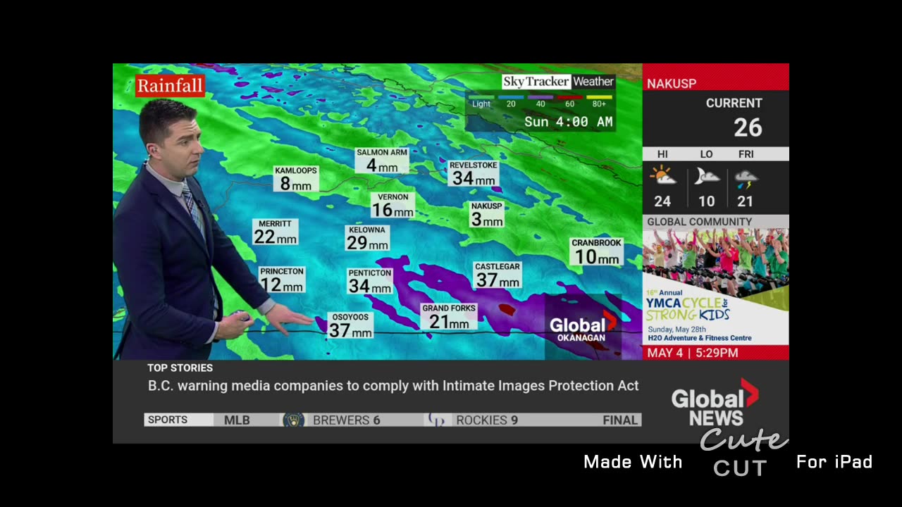
Up To 29 mm Of Rain Possible
Up To 29 mm Of Rain Possible 4:22 a.m. PDT Friday 5 May 2023
Heavy rain possibly contributing to the escalating flooding situation and mudslides.
When: Today through Saturday night.
Where: Central Okanagan - including Kelowna, South Okanagan - including Penticton, Boundary, Arrow Lakes - Slocan Lake, West Kootenay, Kootenay Lake and Highway 3 - Paulson Summit to Kootenay Pass.
Hazards: New flooding, exacerbation of existing flooding, and mudslides are possible from heavy rainfall on melting mid-high elevation snowpack.
Remarks: Showers at times heavy will develop today as the first of multiple systems arrives. By this afternoon, showers will intensify with embedded thunderstorms further increasing precipitation amounts.
Confidence remains low on spatial extent and intensity as the high precipitation amounts will depend on the embedded thunderstorms. Nevertheless, the threat for sudden heavy downpours and flash flooding on top of the volatile spring snowmelt conditions remains.
Rainfall warnings may be issued as certainty grows. Please refer to the British Columbia River Forecast Centre for local messaging on flood potential.
http://bcrfc.env.gov.bc.ca/warnings/index.htm
Please continue to monitor alerts and forecasts issued by Environment Canada. To report severe weather, send an email to BCstorm@ec.gc.ca or tweet reports using #BCStorm.
-
 LIVE
LIVE
Alex Zedra
3 hours agoLIVE! Come Play WoT with me!
808 watching -
 LIVE
LIVE
Drew Hernandez
12 hours agoDOGE EXPOSES $2 BILLION SCHEME LINKED TO STACEY ABRAMS?!
2,678 watching -
 1:27:59
Kim Iversen
7 hours agoRFK Jr Declares No More Cheetos on Welfare? | Yale Confirms Long Covid Is Actually Vaccine Injury!
58.5K90 -
 1:08:43
The Charlie Kirk Show
4 hours agoTHOUGHTCRIME Ep. 74 — Charlie's Campus Return? Robo-Butlers? Garden of American Heroes?
58.8K12 -
 1:09:53
Slightly Offensive
4 hours ago $3.25 earnedIs the US Headed for MORE WAR Under TRUMP? | Guest: Scott Horton
30.5K8 -
 58:29
58:29
The StoneZONE with Roger Stone
4 hours agoRoger Stone Hails Confirmation of Kash Patel, Trashes Schiff for Attacks On Patel | The StoneZONE
37.2K10 -
 48:44
48:44
Man in America
9 hours agoA MASSIVE Global Financial Reset Is Coming—Are You Ready?
27K1 -
 1:15:42
Precision Rifle Network
1 day agoS4E5 Guns & Grub - The Best Rifle Under $2000
35.5K5 -
 1:02:54
Glenn Greenwald
1 day agoSouth Korean Economist Ha-Joon Chang on the Economic World Order, Trump's Tariffs, China & More | SYSTEM UPDATE #410
69.6K44 -
 1:02:27
Donald Trump Jr.
9 hours agoBye Mitch, plus Kash confirmed, Interview with AJ Rice | Triggered Ep.218
120K69