Premium Only Content
This video is only available to Rumble Premium subscribers. Subscribe to
enjoy exclusive content and ad-free viewing.

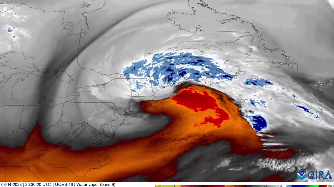
Satellite imagery tracks Nor'easter over northeastern US
1 year ago
78
Timelapse satellite imagery shows the “impressive and classic look” of the nor’easter storm that moved along the eastern US coast from March 13-15, according to the Cooperative Institute for Research in the Atmosphere (CIRA). Video from CIRA shows the storm over a 30-hour period from 4 pm on March 13 to past 1 am on March 15. Credit: CIRA via Storyful
Loading comments...
-
 55:07
55:07
LFA TV
1 day agoDefending the Indefensible | TRUMPET DAILY 2.25.25 7PM
43.7K18 -
 6:09:26
Barry Cunningham
15 hours agoTRUMP DAILY BRIEFING - WATCH WHITE HOUSE PRESS CONFERENCE LIVE! EXECUTIVE ORDERS AND MORE!
86K59 -
 1:46:37
Game On!
9 hours ago $0.51 earnedPUMP THE BRAKES! Checking Today's Sports Betting Lines!
51.6K4 -
 1:27:21
Redacted News
9 hours agoBREAKING! SOMETHING BIG IS HAPPENING AT THE CIA AND FBI RIGHT NOW, AS KASH PATEL CLEANS HOUSE
198K245 -
 1:08:28
In The Litter Box w/ Jewels & Catturd
1 day agoCrenshaw Threatens Tucker | In the Litter Box w/ Jewels & Catturd – Ep. 749 – 2/25/2025
126K57 -
 44:57
44:57
Standpoint with Gabe Groisman
1 day agoWill Byron Donalds Run for Florida Governor? With Congressman Byron Donalds
67K9 -
 1:06:25
Savanah Hernandez
8 hours agoEXPOSED: FBI destroys evidence as NSA’s LGBTQ sex chats get leaked?!
87.4K35 -
 1:59:58
Revenge of the Cis
10 hours agoEpisode 1452: Hindsight
73.2K13 -
 1:20:35
Awaken With JP
12 hours agoCrenshaw Threatens to Kill Tucker and Other Wild Happenings - LIES Ep 80
137K74 -
 1:32:19
Russell Brand
11 hours agoBREAK BREAD EP. 15 - LECRAE
143K10