Premium Only Content

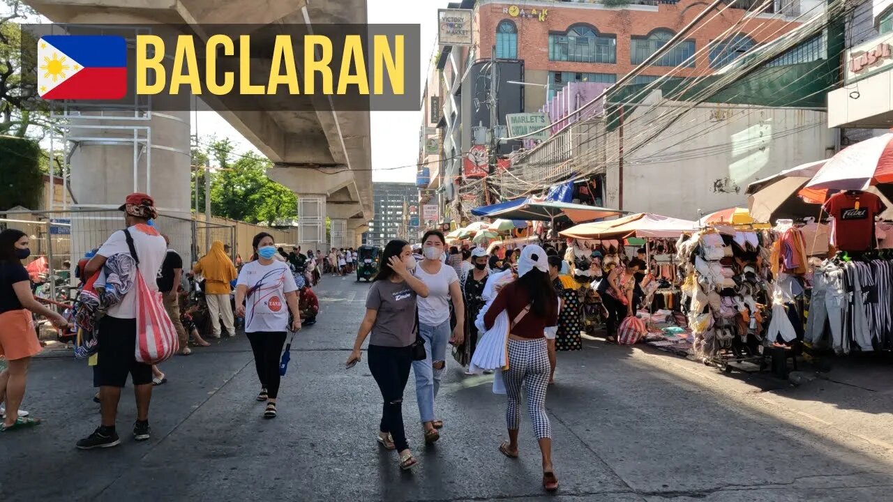
Walking Tour Metro Manila - F.B. Harrison to Baclaran Church to Baclaran Station / Taft Avenue Ext
This is a walking tour around the Baclaran area.
Baclaran is a barangay located in the northern area of the city of Parañaque, Metro Manila, Philippines. It is also known to be located at the borders of the cities of Parañaque and Pasay.
Because of its proximity to the seashore, the place was named after a piece of fishing equipment called "baklad". Baklad is a rattan fence placed around the fish to protect them until they are ready to be sold in the market. Many of these baklads were assembled at the seashore, so people started calling the place "Bakladan". The Filipino grammatical feature of changing d's to r's when a suffix is added changed this to "Baclaran".
00:00 - Start
00:03 - FB Harrison Street
00:47 - Hotel Sogo Pasay - F.B. Harrison St
02:38 - 899 Shopping Center - F.B. Harrison St
04:34 - Bagpi Garment center - F.B. Harrison St
05:11 - Baclaran Bagong Milenyo Plaza - F.B. Harrison St
06:21 - Russel Avenue
10:47 - Roxas Boulevard - Service Road
11:50 - Aguarra Street
14:55 - Shopee Xpress - Aguarra Street
15:14 - Aguarra Street
16:49 - F.B. Harrison Street
18:36 - Redemptorist Road
19:56 - Baclaran Church - Baclaran under the Skyway
24:04 - Roxas Boulevard - Service Road
24:45 - Bayanihan Street
27:30 - Baclaran Church - Baclaran under the Skyway
28:57 - G.G. Cruz Street
30:25 - Bagong Ilog
31:58 - Quirino Avenue
35:25 - Rivera Street
36:53 - J. Gabriel Street
38:23 - Dimasalang Street
38:57 - G.G. Cruz Street
40:11 - C. Rivera Street
40:41 - Lapu Lapu Street
41:50 - Dimasalang Street
42:56 - Lt. Garcia
44:14 - Opena Street
45:48 - G.G. Cruz Street
47:26 - Redemptorist Road
49:20 - Taft Avenue Extension
54:50 - Park Avenue
58:10 - Cuneta Avenue
-
 6:29
6:29
BIG NEM
18 hours agoCultivating God Mode: Ancient Taoist NoFap Practices
9.45K2 -
 30:53
30:53
Uncommon Sense In Current Times
1 day ago $0.52 earned"Pardon or Peril? How Biden’s Clemency Actions Could Backfire"
12.2K -
 40:01
40:01
CarlCrusher
16 hours agoSkinwalker Encounters in the Haunted Canyons of Magic Mesa - ep 4
11.3K2 -
 59:44
59:44
PMG
1 day ago $1.28 earned"BETRAYAL - Johnson's New Spending Bill EXPANDS COVID Plandemic Powers"
30.7K3 -
 6:48:50
Akademiks
14 hours agoKendrick Lamar and SZA disses Drake and BIG AK? HOLD UP! Diddy, Durk, JayZ update. Travis Hunter RUN
156K27 -
 11:45:14
Right Side Broadcasting Network
9 days agoLIVE REPLAY: TPUSA's America Fest Conference: Day Three - 12/21/24
340K28 -
 12:19
12:19
Tundra Tactical
14 hours ago $12.74 earnedDaniel Penny Beats Charges in NYC Subway Killing
62.8K12 -
 29:53
29:53
MYLUNCHBREAK CHANNEL PAGE
1 day agoUnder The Necropolis - Pt 1
153K52 -
 2:00:10
Bare Knuckle Fighting Championship
3 days agoCountdown to BKFC on DAZN HOLLYWOOD & FREE LIVE FIGHTS!
55.7K3 -
 2:53:01
Jewels Jones Live ®
1 day agoA MAGA-NIFICENT YEAR | A Political Rendezvous - Ep. 103
148K36