Off-Line Hill Shade Maps: How To, Part 2
How I make off-line hill shade maps using the MAPC2MAPC application.
This is a great tool for this process and also for converting maps from one format to another. For example, the USGS historical topo maps are available in Geo-TIFF format where the extents are encoded in the image. These could be imported then saved in, for example, the sqlite.db format for OsmAnd.
After months of trying various combinations, it looks like it is possible to make an accurate hill shade map for off-line use. I used the OSMand app. on Android which seems to offer some great map management tools. I was using this hill shade map as an overlay on top of the off-line vector map in the app. This way, I can adjust the transparency of the hill shade map to show details from the vector map, if required. The hill shade map could also be used as the base map or as an underlay to another base map.
I stress on the importance of getting accurate coordinates in this process. This hill shade data is inherently very accurate (~ 1 meter/pixel). All you can do is make it less accurate unless you are diligent in getting accurate latitude/longitude extents to enter when calibrating the image. Having a map that is not properly calibrated is no good when you're trying to find some faint trail out in the bush, BTDT!
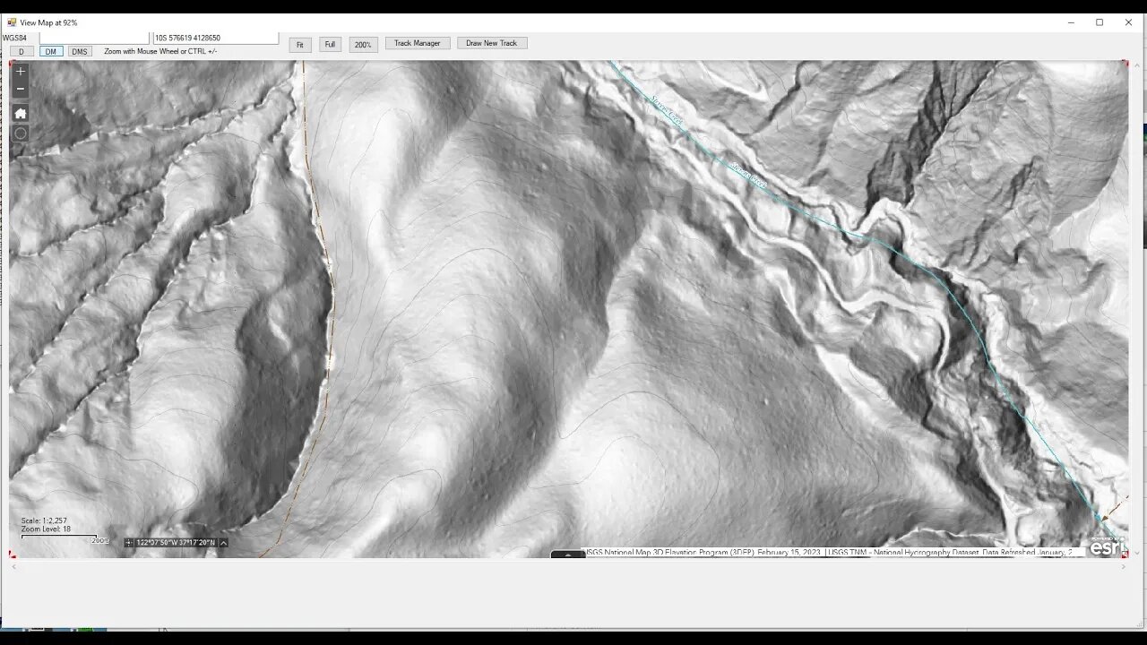
The thumbnail for this video is what you see in the "View" tab of Mapc2Mapc. I am barely scratching the surface of what this application can do in this video. If you've used this application and have some helpful hints, drop a comment below.
OsmAnd (IOS and Android) - Create Offline Raster & Vector Maps:
https://osmand.net/docs/technical/map-creation/create-offline-maps-yourself
Mapc2Mapc (Windows only):
https://www.the-thorns.org.uk/mapping/
USGS National Map Viewer w/ Hill Shade layers:
https://apps.nationalmap.gov/viewer/
If you're looking for hill shade maps of Washington State, use the Washington DNR Lidar Portal instead:
https://lidarportal.dnr.wa.gov/
Awesome resource. If you know any other states that offer similar tools, post up in the comment section below. I've looked for one for California and found nothing of use.
@barteisenberg video on MAPC2MAPC:
https://youtu.be/Y_fekLfcUOc
More to come, moving the map to your mobile device...
Subscribe for more content like this
Comment, rate, share & click the bell icon
And as always, thanks for watching
#USGS #HillShade #osmand
-
 2:14:30
FreshandFit
6 hours agoDavid Icke On COVID Lies, Censorship, Secret Societies, Infiltration of MAGA, AI Control, Alternative Media Subversion And MORE!
85.1K34 -
 1:41:41
The Quartering
8 hours agoTrump's New IVF Order, GameStop CEO Denounces Wokeness Amid Sale, and Elon Musk's DOGE Role Revealed
92.3K55 -
 LIVE
LIVE
Dr Disrespect
7 hours ago🔴LIVE - DR DISRESPECT - TARKOV - ZERO TO HERO PISTOL ONLY
2,412 watching -
 1:55:42
Film Threat
8 hours agoCRISIS ON MULTIPLE MARVEL MOVIES! | Hollywood on the Rocks
17.7K -
 49:19
49:19
Miss Understood With Rachel Uchitel
1 day agoKris Krohn: The Real Estate Playbook for Financial Freedom
51.7K3 -
 15:24
15:24
Bearing
9 hours ago"N*ZI GERMANY HAD TOO MUCH FREE SPEECH" - Brain Dead CBS Anchor Gets SCHOOLED 😂
13.7K30 -
 23:18
23:18
Crowder Bits
10 hours agoDebunked: John Oliver's Outrageous Lies About Trump 2.0
122K51 -
 1:59:18
Russell Brand
7 hours agoThe Battle for Truth: Gregg Hurwitz on Myth, Power & Cultural Control – SF540
158K71 -
 2:00:46
Steven Crowder
10 hours agoFight! Major Lawsuit Announcement...
624K391 -
 19:50
19:50
Clownfish TV
19 hours agoFacebook FIRED 'Underperforming' Employees and They're P*SSED!
36.8K14