Premium Only Content

Wow! Christmas BLIZZARD Potential with ARCTIC VORTEX Surging into Great Lakes Region
**BE ON ALERT THURSDAY THROUGH SATURDAY (Dec. 22-24)**
A Pacific Low will surge ahead of an arctic vortex from Siberia moving into the United States. The storm will undergo dramatic intensification as it reaches the eastern CONUS and fuel heavy snow across multiple areas in the northeastern U.S. Questions do remain as to exactly where low will undergo intensification, with the possibility of a more eastward track limiting winter storm impacts. However, latest models do appear to be trending more towards a Great Lakes Region impact with heavy snow accumulations possible in some spots. Behind the storm, arctic air surges in sending air temperatures tumbling into the teens. Potential blizzard-like conditions could occur with wind gusts reaching 40mph or higher along with additional snowfall. Lake effect snow could continue through Christmas Day across Michigan before the storm finally begins to shift farther north beyond the holiday. Arctic air with subzero wind chills will remain in place for at least a few days after Christmas before a thaw comes to end the winter blast in early January.
**This content is a model analysis for entertainment purposes, please refer to your local NWS forecast for up-to-date info**
LIKE and SUBSCRIBE for more weather-related content like this!
-
 6:08:45
Great Lakes Weather
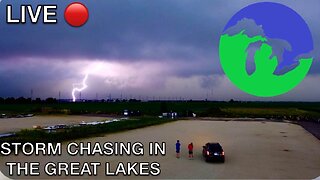
4 months ago $0.36 earnedLIVE STORM CHASE in the Great Lakes Region
737 -
 1:17:49
Game On!
10 hours ago $1.76 earnedThe 49ers should FIRE Kyle Shanhan and RELEASE Brock Purdy IMMEDIATELY!
19.4K -
 LIVE
LIVE
Vigilant News Network
16 hours agoPfizer Named in Another HUGE Scandal | The Daily Dose
1,002 watching -
 1:36:09
Jeff Ahern
2 hours agoFriday Freak out with Jeff Ahern (Woke sports washout)
31.8K -
![Scary Ghost Videos [24/7 LIVESTREAM]](https://1a-1791.com/video/s8/1/Q/f/g/F/QfgFj.0kob-small-Scary-Videos-NON-STOP-With-.jpg) LIVE
LIVE
Goose Pimples
6 hours agoScary Ghost Videos [24/7 LIVESTREAM]
340 watching -
 12:20
12:20
Degenerate Jay
16 hours ago $7.99 earnedWhy Stellar Blade Is My Game Of The Year
59.8K7 -
 30:05
30:05
CarlCrusher
15 hours agoSkinwalker Sightings and Ghostly Encounters at the Infamous Magic Mesa - Ep 2
48.4K4 -
 9:44
9:44
Alabama Arsenal
14 hours ago $5.02 earnedStribog SP10A3 VS HK UMP
30.6K2 -
 2:03
2:03
BIG NEM
14 hours agoIs AI Coming for Comedians Too? PART 2
22.4K1 -
 13:12
13:12
Sleep is CANCELED
1 day ago9 SCARY Videos you'll find Seriously Spook-tacular!
56.3K4