Premium Only Content

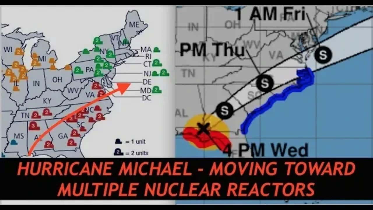
Hurricane Michael On Path of Several Nuclear Reactors, Latest Maps, Charts, Live Data, Flooding
Awesome Specials LP Listeners 92 Meals for $75 - 25 Year Shelf Life http://www.preparewithleakproject.com 1-888-411-0779
*This is a paid sponsorship by My Patriot Supply
Hurricane Michael, Latest Data, Maps, Graphs, Flooding Charts, Live Wind Speeds, Nuclear Reactor Locations.
Links to Graphs, Maps, Slides, Data discussed in podcast
https://www.nhc.noaa.gov/storm_graphics/AT14/refresh/AL142018_5day_cone_no_line_and_wind+png/152003.png
https://www.nhc.noaa.gov/refresh/graphics_at4+shtml/212416.shtml?ero#contents
https://www.nrc.gov/reactors/operating/map-power-reactors.html
Google Maps
http://www.maps.google.com
5G Shielding Tin Foil, Limited Edition Caps
http://www.leakproject.com/shop
Exclusive Content @ http://www.leakproject.com
YouTube Channel @ http://www.youtube.com/clandestinetimelord
-
 1:07:06
Leak Project
13 days ago $1.23 earnedSecret Maps of Antarctica & Under the Ice Bases, "New Intel" Brad Olsen
1.19K1 -
 LIVE
LIVE
Major League Fishing
3 days agoLIVE! - General Tire Team Series: Summit Cup - Day 1
996 watching -
 7:05:23
Hevel Gaming
19 hours ago $62.18 earnedNCAAF Tennessee at Georgia While with Heroes of Might and Magic III & Helldivers 2
189K21 -
 6:34:08
MissesMaam
17 hours agoI'm Addicted | Sons of the Forest 💚✨
129K25 -
 11:22:12
a12cat34dog
20 hours agoALMOST HAVE ALL GUNS DIAMOND :: Call of Duty: Black Ops 6 :: SO MANY ZOMBIES CAMOS {18+}
82.1K4 -
 3:32:31
United Fight League
21 hours agoUFC 309 Watch Party w/ Rampage Jackson, Maycee Barber, Demi Bagby, and Harrison Rogers
178K31 -
 2:35:52
Jewels Jones Live ®
1 day agoELECTION OVER - LIES CONTINUE | A Political Rendezvous - Ep. 100
82.2K77 -
 3:59:18
GamerGril
23 hours agoPAGING ALL ZOMBOIZ | DEAD ISLAND 2
196K21 -
 42:24
42:24
MYLUNCHBREAK CHANNEL PAGE
1 day agoA Century Gone
200K138 -
 38:22
38:22
Stephen Gardner
1 day ago🔥HOLD ON! The RUMORS about Kamala are TRUE...
241K724