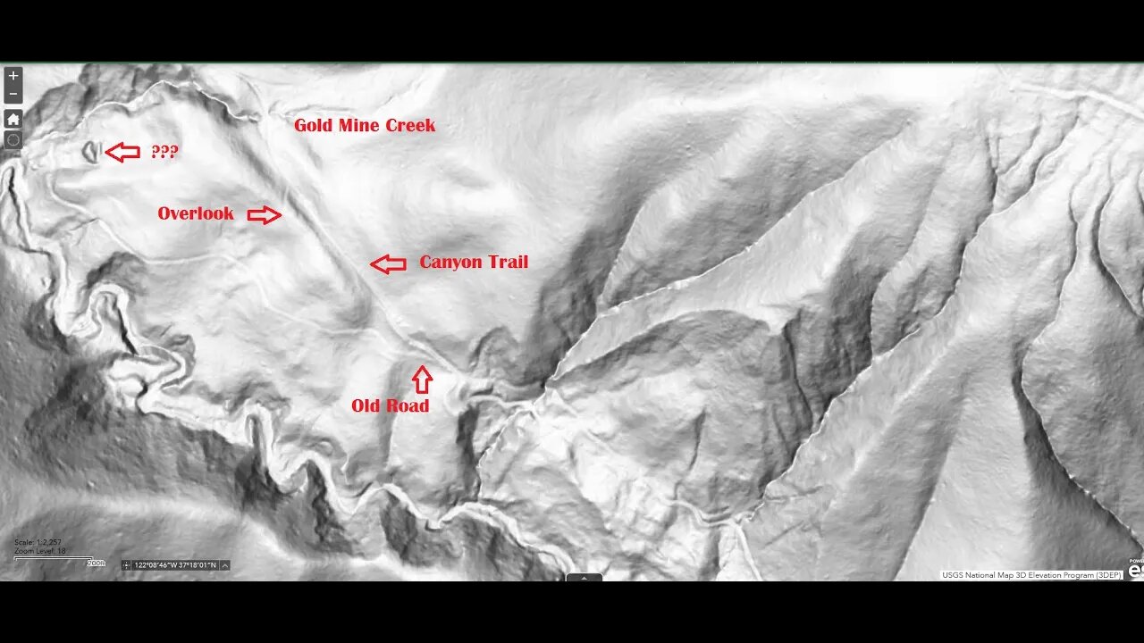
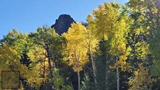
Road to Gold Mine Creek, Intro.
Trying to find an old road that branches off the Canyon Trail and heads down to lower Gold Mine Creek in the Montebello Open Space Preserve that can be seen on the USGS hill shade map.
I've ridden by this part of the Canyon Trail countless times and I've never noticed there's a road here. But once you know where to look, it's there. This is located just down from mile post 2.5.
Hopefully I'll be able to hike this road down to lower Gold Mine Creek once the vegetation dies back this winter. Lower Gold Mine Creek canyon looks like it's very rugged. On the map, the creek is nothing above the Canyon Trail, but right below it turns into a massive canyon and it's chock full of trees and brush. From the Canyon Trail, you can only get a glimpse, but hopefully from below, it may be more visible. Also hope to see what the mysterious object is on the hill shade map.
This may also be a good way to access Stevens Creek to see what this part of the canyon looks like. From Google Maps and the hill shade map it appears to be quite spectacular but also incredibly hard to access. This section of the canyon was ground zero for the 1838 San Andreas earthquake. That quake likely triggered some slides and earth movement that caused the creek to have to cut a very chaotic canyon here. I suspect it's this very rugged terrain that precluded extending the old Canyon Road up the main branch of Stevens Creek.
USGS National Map Viewer w/ Hill Shade:
https://apps.nationalmap.gov/viewer/
About the USGS HTMC:
https://www.usgs.gov/programs/national-geospatial-program/historical-topographic-maps-preserving-past
View/download maps on the TopoView site:
https://ngmdb.usgs.gov/topoview/
Montebello Open Space history page:
https://www.openspace.org/preserves/monte-bello#history
More to come...
Subscribe for more content like this
Comment, rate, share & click the bell icon
And as always, thanks for watching
#USGS #HillShade
-
 3:12
3:12
Glenn Hancock
2 years ago $0.01 earnedCaney Creek Intro
45 -
 3:17
3:17
Glenn Hancock
2 years ago $0.20 earnedCaney Creek Farm Intro
4.66K3 -
 0:10
0:10
coloradohikes
2 years agoBoss Mine via Rock Creek Trail
4 -
 13:57
13:57
wyotexas
2 years agoSunlight Creek & Beartooth Mountain Pass Road Trip 9-5-2022
5 -
 1:22
1:22
ApartmentB
2 years agoBig Thunder Gold Mine
2 -
 3:06
3:06
RichardStewart
2 years ago4720 Yawger Road, Battle Creek, MI Presented by Richard Stewart.
12 -
 0:08
0:08
AraAlidu
2 years agoMy intro
3 -
 15:35
15:35
DeVory Darkins
12 hours ago $3.92 earnedGavin Newsom drops CRUSHING BLOW on Democrats
22K65 -

Etheraeon
8 hours agoPUBG: Battlegrounds | Total Bot Domination
16.4K -
 3:18:33
House of Jacobs
5 hours agoElden Drinks - Drunk Souls Series
14.1K1