Premium Only Content
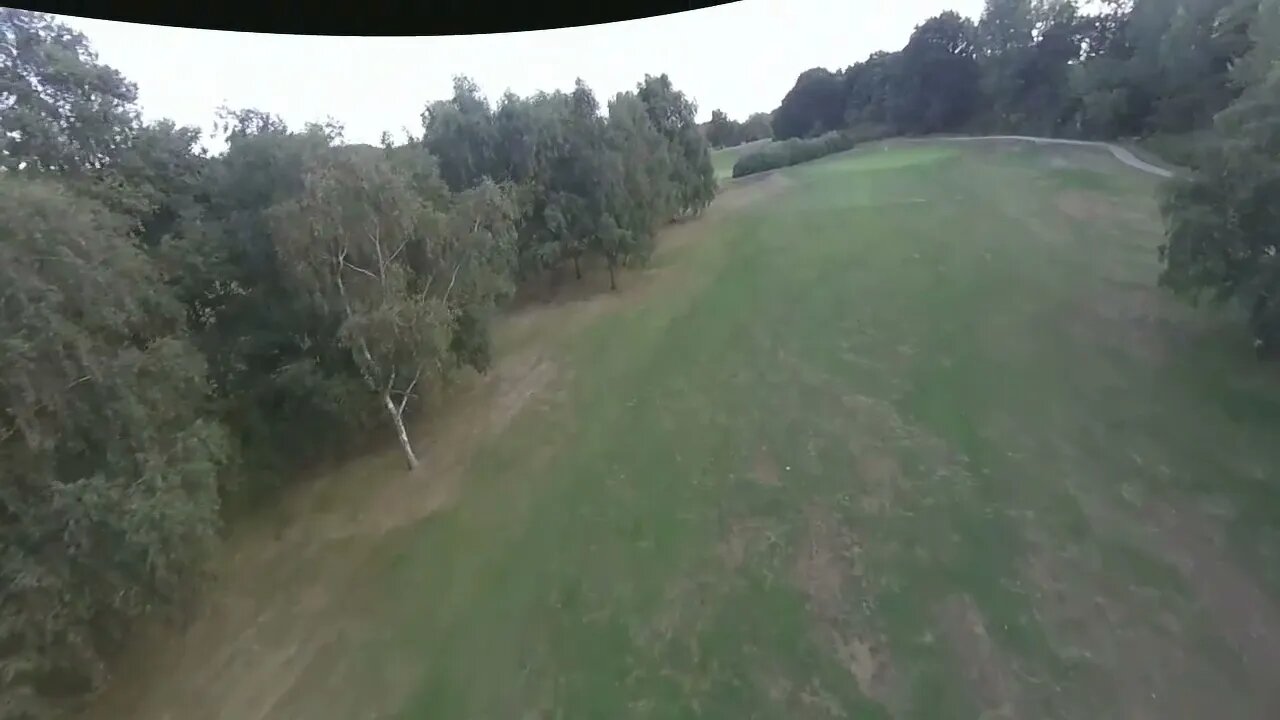
Tornado in the Trenches
Quadcopter "Tornado" investigating World War 1 practice trenches in Canterbury. These can be seen either side of the Stour Valley Walk where it crosses Canterbury Golf Course. They are particularly clear now in the drought conditions that has caused differential die-back of the grass on the fairway.
From Kent County Council web site: (https://webapps.kent.gov.uk/KCC.ExploringKentsPast.Web.Sites.Public/SingleResult.aspx?uid=MKE44363&fbclid=IwAR3sjlmsZB7--oJWl7Xto9cloy4501YzYAK8jJFxtUGshiypAhx5n9jXdFU)
Cropmarks of two types of practice trench from the First World War can be seen on Canterbury Golf Club course in aerial photos including 1990 and modern Google Earth images. The trench systems cover an area of several hundred meters and are visible between the stands of trees on the fairways of the golf course. The western section visible consists of a firing line running north-south and facing east for 67m and branches of communication lines measuring 35m, 35m and 21m and running east-west. The eastern section visible is similar though more is visible, as it runs for a distance of over 100m. Aerial photographs of 2003 show the system extending much further to the south. It is likely that similar traces of military activity extend across the entire site and may be better preserved in the wooded areas.
Thanks to Tom Banbury for stirring up local interest in this site with the still images he posted in the Kent Views Facebook group. Also thanks to Faye Godfrey for suggesting that I film them.
-
 0:07
0:07
slavatsarev
2 years agoTornado
11 -
 0:05
0:05
slavatsarev
2 years agomonstrous tornado
3 -
 0:07
0:07
slavatsarev
2 years agomisterious tornado
17 -
 0:09
0:09
slavatsarev
2 years agoTornado destruction
10 -
 0:30
0:30
slavatsarev
2 years agofire tornado
9 -
 0:09
0:09
slavatsarev
2 years agoTornado Forming
6 -
 0:13
0:13
slavatsarev
2 years agounreal tornado
10 -
 0:07
0:07
slavatsarev
2 years agoMysterious tornado
14 -
 0:06
0:06
slavatsarev
2 years agoMoney Tornado
3 -
 0:10
0:10
slavatsarev
2 years agoSea Tornado
3